Taft, Florida
| Taft, Florida | |
|---|---|
| Census-designated place | |
 Location in Orange County and the state of Florida | |
| Coordinates: 28°25′44″N 81°22′4″W / 28.42889°N 81.36778°WCoordinates: 28°25′44″N 81°22′4″W / 28.42889°N 81.36778°W | |
| Country |
|
| State |
|
| County | Orange |
| Incorporated (town) | 1912 |
| Unincorporated | 1933 |
| Area | |
| • Total | 1 sq mi (2.7 km2) |
| • Land | 1 sq mi (2.6 km2) |
| • Water | 0 sq mi (0.1 km2) |
| Elevation | 95 ft (29 m) |
| Population (2010) | |
| • Total | 2,205 |
| • Density | 2,200/sq mi (820/km2) |
| Time zone | UTC-5 (Eastern (EST)) |
| • Summer (DST) | UTC-4 (EDT) |
| ZIP code | 32824 |
| Area code(s) | 407 |
| FIPS code | 12-70525[1] |
| GNIS feature ID | 0291991[2] |
Taft is a census-designated place and an unincorporated area in Orange County, Florida, United States. The population was 2,205 at the 2010 census.[3] It is part of the Orlando–Kissimmee Metropolitan Statistical Area.
Geography
Taft is located at 28°25′44″N 81°22′4″W / 28.42889°N 81.36778°W (28.428983, -81.367788).[4]
According to the United States Census Bureau, the CDP has a total area of 2.7 km² (1.0 mi²), of which 2.6 km² (1.0 mi²) is land and 0.1 km² (0.04 mi²) (2.88%) is water.
Demographics
| Historical population | ||
|---|---|---|
| Year | Pop. | ±% |
| 1915 | 216 | — |
| 1920 | 259 | +19.9% |
| 1925 | 382 | +47.5% |
| 1930 | 296 | −22.5% |
| U.S. Decennial Census[5] Florida Department of Agriculture[6] | ||
As of the census[1] of 2000, there were 1,938 people, 678 households, and 463 families residing in the CDP. The population density was 733.6/km² (1,907.3/mi²). There were 729 housing units at an average density of 275.9/km² (717.5/mi²). The racial makeup of the CDP was 84.88% White, 6.66% African American, 1.08% Native American, 1.70% Asian, 0.36% Pacific Islander, 4.70% from other races, and 0.62% from two or more races. Hispanic or Latino of any race were 15.38% of the population.
There were 678 households out of which 29.4% had children under the age of 18 living with them, 42.6% were married couples living together, 17.8% had a female householder with no husband present, and 31.6% were non-families. 19.2% of all households were made up of individuals and 4.7% had someone living alone who was 65 years of age or older. The average household size was 2.86 and the average family size was 3.20.
In the CDP, the population was spread out with 25.6% under the age of 18, 8.8% from 18 to 24, 32.9% from 25 to 44, 23.6% from 45 to 64, and 9.1% who were 65 years of age or older. The median age was 34 years. For every 100 females, there were 113.4 males. For every 100 females age 18 and over, there were 116.0 males.
The median income for a household in the CDP was $32,500, and the median income for a family was $32,250. Males had a median income of $25,438 versus $25,893 for females. The per capita income for the CDP was $12,331. About 14.8% of families and 14.3% of the population were below the poverty line, including 16.1% of those under age 18 and 8.4% of those age 65 or over.
References
- 1 2 "American FactFinder". United States Census Bureau. Retrieved 2008-01-31.
- ↑ "US Board on Geographic Names". United States Geological Survey. 2007-10-25. Retrieved 2008-01-31.
- ↑ "Profile of General Population and Housing Characteristics: 2010 Demographic Profile Data (DP-1): Taft CDP, Florida". U.S. Census Bureau, American Factfinder. Retrieved September 25, 2012.
- ↑ "US Gazetteer files: 2010, 2000, and 1990". United States Census Bureau. 2011-02-12. Retrieved 2011-04-23.
- ↑ "Census of Population and Housing". Census.gov. Archived from the original on May 12, 2015. Retrieved June 4, 2015.
- ↑ Florida Department of Agriculture (1906). Census of the State of Florida. Urbana, I.L.
External links
- Prosper Colony Osceola County, FL Kissimmee Valley Gazette, September 3, 1909, pg. 1, via Genealogy Club of Osceola County
Municipalities and communities of Orange County, Florida, United States | ||
|---|---|---|
| Cities | 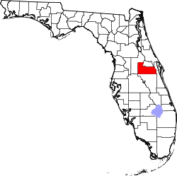 | |
| Towns | ||
| CDPs |
| |
| Unincorporated communities | ||
| Footnotes | ‡This populated place also has portions in an adjacent county or counties | |
