Pattalam, Chennai
| Pattalam பட்டாளம் | |
|---|---|
| Neighbourhood | |
 Pattalam Location in Chennai, Tamil Nadu  Pattalam Pattalam (Tamil Nadu)  Pattalam Pattalam (India) | |
| Coordinates: 13°05′51″N 80°15′33″E / 13.09739°N 80.259288°ECoordinates: 13°05′51″N 80°15′33″E / 13.09739°N 80.259288°E | |
| Country |
|
| State |
|
| Metro | Chennai |
| Elevation | 5 m (16 ft) |
| Languages | |
| • Official | Tamil |
| Time zone | UTC+5:30 (IST) |
| PIN | 600012 |
| Telephone code | 044 |
| Planning agency | CMDA |
| City | Chennai |
| Civic agency | Chennai Corporation |
Pattalam (Tamil: பட்டாளம்), is a developed residential area in Central Chennai, a metropolitan city in Tamil Nadu, India.
The area is famous for its Hunnuman temple which occupies the center of the place.[1]
It features the largest marketplace in North Chennai.
Location
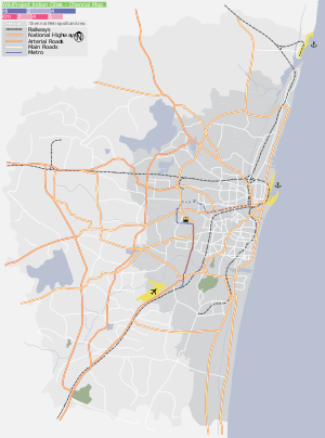
Pattalam is located near Purasawalkam, Pulianthope. A very close residence of Choolai getting connected along with the Perambur Barracks road.
Surroundings
Directions From Pattalam | |
|---|---|
References
| State symbols |
|
|---|---|
| Governance |
|
| Topics | |
| Districts |
|
| Major cities | |
| City |  | |
|---|---|---|
| Country | ||
| State | ||
| Region | ||
| Revenue Divisions | ||
| Taluks | ||
| Governing body | ||
| History | ||
| Places of interest |
| |
| Universities |
| |
This article is issued from
Wikipedia.
The text is licensed under Creative Commons - Attribution - Sharealike.
Additional terms may apply for the media files.