Maduravoyal
| Maduravoyal | |
|---|---|
| Neighbourhood | |
| Nickname(s): West Door Of Chennai | |
 Maduravoyal  Maduravoyal  Maduravoyal | |
| Coordinates: 13°04′03″N 80°09′48″E / 13.0675°N 80.1632°ECoordinates: 13°04′03″N 80°09′48″E / 13.0675°N 80.1632°E | |
| Country | India |
| State | Tamil Nadu |
| District | Chennai District |
| Taluk | Maduravoyal |
| Metro | Chennai |
| Government | |
| • Body | Greater Chennai Corporation |
| Elevation | 16 m (52 ft) |
| Population (2011) | |
| • Total | 86,195 |
| Languages | |
| • Official | Tamil |
| Time zone | UTC+5:30 (IST) |
| PIN | 600095 |
| Vehicle registration | TN-12 |
| Planning agency | CMDA |
| Civic agency | Greater Chennai Corporation |
| Website |
www |
Maduravoyal is a residential neighbourhood located in the west of Chennai, India. Maduravoyal was only a locality with people belonging to Nayakars (Vaniya Kula Shatriya) and other communities of which privileges in North Tamil Nadu. As of 2011, the town had a population of 86,195.
Maduravoyal also has a name as "ettam kal" (8th mile), so it could be famous in British Period too, it is exactly 12.87 kilometres (8.00 mi) from Chennai Harbour, and Maduravoyal located 3 km from the west of Koyambedu area which is a major hub of activity in Chennai City. Maduravoyal is Chennai became a part of Greater Chennai Corporation in 2009 city expansion order passed by the state government.[1][2] Nearby areas include Nerkundram, Mogappair, Vanagaram, Valasaravakkam, Alapakkam and Porur.
The second phase of Chennai Bypass cuts through Maduravoyal to reach the northern borders of Chennai. Maduravoyal noticed a rapid developed and sudden increase in property prices ever since the Maduravoyal Junction with the cloverleaf interchange (flyover) became operational.[3][4]
Former Prime Minister, Dr Manmohan Singh in the year January 2009[5] laid foundation stone for the Chennai Port – Maduravoyal Expressway a 19 kilometres (12 mi) elevated express-way project by National Highways Authority of India (NHAI).
Etymology
Maduravoyal name came from Madura+Vayal, Madura = Beautiful - Vayal = Entrance (மதுரா / மதுரம் = அழகிய+ வாயல் = மதுரவாயல்). So the meaning of the name Maduravoyal which means beautiful Entrance. There is no connection with Madurai in South Tamil Nadu nor the people who lives there.
Maduravoyal
In Maduravoyal, the south side of "Madurai Nayakar Street", amateur archaeologists of Ayyavoo Nagar residents played discovered two rare inscriptions of the Telugu Cholas dating back to the 13th century while renovating an ancient Maha Shiva temple. The residents found these inscriptions when they were removing thick lime wash on the temple walls, as part of the renovation. The temple had been lime washed to yellow a few decades back, hiding the inscriptions. "It is a rare finding of the Telugu Chola period", the name of village called Maduravoyal .
Written in Tamil, the inscriptions have been dated to the period 1246–1249 CE during the reign of Vijayakandangopalan of Telugu Cholas. Vijayakandangoplan, who ruled for 25 years from 1242 CE, was a famous feudatory ruler of the Cholas, and had marriage relations with them. The Telugu Cholas reigned between the seventh and thirteenth centuries and adopted the title of Chola to show the feudatory status they had under the Chola-Chalukya rulers. The Chinese traveller Yuanzhuang referred to the Telugu Cholas as "Chuliyas".
Inscriptions found at the temple refer to two contributions made by the ruler on two different occasions for the purpose of temple maintenance. In the first instance, Vijayakandangoplan donated four cows and a huge lamp for illuminating the temple in 1246 CE. Three years later, he again contributed large acres of farmland in Sembakkam, a village in Singalur of Tiruvallur district. In the inscription, he rules that revenue generated in the form of taxes from these lands should be spent for the maintenance of the temple. "In ancient times, temples acted not only as places of worship but, also as registration offices, schools, and assemblies of elders".
Demographics
According to 2011 census, Maduravoyal had a population of 86,195 with a sex-ratio of 993 females for every 1,000 males, much above the national average of 929.[6] A total of 10,392 were under the age of six, constituting 5,277 males and 5,115 females. Scheduled Castes and Scheduled Tribes accounted for 13.58% and .36% of the population respectively. The average literacy of the town was 77.04%, compared to the national average of 72.99%.[6] The town had a total of 21,623 households. There were a total of 33,208 workers, comprising 234 cultivators, 130 main agricultural labourers, 417 in house hold industries, 29,614 other workers, 2,813 marginal workers, 32 marginal cultivators, 25 marginal agricultural labourers, 78 marginal workers in household industries and 2,678 other marginal workers.[7] As per the religious census of 2011, Maduravoyal (M) had 89.47% Hindus, 4.11% Muslims, 5.93% Christians, 0.05% Sikhs, 0.02% Buddhists, 0.07% Jains, 0.34% following other religions and 0.01% following no religion or did not indicate any religious preference.[8]
Localities
- Andal Nagar,Shaik Manniyam 7th Street
- Old Maduravoyal (Bharathiyar Street)
- 6th block, MMDA Colony
- Madurai Naicken Street
- Maduravoyal Post Office
- Vel Nagar
- Ayyavoo Nagar
- Venkateswara Nagar
- Kannan nagar
- Janaki Nagar
- Kambar Nagar 1st and 2nd Street
- MMDA Colony (4th to 7th blocks)
- Karthikeyan Nagar
- Old Maduravoyal (Perumal Koil Street, Sannadhi Street, North Mada Street & South Mada Street)
- Maduravoyal Market
- Pallavan Nagar
- Erikarai
- CDN Nagar
- Kamaraj Nagar
- Maduravoyal-Alapakkam Lake[9][10]
- Mettukuppam
- Gangai Amman Nagar
- Seemaaththamman Nagar
- Kamatchi Nagar
- Chozhan Nagar
- Lakshmi Nagar
- Sri Krishna Nagar
- Srinivasa Nagar
- Abirami Nagar
- Ganapathy Nagar 1 Street Annex
- Varalakshmi Nagar
- Pillaiyar Kovil Street
- Lakshmi Nagar
- Sri Lakshmi Nagar
- Bhagya Lakshmi Nagar
- Ganapathy Nagar
- Kamaraj Nagar
- Bharathiyar Street (Land Mark Post Office)
- Vadavenni amman nagar
Ward and zone
As per Chennai Corporation's new zone map (issued after expansion in 2009), Maduravoyal comes under Ward XI in Valasaravakkam Zone. The ward divisions of Maduravoyal Ex counsellor 144 ward member - Mr Baarath, 146 ward member - Mr Jeevanantham and 147 ward member-Mr A Devados.
Place of worship
Temples
- Venkatesha Perumal Temple - Madurai Naicker Street
- Selva Vinayagar Temple - Vel Nagar
- Gangai Amman Temple, Janaki Nagar.
- Seemathamman Temple, Seemathamman Nagar.
- Markasakaya Eshwar Temple (Shiva Temple), more than 860 years 13 CE temple by Telegu Kolathangan Chola king build temple (South Mada Street)
- Vinayagar Temple, (North Mada Street)
- Murugan Temple, Karthikeyan Nagar
- Ganesh Temple, Pallavan Nagar
- Perumal Temple, Old Maduravoyal
- Sivan Temple, Maduravoyal (Near Municipality Office)
- Gangai Amman Temple, Gangai Amman Nagar.
- Bhuvaneswari Nagathamman Temple, MMDA Colony
- Maha Sakthi Vinayagar Temple, 6th Block, MMDA Colony
- Samaiyapurathu Mariyammam Temple, Lakshmi Nagar
- Vinayagar Temple, Chozhan Nagar.
- Selva Vinayagar Temple-Ganapathy Nagar
- Muthumariamman Temple Maduravoyal Mettukuppam Road (MMDA)
- Kamatchi Amman temple , Kamatchi Nagar
Mosques
- Maduravoyal Mosque
- MMDA Mosque
- Erikarai Mosque
- Kanniyamman Nagar Mosque
Churches
- CSI Church, Maduravoyal Market
- St Antony's Church, Maduravoyal Ration Shop
- ELG Ministry, Maduravoyal EB
- ECI Church, Maduravoyal Market
- BLESSING Church, Maduravoyal MMDA Colony
- Mission AG Church, Periyar Street, Sri Lakshmi Nagar
Hospitals
- 24 hours Emergency Clinic, Maduravoyal Market
- Meenakshi General Hospital, Allapakam Road
- Appollo Hospital, Ayanambakkam (1.5 km away)
- Neuro Life Line Hospital, Aalapakkam Main Road
- Yours Clinic, Pallavan Nagar
- Trinity Dental Clinic, Golden George Nagar
NGO (Service Organisation)
Shasha Foundation, Madurai Naiyakan Street, Maduravoyal
Pharmacies
- Buhari Medicals, Maduravoyal Ration Shop Stopping
- Maduravoyal Pharmacy, Maduravoyal Earikarai Stopping
- Thulasi Medicals, Aalapakkam Main Road
- Kasthuri Medicals, Aalapakkam Main Road
- Rama Medicals, Aalapakkam Main Road
- Senthil Medicals, Maduravoyal Market
- MedPlus, Aalapakkam Main Road
- OM Medicals, Near Krishna nagar police booth
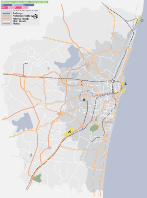
Location in context
Directions From Maduravoyal | |
|---|---|
References
- ↑ "Chennai City Expansion Order" (PDF). chennaicorporation.gov.in. 26 December 2009. Retrieved 10 October 2018.
- ↑ "More areas to come under Chennai Corporation". The Hindu. Chennai, India. 30 December 2009. Retrieved 12 October 2012.
- ↑ "Maduravoyal flyover a hit before it's opened". Times of India. 7 June 2010. Retrieved 12 October 2012.
- ↑ Madhavan, T. (22 August 2010). "Maduravoyal flyover, a relief for motorists". The Hindu. Chennai, India. Retrieved 12 October 2012.
- ↑ "PM lays foundation". 8 January 2009. Retrieved 12 October 2012.
- 1 2 "Census Info 2011 Final population totals". Office of The Registrar General and Census Commissioner, Ministry of Home Affairs, Government of India. 2013. Retrieved 26 January 2014.
- ↑ "Census Info 2011 Final population totals - Maduravoyal". Office of The Registrar General and Census Commissioner, Ministry of Home Affairs, Government of India. 2013. Retrieved 26 January 2014.
- ↑ "Population By Religious Community - Tamil Nadu" (XLS). Office of The Registrar General and Census Commissioner, Ministry of Home Affairs, Government of India. 2011. Retrieved 13 September 2015.
- ↑ "Maduravoyal may escape inundation". The Hindu. Chennai, India. 5 October 2007.
- ↑ "Once a lake, now just a ghost of it". The Hindu. Chennai, India. 4 February 2009.