Ariyalur, Chennai
| Ariyalur அரியலூர் | |
|---|---|
| Neighbourhood | |
 Ariyalur  Ariyalur  Ariyalur | |
| Coordinates: 13°11′27″N 80°15′03″E / 13.19072°N 80.25094°ECoordinates: 13°11′27″N 80°15′03″E / 13.19072°N 80.25094°E | |
| Country |
|
| State |
|
| District | Chennai |
| Taluk | Tiruvottiyur |
| Metro | Chennai |
| Zone & Ward | Manali Zone 2 & Ward 17 |
| Elevation | 25 m (82 ft) |
| Languages | |
| • Official | Tamil |
| Time zone | UTC+5:30 (IST) |
| PIN | 600103 |
| Telephone code | 044-2594 |
| Vehicle registration | TN-18-xxxx & TN-20-xxxx(old) |
| Civic agency | Corporation of Chennai |
| Planning agency | CMDA |
| City | Chennai |
| Lok Sabha constituency | Chennai North |
| Vidhan Sabha constituency | Tiruvottiyur |
| Website | http://www.chennaicorporation.gov.in/ |
Ariyalur (Tamil: அரியலூர்), is a developing residential area in North Chennai, a metropolitan city in Tamil Nadu, India
Location
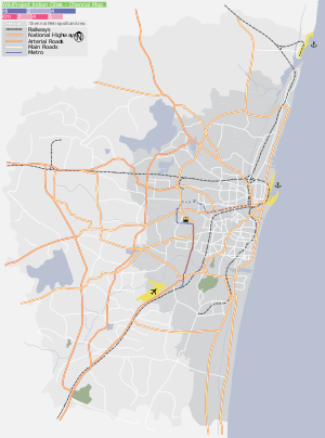
Theeyampakkam is located near Manali in North Chennai with Vichoor in the north, Kosappur in the west, Andarkuppam in the east and Mathur to the South. Other neighbouring areas include Madhavaram, Kodungaiyur.
The arterial roads to Ariyalur are the Anna Salai (Andarkuppam-Redhills Road), Vaikkadu-Ammulaivoyal Road, Madhavaram Milk Colony Road and the Kamarajar Salai. This part of Chennai was considered to be rural even its location within Greater Chennai Corporation limits. With the Inner Ring Road becoming functional the area was easily accessible from the Chennai Mofussil Bus Terminus.
Geographic Location | ||||||||||
|---|---|---|---|---|---|---|---|---|---|---|
| ||||||||||
References
External links
Areas of Chennai | |
|---|---|
| North |
|
| West |
|
| Central |
|
| South |
|
| State symbols |
|
|---|---|
| Governance |
|
| Topics | |
| Districts |
|
| Major cities | |
| District Headquarters |  | |
|---|---|---|
| Country | ||
| State | ||
| Region | ||
| Revenue Divisions | ||
| Taluks | ||
| Revenue blocks | ||
| Municipal Corporation |
| |
| Municipalities | ||
| Town Panchayats | ||
| History | ||
| Places of interest |
| |
| Universities |
| |
This article is issued from
Wikipedia.
The text is licensed under Creative Commons - Attribution - Sharealike.
Additional terms may apply for the media files.