Alwarthirunagar
| Alwarthirunagar Alwarthirangara Alwar Thiru Nagar | |
|---|---|
| neighbourhood | |
| Nickname(s): Olive | |
 Alwarthirunagar  Alwarthirunagar  Alwarthirunagar | |
| Coordinates: 13°02′51″N 80°11′14″E / 13.047545°N 80.187293°ECoordinates: 13°02′51″N 80°11′14″E / 13.047545°N 80.187293°E | |
| Country | India |
| State | Tamil Nadu |
| District | Chennai |
| Metro | Chennai |
| Languages | |
| • Official | Tamil |
| Time zone | UTC+5:30 (IST) |
| PIN | 600087 |
| Vehicle registration | TN-10 |
| Lok Sabha constituency | Chennai South |
| Vidhan Sabha constituency | Virugambakkam |
| Website |
alwarthirunagar |
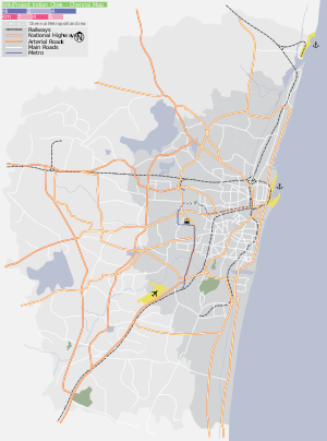
Alwarthirunagar (Tamil: ஆழ்வார்திருநகர்) is an urban locality in Chennai, the capital city of Tamil Nadu, India. Alwarthirunagar Pin code is 600087 and postal head office is Valasaravakkam[1]. It falls under Valasaravakkam , municipality, in Maduravoyal (State Assembly Constituency) constituency in Tiruvallur district in the Indian state of Tamil Nadu .The word nagar refers to a settlement in sanskrit. The neighbourhood was developed by the City Lando Corporation in the late 1960s. With the opening of schools and shopping centres, Alwarthirunagar emerged as a service centre in Chennai's west. Twenty acres of forestation in the area acts against pollution.[2] The area is traversed by state road number 113.[3]
Neighbourhoods
Ramakrishna Nagar
Ramakrishna Nagar is located in the centre of Alwarthirunagar. There, a large recreation area, developed in the 1980s, is used for playing cricket. However, in 2008, new constructions encroached on the area and flooding is a common problem during the rainy season.
Velan Nagar
Velan Nagar is approximately 1 km from the Alwarthirunagar bus stop and about 800 m from the Lamech bus stop. During the late 1980s, Velan Nagar was affected by stagnating water during the rainy season. By the 1990s, the area had developed into a very large residential area, decreasing the number of parks and making cycling more difficult. There is a Banyan tree that is considered holy. The Ganesh temple in Velan Nagar has been renovated.
Palaniappa Nagar
Palaniappa Nagar is adjacent to Alwarthirunagar with streets connecting from Arcot Road and Radhakrishnan Salai.
Central business district
The main commercial district is on Arcot road. There is a multi brand superstore, grocery stores, fast food outlets, a bakery and a library. There is also a Panchayat Union dispensary.
Schools
- St John's matriculation higher secondary school.[4]
- Sri Venkateswara matriculation higher secondary school
- Le Chatelaine school
- Lamech school
Banks
Several banks are located on or near Arcot road.
- Andhra Bank
- ICICI Bank
- HDFC Bank
- Axis Bank
- Punjab National Bank (Radhakrishnan Salai)
Highlights
Major connecting point between Arcot road and Mt. Poonamallee road via RamapurAm (through Arasamaram junction)where DLF IT Park, Miot hospital, Chennai Trade center is located .
There is a very big Mangrove nearly 20 acres of land which serves as a pollution controller and that which balances the eco system of Alwarthirunagar amidst the busy and hectic traffic prone Arcot road.
Recent retail, restaurants and other commercial establishments near the Manthope in the Arcot road of Alwarthirunagar has made the area a well sophisticated and busy place. Aavin Junction is proving to be a place of recreation for the locals here.
With more broadening of the Arcot road and providing footpath and space for pedestrians the commercial activities will rise up more in this area.
References
- ↑ "Alwarthirunagar Pincode" Accessed 21 February 2018.
- ↑ "Alwarthirunagar." Alwarthirunagar Tourism and Events. OV Guide. Accessed 16 January 2013.
- ↑ "Alwarthirunagar." Maps of India. Accessed 17 February 2014.
- ↑ "St John's." Hindu.com. 22 February 2005.