Beacon Street
Beacon Street is a major thoroughfare in Boston, Massachusetts and its western suburbs Brookline and Newton. It passes through many of Boston’s central and western neighborhoods, including Beacon Hill, Back Bay, Fenway-Kenmore, the Boston University campus, Brighton, and Chestnut Hill.
It is not to be confused with the Beacon Street in nearby Somerville or others elsewhere.
Description
Beacon Street begins as a one-way street from the intersection of Tremont Street and School Street. From this point, it rises up Beacon Hill for a block where it meets Park Street in front of the Massachusetts State House. From that intersection it descends Beacon Hill as a two-lane, bi-directional street until it reaches Charles Street. At Charles Street, it becomes a one-way avenue that runs through the Back Bay neighborhood until it reaches Kenmore Square.
From Kenmore Square, Beacon Street skirts the area around Fenway Park and follows a southwesterly slant through Brookline along either side of the MBTA Green Line trolley tracks to Cleveland Circle in Brighton. From there it passes through Chestnut Hill, including the Chestnut Hill Reservoir and Boston College. It winds its way into the city of Newton, where it crosses Centre Street to form the defining intersection of Newton Centre, meets Walnut Street at "Four Corners" near the Newton Cemetery, and goes through Waban at its intersection with Woodward Street. It ends at Washington Street near Boston's circumferential highway, Route 128.
History
Beacon Street initially formed the northern limit of Boston Common, and was extended over the Charles River Basin as a dam that would later form the shore between a narrowed river and the newly filled-in Back Bay neighborhood. The part of Beacon Street west of Kenmore Square was originally laid out in 1850. Railroad tracks were first laid in 1888 for what would eventually become the modern Green Line C branch.
In popular culture
- Robert McCloskey's 1941 children's book Make Way for Ducklings features a mother duck leading her eight ducklings across Beacon Street, with the help of four members of the Boston Police Department.
- The Beacon Street Girls series of preteen books is set around Beacon Street in Brookline.
- Nanci Griffith's 1987 album Lone Star State of Mind has a song called Beacon Street.
- Beacon Street is the location of the fictional pizza parlor "Beacon Street Pizza" during the first season of the sitcom Two Guys and a Girl.
- 112½ is the address of the fictional bar Cheers.[1] The actual location of the exterior shots is 84 Beacon Street.
- The Unitarian Universalist Association managed to confuse the numbers on this street. In 1927, moving from 25 Beacon Street down the street, they wanted to keep the number 25, and convinced the legislature to pass a law to keep it.[2]
- In Rick Riordan’s “Magnus Chase and the Gods of Asgard” a main character owns a shop on Beacon Street and the shop appears several times throughout the series.
Image gallery
 Beginnings of Beacon St., 1722 (upper left)
 Beacon Street, Boston, 1850s
 Beacon St., 1870
 Beacon St., Back Bay, c. 1870s
 Interior of 241 Beacon St., former home of Julia Ward Howe, 19th century
 Top of Beacon St., across from the State House, c. 1885
 Parade of the Ancient and Honorable Artillery Company of Massachusetts, 1900
.jpg) Boston Water Works, Chestnut Hill High-Service Pumping Station, 2450 Beacon Street, c. 1970s(?)
Boston Water Works, Chestnut Hill High-Service Pumping Station, 2450 Beacon Street, c. 1970s(?) Boston Marathon, mile 25, Beacon St., 2005
 922 Beacon Street in 2006 with Ruggles Baptist Church in the background
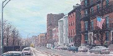 Boston's Beacon Street (2008) by R. Vojir featuring the Somerset Club
 Top of Beacon St., showing One Beacon Street building, 2008
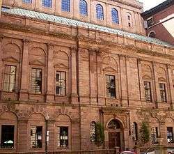 Facade of the Boston Athenaeum
See also
- Amory-Ticknor House
- Nathan Appleton Residence
- Beacon Street Girls
- Boston Athenæum
- Boston Bar Association
- Boston Common
- Boston Public Garden
- Boston Transit Commission Building
- Cheers Beacon Hill
- Chester Harding House
- Cleveland Circle
- Dean Road station
- Gibson House Museum
- Hancock Manor
- Headquarters House (Boston, Massachusetts)
- Harrison Gray Otis House
- Oliver Wendell Holmes, Sr. lived on Beacon St. 1871–1894[3]
- Julia Ward Howe lived on Beacon St.
- Kenmore Square
- Leavitt-Riedler Pumping Engine
- Massachusetts State House
- Mount Vernon Church, Boston
- Myles Annex
- Myles Standish Hall
- One Beacon Street
- Page Company, former tenant
- John Phillips (mayor) lived on Beacon St. (corner of Walnut Street), 1804–1823[4]
- William H. Prescott lived on Beacon St. 1845–1859[5]
- Robert Gould Shaw Memorial
- Somerset Club
- Washington Square (Boston)
References
- "The Stork Brings a Crane". Cheers. Season 8. Episode 6. 03:15 minutes in.
- ""A Movable Feast: 25 Beacon Street – A Love Story"". Archived from the original on 2014-11-29. Retrieved 2014-11-21.
- State Street Trust Company. Forty of Boston's historic houses. 1912.
- State Street Trust Co. 1912.
- State Street Trust Co. 1912.
External links

- New York Public Library. Postcard of Unitarian Building, 25 Beacon Street Boston, Headquarters American Unitarian Association. Also shows State House, Hotel Bellevue, early 20th century
