Khagaria district
Khagaria district is an administrative district in the state of Bihar in India. The district headquarters are located at Khagaria. Earlier it was a part of Munger District as a sub-division that was created in 1943-44. It was upgraded to the status of a district on 10 May 1981. Khagaria district is a part of Munger Division.[1]
Khagaria district | |
|---|---|
District of Bihar | |
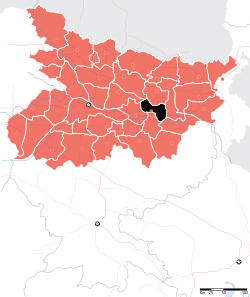 Location of Khagaria district in Bihar | |
| Country | India |
| State | Bihar |
| Division | Munger |
| Headquarters | Khagaria |
| Government | |
| • Lok Sabha constituencies | Khagaria |
| Area | |
| • Total | 1,485 km2 (573 sq mi) |
| Population (2011) | |
| • Total | 1,666,886 |
| • Density | 1,100/km2 (2,900/sq mi) |
| Demographics | |
| • Literacy | 72.87 per cent |
| • Sex ratio | 896 |
| Time zone | UTC+05:30 (IST) |
| Major highways | NH 31, NH 107 |
| Average annual precipitation | 1182 mm |
| Website | khagaria |
The present collector and District Magistrate of Khagaria is Shri Alok Ranjan Ghosh and the current S.P of khagaria is Smt Meenu Kumari.[2]
History
Also known as Farakiya in local region. There is an interesting story behind it. Five centuries ago Akbar, then the king of Mughal empire directed his revenue minister Todar Mal to map his entire empire. But he could not map this region now known as Khagaria due to difficult terrain, rivers and dense forests. So, he named it Farakiya (Farak in Urdu means separate, different). Now there is even a weekly newspaper- 'Farkiyanchal Times' (albeit published arbitrarily) and Farakiya times (weekly news paper).
Geography
Khagaria district occupies an area of 1,486 square kilometres (574 sq mi),[3] comparatively equivalent to Greenland's Nares Land.[4] The district is surrounded by seven rivers namely Ganges, Kamla Balan, Koshi, Budhi Gandak, Kareh, Kali Koshi and Bagmati. These rivers cause floods every year which causes great loss of life and property including livestock. River Ganga forms the southern boundary of the district.
Khagaria experiences an extreme climate with very hot summers and extremely cold winters. Rainy season continues up to October with heavy rainfall causing the rivers to overflow and causing floods in most regions.
Khagaria has rich alluvial soil which is very good for cultivation which is a major occupation of most of the rural population. The dictrict does not have any mineral resources. Wheat is a prominent rabi crop in the district while Maize is abundantly grown in almost throughout the district. Banana cultivation as a cash crop has grown into prominence in last two decades. Banana cultivation is done mostly in Choutham, Gogari and Parvatta blocks. Apart from these mango and litchi orchards are abundant in this district and are found almost throughout the entire area. The study of old gazetteers shows that these orchards have been in existence for a long time.
Administration
Economy
In 2015 union Food processing minister Harsimrat Kaur Badal laid the foundation stone of a mega food at Mansi block. This will provide benefit to 30000 and generate around 6000 direct and indirect jobs.[6] In 2006 the Ministry of Panchayati Raj named Khagaria one of the country's 250 most backward districts (out of a total of 640).[7] It is one of the 36 districts in Bihar currently receiving funds from the Backward Regions Grant Fund Programme (BRGF).[7]
Transport
Khagaria is a small town with a major railway junction on the Barauni Guwahati section of the Indian Railways. National Highway No.31, which connects rest of India to North Eastern region passes through this town. It is also connected to other regions of north Bihar by another rail line to Saharsa and Samastipur. A major rail bridge across river Ganges at Munger connects it to south Bihar and Jharkhand directly.
Demographics
According to the 2011 census Khagaria district has a population of 1,666,886,[8] roughly equal to the nation of Guinea-Bissau[9] or the US state of Idaho.[10] This gives it a ranking of 300th in India (out of a total of 640).[8] The district has a population density of 1,115 inhabitants per square kilometre (2,890/sq mi) .[8] Its population growth rate over the decade 2001-2011 was 29.46%.[8] Khagaria has a sex ratio of 883 females for every 1000 males,[8] and a literacy rate of 60.87%.[8]
At the time of the 2011 Census of India, 93.86% of the population in the district spoke Hindi and 5.90% Urdu as their first language.[11]
| Historical population | ||
|---|---|---|
| Year | Pop. | ±% p.a. |
| 1901 | 321,380 | — |
| 1911 | 331,441 | +0.31% |
| 1921 | 315,166 | −0.50% |
| 1931 | 354,889 | +1.19% |
| 1941 | 401,206 | +1.23% |
| 1951 | 443,401 | +1.01% |
| 1961 | 540,794 | +2.01% |
| 1971 | 641,202 | +1.72% |
| 1981 | 768,653 | +1.83% |
| 1991 | 987,227 | +2.53% |
| 2001 | 1,280,354 | +2.63% |
| 2011 | 1,666,886 | +2.67% |
| source:[12] | ||
Goddess Durga temple
Mother Durga's temple is situated in sanhouli,[13] adjacent to Khagaria city for decades. A large number of pilgrims perform religious rituals worshiping here. In addition to various parts of the state, devotees of Assam, Uttar Pradesh etc. States also come here to offer prayers and offerings in mother's court.
References
- "Khagari district info".
- "Archived copy". Archived from the original on 2011-07-15. Retrieved 2010-10-08.CS1 maint: archived copy as title (link)
- Srivastava, Dayawanti et al. (ed.) (2010). "States and Union Territories: Bihar: Government". India 2010: A Reference Annual (54th ed.). New Delhi, India: Additional Director General, Publications Division, Ministry of Information and Broadcasting (India), Government of India. pp. 1118–1119. ISBN 978-81-230-1617-7.CS1 maint: extra text: authors list (link)
- "Island Directory Tables: Islands by Land Area". United Nations Environment Program. 1998-02-18. Archived from the original on 2015-12-01. Retrieved 2011-10-11.
Nares Land 1,466km2
- "Khagaria District Administration".
- https://wap.business-standard.com/article-amp/pti-stories/badal-lays-foundation-stone-of-2nd-mega-food-park-in-bihar-115081401622_1.html
- Ministry of Panchayati Raj (September 8, 2009). "A Note on the Backward Regions Grant Fund Programme" (PDF). National Institute of Rural Development. Archived from the original (PDF) on April 5, 2012. Retrieved September 27, 2011.
- "District Census 2011". Census2011.co.in. 2011. Archived from the original on 2011-06-11. Retrieved 2011-09-30.
- US Directorate of Intelligence. "Country Comparison:Population". Archived from the original on 27 September 2011. Retrieved 2011-10-01.
Guinea-Bissau 1,596,677 July 2011 est.
- "2010 Resident Population Data". U. S. Census Bureau. Archived from the original on 2013-10-19. Retrieved 2011-09-30.
Idaho 1,567,582
- 2011 Census of India, Population By Mother Tongue
- Decadal Variation In Population Since 1901
- http://atulyabihar.com/goddess-durga-temple-in-khagaria/
External links
Places adjacent to Khagaria district | |
|---|---|
| State symbols | |
|---|---|
| History |
|
| Administration |
|
| Overviews | |
| Divisions and districts | |
| Cities | |
| Municipal Corporation |
|
| Poltics | |
| Culture |
|