Climate of Bihar
Bihar completely lies in the Sub Tropical region of Temperate zone and its climatic type is Humid Sub Tropical (Cwa).
Seasons
Winter
The cold weather commences early in November and comes to an end in the middle of March.[1] The climate in the October and November is pleasant. The days are bright and warm and the sun is not too hot. As soon as the sun sets the temperature falls and the heat of the day yields place to a sharp bracing cold. The cold waves locally known Sheet-lahar brings in the sharpness in winter and drastically drops the temperature in Bihar disrupting lives of millions of poor people and also causes several deaths[2]. The temperature in Winter all over Bihar varies from 0–10 °C.[1] On 7 January 2013, in early morning, mercury dipped to a record low to -2 °C in Forbesganj, 0 °C in Gopalganj, 0.2 °C in Jehanabad, 0.7 °C in Vaishali, -1 °C in Patna, Muzaffarpur and other cities. December and January are the coldest months in Bihar.
Summer
The hot weather sets in March and lasts until the middle of June. The highest temperature is often registered in May which is the hottest month in the state. Like the rest of the northern India, Bihar also experiences dust-storms, thunder-storms and dust-raising winds during the hot season. Dust storms having a velocity of 48–64 km/hour are most frequent in May and with second maximum in April and June. The hot winds (loo) of Bihar plains blow during April and May with an average velocity of 8–16 km/hour. This hot winds greatly affects human comfort during this season.
Monsoon
The monsoon season in Bihar is usually becoming very unpredictable and erratic. In last one decade Bihar recorded 6 to 7 drought years. The last time Bihar truly had a wet year was in 2007. From 2009 till 2019 Bihar experienced erratic monsoons with least rainy days. The concern is growing because due to rapid industrialisation and cutting of trees led to serious climate change in the state. Begusarai district of Bihar is one of the most affected area due to climate change. Begusarai used to receive around 1200 to 1300 mm of annual rainfall annually with 1750 mm in 2007 but now it receives less than 500 to 600 mm due to which there's less rice cultivation and other crops which require high rainfall. This area of Bihar was known to grow varieties of rice but farmers are not willing to grow rice due to shortage of rain and irrigation. There's a concern about climate change that is serious and fatal because now people are experiencing shortage of groundwater.
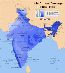
Soon after Mid June this the rainy season commences and continues till the end of September,[3] the beginning of this season occurs when a storm from the Bay of Bengal passes over Bihar. The commencement of monsoon may be as early as the last week of May or as the first or second week of July. The rainy season begins in June. The rainiest months are July and August. The rains are the gifts of the south west monsoon. There are three distinct areas where rainfall exceeds 1800 mm. Two of them lie on northern and north-western wings of the state and the third lies in the Netarhat pat. The south-west monsoon normally withdraws from Bihar in the first week of October.
Post Monsoon
An important feature of the retreating monsoon season in Bihar is the invasion of tropical cyclones originating in the Bay of Bengal at about 12° N latitude. Bihar is also influenced by the typhoons originating in the south China sea. The maximum frequency of the tropical cyclones in Bihar is during September–November[3] especially during the asterism called hathiya. These cyclones are essential for the maturing of paddy, and are required for the moistening of the soil for the cultivation of rabi crops.
Statistics
Temperature
| — | Winter (Jan – Feb) |
Summer (Mar – May) |
Monsoon (Jun – Sep) |
Post-monsoon (Oct – Dec) |
Year-round | ||||||||
|---|---|---|---|---|---|---|---|---|---|---|---|---|---|
| City | Jan | Feb | Mar | April | may | June | Jul | Aug | Sep | Oct | Nov | Dec | Avg |
| Patna | 16 | 19 | 25 | 30 | 31 | 31 | 29 | 29 | 28 | 26 | 22 | 17 | 26 |
| Arrah | 16 | 18 | 24 | 30 | 31 | 30 | 29 | 28 | 29 | 26 | 21 | 17 | 25 |
| Darbhanga | 16 | 18 | 23 | 28 | 29 | 29 | 29 | 28 | 28 | 26 | 21 | 17 | 25 |
Precipitation
| — | Winter (Jan – Feb) |
Summer (Mar – May) |
Monsoon (Jun – Sep) |
Post-monsoon (Oct – Dec) |
Year-round | ||||||||
|---|---|---|---|---|---|---|---|---|---|---|---|---|---|
| City | Jan | Feb | Mar | Apr | May | Jun | Jul | Aug | Sep | Oct | Nov | Dec | Total |
| Patna | 10 | --- | 10 | --- | 40 | 120 | 220 | 260 | 170 | 70 | 10 | --- | 990 |
| Gaya | 20 | 19 | 12 | 7 | 21 | 137 | 314 | 328 | 206 | 53 | 10 | 4 | 1130 |
| Arrah | 10 | 10 | 10 | --- | 30 | 180 | 290 | 330 | 210 | 50 | --- | --- | 1180 |
| Darbhanga | 10 | 10 | 10 | 10 | 60 | 190 | 300 | 340 | 230 | 50 | --- | --- | 1260 |
Disasters
Floods

Total human deaths is 5874 and animal deaths is 19044 in Bihar due to floods between 1979–2006[8][9]
Bihar is India's most flood-prone State, with 76% of the population in the north Bihar living under the recurring threat of flood devastation.[10] According to some historical data, 16.5% of the total flood affected area in India is located in Bihar while 22.1% of the flood affected population in India lives in Bihar.[11] About 68,800 square kilometres (26,600 sq mi) out of total geographical area of 94,160 square kilometres (36,360 sq mi) comprising 73.06% is flood affected. Floods in Bihar are a recurring disaster which on an annual basis destroys thousands of human lives apart from livestock and assets worth millions.[10]
There are many environmental issues in Bihar. Air pollution, water pollution, garbage, and pollution of the natural environment are all challenges for Bihar.
See also
- 1934 Nepal–Bihar earthquake
- Bengal famine of 1770
- Bihar famine of 1873–74
- Climate of India
- Climatic regions of India
- Geography of Bihar
- Golghar
References
- "Archived copy". Archived from the original on 2008-06-11. Retrieved 2008-11-23.CS1 maint: archived copy as title (link)
- "Soil and Climate of Bihar". Archived from the original on 2011-09-28. Retrieved 2011-09-13.
- "Country Guide: India". BBC Weather. Archived from the original on 2005-05-25. Retrieved 2007-03-23.
- "Weatherbase". Archived from the original on 2007-03-22. Retrieved 2007-03-24.
- "Wunderground". Weather Underground. Archived from the original on 2007-03-21. Retrieved 2007-03-24.
- "Weather.com". The Weather Channel. Archived from the original on 2007-03-23. Retrieved 2007-03-23.
- Disaster Management in Bihar Archived 2008-10-23 at the Wayback Machine
- Disaster Management in Bihar - Statistics Archived 2008-10-19 at the Wayback Machine
- Flood Management Information System – History of Flood in Bihar Archived 2010-04-19 at the Wayback Machine
- India Water Portal – Bihar Floods 2008 Archived 2009-02-01 at the Wayback Machine