Woodstock, Georgia
Woodstock is a city in Cherokee County, Georgia, United States. The population was 23,896 at the 2010 census.[2] Originally a stop on the Louisville and Nashville Railroad, Woodstock is part of the Atlanta metropolitan area. In 2007 it was the tenth fastest-growing suburb in the United States.[6]
Woodstock, Georgia | |
|---|---|
City | |
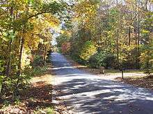
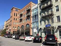 Downtown Woodstock | |
 Seal | |
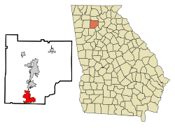 Location in Cherokee County and the state of Georgia | |
 Woodstock, Georgia Location in Cherokee County and the state of Georgia  Woodstock, Georgia Woodstock, Georgia (the United States)  Woodstock, Georgia Woodstock, Georgia (Metro Atlanta) | |
| Coordinates: 34°06′05″N 84°31′10″W | |
| Country | United States |
| State | Georgia |
| County | Cherokee |
| Government | |
| • Mayor | Donnie Henriques (R) |
| Area | |
| • Total | 12.53 sq mi (32.46 km2) |
| • Land | 12.43 sq mi (32.19 km2) |
| • Water | 0.10 sq mi (0.27 km2) |
| Elevation | 968 ft (291 m) |
| Population | |
| • Total | 23,896 |
| • Estimate (2019)[3] | 33,039 |
| • Density | 2,593.45/sq mi (1,001.33/km2) |
| Time zone | UTC−5 (EST) |
| • Summer (DST) | UTC−4 (EDT) |
| ZIP codes | 30188-30189 |
| Area code | 770/678/470 |
| FIPS code | 13-84176[4] |
| GNIS feature ID | 0333462[5] |
| Website | www |
History
The Georgia General Assembly incorporated Woodstock as a town in 1897.[7] The community derives its name from Woodstock, an 1826 novel by Walter Scott.[8]
The Woodstock Depot was built in 1912 by the Louisville & Nashville Railroad as the town grew. The line transported cotton, rope, and other agricultural products, as well as passengers. Passenger service ended in 1949.[9]
Geography
According to the United States Census Bureau, Woodstock has a total area of 11.3 square miles (29.2 km2), of which 11.2 square miles (28.9 km2) is land and 0.12 square miles (0.3 km2), or 0.92%, is water.[10]
Demographics
| Historical population | |||
|---|---|---|---|
| Census | Pop. | %± | |
| 1880 | 92 | — | |
| 1900 | 276 | — | |
| 1910 | 442 | 60.1% | |
| 1920 | 415 | −6.1% | |
| 1930 | 421 | 1.4% | |
| 1940 | 389 | −7.6% | |
| 1950 | 545 | 40.1% | |
| 1960 | 726 | 33.2% | |
| 1970 | 870 | 19.8% | |
| 1980 | 2,699 | 210.2% | |
| 1990 | 4,361 | 61.6% | |
| 2000 | 10,050 | 130.5% | |
| 2010 | 23,896 | 137.8% | |
| Est. 2019 | 33,039 | [3] | 38.3% |
| U.S. Decennial Census[11] | |||
As of the census of 2010,[2] there were 23,896 people, 9,580 households, and 6,137 families residing in the city. The population density was 2,715.4 people per square mile (1043.5/km²). There were 10,298 housing units at an average density of 1170.2 per square mile (449.7/km²). The racial makeup of the city was 79.3% White, 10.2% African American, 0.2% American Indian, 4.5% Asian, 0.02% Pacific Islander, 2.7% from other races, and 3.1% from two or more races. Hispanic or Latino of any race were 9.7% of the population.
There were 9,580 households out of which 35.2% had children under the age of 18 living with them, 48.8% were married couples living together, 11.7% had a female householder with no husband present, and 35.9% were non-families. 29.3% of all households were made up of individuals and 7.5% had someone living alone who was 65 years of age or older. The average household size was 2.48 and the average family size was 3.12.
In the city, the age distribution of the population shows 26.5% under the age of 18, 6.8% from 18 to 24, 37.4% from 25 to 44, 20.8% from 45 to 64, and 8.5% who were 65 years of age or older. The median age was 34 years. For every 100 females, there were 88.4 males. For every 100 females age 18 and over, there were 84.1 males.
In 2000, the median income for a household in the city was $58,506, and the median income for a family was $65,740. Males had a median income of $48,054 versus $32,798 for females. The per capita income for the city was $25,586. About 2.2% of families and 4.2% of the population were below the poverty line, including 5.0% of those under age 18 and 8.6% of those age 65 or over.
Arts and culture
Memorials
On May 25, 2009, the city of Woodstock unveiled the new Woodstock Memorial, 10 tons of polished granite dedicated to Woodstock veterans. It reads: "To the men and women of Woodstock, Georgia who served in the armed forces of our country preserving our freedom and our way of life Erected in their honor - May 2009".[12][13]
A one-lane bridge over Kellogg Creek along Kemp Drive was named after 15-year-old Katie Hamlin, who was murdered in 2002.[14]
Parks and recreation
The Greenprints Project
The Greenprints Project[15] calls for the construction of trails along the city's natural areas like the Little River, Noonday Creek, and the U.S. Army Corps of Engineers' property, and in the city's core areas. Bike lanes, which within the project are considered trails, would be built along roads throughout the city.
The proposed trails would connect with existing trails elsewhere in Cherokee County as well as in the cities of Roswell and Alpharetta and Cobb County. The project also would preserve greenspace throughout the city and create new parks.
Greenprints Alliance, Inc. is a grassroots citizen action group formed in spring 2009 to advance the city of Woodstock's green infrastructure master plan known as the Greenprints Project. When complete, the project will add over 60 miles (97 km) of trails throughout the city connecting every public place, shopping area and neighborhood.[16]
Infrastructure
Transportation
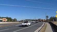
Major roads


Pedestrians and cycling
- Noonday Creek Trail
- Serenade Trail
- Trestle Rock Trail
City services
Woodstock maintains its own fire and police departments. As of January 2018, the fire department had two fire stations and 44 certified fire fighters. The fire department is commanded by Dave Soumas.[17] The police department is composed of four divisions with 54 sworn officers. Calvin Moss is the Chief of Police.[18] They are the largest municipal police department in Cherokee County, responsible for 11 square miles (28 km2) and over 23,000 residents (as of October, 2007).
Notable people
- Buff Bagwell, professional wrestler, five-time WCW World Tag Team champion
- Eugene T. Booth, Rhodes Scholar who constructed the Columbia University cyclotron and worked on the Manhattan Project
- Lew Carpenter, Baseball player, Washington Senators (1943–1945)
- Mary Hood, author
- Johnny Hunt, president of the Southern Baptist Convention (2008–2010)
- Harold S. Johnston, chemist and National Medal of Science laureate
- Chris Kirk, PGA Tour golfer
- Dusan Langura, basketball player
- Nick Markakis, baseball player, Atlanta Braves
- Bruce Miller, NFL football player, San Francisco 49ers (2011-2016)
- Rich The Kid, rap artist
- Chandler Riggs, actor
- Dean Rusk, United States Secretary of State (1961–1969)
- Buster Skrine, NFL player, Chicago Bears
- Mark Wills, country music artist
- Tyler Speer, professional racer
References
- "2018 U.S. Gazetteer Files". United States Census Bureau. Retrieved Feb 12, 2020.
- "2010 Census Data". US Census Bureau. Archived from the original on February 12, 2020. Retrieved August 30, 2011.
- "Population and Housing Unit Estimates". Retrieved May 21, 2020.
- "U.S. Census website". United States Census Bureau. Retrieved 2008-01-31.
- "US Board on Geographic Names". United States Geological Survey. 2007-10-25. Retrieved 2008-01-31.
- Woolsey, Matt (July 16, 2007). "America's Fastest-Growing Suburbs". Forbes.com. Retrieved September 16, 2007.
- Acts of the General Assembly of the State of Georgia. Clark & Hines, State Printers. 1898. p. 368.
- Krakow, Kenneth K. (1975). Georgia Place-Names: Their History and Origins (PDF). Macon, GA: Winship Press. p. 257. ISBN 0-915430-00-2.
- "Archived copy". Archived from the original on 2014-03-24. Retrieved 2014-03-24.CS1 maint: archived copy as title (link)
- "Geographic Identifiers: 2010 Demographic Profile Data (G001): Canton city, Georgia". U.S. Census Bureau, American Factfinder. Archived from the original on February 12, 2020. Retrieved July 24, 2014.
- "Census of Population and Housing". Census.gov. Retrieved June 4, 2015.
- "Woodstock Memorial-Woodstock, Georgia Image". Waymarking.com.
- "34°06'05.5"N 84°31'07.4"W". 34°06'05.5"N 84°31'07.4"W.
- "Cherokee County names bridge after late teen".
- "." Greenprints Alliance Project. Accessed October 10, 2012.
- Dixon, Crystal (January 1, 2010). "Banner Year". Cherokee Tribune. Retrieved January 3, 2010.
- "Woodstock Ga Fire Department". City of Woodstock Ga. Retrieved 24 January 2018.
- "Woodstock, GA - Official Website". Woodstockga.gov. Retrieved 12 July 2018.
External links
|  | |||||
|
| ||||||
| ||||||
Municipalities and communities of Cherokee County, Georgia, United States | ||
|---|---|---|
| Cities | 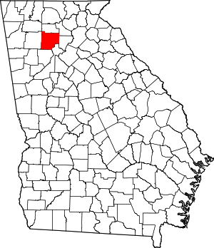 Map of Georgia highlighting Cherokee County | |
| Unincorporated communities | ||
| Footnotes | ‡This populated place also has portions in an adjacent county or counties | |
| Authority control |
|
|---|