Toney Fork, West Virginia
| Toney Fork, West Virginia | |
|---|---|
| Unincorporated community | |
 Toney Fork, West Virginia  Toney Fork, West Virginia | |
| Coordinates: 37°42′46″N 81°35′51″W / 37.71278°N 81.59750°WCoordinates: 37°42′46″N 81°35′51″W / 37.71278°N 81.59750°W | |
| Country | United States |
| State | West Virginia |
| County | Wyoming |
| Elevation | 1,362 ft (415 m) |
| Time zone | UTC-5 (Eastern (EST)) |
| • Summer (DST) | UTC-4 (EDT) |
| Area code(s) | 304 & 681 |
| GNIS feature ID | 1548155[1] |
Toney Fork is an unincorporated community in Wyoming County, West Virginia, United States. Toney Fork is located on West Virginia Route 85 at the confluence of the Clear Fork and the Toney Fork, 2 miles (3.2 km) northeast of Oceana.[2]
The community takes its name from nearby Toney Fork creek.[3]
References
- ↑ "Toney Fork". Geographic Names Information System. United States Geological Survey.
- ↑ Wyoming County, West Virginia General Highway Map (PDF) (Map). West Virginia Department of Transportation. 2011. p. 1. Retrieved February 24, 2013.
- ↑ Kenny, Hamill (1945). West Virginia Place Names: Their Origin and Meaning, Including the Nomenclature of the Streams and Mountains. Piedmont, WV: The Place Name Press. p. 629.
Municipalities and communities of Wyoming County, West Virginia, United States | ||
|---|---|---|
| City | 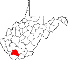 | |
| Towns | ||
| CDPs | ||
| Unincorporated communities |
| |
| Footnotes | ‡This populated place also has portions in an adjacent county or counties | |
This article is issued from
Wikipedia.
The text is licensed under Creative Commons - Attribution - Sharealike.
Additional terms may apply for the media files.