Vialas
| Vialas | ||
|---|---|---|
| Commune | ||
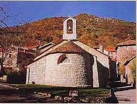 Protestant church in Vialas | ||
| ||
 Vialas Location within Occitanie region  Vialas | ||
| Coordinates: 44°20′04″N 3°53′48″E / 44.3344°N 3.8967°ECoordinates: 44°20′04″N 3°53′48″E / 44.3344°N 3.8967°E | ||
| Country | France | |
| Region | Occitanie | |
| Department | Lozère | |
| Arrondissement | Florac | |
| Canton | Saint-Étienne-du-Valdonnez | |
| Government | ||
| • Mayor (2008–2014) | Bernard Vignes[1] | |
| Area1 | 49.77 km2 (19.22 sq mi) | |
| Population (1999)2 | 425 | |
| • Density | 8.5/km2 (22/sq mi) | |
| Time zone | UTC+1 (CET) | |
| • Summer (DST) | UTC+2 (CEST) | |
| INSEE/Postal code | 48194 /48220 | |
| Elevation |
335–1,509 m (1,099–4,951 ft) (avg. 610 m or 2,000 ft) | |
|
1 French Land Register data, which excludes lakes, ponds, glaciers > 1 km2 (0.386 sq mi or 247 acres) and river estuaries. 2 Population without double counting: residents of multiple communes (e.g., students and military personnel) only counted once. | ||

Vialas is a commune in the Lozère department in southern France.
Population
| Year | 1793 | 1800 | 1806 | 1821 | 1831 | 1836 | 1841 | 1846 | 1851 | 1856 | 1861 | 1866 | 1872 | 1876 | 1881 | 1886 |
|---|---|---|---|---|---|---|---|---|---|---|---|---|---|---|---|---|
| Population | 1 550 | 1 709 | 1 790 | 2 051 | 2 041 | 2 130 | 2 126 | 1 990 | 2 005 | 1 980 | 2 299 | 2 448 | 2 310 | 2 152 | 2 096 | 2 002 |
| Year | 1891 | 1896 | 1901 | 1906 | 1911 | 1921 | 1926 | 1931 | 1936 | 1946 | 1954 | 1962 | 1968 | 1975 | 1982 | 1990 | 1999 |
|---|---|---|---|---|---|---|---|---|---|---|---|---|---|---|---|---|---|
| Population | 1 720 | 1 463 | 1 359 | 1 285 | 1 179 | 890 | 848 | 796 | 809 | 617 | 507 | 478 | 352 | 304 | 356 | 384 | 425 |
See also
References
- ↑ Site du conseil général de la Lozère Archived October 24, 2008, at the Wayback Machine.
| Wikimedia Commons has media related to Vialas. |
This article is issued from
Wikipedia.
The text is licensed under Creative Commons - Attribution - Sharealike.
Additional terms may apply for the media files.