Saint-Martin-de-Lansuscle
| Saint-Martin-de-Lansuscle | |
|---|---|
| Commune | |
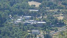 An overview of Saint-Martin-de-Lansuscle from the Col de Malhaussette | |
 Saint-Martin-de-Lansuscle Location within Occitanie region  Saint-Martin-de-Lansuscle | |
| Coordinates: 44°13′01″N 3°45′14″E / 44.2169°N 3.7539°ECoordinates: 44°13′01″N 3°45′14″E / 44.2169°N 3.7539°E | |
| Country | France |
| Region | Occitanie |
| Department | Lozère |
| Arrondissement | Florac |
| Canton | Le Collet-de-Dèze |
| Intercommunality | Cévenne des Hauts Gardons |
| Government | |
| • Mayor (2008–2014) | Hubert Pfister |
| Area1 | 18.05 km2 (6.97 sq mi) |
| Population (1999)2 | 141 |
| • Density | 7.8/km2 (20/sq mi) |
| Time zone | UTC+1 (CET) |
| • Summer (DST) | UTC+2 (CEST) |
| INSEE/Postal code | 48171 /48110 |
| Elevation |
376–1,147 m (1,234–3,763 ft) (avg. 600 m or 2,000 ft) |
|
1 French Land Register data, which excludes lakes, ponds, glaciers > 1 km2 (0.386 sq mi or 247 acres) and river estuaries. 2 Population without double counting: residents of multiple communes (e.g., students and military personnel) only counted once. | |
Saint-Martin-de-Lansuscle is a commune in the Lozère department in southern France.
See also
References
| Wikimedia Commons has media related to Saint-Martin-de-Lansuscle. |
This article is issued from
Wikipedia.
The text is licensed under Creative Commons - Attribution - Sharealike.
Additional terms may apply for the media files.