Saint-Léger-du-Malzieu
| Saint-Léger-du-Malzieu | |
|---|---|
| Commune | |
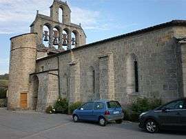 The church of Saint-Barthélémy, in Saint-Léger-du-Malzieu | |
 Saint-Léger-du-Malzieu Location within Occitanie region  Saint-Léger-du-Malzieu | |
| Coordinates: 44°53′19″N 3°18′38″E / 44.8886°N 3.3106°ECoordinates: 44°53′19″N 3°18′38″E / 44.8886°N 3.3106°E | |
| Country | France |
| Region | Occitanie |
| Department | Lozère |
| Arrondissement | Mende |
| Canton | Saint-Alban-sur-Limagnole |
| Intercommunality | Terres d'Apcher |
| Government | |
| • Mayor (2008–2014) | Ludovic Jaffuel |
| Area1 | 18.92 km2 (7.31 sq mi) |
| Population (1999)2 | 189 |
| • Density | 10.0/km2 (26/sq mi) |
| Time zone | UTC+1 (CET) |
| • Summer (DST) | UTC+2 (CEST) |
| INSEE/Postal code | 48169 /48140 |
| Elevation |
797–1,184 m (2,615–3,885 ft) (avg. 859 m or 2,818 ft) |
|
1 French Land Register data, which excludes lakes, ponds, glaciers > 1 km2 (0.386 sq mi or 247 acres) and river estuaries. 2 Population without double counting: residents of multiple communes (e.g., students and military personnel) only counted once. | |
Saint-Léger-du-Malzieu (Auvergnat: Sent Latgièr del Malasiu) is a commune in the Lozère department in southern France.
See also
References
| Wikimedia Commons has media related to Saint-Léger-du-Malzieu. |
This article is issued from
Wikipedia.
The text is licensed under Creative Commons - Attribution - Sharealike.
Additional terms may apply for the media files.