Saint-Laurent-de-Muret
| Saint-Laurent-de-Muret | |
|---|---|
| Commune | |
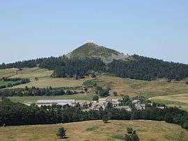 Saint-Laurent-de-Muret and the Pic de Mus | |
 Saint-Laurent-de-Muret Location within Occitanie region  Saint-Laurent-de-Muret | |
| Coordinates: 44°36′11″N 3°12′27″E / 44.6031°N 3.20750°ECoordinates: 44°36′11″N 3°12′27″E / 44.6031°N 3.20750°E | |
| Country | France |
| Region | Occitanie |
| Department | Lozère |
| Arrondissement | Mende |
| Canton | Aumont-Aubrac |
| Intercommunality | Gévaudan |
| Government | |
| • Mayor (2008–2014) | Jean-François de Jabrun |
| Area1 | 46.04 km2 (17.78 sq mi) |
| Population (1999)2 | 164 |
| • Density | 3.6/km2 (9.2/sq mi) |
| Time zone | UTC+1 (CET) |
| • Summer (DST) | UTC+2 (CEST) |
| INSEE/Postal code | 48165 /48100 |
| Elevation |
976–1,381 m (3,202–4,531 ft) (avg. 1,120 m or 3,670 ft) |
|
1 French Land Register data, which excludes lakes, ponds, glaciers > 1 km2 (0.386 sq mi or 247 acres) and river estuaries. 2 Population without double counting: residents of multiple communes (e.g., students and military personnel) only counted once. | |
Saint-Laurent-de-Muret is a commune in the Lozère department in southern France. It is located on the east of the Aubrac region (Massif central).
See also
References
| Wikimedia Commons has media related to Saint-Laurent-de-Muret. |
This article is issued from
Wikipedia.
The text is licensed under Creative Commons - Attribution - Sharealike.
Additional terms may apply for the media files.