Saint-Flour-de-Mercoire
| Saint-Flour-de-Mercoire | |
|---|---|
| Commune | |
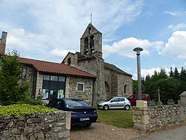 Church and Mairie | |
 Saint-Flour-de-Mercoire Location within Occitanie region  Saint-Flour-de-Mercoire | |
| Coordinates: 44°41′47″N 3°49′34″E / 44.6964°N 3.8261°ECoordinates: 44°41′47″N 3°49′34″E / 44.6964°N 3.8261°E | |
| Country | France |
| Region | Occitanie |
| Department | Lozère |
| Arrondissement | Mende |
| Canton | Langogne |
| Intercommunality | Haut Allier |
| Government | |
| • Mayor (2008–2014) | Charles Castanier |
| Area1 | 12.17 km2 (4.70 sq mi) |
| Population (1999)2 | 121 |
| • Density | 9.9/km2 (26/sq mi) |
| Time zone | UTC+1 (CET) |
| • Summer (DST) | UTC+2 (CEST) |
| INSEE/Postal code | 48150 /48300 |
| Elevation |
954–1,229 m (3,130–4,032 ft) (avg. 1,000 m or 3,300 ft) |
|
1 French Land Register data, which excludes lakes, ponds, glaciers > 1 km2 (0.386 sq mi or 247 acres) and river estuaries. 2 Population without double counting: residents of multiple communes (e.g., students and military personnel) only counted once. | |
Saint-Flour-de-Mercoire is a commune in the Lozère department in southern France. The Robert Louis Stevenson Trail (GR 70), a popular long-distance path, runs through the village.[1]
See also
References
- Notes
- Sources
| Wikimedia Commons has media related to Saint-Flour-de-Mercoire. |
This article is issued from
Wikipedia.
The text is licensed under Creative Commons - Attribution - Sharealike.
Additional terms may apply for the media files.