Les Bondons
| Les Bondons | |
|---|---|
| Commune | |
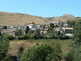 A general view of Les Bondons | |
 Les Bondons Location within Occitanie region  Les Bondons | |
| Coordinates: 44°23′14″N 3°37′12″E / 44.3872°N 3.62000°ECoordinates: 44°23′14″N 3°37′12″E / 44.3872°N 3.62000°E | |
| Country | France |
| Region | Occitanie |
| Department | Lozère |
| Arrondissement | Florac |
| Canton | Saint-Étienne-du-Valdonnez |
| Intercommunality | Pays de Florac et du Haut Tarn |
| Government | |
| • Mayor (2008–2014) | Michel Palmier |
| Area1 | 45.54 km2 (17.58 sq mi) |
| Population (2009)2 | 141 |
| • Density | 3.1/km2 (8.0/sq mi) |
| Time zone | UTC+1 (CET) |
| • Summer (DST) | UTC+2 (CEST) |
| INSEE/Postal code | 48028 /48400 |
| Elevation |
600–1,569 m (1,969–5,148 ft) (avg. 863 m or 2,831 ft) |
|
1 French Land Register data, which excludes lakes, ponds, glaciers > 1 km2 (0.386 sq mi or 247 acres) and river estuaries. 2 Population without double counting: residents of multiple communes (e.g., students and military personnel) only counted once. | |
Les Bondons is a commune in the Lozère department in southern France.
Population
| Historical population | ||
|---|---|---|
| Year | Pop. | ±% |
| 1793 | 895 | — |
| 1800 | 902 | +0.8% |
| 1806 | 1,039 | +15.2% |
| 1821 | 956 | −8.0% |
| 1831 | 952 | −0.4% |
| 1836 | 983 | +3.3% |
| 1841 | 967 | −1.6% |
| 1846 | 956 | −1.1% |
| 1851 | 1,004 | +5.0% |
| 1856 | 900 | −10.4% |
| 1861 | 921 | +2.3% |
| 1866 | 895 | −2.8% |
| 1872 | 819 | −8.5% |
| 1876 | 876 | +7.0% |
| 1881 | 932 | +6.4% |
| 1886 | 948 | +1.7% |
| 1891 | 922 | −2.7% |
| 1896 | 879 | −4.7% |
| 1901 | 830 | −5.6% |
| 1906 | 795 | −4.2% |
| 1911 | 781 | −1.8% |
| 1921 | 648 | −17.0% |
| 1926 | 602 | −7.1% |
| 1931 | 567 | −5.8% |
| 1936 | 488 | −13.9% |
| 1946 | 430 | −11.9% |
| 1954 | 367 | −14.7% |
| 1962 | 291 | −20.7% |
| 1968 | 230 | −21.0% |
| 1975 | 234 | +1.7% |
| 1982 | 194 | −17.1% |
| 1990 | 159 | −18.0% |
| 1999 | 150 | −5.7% |
| 2006 | 140 | −6.7% |
| 2009 | 141 | +0.7% |
See also
References
| Wikimedia Commons has media related to Les Bondons. |
This article is issued from
Wikipedia.
The text is licensed under Creative Commons - Attribution - Sharealike.
Additional terms may apply for the media files.