Recoules-de-Fumas
| Recoules-de-Fumas | |
|---|---|
| Commune | |
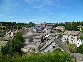 The village of Recoules-de-Fumas | |
 Recoules-de-Fumas Location within Occitanie region  Recoules-de-Fumas | |
| Coordinates: 44°38′31″N 3°20′48″E / 44.6419°N 3.3467°ECoordinates: 44°38′31″N 3°20′48″E / 44.6419°N 3.3467°E | |
| Country | France |
| Region | Occitanie |
| Department | Lozère |
| Arrondissement | Mende |
| Canton | Marvejols |
| Intercommunality | Gévaudan |
| Government | |
| • Mayor (2001–2008) | Michel Brun |
| Area1 | 9.77 km2 (3.77 sq mi) |
| Population (1999)2 | 91 |
| • Density | 9.3/km2 (24/sq mi) |
| Time zone | UTC+1 (CET) |
| • Summer (DST) | UTC+2 (CEST) |
| INSEE/Postal code | 48124 /48100 |
| Elevation |
879–1,144 m (2,884–3,753 ft) (avg. 1,050 m or 3,440 ft) |
|
1 French Land Register data, which excludes lakes, ponds, glaciers > 1 km2 (0.386 sq mi or 247 acres) and river estuaries. 2 Population without double counting: residents of multiple communes (e.g., students and military personnel) only counted once. | |
Recoules-de-Fumas is a commune in the Lozère department in southern France.
Geography
The Colagne forms most of the commune's eastern border.
See also
| Wikimedia Commons has media related to Recoules-de-Fumas. |
This article is issued from
Wikipedia.
The text is licensed under Creative Commons - Attribution - Sharealike.
Additional terms may apply for the media files.