Cubières
| Cubières | ||
|---|---|---|
| Commune | ||
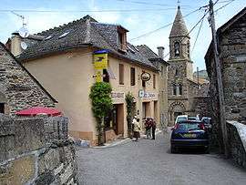 A view within the village, of the church and surrounding buildings | ||
| ||
 Cubières Location within Occitanie region  Cubières | ||
| Coordinates: 44°28′27″N 3°46′24″E / 44.4742°N 3.7733°ECoordinates: 44°28′27″N 3°46′24″E / 44.4742°N 3.7733°E | ||
| Country | France | |
| Region | Occitanie | |
| Department | Lozère | |
| Arrondissement | Mende | |
| Canton | Saint-Étienne-du-Valdonnez | |
| Intercommunality | Goulet-Mont Lozère | |
| Government | ||
| • Mayor (2008–2014) | Stéphan Massador[1] | |
| Area1 | 48.88 km2 (18.87 sq mi) | |
| Population (1999)2 | 197 | |
| • Density | 4.0/km2 (10/sq mi) | |
| Time zone | UTC+1 (CET) | |
| • Summer (DST) | UTC+2 (CEST) | |
| INSEE/Postal code | 48053 /48190 | |
| Elevation |
756–1,633 m (2,480–5,358 ft) (avg. 900 m or 3,000 ft) | |
|
1 French Land Register data, which excludes lakes, ponds, glaciers > 1 km2 (0.386 sq mi or 247 acres) and river estuaries. 2 Population without double counting: residents of multiple communes (e.g., students and military personnel) only counted once. | ||
.svg.png)
Cubières is a commune in the Lozère department in southern France.
See also
References
- ↑ Site du conseil général de la Lozère Archived 2008-10-24 at the Wayback Machine.
| Wikimedia Commons has media related to Cubières. |
This article is issued from
Wikipedia.
The text is licensed under Creative Commons - Attribution - Sharealike.
Additional terms may apply for the media files.