Blavignac
| Blavignac | |
|---|---|
| Commune | |
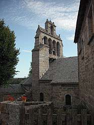 The church in Blavignac | |
 Blavignac Location within Occitanie region  Blavignac | |
| Coordinates: 44°53′11″N 3°17′15″E / 44.8864°N 3.28750°ECoordinates: 44°53′11″N 3°17′15″E / 44.8864°N 3.28750°E | |
| Country | France |
| Region | Occitanie |
| Department | Lozère |
| Arrondissement | Mende |
| Canton | Saint-Chély-d'Apcher |
| Government | |
| • Mayor (2008–2014) | Daniel Bestion |
| Area1 | 13.83 km2 (5.34 sq mi) |
| Population (2009)2 | 213 |
| • Density | 15/km2 (40/sq mi) |
| Time zone | UTC+1 (CET) |
| • Summer (DST) | UTC+2 (CEST) |
| INSEE/Postal code | 48026 /48200 |
| Elevation |
793–1,106 m (2,602–3,629 ft) (avg. 963 m or 3,159 ft) |
|
1 French Land Register data, which excludes lakes, ponds, glaciers > 1 km2 (0.386 sq mi or 247 acres) and river estuaries. 2 Population without double counting: residents of multiple communes (e.g., students and military personnel) only counted once. | |
Blavignac is a commune in the Lozère department in southern France.
Population
| Historical population | ||
|---|---|---|
| Year | Pop. | ±% |
| 1793 | 438 | — |
| 1800 | 359 | −18.0% |
| 1806 | 659 | +83.6% |
| 1821 | 461 | −30.0% |
| 1831 | 419 | −9.1% |
| 1836 | 450 | +7.4% |
| 1841 | 426 | −5.3% |
| 1846 | 422 | −0.9% |
| 1851 | 462 | +9.5% |
| 1856 | 446 | −3.5% |
| 1861 | 466 | +4.5% |
| 1866 | 433 | −7.1% |
| 1872 | 504 | +16.4% |
| 1876 | 505 | +0.2% |
| 1881 | 511 | +1.2% |
| 1886 | 521 | +2.0% |
| 1891 | 538 | +3.3% |
| 1896 | 558 | +3.7% |
| 1901 | 535 | −4.1% |
| 1906 | 430 | −19.6% |
| 1911 | 472 | +9.8% |
| 1921 | 414 | −12.3% |
| 1926 | 405 | −2.2% |
| 1931 | 380 | −6.2% |
| 1936 | 321 | −15.5% |
| 1946 | 291 | −9.3% |
| 1954 | 269 | −7.6% |
| 1962 | 275 | +2.2% |
| 1968 | 207 | −24.7% |
| 1975 | 162 | −21.7% |
| 1982 | 246 | +51.9% |
| 1990 | 273 | +11.0% |
| 1999 | 225 | −17.6% |
| 2006 | 214 | −4.9% |
| 2009 | 213 | −0.5% |
See also
References
| Wikimedia Commons has media related to Blavignac. |
This article is issued from
Wikipedia.
The text is licensed under Creative Commons - Attribution - Sharealike.
Additional terms may apply for the media files.