Ustou
| Ustou | |
|---|---|
| Commune | |
 Ruins of the chateau of Mirabat | |
 Ustou Location within Occitanie region  Ustou | |
| Coordinates: 42°47′59″N 1°15′52″E / 42.7997°N 1.2644°ECoordinates: 42°47′59″N 1°15′52″E / 42.7997°N 1.2644°E | |
| Country | France |
| Region | Occitanie |
| Department | Ariège |
| Arrondissement | Saint-Girons |
| Canton | Couserans Est |
| Intercommunality | Oust |
| Government | |
| • Mayor (2008–2014) | Alain Servat |
| Area1 | 98.34 km2 (37.97 sq mi) |
| Population (2008)2 | 346 |
| • Density | 3.5/km2 (9.1/sq mi) |
| Time zone | UTC+1 (CET) |
| • Summer (DST) | UTC+2 (CEST) |
| INSEE/Postal code | 09322 /09140 |
| Elevation |
560–2,803 m (1,837–9,196 ft) (avg. 746 m or 2,448 ft) |
|
1 French Land Register data, which excludes lakes, ponds, glaciers > 1 km2 (0.386 sq mi or 247 acres) and river estuaries. 2 Population without double counting: residents of multiple communes (e.g., students and military personnel) only counted once. | |
Ustou is a commune in the Ariège department in southwestern France.
The commune of Ustou comprises several villages: Saint-Lizier, Le Trein, Sérac; and numerous hamlets, including: Escots, Bieille, Rouzes.
Population
Inhabitants of Ustou are called Ustouens.
| Historical population | ||
|---|---|---|
| Year | Pop. | ±% |
| 1962 | 429 | — |
| 1968 | 502 | +17.0% |
| 1975 | 428 | −14.7% |
| 1982 | 520 | +21.5% |
| 1990 | 351 | −32.5% |
| 1999 | 299 | −14.8% |
| 2008 | 346 | +15.7% |
Sights
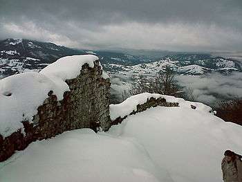
- The Château de Mirabat, a Middle Ages castle, known to be in ruins in the 14th century, is in the communes of Seix, Oust and Ustou.
See also
References
| Wikimedia Commons has media related to Ustou. |
This article is issued from
Wikipedia.
The text is licensed under Creative Commons - Attribution - Sharealike.
Additional terms may apply for the media files.