Aleu
| Aleu | |
|---|---|
| Commune | |
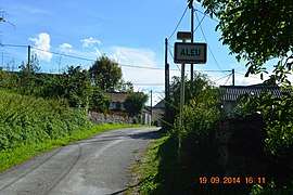 The road into Aleu | |
 Aleu Location within Occitanie region  Aleu | |
| Coordinates: 42°53′37″N 1°16′01″E / 42.8936°N 1.2669°ECoordinates: 42°53′37″N 1°16′01″E / 42.8936°N 1.2669°E | |
| Country | France |
| Region | Occitanie |
| Department | Ariège |
| Arrondissement | Saint-Girons |
| Canton | Couserans Est |
| Intercommunality | CC Couserans - Pyrénées |
| Government | |
| • Mayor (2014-2020) | André Vidal |
| Area1 | 13.95 km2 (5.39 sq mi) |
| Population (2014)2 | 122 |
| • Density | 8.7/km2 (23/sq mi) |
| Time zone | UTC+1 (CET) |
| • Summer (DST) | UTC+2 (CEST) |
| INSEE/Postal code | 09005 /09320 |
| Elevation |
496–1,105 m (1,627–3,625 ft) (avg. 700 m or 2,300 ft) |
|
1 French Land Register data, which excludes lakes, ponds, glaciers > 1 km2 (0.386 sq mi or 247 acres) and river estuaries. 2 Population without double counting: residents of multiple communes (e.g., students and military personnel) only counted once. | |
Aleu is a commune in the Ariège department in the Occitanie region of southwestern France.
The inhabitants of the commune are known as Aleudiens or Aleudiennes[1]
Geography
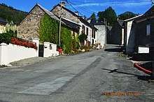
Aleu is located some 10 km south-east of Saint-Girons and 30 km west by south-west of Foix. It can be accessed by the D618 road coming from the west and following the northern border of the commune continuing to Biert in the east. The only access to the village by vehicle is by a small mountain road branching from the D618 at Castet d'Aleu. There is a small unsealed airstrip north-east of the village at approx 1000m altitude. The commune is very rugged with extensive forests. Apart from the village, there are numerous hamlets: Castet d'Aleu, Galas d'en Bas and Galas d'en Haut, La Trappe, La Bordasse, Biech, Pinsou, La Rouere and Fontale.[2]
The Ruisseau d'Aleu rises in the south of the commune and flows north through the centre of the commune and the village gathering many tributaries and continues to join the Arac which forms the entire northern border of the commune. The Ruisseau de Loule forms most of the eastern border and also flows into the Arac. In the west the Ruisseau de Regude forms most of the border and flows north-west to join the Arac north-west of the commune.[2]
Neighbouring communes and villages[2]
Places adjacent to Aleu | ||||||||||
|---|---|---|---|---|---|---|---|---|---|---|
| ||||||||||
History
The commune of Aleu was created in the French Revolution superseding the Community of Aleu which was detached in 1776 from that of Soulan.
Administration
List of successive mayors[3]
| From | To | Name | Party | Position |
|---|---|---|---|---|
| 2001 | 2008 | Louis Gilabert | ||
| 2008 | 2020 | André Vidal |
(Not all data is known)
Demography
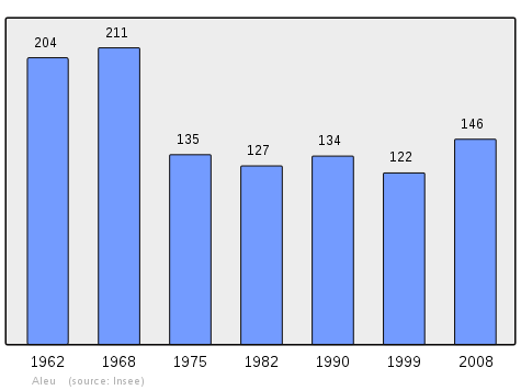
In 2013, the commune had 125 inhabitants. The evolution of the number of inhabitants is known through the population censuses conducted in the commune since 1793. From the 21st century, a census of communes with fewer than 10,000 inhabitants is held every five years, unlike larger towns that have a sample survey every year.[Note 1]
| 1793 | 1800 | 1806 | 1821 | 1831 | 1836 | 1841 | 1846 | 1851 |
|---|---|---|---|---|---|---|---|---|
| 1,095 | 1,107 | 1,205 | 1,069 | 1,175 | 1,343 | 1,331 | 1,283 | 1,204 |
| 1856 | 1861 | 1866 | 1872 | 1876 | 1881 | 1886 | 1891 | 1896 |
|---|---|---|---|---|---|---|---|---|
| 1,136 | 1,174 | 1,130 | 1,162 | 1,151 | 1,076 | 1,151 | 1,148 | 1,032 |
| 1901 | 1906 | 1911 | 1921 | 1926 | 1931 | 1936 | 1946 | 1954 |
|---|---|---|---|---|---|---|---|---|
| 974 | 921 | 790 | 695 | 595 | 531 | 516 | 386 | 293 |
| 1962 | 1968 | 1975 | 1982 | 1990 | 1999 | 2006 | 2008 | 2010 |
|---|---|---|---|---|---|---|---|---|
| 204 | 211 | 135 | 127 | 134 | 122 | 141 | 146 | 152 |
Sources : Ldh/EHESS/Cassini until 1962, INSEE database from 1968 (population without double counting and municipal population from 2006)
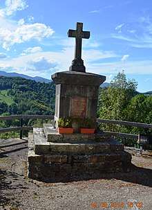
Sites and monuments
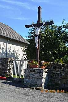
- Joubac, a small peak just above Aleu, has an altiport with a view of all the surrounding mountains and the Mont Valier mountain chain[4]
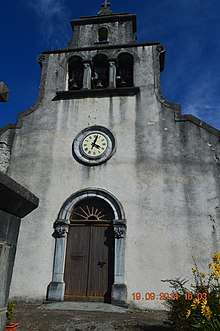
- The Church of Saint Benedict contains a 12th-century font

- Church of Saint Roch and Saint Germaine at Castet d'Aleu (windows from the 19th century)
- Castelet of Castet at Aleu dating from the 12th or 13th century
Notable people linked to the commune
- Léopold Galy, born in Aleu on 12 March 1908 and died at Toulouse on 17 February 2001, was a French aviator and test pilot
See also
Notes and references
Notes
- ↑ At the beginning of the 21st century, the methods of identification have been modified by law No. 2002-276 of 27 February 2002 Archived 2016-03-06 at the Wayback Machine., the so-called "law of local democracy" and in particular Title V "census operations" which allow, after a transitional period running from 2004 to 2008, the annual publication of the legal population of the different French administrative districts. For municipalities with a population greater than 10,000 inhabitants, a sample survey is conducted annually, the entire territory of these municipalities is taken into account at the end of the period of five years. The first "legal population" after 1999 under this new law came into force on 1 January 2009 and was based on the census of 2006.
References
- ↑ Inhabitants of Ariège (in French)
- 1 2 3 Google Maps
- ↑ List of Mayors of France
- ↑ LE PANORAMA DE JOUBAC, (in French)
- ↑ Ministry of Culture, Palissy PM09000003 Bénitier
(in French)

External links
- Aleu on the old IGN website (in French)
- Aleu on Lion1906
- Aleu on Google Maps
- Aleu on Géoportail, National Geographic Institute (IGN) website (in French)
- Aleu on the 1750 Cassini Map
- Aleu on the INSEE website (in French)
- INSEE (in French)
| Wikimedia Commons has media related to Aleu. |