Montégut-Plantaurel
| Montégut-Plantaurel | |
|---|---|
| Commune | |
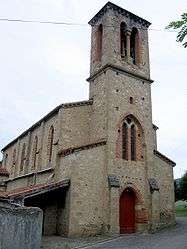 The church in Montégut-Plantaurel | |
 Montégut-Plantaurel Location within Occitanie region  Montégut-Plantaurel | |
| Coordinates: 43°04′12″N 1°29′11″E / 43.07°N 1.4864°ECoordinates: 43°04′12″N 1°29′11″E / 43.07°N 1.4864°E | |
| Country | France |
| Region | Occitanie |
| Department | Ariège |
| Arrondissement | Foix |
| Canton | Val d'Ariège |
| Intercommunality | Canton of Varilhes |
| Government | |
| • Mayor (2008–2014) | Michel Carriere |
| Area1 | 18.95 km2 (7.32 sq mi) |
| Population (2008)2 | 320 |
| • Density | 17/km2 (44/sq mi) |
| Time zone | UTC+1 (CET) |
| • Summer (DST) | UTC+2 (CEST) |
| INSEE/Postal code | 09202 /09120 |
| Elevation |
307–630 m (1,007–2,067 ft) (avg. 325 m or 1,066 ft) |
|
1 French Land Register data, which excludes lakes, ponds, glaciers > 1 km2 (0.386 sq mi or 247 acres) and river estuaries. 2 Population without double counting: residents of multiple communes (e.g., students and military personnel) only counted once. | |
Montégut-Plantaurel is a commune in the Ariège department in southwestern France.
Geography
The Lèze flows through the northwestern part of the commune.
History
The Chateau de La Hille, was home to Jewish refugee children during the early 1940s.[1]
Population
| Historical population | ||
|---|---|---|
| Year | Pop. | ±% |
| 1962 | 189 | — |
| 1968 | 210 | +11.1% |
| 1975 | 171 | −18.6% |
| 1982 | 179 | +4.7% |
| 1990 | 253 | +41.3% |
| 1999 | 267 | +5.5% |
| 2008 | 320 | +19.9% |
See also
References
| Wikimedia Commons has media related to Montégut-Plantaurel. |
This article is issued from
Wikipedia.
The text is licensed under Creative Commons - Attribution - Sharealike.
Additional terms may apply for the media files.