Serres-sur-Arget
| Serres-sur-Arget | |
|---|---|
| Commune | |
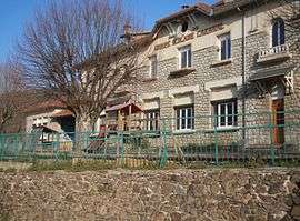 School | |
 Serres-sur-Arget Location within Occitanie region  Serres-sur-Arget | |
| Coordinates: 42°58′12″N 1°31′10″E / 42.97°N 1.5194°ECoordinates: 42°58′12″N 1°31′10″E / 42.97°N 1.5194°E | |
| Country | France |
| Region | Occitanie |
| Department | Ariège |
| Arrondissement | Foix |
| Canton | Val d'Ariège |
| Intercommunality | Pays de Foix |
| Government | |
| • Mayor (2008–2014) | Guy Destrem |
| Area1 | 17.73 km2 (6.85 sq mi) |
| Population (2008)2 | 779 |
| • Density | 44/km2 (110/sq mi) |
| Time zone | UTC+1 (CET) |
| • Summer (DST) | UTC+2 (CEST) |
| INSEE/Postal code | 09293 /09000 |
| Elevation |
469–1,056 m (1,539–3,465 ft) (avg. 500 m or 1,600 ft) |
|
1 French Land Register data, which excludes lakes, ponds, glaciers > 1 km2 (0.386 sq mi or 247 acres) and river estuaries. 2 Population without double counting: residents of multiple communes (e.g., students and military personnel) only counted once. | |
Serres-sur-Arget is a commune in the Ariège department in southwestern France.
Population
Inhabitants of Serres-sur-Arget are called Serrésiens.
| Historical population | ||
|---|---|---|
| Year | Pop. | ±% |
| 1962 | 275 | — |
| 1968 | 444 | +61.5% |
| 1975 | 385 | −13.3% |
| 1982 | 460 | +19.5% |
| 1990 | 565 | +22.8% |
| 1999 | 701 | +24.1% |
| 2008 | 779 | +11.1% |
See also
References
| Wikimedia Commons has media related to Serres-sur-Arget. |
This article is issued from
Wikipedia.
The text is licensed under Creative Commons - Attribution - Sharealike.
Additional terms may apply for the media files.