Couflens
| Couflens | |
|---|---|
| Commune | |
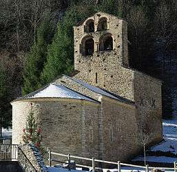 The church in Salau | |
 Couflens Location within Occitanie region  Couflens | |
| Coordinates: 42°47′17″N 1°11′14″E / 42.7881°N 1.1872°ECoordinates: 42°47′17″N 1°11′14″E / 42.7881°N 1.1872°E | |
| Country | France |
| Region | Occitanie |
| Department | Ariège |
| Arrondissement | Saint-Girons |
| Canton | Couserans Est |
| Intercommunality | Canton d'Oust |
| Government | |
| • Mayor (2008–2014) | Henry Richl |
| Area1 | 56.26 km2 (21.72 sq mi) |
| Population (2008)2 | 84 |
| • Density | 1.5/km2 (3.9/sq mi) |
| Time zone | UTC+1 (CET) |
| • Summer (DST) | UTC+2 (CEST) |
| INSEE/Postal code | 09100 /09140 |
| Elevation |
559–2,865 m (1,834–9,400 ft) (avg. 702 m or 2,303 ft) |
|
1 French Land Register data, which excludes lakes, ponds, glaciers > 1 km2 (0.386 sq mi or 247 acres) and river estuaries. 2 Population without double counting: residents of multiple communes (e.g., students and military personnel) only counted once. | |
Couflens (Occitan: Conflenç) is a commune in the Ariège department in southwestern France.
Population
| Historical population | ||
|---|---|---|
| Year | Pop. | ±% |
| 1962 | 103 | — |
| 1968 | 113 | +9.7% |
| 1975 | 371 | +228.3% |
| 1982 | 262 | −29.4% |
| 1990 | 70 | −73.3% |
| 1999 | 63 | −10.0% |
| 2008 | 84 | +33.3% |
See also
References
| Wikimedia Commons has media related to Couflens. |
This article is issued from
Wikipedia.
The text is licensed under Creative Commons - Attribution - Sharealike.
Additional terms may apply for the media files.