Mercus-Garrabet
| Mercus-Garrabet | |
|---|---|
| Commune | |
.jpg) A general view of Mercus-Garrabet | |
 Mercus-Garrabet Location within Occitanie region  Mercus-Garrabet | |
| Coordinates: 42°52′50″N 1°37′52″E / 42.8806°N 1.6311°ECoordinates: 42°52′50″N 1°37′52″E / 42.8806°N 1.6311°E | |
| Country | France |
| Region | Occitanie |
| Department | Ariège |
| Arrondissement | Foix |
| Canton | Sabarthès |
| Intercommunality | Pays de Tarascon |
| Government | |
| • Mayor (2008–2014) | José Lorenzo |
| Area1 | 14.79 km2 (5.71 sq mi) |
| Population (2008)2 | 1,143 |
| • Density | 77/km2 (200/sq mi) |
| Time zone | UTC+1 (CET) |
| • Summer (DST) | UTC+2 (CEST) |
| INSEE/Postal code | 09188 /09400 |
| Elevation |
432–1,603 m (1,417–5,259 ft) (avg. 480 m or 1,570 ft) |
|
1 French Land Register data, which excludes lakes, ponds, glaciers > 1 km2 (0.386 sq mi or 247 acres) and river estuaries. 2 Population without double counting: residents of multiple communes (e.g., students and military personnel) only counted once. | |
Mercus-Garrabet is a commune in the Ariège department in southwestern France.
Population
| Historical population | ||
|---|---|---|
| Year | Pop. | ±% |
| 1962 | 713 | — |
| 1968 | 869 | +21.9% |
| 1975 | 944 | +8.6% |
| 1982 | 972 | +3.0% |
| 1990 | 925 | −4.8% |
| 1999 | 1,005 | +8.6% |
| 2008 | 1,143 | +13.7% |
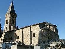
Mercus church
See also
References
| Wikimedia Commons has media related to Mercus-Garrabet. |
This article is issued from
Wikipedia.
The text is licensed under Creative Commons - Attribution - Sharealike.
Additional terms may apply for the media files.