Sieuras
| Sieuras | |
|---|---|
| Commune | |
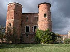 Chateau Nogarède in Sieuras | |
 Sieuras Location within Occitanie region  Sieuras | |
| Coordinates: 43°11′06″N 1°20′23″E / 43.185°N 1.3397°ECoordinates: 43°11′06″N 1°20′23″E / 43.185°N 1.3397°E | |
| Country | France |
| Region | Occitanie |
| Department | Ariège |
| Arrondissement | Saint-Girons |
| Canton | Arize-Lèze |
| Intercommunality | Vallée de la Lèze |
| Government | |
| • Mayor (2008–2014) | Alain Coyard |
| Area1 | 7.63 km2 (2.95 sq mi) |
| Population (2008)2 | 80 |
| • Density | 10/km2 (27/sq mi) |
| Time zone | UTC+1 (CET) |
| • Summer (DST) | UTC+2 (CEST) |
| INSEE/Postal code | 09294 /09130 |
| Elevation |
229–408 m (751–1,339 ft) (avg. 380 m or 1,250 ft) |
|
1 French Land Register data, which excludes lakes, ponds, glaciers > 1 km2 (0.386 sq mi or 247 acres) and river estuaries. 2 Population without double counting: residents of multiple communes (e.g., students and military personnel) only counted once. | |
Sieuras is a commune in the Ariège department in southwestern France.
Population
Inhabitants of Sieuras are called Sieurassois.
| Historical population | ||
|---|---|---|
| Year | Pop. | ±% |
| 1962 | 72 | — |
| 1968 | 89 | +23.6% |
| 1975 | 63 | −29.2% |
| 1982 | 74 | +17.5% |
| 1990 | 57 | −23.0% |
| 1999 | 72 | +26.3% |
| 2008 | 80 | +11.1% |
See also
References
| Wikimedia Commons has media related to Sieuras. |
This article is issued from
Wikipedia.
The text is licensed under Creative Commons - Attribution - Sharealike.
Additional terms may apply for the media files.