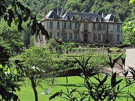
Château-Verdun
| Château-Verdun | |
|---|---|
| Commune | |
 | |
 Château-Verdun Location within Occitanie region  Château-Verdun | |
| Coordinates: 42°46′59″N 1°40′50″E / 42.7831°N 1.6806°ECoordinates: 42°46′59″N 1°40′50″E / 42.7831°N 1.6806°E | |
| Country | France |
| Region | Occitanie |
| Department | Ariège |
| Arrondissement | Foix |
| Canton | Haute-Ariège |
| Intercommunality | Vallées d'Ax |
| Government | |
| • Mayor (2008–2014) | Jean-Cyprien Cambus |
| Area1 | 0.7 km2 (0.3 sq mi) |
| Population (2008)2 | 54 |
| • Density | 77/km2 (200/sq mi) |
| Time zone | UTC+1 (CET) |
| • Summer (DST) | UTC+2 (CEST) |
| INSEE/Postal code | 09096 /09310 |
| Elevation |
529–766 m (1,736–2,513 ft) (avg. 550 m or 1,800 ft) |
|
1 French Land Register data, which excludes lakes, ponds, glaciers > 1 km2 (0.386 sq mi or 247 acres) and river estuaries. 2 Population without double counting: residents of multiple communes (e.g., students and military personnel) only counted once. | |
Château-Verdun is a commune in the Ariège department in southwestern France.
Population
| Historical population | ||
|---|---|---|
| Year | Pop. | ±% |
| 1962 | 56 | — |
| 1968 | 63 | +12.5% |
| 1975 | 46 | −27.0% |
| 1982 | 44 | −4.3% |
| 1990 | 39 | −11.4% |
| 1999 | 39 | +0.0% |
| 2008 | 54 | +38.5% |
See also
References
| Wikimedia Commons has media related to Château-Verdun. |
This article is issued from
Wikipedia.
The text is licensed under Creative Commons - Attribution - Sharealike.
Additional terms may apply for the media files.