Le Pla
| Le Pla | |
|---|---|
| Commune | |
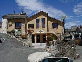 The town hall in Le Pla | |
 Le Pla Location within Occitanie region  Le Pla | |
| Coordinates: 42°42′59″N 2°04′53″E / 42.7164°N 2.0814°ECoordinates: 42°42′59″N 2°04′53″E / 42.7164°N 2.0814°E | |
| Country | France |
| Region | Occitanie |
| Department | Ariège |
| Arrondissement | Foix |
| Canton | Haute-Ariège |
| Intercommunality | Donezan |
| Government | |
| • Mayor (2008–2014) | Sylvie Bousquet |
| Area1 | 12.97 km2 (5.01 sq mi) |
| Population (2008)2 | 67 |
| • Density | 5.2/km2 (13/sq mi) |
| Time zone | UTC+1 (CET) |
| • Summer (DST) | UTC+2 (CEST) |
| INSEE/Postal code | 09230 /09460 |
| Elevation |
983–2,431 m (3,225–7,976 ft) (avg. 1,075 m or 3,527 ft) |
|
1 French Land Register data, which excludes lakes, ponds, glaciers > 1 km2 (0.386 sq mi or 247 acres) and river estuaries. 2 Population without double counting: residents of multiple communes (e.g., students and military personnel) only counted once. | |
Le Pla is a commune in the Ariège department in southwestern France.
Population
Inhabitants of Le Pla are called Pléens.
| Historical population | ||
|---|---|---|
| Year | Pop. | ±% |
| 1962 | 84 | — |
| 1968 | 86 | +2.4% |
| 1975 | 64 | −25.6% |
| 1982 | 71 | +10.9% |
| 1990 | 75 | +5.6% |
| 1999 | 79 | +5.3% |
| 2008 | 67 | −15.2% |
See also
References
| Wikimedia Commons has media related to Le Pla. |
This article is issued from
Wikipedia.
The text is licensed under Creative Commons - Attribution - Sharealike.
Additional terms may apply for the media files.