St. Charles County, Missouri
| St. Charles County, Missouri | ||
|---|---|---|
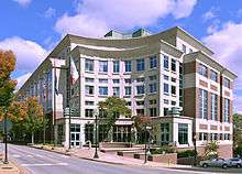 St. Charles County Courthouse in St. Charles | ||
| ||
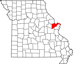 Location in the U.S. state of Missouri | ||
 Missouri's location in the U.S. | ||
| Founded | October 1, 1812 | |
| Named for | Charles Borromeo | |
| Seat | St. Charles | |
| Largest city | O'Fallon | |
| Area | ||
| • Total | 593 sq mi (1,536 km2) | |
| • Land | 560 sq mi (1,450 km2) | |
| • Water | 32 sq mi (83 km2), 5.4% | |
| Population (est.) | ||
| • (2015) | 385,590 | |
| • Density | 666.96/sq mi (257.51/km2) | |
| Congressional districts | 2nd, 3rd | |
| Time zone | Central: UTC−6/−5 | |
| Website |
www | |
St. Charles County is in the central eastern part of the U.S. state of Missouri. As of the 2010 census, the population was 360,485,[1] making it Missouri's third-most populous county. Its county seat is St. Charles.[2] The county was organized October 1, 1812 and named for Saint Charles Borromeo, an Italian cardinal. The county executive is Steve Ehlmann, since January 2007.
St. Charles County is part of the St. Louis, MO-IL Metropolitan Statistical Area and contains many of the city's northwestern suburbs.
The wealthiest county in Missouri,[3] St. Charles County is one of the nation's fastest-growing counties. The county is also recognized as very conservative, ranking in the top 100 nationally.[4]
St. Charles County includes an area of vineyards and wineries whose distinction has been nationally recognized. On its rural outer edge along the south-facing bluffs above the Missouri River is an area of numerous wineries, so that Missouri Route 94 is sometimes called the Missouri Weinstrasse. The area includes the Augusta AVA, designated in 1980 as the first American Viticultural Area by the federal government.
History
The County of St. Charles was originally called the District of St. Charles and had no definite limits until 1816 to 1818 when neighboring counties were formed.[5] The borders of St. Charles are the same today as they were in 1818.
Geography
According to the U.S. Census Bureau, the county has a total area of 593 square miles (1,540 km2), of which 560 square miles (1,500 km2) is land and 32 square miles (83 km2) (5.4%) is water.[7]
The highest elevation is 901 feet (275 m) northwest of Augusta near Femme Osage Creek headwaters.[8]
Adjacent counties
- Lincoln County (northwest)
- Calhoun County, Illinois (north)
- Jersey County, Illinois (northeast)
- Madison County, Illinois (east)
- St. Louis County (southeast)
- Franklin County (south)
- Warren County (west)
Major highways
.svg.png)
.svg.png)


National protected area
Demographics
| Historical population | |||
|---|---|---|---|
| Census | Pop. | %± | |
| 1810 | 3,505 | — | |
| 1820 | 3,970 | 13.3% | |
| 1830 | 4,320 | 8.8% | |
| 1840 | 7,911 | 83.1% | |
| 1850 | 11,454 | 44.8% | |
| 1860 | 16,523 | 44.3% | |
| 1870 | 21,304 | 28.9% | |
| 1880 | 23,065 | 8.3% | |
| 1890 | 22,977 | −0.4% | |
| 1900 | 24,474 | 6.5% | |
| 1910 | 24,695 | 0.9% | |
| 1920 | 22,828 | −7.6% | |
| 1930 | 24,354 | 6.7% | |
| 1940 | 25,562 | 5.0% | |
| 1950 | 29,834 | 16.7% | |
| 1960 | 52,970 | 77.5% | |
| 1970 | 92,954 | 75.5% | |
| 1980 | 144,107 | 55.0% | |
| 1990 | 212,907 | 47.7% | |
| 2000 | 283,883 | 33.3% | |
| 2010 | 360,485 | 27.0% | |
| Est. 2017 | 395,504 | [9] | 9.7% |
| U.S. Decennial Census[10] 1790-1960[11] 1900-1990[12] 1990-2000[13] 2010-2015[1] | |||
As of 2010, there were 360,485 people, 132,906 households, and 77,060 families residing in the county. The population density was 643 people per square mile (1665/km²). There were 142,766 housing units at an average density of 73 persons/km² (188 persons/sq mi). The racial makeup of the county was 91.3% White, 4.4% African American, 0.3% Native American, 2.3% Asian (0.9% Asian Indian, 0.4% Chinese, 0.2% Filipino, 0.2% Vietnamese, 0.2% Korean, 0.1% Japanese, 0.2% Other), 0.1% Pacific Islander, and 1.6% from two or more races. Hispanic or Latino made up 2.5% of the population (1.8% Mexican, 0.2% Puerto Rican, 0.1% Cuban, 0.7% Other)[14].
There were 101,663 households out of which 40.50% had children under the age of 18 living with them, 63.20% were married couples living together, 9.20% have a woman whose husband does not live with her, and 24.20% were non-families. 19.40% of all households were made up of individuals and 5.90% had someone living alone who was 65 years of age or older. The average household size was 2.76 and the average family size was 3.18.
In the county, the population was spread out with 29.00% under the age of 18, 8.20% from 18 to 24, 32.60% from 25 to 44, 21.60% from 45 to 64, and 8.80% who were 65 years of age or older. The median age was 34 years. For every 100 females there were 97.10 males. For every 100 females age 18 and over, there were 94.10 males.
The median income for a household in the county was $71,458, and the median income for a family was $64,415. Males had a median income of $44,528 versus $29,405 for females. The per capita income for the county was $23,592. 4.00% of the population and 2.80% of families were below the poverty line. Out of the total people living in poverty, 4.90% are under the age of 18 and 5.10% are 65 or older.
St. Charles County, with an estimated population of 373,495, has been one of the fastest-growing counties in the country for decades, with 55% growth in the 1970s, 48% in the 1980s, 33% in the 1990s, and another 27% in the 2000s. The county features a cross-section of industry, as well as extensive retail and some agriculture. With the Missouri River on the south and east and the Mississippi River on the north, the county is bisected east to west by Interstate 70. St. Charles County has one small airport St. Charles County Smartt Airport ( St. Charles Airport closed in 2010 ) and two ferries that cross the Mississippi River.
| Racial composition | 2010[15] | 2016[16] |
|---|---|---|
| White | 91.3% | 90.3% |
| —Non-Hispanic | 89.1% | 87.5% |
| Black or African American | 4.4% | 4.8% |
| Hispanic or Latino (of any race) | 2.9% | 3.2% |
| Asian | 2.3% | 2.6% |
| Two or More Races | 1.6% | 1.9% |
Education
Public schools
- Fort Zumwalt R-II School District – O'Fallon
- Joseph L. Mudd Elementary School – (K-02) – O'Fallon
- St. Peters Elementary School – (K-02) – St. Peters
- Dardenne Elementary School – (K-05) – O'Fallon
- Emge Elementary School – (K-05) – O'Fallon
- Hawthorn Elementary School – (K-05) – St. Peters
- Mid Rivers Elementary School – (K-05) – St. Peters
- Mount Hope Elementary School – (K-05) – O'Fallon
- Ostmann Elementary School – (K-05) – O'Fallon
- Pheasant Point Elementary School – (K-05) – O'Fallon
- Progress South Elementary School – (K-05) – St. Peters
- Rock Creek Elementary School – (K-05) – O'Fallon
- Twin Chimneys Elementary School – (K-05) – O'Fallon
- Westhoff Elementary School – (K-05) – O'Fallon
- Forest Park Elementary School – (03-05) – O'Fallon
- Lewis & Clark Elementary School – (03-05) – St. Peters
- Dr. Bernard J. DuBray Middle School – (06-08) – St. Peters
- Ft. Zumwalt North Middle School – (06-08) – O'Fallon
- Ft. Zumwalt South Middle School – (06-08) – St. Peters
- Ft. Zumwalt West Middle School – (06-08) – O'Fallon
- Ft. Zumwalt East High School – (09-12) – St. Peters
- Ft. Zumwalt North High School – (09-12) – O'Fallon
- Ft. Zumwalt South High School – (09-12) – St. Peters
- Ft. Zumwalt West High School – (09-12) – O'Fallon
- Francis Howell R-III School District – St. Peters
- Early Childhood Family Education Center – (PK) – St. Peters
- Early Childhood Family Education Center – (PK) – St. Peters
- Early Childhood Family Education Center – (PK) – Weldon Spring
- Becky-David Elementary School – (K-05) – St. Peters
- Castlio Elementary School – (K-05) – St. Peters
- Central Elementary School – (K-05) – St. Peters
- Daniel Boone Elementary School – (K-05) – New Melle
- Fairmount Elementary School – (K-05) – St. Peters
- Harvest Ridge Elementary School – (K-05) – St. Charles
- Henderson Elementary School – (K-05) – St. Peters
- Independence Elementary School – (K-05) – Weldon Spring
- John Weldon Elementary School – (K-05) – Dardenne Prairie
- Warren Elementary School – (K-05) – Cottleville[17]
- Barnwell Middle School – (06-08) – St. Peters
- Bryan Middle School – (06-08) – Weldon Spring
- Francis Howell Middle School – (06-08) – Weldon Spring
- Hollenbeck Middle School – (06-08) – St. Peters
- Saeger Middle School – (06-08) – Cottleville
- Francis Howell Central High School – (09-12) – Cottleville
- Francis Howell North High School – (09-12) – St. Peters
- Francis Howell High School – (09-12) – Weldon Spring Heights
- Orchard Farm R-V School District – St. Charles
- Discovery Elementary School – (PK-02) – St. Charles
- Orchard Farm Elementary School – (K-05) – St. Charles
- Orchard Farm Middle School – (06-08) – St. Charles
- Orchard Farm High School – (09-12) – St. Charles
- St. Charles R-VI School District – St. Charles
- Coverdell Elementary School – (K-04) – St. Charles
- George M. Null Elementary School – (K-04) – St. Charles
- Harris Elementary School – (K-04) – St. Charles
- Monroe Elementary School – (K-04) – St. Charles
- Lincoln Elementary School – (K-04) – St. Charles
- Jefferson Intermediate School – (05-06) – St. Charles
- Hardin Middle School – (07-08) – St. Charles
- St. Charles High School – (09-12) – St. Charles
- St. Charles West High School – (09-12) – St. Charles
- Wentzville R-IV School District – Wentzville
- Early Childhood Center – (PK) – Wentzville
- Heritage Primary School – (K-02) – Wentzville
- Boone Trail Elementary School – (K-05) – Wentzville
- Crossroads Elementary School – (K-05) – O'Fallon
- Duello Elementary School – (K-05) – Lake St. Louis
- Discovery Ridge Elementary School – (K-05) – Lake St. Louis
- Green Tree Elementary School – (K-05) – Lake St. Louis
- Peine Ridge Elementary School – (K-05) – Wentzville
- Prairie View Elementary School – (K-05) – O'Fallon
- Stone Creek Elementary School – (K-05) – Wentzville
- Heritage Intermediate School – (03-05) – Wentzville
- Frontier Middle School – (06-08)– O'Fallon
- Wentzville Middle School – (06-08) – Wentzville
- Wentzville South Middle School – (06-08) – Wentzville
- Liberty High School – (09-12) – Lake St. Louis
- Emil E. Holt High School – (09-12) – Wentzville
- Timberland High School – (09-12) – Wentzville
Private schools
- Academy of the Sacred Heart – St. Charles – (PK-08) – Roman Catholic
- All Saints School – St. Peters – (K-08) – Roman Catholic
- Assumption Catholic Grade School – O'Fallon – (K-08) – Roman Catholic
- Campbell Montessori School – St. Charles – (NS-06) – Nonsectarian
- Duchesne High School– St. Charles– (09-12)– Roman Catholic
- First Baptist Christian Academy – O'Fallon – (PK-07) – Nondenominational Christian
- Foristell Baptist Academy – Foristell – (K-09) – Baptist
- Hope Montessori Academy – Lake St. Louis – (PK-K) – Nonsectarian
- Immaculate Conception Catholic School – Dardenne Prairie – (K-08) – Roman Catholic
- Immanuel Lutheran School – St. Charles – (PK-08) – Lutheran
- Immanuel Lutheran School – Wentzville – (PK-08) – Lutheran
- Liberty Classical School – O'Fallon – (07-12) – Nondenominational Christian
- Living Word Christian School District – O'Fallon and St. Peters– (PK-12) – Nondenominational Christian
- Lutheran High School of St. Charles County – St. Peters – (09-12) – Lutheran
- Messiah Lutheran School – Weldon Spring – (PK-08) – Lutheran
- Mid Rivers Seventh-day Adventist School – St. Peters – (03-08) – Seventh-day Adventist
- St. Charles Borromeo – St. Charles – (K-08) – Roman Catholic
- St. Cletus School – St. Charles – (K-08) – Roman Catholic
- St. Dominic High School – O'Fallon – (09-12) – Roman Catholic
- St. Elizabeth St. Robert Regional School – St. Charles – (PK-08) – Roman Catholic
- St. Joseph School – Cottleville – (K-08) – Roman Catholic
- St. Joseph School – Wentzville – (PK-08) – Roman Catholic
- St. Patrick Elementary School – Wentzville – (K-08) – Roman Catholic
- St. Paul Elementary School – St. Paul – (PK-08) – Roman Catholic
- St. Peter Catholic School – St. Charles – (PK-08) – Roman Catholic
- St. Theodore School – Wentzville – (K-08) – Roman Catholic
- Sts. Joachim & Ann School – St. Charles – (PK-08) – Roman Catholic
- Trinity Lutheran School – St. Charles – (01-08) – Lutheran
- Willott Road Christian Academy – St. Peters – (NS-09) – Baptist
- Zion Lutheran School – St. Charles – (PK-08) – Lutheran
Alternative schools
- Boonslick State School – St. Peters – Special Education
- Fort Zumwalt Hope High School – O'Fallon – Other/Alternative School – (09-12)
- Francis Howell Union High School – St. Charles – Other/Alternative School – (09-12)
- Heritage Landing – St. Peters – Other/Alternative School – (06-12)
- Lewis & Clark Career Center – St. Charles – Vocational/Technical School – (09-12)
- Quest Day Treatment Center – St. Charles – Other/Alternative School – (06-12)
Higher education
- Lindenwood University – St. Charles
- St. Charles Community College – Cottleville
Public libraries
- Saint Charles City - County Library District [18]
Law and government
St. Charles County is governed by a county executive and a county council. The county council consists of seven members, each elected from various districts in the county. The county executive is elected by the entire county. The current executive is Steve Ehlmann. He was preceded by Joe Ortwerth, who was preceded by Gene Schwendemann, the first county executive of St. Charles County under the new form of government. The executive under the old form of county government was termed a "judge." The county had 258,525 registered voters as of March 2016.[19]
The St. Charles County Police Department operates under the authority of the St. Charles County government and is the largest law enforcement agency in St. Charles County.St. Charles County Police Department (SCCPD)
St. Charles County Ambulance District (SCCAD) is the largest district in Missouri, serving all of St. Charles County and its population of nearly 370,000.St. Charles County Ambulance District (SCCAD)
Politics
Local
The Republican Party predominantly controls politics at the local level in St. Charles County. Republicans hold all the elected positions in the county.[20]
| Position | Incumbent | Party |
|---|---|---|
| Assessor | Scott Shipman | Republican |
| Collector | Michelle McBride | Republican |
| Council Member – District 1 | Joe Cronin | Republican |
| Council Member – District 2 | Joseph Brazil | Republican |
| Council Member – District 3 | Michael Elam | Republican |
| Council Member – District 4 | David Hammond | Republican |
| Council Member – District 5 | Terry Hollander | Republican |
| Council Member – District 6 | Mike Klinghammer | Republican |
| Council Member – District 7 | John White | Republican |
| County Executive | Steve Ehlmann | Republican |
| Director of Elections | Rich Chrismer | Republican |
| Prosecuting Attorney | Tim Lohmar | Republican[21] |
| Recorder | Barbara J. Hall | Republican |
| Sheriff | Scott Lewis | Republican |
State
| Year | Republican | Democratic | Third Parties |
|---|---|---|---|
| 2016 | 54.52% 103,946 | 42.58% 85,704 | 2.90% 5,836 |
| 2012 | 48.58% 89,144 | 48.97% 89,860 | 2.45% 4,486 |
| 2008 | 44.51% 82,440 | 53.84% 99,705 | 1.65% 3,058 |
| 2004 | 55.90% 91,323 | 42.96% 70,184 | 1.14% 1,865 |
| 2000 | 58.24% 74,357 | 39.49% 50,415 | 2.27% 2,907 |
| 1996 | 49.48% 47,886 | 48.01% 46,462 | 2.50% 2,424 |
St. Charles County is divided among twelve legislative districts in the Missouri House of Representatives, all of which are held by Republicans.
- District 42 – Bart Korman (R-High Hill, since 2011). Consists of Augusta, Defiance and part of New Melle.
- District 63 – Bryan Spencer (R-Wentzville, since 2013). Consists of Wentzville, Foristell, and part of New Melle.
- District 64 – Robert Cornejo (R-St. Peters, since 2013). Consists of Flint Hill, Josephville, St. Paul, and parts of O'Fallon and St. Peters.
- District 65 – Tom Hannegan (R-St. Charles, since 2017). Consists of West Alton, Portage Des Sioux, and part of St. Charles.
- District 70 – Mark Matthiesen (R-Maryland Heights, since 2017). Consists of parts of St. Charles and Weldon Spring.
- District 102 – Kurt Bahr (R-O'Fallon, since 2011). Consists of Weldon Springs Heights, and parts of O'Fallon, Dardenne Prairie, New Melle, and Weldon Spring.
- District 103 – John Wiemann (R-O'Fallon, since 2015). Consists of Cottleville and parts of O'Fallon, St. Peters, and Weldon Spring.
- District 104 – Kathie Conway (R-St. Charles, since 2011). Consists of part of St. Peters.
- District 105 – Phil Christofanelli (R-St. Charles, since 2017). Consists of parts of St. Charles and St. Peters.
- District 106 – Chrissy Sommer (R-St. Charles, since 2012). Consists of parts of St. Charles and St. Peters.
- District 107 – Nick Schroer (R-O'Fallon, since 2017). Consists of parts of Lake St. Louis, O’Fallon, and St. Peters.
- District 108 – Justin Hill (R-Lake St. Louis, since 2015). Consists of parts of Lake St. Louis and Dardenne Prairie.
St. Charles County is divided into two districts in the Missouri Senate, both of which have elected Republicans.
- District 2 – Bob Onder (R-Lake St. Louis, since 2015). Consists of the communities of Augusta, Dardenne Prairie, Flint Hill, Foristell, Josephville, Lake St. Louis, New Melle, O'Fallon, St. Paul, Weldon Spring Heights, and Wentzville.
- District 23 – Bill Eigel (R-Weldon Spring, since 2017). Consists of Portage Des Sioux, St. Charles, St. Peters, Weldon Spring, and West Alton.
Federal
Missouri is represented in the U.S. Senate by Roy Blunt and Claire McCaskill, whose most recent election results are included here.
| Party | Candidate | Votes | % | ± | |
|---|---|---|---|---|---|
| Republican | Roy Blunt | 103,946 | 51.78% | +6.87 | |
| Democratic | Jason Kander | 88,238 | 43.95% | -5.18 | |
| Libertarian | Jonathan Dine | 5,238 | 2.61% | -3.35 | |
| Green | Johnathan McFarland | 1,970 | 0.98% | +0.98 | |
| Constitution | Fred Ryman | 1,355 | 0.67% | +0.67 | |
| Party | Candidate | Votes | % | ± | |
|---|---|---|---|---|---|
| Republican | Todd Akin | 82,319 | 44.91% | ||
| Democratic | Claire McCaskill | 90,040 | 49.13% | ||
| Libertarian | Jonathan Dine | 10,924 | 5.96% | ||
Part of St. Charles County is included in Missouri’s 2nd Congressional District and is currently represented by Ann Wagner in the U.S. House of Representatives.
| Party | Candidate | Votes | % | ± | |
|---|---|---|---|---|---|
| Republican | Ann Wagner | 46,313 | 63.18% | -4.77 | |
| Democratic | Bill Otto | 23,744 | 32.39% | +4.63 | |
| Libertarian | Jim Higgins | 2,578 | 3.52% | -0.77 | |
| Green | David Justus Arnold | 668 | 0.91% | +0.91 | |
Most of St. Charles County is included in Missouri’s 3rd Congressional District and is currently represented by Blaine Luetkemeyer (R-St. Elizabeth) in the U.S. House of Representatives.
| Party | Candidate | Votes | % | ± | |
|---|---|---|---|---|---|
| Republican | Blaine Luetkemeyer | 75,623 | 62.72% | -2.19 | |
| Democratic | Kevin Miller | 39,557 | 32.81% | +2.50 | |
| Libertarian | Dan Hogan | 4,275 | 3.55% | -1.22 | |
| Constitution | Doanita Simmons | 1,107 | 0.92% | +0.92 | |
| Year | Republican | Democratic | Third parties |
|---|---|---|---|
| 2016 | 59.9% 121,650 | 33.8% 68,626 | 6.4% 12,908 |
| 2012 | 59.4% 110,784 | 38.6% 71,838 | 2.0% 3,744 |
| 2008 | 54.3% 102,550 | 44.6% 84,183 | 1.2% 2,224 |
| 2004 | 58.6% 95,826 | 40.9% 66,855 | 0.5% 807 |
| 2000 | 56.0% 72,114 | 41.8% 53,806 | 2.2% 2,766 |
| 1996 | 46.7% 47,705 | 40.5% 41,369 | 12.9% 13,172 |
| 1992 | 36.3% 38,673 | 35.0% 37,263 | 28.7% 30,627 |
| 1988 | 62.9% 50,005 | 36.8% 29,286 | 0.3% 209 |
| 1984 | 73.1% 47,784 | 26.9% 17,617 | |
| 1980 | 60.3% 36,050 | 34.6% 20,668 | 5.1% 3,050 |
| 1976 | 53.6% 26,105 | 45.3% 22,063 | 1.1% 536 |
| 1972 | 69.9% 25,677 | 30.1% 11,034 | |
| 1968 | 45.6% 13,533 | 35.0% 10,374 | 19.4% 5,752 |
| 1964 | 38.3% 9,020 | 61.7% 14,530 | |
| 1960 | 47.8% 10,888 | 52.2% 11,890 | |
| 1956 | 55.4% 9,462 | 44.6% 7,618 | |
| 1952 | 56.5% 8,451 | 43.4% 6,493 | 0.1% 20 |
| 1948 | 49.5% 5,976 | 50.1% 6,049 | 0.3% 39 |
| 1944 | 58.9% 7,050 | 40.8% 4,880 | 0.3% 36 |
| 1940 | 59.1% 7,792 | 40.5% 5,334 | 0.4% 50 |
| 1936 | 42.7% 5,156 | 48.9% 5,903 | 8.4% 1,009 |
| 1932 | 34.1% 3,664 | 64.4% 6,911 | 1.5% 162 |
| 1928 | 51.4% 5,404 | 48.4% 5,081 | 0.2% 22 |
| 1924 | 59.1% 4,668 | 29.9% 2,364 | 11.0% 865 |
| 1920 | 72.1% 6,645 | 26.8% 2,472 | 1.0% 96 |
| 1916 | 64.2% 3,518 | 34.9% 1,914 | 0.9% 51 |
| 1912 | 49.0% 2,350 | 37.4% 1,792 | 13.6% 654 |
| 1908 | 62.8% 3,480 | 35.7% 1,979 | 1.4% 79 |
| 1904 | 62.9% 3,203 | 35.1% 1,788 | 2.0% 100 |
| 1900 | 58.1% 3,324 | 41.0% 2,343 | 0.9% 54 |
| 1896 | 56.2% 3,173 | 43.3% 2,448 | 0.5% 30 |
| 1892 | 50.0% 2,522 | 49.3% 2,485 | 0.7% 37 |
| 1888 | 52.7% 2,668 | 47.0% 2,381 | 0.4% 18 |
2016 Missouri presidential primary results
Republican
Donald Trump won the most votes in St. Charles County, with 41.50 percent. U.S. Senator Ted Cruz (R-Texas) came in second with 38.87 percent, Governor John Kasich (R-Ohio) placed third with 10.70 percent, and U.S. Senator Marco Rubio (R-Florida) was fourth with 7.10 percent.
Democratic
U.S. Senator Bernie Sanders (I-Vermont) won the primary with 54.32 percent to former Secretary of State Hillary Clinton's 44.80 percent.
2012 Missouri presidential primary results
Republican
Former U.S. Senator Rick Santorum (R-Pennsylvania) won the most votes in St. Charles County, with 56.29 percent. Former Governor Mitt Romney (R-Massachusetts) came in second with 25.43 percent, and former U.S. Representative Ron Paul (R-Texas) was third with 12.69 percent.
Democratic
With incumbent President Barack Obama facing no serious opposition, few St. Charles County voters voted in the Democratic primary; Obama won 87.83 percent.
2008 Missouri presidential primary results
Republican
Former Governor Mitt Romney (R-Massachusetts) won the most votes in St. Charles County, with 37.72 percent. U.S. Senator John McCain (R-Arizona) came in second with 34.95 percent, former Governor Mike Huckabee (R-Arkansas) placed third with 21.83 percent, and U.S. Representative Ron Paul (R-Texas) was fourth with 3.83 percent.
Democratic
Former U.S. Senator Hillary Clinton (D-New York) received more votes, a total of 23,611, than any candidate from either party in St. Charles County during the 2008 presidential primary.
| St. Charles County, Missouri | |
|---|---|
| 2008 Republican primary in Missouri | |
| John McCain | 14,705 (34.95%) |
| Mike Huckabee | 9,185 (21.83%) |
| Mitt Romney | 15,869 (37.72%) |
| Ron Paul | 1,613 (3.83%) |
| St. Charles County, Missouri | |
|---|---|
| 2008 Democratic primary in Missouri | |
| Hillary Clinton | 23,611 (50.14%) |
| Barack Obama | 22,356 (47.48%) |
| John Edwards (withdrawn) | 821 (1.74%) |
| Uncommitted | {{{uncommitted}}} |
Communities
Cities
Villages
Census-designated place
Other unincorporated places
Subregions
Westplex
Westplex is an area within St. Charles County in east-central Missouri to the west of St. Louis County.[23]
The Westplex is part of St. Charles County that used to be called “The Golden Triangle”. The “triangle” was formed by I-70 to the north, Missouri Route 94 to the southeast, and I-64 to the southwest. Since almost all of the growth in St. Charles County was within this triangle it was dubbed the “Golden” area of St. Charles county, hence, Golden Triangle. Today the Westplex is made up of St. Charles, St. Peters, Weldon Spring, Cottleville, Dardenne Prairie, O’Fallon, Lake St. Louis, Wentzville and St. Paul.
See also
References
- 1 2 "State & County QuickFacts". United States Census Bureau. Retrieved September 24, 2013.
- ↑ "Find a County". National Association of Counties. Retrieved June 7, 2011.
- ↑ "County-Level Unemployment and Median Household Income for Missouri". www.ers.usda.gov. USDA Economic Research Service. Retrieved March 30, 2009.
- ↑ "America's 100 most conservative-friendly counties". The Daily Caller. March 16, 2010. Retrieved June 16, 2018.
- ↑ Bryan, William S. (1993). St. Charles Co., Missouri: biographical sketches from pioneer families of Missouri by Bryan and Rose. Baltimore, Maryland: Genealogical Publishing Company. p. 1.
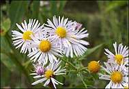
- ↑ "Decurrent False Aster". Field Guide. Missouri Dept. of Conservation. Retrieved September 2, 2015.
- ↑ "2010 Census Gazetteer Files". United States Census Bureau. August 22, 2012. Archived from the original on October 21, 2013. Retrieved November 20, 2014.
- ↑ USGS 1/3 Arc Second NED
- ↑ "Population and Housing Unit Estimates". Retrieved June 9, 2017.
- ↑ "U.S. Decennial Census". United States Census Bureau. Retrieved November 20, 2014.
- ↑ "Historical Census Browser". University of Virginia Library. Retrieved November 20, 2014.
- ↑ "Population of Counties by Decennial Census: 1900 to 1990". United States Census Bureau. Retrieved November 20, 2014.
- ↑ "Census 2000 PHC-T-4. Ranking Tables for Counties: 1990 and 2000" (PDF). United States Census Bureau. Retrieved November 20, 2014.
- ↑ American Census Bureau https://factfinder.census.gov/faces/tableservices/jsf/pages/productview.xhtml?src=CF. Retrieved 6 October 2018. Missing or empty
|title=(help) - ↑ "American Fact Finder". U.S. Census.
- ↑ "American Fact Finder". U.S. Census.
- ↑ "About Us". Warren Elementary School. Retrieved February 13, 2017.
Our school is located in Cottleville, Missouri
- ↑ Breeding, Marshall. "Saint Charles City - County Public Library". Libraries.org. Retrieved May 8, 2017.
- ↑ "Presidential Preference Primary, March 15, 2016, St. Charles County Missouri". St. Charles County Election Authority. March 22, 2016. Retrieved March 30, 2016.
- ↑ "Election Summary Report, General Election". St. Charles County Election Authority. November 4, 2014. Retrieved March 30, 2016.
- ↑ Korando, Russell (November 23, 2012). "St. Charles County judge nominated for prosecutor". St. Charles County Suburban Journal. Retrieved December 3, 2013.
Ehlmann was required to appoint someone from the same political party as Banas, a Republican, to serve until the office comes up for election in November 2014.
- ↑ Leip, David. "Dave Leip's Atlas of U.S. Presidential Elections". uselectionatlas.org. Retrieved March 26, 2018.
- ↑ "About Westplex". westplex.com. Retrieved October 20, 2017.
External links
- St. Charles County Government Website
- St. Charles City-County Library District
- St. Charles County Ambulance District
- Greater St. Charles County Chamber of Commerce
- St. Charles County Jail Information
- Digitized 1930 Plat Book of St. Charles County from University of Missouri Division of Special Collections, Archives, and Rare Books
Places adjacent to St. Charles County, Missouri | ||||||||||
|---|---|---|---|---|---|---|---|---|---|---|
| ||||||||||
| Topics | 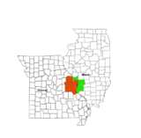 | |
|---|---|---|
| Central city | ||
| Largest cities (over 50,000 in 2010) | ||
| Medium-sized cities (over 20,000 in 2010) | ||
| Largest towns and villages (over 10,000 in 2010) |
| |
| Missouri Counties | ||
| Illinois Counties | ||
| Subregions | ||
Municipalities and communities of St. Charles County, Missouri, United States | ||
|---|---|---|
| Cities | | |
| Villages | ||
| Townships |
| |
| CDP | ||
| Other unincorporated communities | ||
| Ghost towns | ||
| Footnotes | ‡This populated place also has portions in an adjacent county or counties | |
