Lincoln County, Missouri
| Lincoln County, Missouri | |
|---|---|
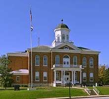 Lincoln County Courthouse in Troy | |
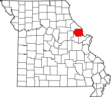 Location in the U.S. state of Missouri | |
 Missouri's location in the U.S. | |
| Founded | December 14, 1818 |
| Named for | Benjamin Lincoln |
| Seat | Troy |
| Largest city | Troy |
| Area | |
| • Total | 640 sq mi (1,658 km2) |
| • Land | 627 sq mi (1,624 km2) |
| • Water | 14 sq mi (36 km2), 2.2% |
| Population (est.) | |
| • (2015) | 54,696 |
| • Density | 84/sq mi (32/km2) |
| Congressional district | 3rd |
| Time zone | Central: UTC−6/−5 |
| Website |
www |
Lincoln County is a county in the eastern part of the U.S. state of Missouri. As of the 2010 census, the population was 52,566.[1] Its county seat is Troy.[2] The county was founded December 14, 1818, and named for Major General Benjamin Lincoln of the American Revolutionary War.[3]
Lincoln County is part of the St. Louis, MO-IL Metropolitan Statistical Area.
History
According to Goodspeed's History of Lincoln County, Missouri (1888), Lincoln County was named by Major Christopher Clark, the first permanent white settler in an address to the Territorial Legislature. He said, "I was born, sir, in Link-Horn County, N.C., I lived for many years in Link-Horn County in old Kain-tuck. I wish to die in Link-Horn County, in Missouri; and I move, therefore, that the blank in the bill be filled with the name Link-Horn." The motion was carried unanimously and the clerk, not adopting the frontier parlance of the Major, wrote "Lincoln" in the blank space of the bill. Others say it was named for Major General Benjamin Lincoln, who served in the Continental Army during the American Revolution.
Notable people
- Oliver Winfield Killam - Oil industrialist and former Oklahoma state legislator
- Clarence Cannon - Congressmember and notable U.S. House Parliamentarian from Elsberry, Missouri
Geography
According to the U.S. Census Bureau, the county has a total area of 640 square miles (1,700 km2), of which 627 square miles (1,620 km2) is land and 14 square miles (36 km2) (2.2%) is water.[4] The county's eastern border with Illinois is formed by the Mississippi River.
Adjacent counties
- Pike County (north)
- Calhoun County, Illinois (east)
- St. Charles County (southeast)
- Warren County (southwest)
- Montgomery County (west)
Major highways
Demographics
| Historical population | |||
|---|---|---|---|
| Census | Pop. | %± | |
| 1820 | 1,662 | — | |
| 1830 | 4,059 | 144.2% | |
| 1840 | 7,449 | 83.5% | |
| 1850 | 9,421 | 26.5% | |
| 1860 | 14,210 | 50.8% | |
| 1870 | 15,960 | 12.3% | |
| 1880 | 17,426 | 9.2% | |
| 1890 | 18,346 | 5.3% | |
| 1900 | 18,352 | 0.0% | |
| 1910 | 17,003 | −7.4% | |
| 1920 | 15,956 | −6.2% | |
| 1930 | 13,929 | −12.7% | |
| 1940 | 14,395 | 3.3% | |
| 1950 | 13,478 | −6.4% | |
| 1960 | 14,783 | 9.7% | |
| 1970 | 18,041 | 22.0% | |
| 1980 | 22,193 | 23.0% | |
| 1990 | 28,892 | 30.2% | |
| 2000 | 38,944 | 34.8% | |
| 2010 | 52,566 | 35.0% | |
| Est. 2016 | 55,267 | [5] | 5.1% |
| U.S. Decennial Census[6] 1790-1960[7] 1900-1990[8] 1990-2000[9] 2010-2015[1] | |||
As of the census[10] of 2000, there were 38,944 people, 13,851 households, and 10,554 families residing in the county. The population density was 62 people per square mile (24/km²). There were 15,511 housing units at an average density of 25 per square mile (10/km²). The racial makeup of the county was 96.13% White, 1.74% Black or African American, 0.37% Native American, 0.17% Asian, 0.03% Pacific Islander, 0.43% from other races, and 1.14% from two or more races. Approximately 1.14% of the population were Hispanic or Latino of any race. 37.7% were of German, 17.0% American, 10.9% Irish and 7.4% English ancestry.
There were 13,851 households out of which 40.00% had children under the age of 18 living with them, 61.50% were married couples living together, 10.10% had a female householder with no husband present, and 23.80% were non-families. 19.70% of all households were made up of individuals and 7.70% had someone living alone who was 65 years of age or older. The average household size was 2.77 and the average family size was 3.17.
In the county, the population was spread out with 30.00% under the age of 18, 8.10% from 18 to 24, 30.20% from 25 to 44, 21.00% from 45 to 64, and 10.80% who were 65 years of age or older. The median age was 34 years. For every 100 females there were 98.40 males. For every 100 females age 18 and over, there were 97.90 males.
The median income for a household in the county was $42,592, and the median income for a family was $47,747. Males had a median income of $35,564 versus $23,270 for females. The per capita income for the county was $17,149. About 6.20% of families and 8.30% of the population were below the poverty line, including 9.60% of those under age 18 and 9.00% of those age 65 or over.
Education
Public schools
- Silex R-I School District – Silex
- Silex Elementary School (K-06)
- Silex High School (07-12)
- Elsberry R-II School District – Elsberry
- Clarence Cannon Elementary School (PK-04)
- Ida Cannon Middle School (05-08)
- Elsberry High School (09-12)
- Troy R-III School District – Troy
- Early Childhood Education Center (Pre-K & PAT)
- Boone Elementary School (K-05)
- Claude Brown Elementary School (K-05)
- Cuivre Park Elementary School (K-05)
- Hawk Point Elementary School (K-05)
- Lincoln Elementary School (K-05)
- Main Street Elementary School (K-05)
- William R. Cappel Elementary School (K-05)
- Troy Middle School (06-08)
- Troy South Middle School (06-08)
- Ninth Grade Center (09)
- Troy Buchanan High School (10-12)
- New Horizons High School (10-12)
- Winfield R-IV School District – Winfield
- Winfield Elementary School (PK-02)
- Winfield Intermediate School (03-05)
- Winfield Middle School (06-08)
- Winfield High School (09-12)
Private schools
- Calvary Christian School – Winfield (01-12) – Pentecostal
- First Baptist Christian Academy - Troy (K-08) - Baptist
- Immaculate Conception School – Old Monroe (K-08) – Roman Catholic
- Sacred Heart School – Troy (K-08) – Roman Catholic
- St. Alphonsus School – Silex (PK-08) – Roman Catholic
- Troy Holiness School – Troy (K-12) – Methodist
Public libraries
- Powell Memorial Library[11]
Politics
Local
The Democratic Party mostly controls politics at the local level in Lincoln County. Democrats hold all but six of the elected positions in the county.
| Lincoln County, Missouri | ||||
|---|---|---|---|---|
| Elected countywide officials | ||||
| Assessor | Kevin L. Bishop | Republican | ||
| Circuit Clerk | Grace Sinclair | Democratic | ||
| County Clerk | Crystal Hall | Democratic | ||
| Collector | Jerry Fox | Democratic | ||
| Commissioner (Presiding) |
Daniel H. Colbert | Republican | ||
| Commissioner (District 1) |
Mike Mueller | Republican | ||
| Commissioner (District 2) |
Matt Bass | Republican | ||
| Coroner | Kelly Walters | Democratic | ||
| Prosecuting Attorney | Leah Askey | Democratic | ||
| Public Administrator | Sandy Jung | Republican | ||
| Recorder | Dottie D. Crenshaw | Democratic | ||
| Sheriff | John Cottle | Republican | ||
| Surveyor | Donald “Tec” Parr | Democratic | ||
| Treasurer | Brenda O'Brien | Democratic | ||
State
| Year | Republican | Democratic | Third Parties |
|---|---|---|---|
| 2016 | 58.56% 14,536 | 37.68% 9,352 | 3.76% 934 |
| 2012 | 49.29% 11,092 | 47.64% 10,730 | 3.12% 703 |
| 2008 | 45.43% 10,589 | 52.33% 12,197 | 2.23% 521 |
| 2004 | 53.75% 10,626 | 44.64% 8,824 | 1.61% 318 |
| 2000 | 52.12% 8,282 | 44.26% 7,034 | 3.62% 575 |
| 1996 | 43.69% 5,507 | 53.93% 6,797 | 2.38% 300 |
Lincoln County is divided into three legislative districts in the Missouri House of Representatives.
- District 40 — Jim Hansen (R-Frankford). Consists of the northernmost section of the county.
| Party | Candidate | Votes | % | ± | |
|---|---|---|---|---|---|
| Republican | Jim Hansen | 232 | 100.00% | +23.78 | |
| Party | Candidate | Votes | % | ± | |
|---|---|---|---|---|---|
| Republican | Jim Hansen | 125 | 76.22% | +17.79 | |
| Democratic | Lowell Jackson | 39 | 23.78% | -17.79 | |
| Party | Candidate | Votes | % | ± | |
|---|---|---|---|---|---|
| Republican | Jim Hansen | 156 | 58.43% | ||
| Democratic | Paul Quinn | 111 | 41.57% | ||
- District 41 — Randy Pietzman (R-Troy). Consists of most of the entire county and includes the communities of Cave, Elsberry, Foley, Hawk Point, Silex, Troy, Truxton, and Whiteside.
| Party | Candidate | Votes | % | ± | |
|---|---|---|---|---|---|
| Republican | Randy Pietzman | 15,609 | 100.00% | +38.21 | |
| Party | Candidate | Votes | % | ± | |
|---|---|---|---|---|---|
| Republican | Randy Pietzman | 6,243 | 61.79% | +20.10 | |
| Democratic | Dan Dildine | 3,861 | 38.21% | -20.10 | |
| Party | Candidate | Votes | % | ± | |
|---|---|---|---|---|---|
| Democratic | Ed Schieffer | 9,589 | 58.31% | ||
| Republican | Beverly Steiniger | 6,857 | 41.69% | ||
- District 64 — Robert Cornejo (R- St. Peters) Consists of the southeast corner of the county and includes the communities of Chain of Rocks, Fountain N' Lakes, Moscow Mills, Old Monroe, and Winfield.
| Party | Candidate | Votes | % | ± | |
|---|---|---|---|---|---|
| Republican | Robert Cornejo | 4,286 | 68.92% | -0.60 | |
| Democratic | Mark Routberg | 1,933 | 31.08% | +0.60 | |
| Party | Candidate | Votes | % | ± | |
|---|---|---|---|---|---|
| Republican | Robert Cornejo | 2,080 | 69.52% | +23.84 | |
| Democratic | Linda Castaneda | 912 | 30.48% | -23.84 | |
| Party | Candidate | Votes | % | ± | |
|---|---|---|---|---|---|
| Republican | Robert Cornejo | 2,472 | 45.68% | ||
| Democratic | Wayne Henke | 2,940 | 54.32% | ||
All of Lincoln County is a part of Missouri’s 10th District in the Missouri Senate and is currently represented by Jeanie Riddle (R-Fulton).
| Party | Candidate | Votes | % | ± | |
|---|---|---|---|---|---|
| Republican | Jeanie Riddle | 7,542 | 56.52% | ||
| Democratic | Ed Scheiffer | 5,802 | 44.48% | ||
Federal
| Party | Candidate | Votes | % | ± | |
|---|---|---|---|---|---|
| Republican | Roy Blunt | 14,061 | 56.70% | +8.57 | |
| Democratic | Jason Kander | 9,264 | 37.35% | -7.97 | |
| Libertarian | Jonathan Dine | 751 | 3.03% | -3.52 | |
| Green | Johnathan McFarland | 305 | 1.23% | +1.23 | |
| Constitution | Fred Ryman | 419 | 1.69% | +1.69 | |
| Party | Candidate | Votes | % | ± | |
|---|---|---|---|---|---|
| Democratic | Claire McCaskill | 10,225 | 45.32% | ||
| Republican | Todd Akin | 10,860 | 48.13% | ||
| Libertarian | Jonathan Dine | 1.479 | 6.55% | ||
All of Lincoln County is included in Missouri’s 3rd Congressional District and is currently represented by Blaine Luetkemeyer (R-St. Elizabeth) in the U.S. House of Representatives.
| Party | Candidate | Votes | % | ± | |
|---|---|---|---|---|---|
| Republican | Blaine Luetkemeyer | 16,826 | 69.05% | +0.87 | |
| Democratic | Kevin Miller | 6,429 | 26.38% | -0.52 | |
| Libertarian | Dan Hogan | 775 | 3.18% | -1.74 | |
| Constitution | Doanita Simmons | 338 | 1.39% | +1.39 | |
| Party | Candidate | Votes | % | ± | |
|---|---|---|---|---|---|
| Republican | Blaine Luetkemeyer | 8,804 | 68.18% | +7.45 | |
| Democratic | Courtney Denton | 3,473 | 26.90% | -8.15 | |
| Libertarian | Steven Hedrick | 635 | 4.92% | +0.70 | |
| Party | Candidate | Votes | % | ± | |
|---|---|---|---|---|---|
| Republican | Blaine Luetkemeyer | 13,171 | 60.73% | ||
| Democratic | Eric Mayer | 7,601 | 35.05% | ||
| Libertarian | Steven Wilson | 916 | 4.22% | ||
| Year | Republican | Democratic | Third parties |
|---|---|---|---|
| 2016 | 72.3% 18,159 | 22.2% 5,575 | 5.5% 1,380 |
| 2012 | 62.9% 14,332 | 34.0% 7,734 | 3.1% 710 |
| 2008 | 54.7% 12,924 | 43.3% 10,234 | 2.0% 461 |
| 2004 | 57.0% 11,316 | 42.2% 8,368 | 0.8% 155 |
| 2000 | 53.7% 8,549 | 43.7% 6,961 | 2.5% 403 |
| 1996 | 38.8% 4,897 | 44.8% 5,644 | 16.4% 2,070 |
| 1992 | 29.1% 3,718 | 42.7% 5,453 | 28.2% 3,594 |
| 1988 | 53.4% 5,305 | 46.3% 4,605 | 0.3% 28 |
| 1984 | 65.1% 6,137 | 34.9% 3,290 | |
| 1980 | 53.2% 4,963 | 44.0% 4,110 | 2.8% 262 |
| 1976 | 44.0% 3,581 | 55.0% 4,473 | 1.1% 86 |
| 1972 | 64.8% 5,127 | 35.2% 2,784 | |
| 1968 | 41.8% 3,185 | 41.2% 3,142 | 17.0% 1,297 |
| 1964 | 31.3% 2,271 | 68.7% 4,993 | |
| 1960 | 47.8% 3,471 | 52.2% 3,793 | |
| 1956 | 43.8% 3,114 | 56.2% 3,990 | |
| 1952 | 46.2% 3,458 | 53.7% 4,020 | 0.1% 9 |
| 1948 | 33.7% 2,135 | 66.1% 4,190 | 0.2% 11 |
| 1944 | 43.5% 2,910 | 56.3% 3,773 | 0.2% 15 |
| 1940 | 40.6% 3,035 | 59.1% 4,420 | 0.3% 25 |
| 1936 | 32.6% 2,258 | 66.8% 4,625 | 0.6% 41 |
| 1932 | 26.5% 1,604 | 73.1% 4,428 | 0.5% 29 |
| 1928 | 44.7% 2,722 | 55.1% 3,356 | 0.2% 10 |
| 1924 | 41.6% 2,563 | 55.5% 3,419 | 2.8% 175 |
| 1920 | 46.5% 3,209 | 53.0% 3,660 | 0.6% 40 |
| 1916 | 39.7% 1,642 | 59.6% 2,468 | 0.7% 30 |
| 1912 | 33.2% 1,258 | 61.3% 2,326 | 5.5% 209 |
| 1908 | 38.5% 1,620 | 60.7% 2,555 | 0.8% 32 |
| 1904 | 38.1% 1,462 | 59.8% 2,295 | 2.0% 78 |
| 1900 | 35.5% 1,563 | 62.7% 2,761 | 1.9% 83 |
| 1896 | 34.1% 1,564 | 65.5% 3,003 | 0.4% 17 |
| 1892 | 35.2% 1,380 | 63.9% 2,508 | 1.0% 38 |
| 1888 | 40.6% 1,628 | 59.3% 2,380 | 0.1% 5 |
Missouri presidential preference primary (2008)
- Former U.S. Senator Hillary Clinton (D-New York) received more votes, a total of 3,490, than any candidate from either party in Lincoln County during the 2008 presidential primary.
| Lincoln County, Missouri | |
|---|---|
| 2008 Republican primary in Missouri | |
| John McCain | 1,412 (30.82%) |
| Mike Huckabee | 1,484 (32.39%) |
| Mitt Romney | 1,400 (30.55%) |
| Ron Paul | 216 (4.71%) |
| Lincoln County, Missouri | |
|---|---|
| 2008 Democratic primary in Missouri | |
| Hillary Clinton | 3,490 (61.35%) |
| Barack Obama | 1,963 (34.51%) |
| John Edwards (withdrawn) | 190 (3.34%) |
Communities
Cities and villages
- Cave
- Chain of Rocks
- Elsberry
- Foley
- Fountain N' Lakes
- Hawk Point
- Moscow Mills
- Old Monroe
- Silex
- Snow Hill
- Troy (county seat)
- Truxton
- Whiteside
- Winfield
Unincorporated communities
See also
References
- 1 2 "State & County QuickFacts". United States Census Bureau. Archived from the original on July 13, 2011. Retrieved September 10, 2013.
- ↑ "Find a County". National Association of Counties. Retrieved June 7, 2011.
- ↑ Eaton, David Wolfe (1916). How Missouri Counties, Towns and Streams Were Named. The State Historical Society of Missouri. pp. 185–186.
- ↑ "2010 Census Gazetteer Files". United States Census Bureau. August 22, 2012. Archived from the original on September 13, 2014. Retrieved November 16, 2014.
- ↑ "Population and Housing Unit Estimates". Retrieved June 9, 2017.
- ↑ "U.S. Decennial Census". United States Census Bureau. Retrieved November 16, 2014.
- ↑ "Historical Census Browser". University of Virginia Library. Retrieved November 16, 2014.
- ↑ "Population of Counties by Decennial Census: 1900 to 1990". United States Census Bureau. Retrieved November 16, 2014.
- ↑ "Census 2000 PHC-T-4. Ranking Tables for Counties: 1990 and 2000" (PDF). United States Census Bureau. Retrieved November 16, 2014.
- ↑ "American FactFinder". United States Census Bureau. Retrieved January 31, 2008.
- ↑ Breeding, Marshall. "Powell Memorial Library". Libraries.org. Retrieved May 8, 2017.
- 1 2 3 4 5 "Lincoln County - General Election - November 8, 2016". Lincoln County Clerk. November 14, 2016. Retrieved April 15, 2017.
- 1 2 3 4 5 "Lincoln County, Missouri Official Results General Election". Lincoln County Clerk. November 4, 2014. Retrieved April 7, 2016.
- 1 2 3 4 5 "Lincoln County, Missouri Official Results". Lincoln County Clerk. November 6, 2012. Retrieved April 7, 2016.
- ↑ Leip, David. "Dave Leip's Atlas of U.S. Presidential Elections". uselectionatlas.org. Retrieved 2018-03-25.
Further reading
- History of Lincoln County, Missouri, from the earliest time to the present: including a department devoted to the preservation of sundry personal, business, professional and private records, besides a valuable fund of notes original observation.... (1888) full text
External links
- Digitized 1930 Plat Book of Lincoln County from University of Missouri Division of Special Collections, Archives, and Rare Books
Places adjacent to Lincoln County, Missouri | ||||||||||
|---|---|---|---|---|---|---|---|---|---|---|
| ||||||||||
| Topics |  | |
|---|---|---|
| Central city | ||
| Largest cities (over 50,000 in 2010) | ||
| Medium-sized cities (over 20,000 in 2010) | ||
| Largest towns and villages (over 10,000 in 2010) |
| |
| Missouri Counties | ||
| Illinois Counties | ||
| Subregions | ||
Municipalities and communities of Lincoln County, Missouri, United States | ||
|---|---|---|
| Cities | | |
| Villages | ||
| Townships | ||
| Unincorporated communities | ||
| Ghost towns | ||
