St. Joseph, Missouri
| St. Joseph, Missouri | |
|---|---|
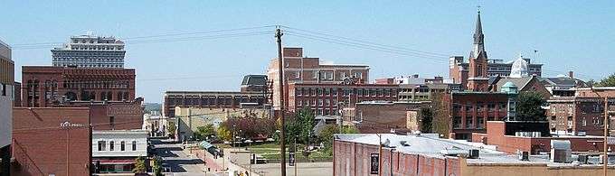 Downtown St. Joseph in 2006 | |
| Nickname(s): St. Joe | |
 Location in the state of Missouri | |
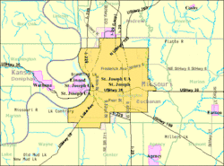 U.S. Census Map | |
| Coordinates: 39°45′29″N 94°50′12″W / 39.75806°N 94.83667°WCoordinates: 39°45′29″N 94°50′12″W / 39.75806°N 94.83667°W | |
| Country | United States |
| State | Missouri |
| County | Buchanan |
| Government | |
| • Mayor | Bill McMurray |
| Area[1] | |
| • Total | 44.77 sq mi (115.95 km2) |
| • Land | 43.99 sq mi (113.93 km2) |
| • Water | 0.78 sq mi (2.02 km2) |
| Population (2010)[2] | |
| • Total | 76,780 |
| • Estimate (2017)[3] | 76,442 |
| • Density | 1,700/sq mi (660/km2) |
| Time zone | UTC−6 (CST) |
| • Summer (DST) | UTC−5 (CDT) |
| ZIP Code | 64501-64508 |
| Area code(s) | 816 |
| Website |
stjoemo |
St. Joseph (informally St. Joe) is a city in and the county seat of Buchanan County, Missouri, United States.[4] It is the principal city of the St. Joseph Metropolitan Statistical Area, which includes Buchanan, Andrew, and DeKalb counties in Missouri and Doniphan County, Kansas. As of the 2010 census, St. Joseph had a total population of 76,780, making it the eighth largest city in the state, and the third largest in Northwest Missouri.[5]
Named after the biblical Saint Joseph, the city is located on the Missouri River. It is the birthplace of hip hop star Eminem[6] as well as the death place of Jesse James; it is also the starting point of the Pony Express. St. Joseph is also home to Missouri Western State University.
History
St. Joseph was founded on the Missouri River by Joseph Robidoux, a local fur trader, and officially incorporated in 1843.[7] In its early days, it was a bustling outpost and rough frontier town, serving as a last supply point and jumping-off point on the Missouri River toward the "Wild West". It was the westernmost point in the United States accessible by rail until after the American Civil War.
The main east-west downtown streets were named for Robidoux's eight children: Faraon, Jules, Francois (Francis), Felix, Edmond, Charles, Sylvanie, and Messanie. The street between Sylvanie and Messanie was named for his second wife, Angelique.
St. Joseph, or "St. Joe", as it was called by many, was a "Jumping-Off Point" for those headed to the Oregon Territory in the mid-1800s. These cities, including Independence, and St. Joseph, were where pioneers would stay and purchase supplies before they would head out in wagon trains. The town was a very bustling place, and was the second city in the USA to have electric streetcars.
Between April 3, 1860, and late October 1861, St. Joseph was one of the two endpoints of the Pony Express, which operated for a short period over the land then inaccessible by rail, to provide fast mail service. The pony riders carried additionally, along with the mail, a small personal Bible. Today the Pony Express Museum hosts visitors in the old stables.
In 1882, on April 3, the outlaw Jesse James was killed at his home, originally located at 1318 Lafayette, now sited next to The Patee House. In the post-Civil War years, when the economy was down, the hotel had served for a time as the home of the Patee Female College, followed by the St. Joseph Female College up to 1880.[8] James was living under the alias of Mr. Howard. An excerpt from a popular poem of the time is: "...that dirty little coward that shot Mr. Howard has laid poor Jesse in his grave."

The Heaton-Bowman-Smith Funeral Home maintains a small museum about Jesse James. Their predecessors conducted the funeral. The museum is open to the public. His home is now known as the Jesse James Home Museum. It has been relocated at least three times, and features the bullet hole from that fateful shot. St. Joseph is identified by the slogan, "Where the Pony Express started and Jesse James ended."
Among properties listed on the National Register of Historic Places are the Patee House, a former hotel now maintained as a museum of transportation, and the Missouri Theatre, an ornate movie palace.
St. Joseph's population peaked in 1900, with a census population of 102,979. This population figure is questionable, as civic leaders tried to inflate the numbers for that census.[9] At the time, it was the home to one of the largest wholesale companies in the Midwest, the Nave & McCord Mercantile Company, as well as the Hannibal and St. Joseph Railroad, and the C.D. Smith & Company, which would become C.D. Smith Healthcare.
The Walnut Park Farm Historic District near St. Joseph was listed on the National Register of Historic Places in 1999.[10]
Honors
In 1997, St. Joseph was named an "All-America City" by the National Civic League.[11] St. Joseph was voted the top true western town of 2007 by True West Magazine, in the January/February 2008 issue.
Geography and climate
Saint Joseph is located at 39°45′29″N 94°50′12″W / 39.75806°N 94.83667°W (39.757944, -94.836541),[12] on the Missouri/Kansas border in northwestern Missouri, also close to Nebraska; Iowa is another 70 miles further north. The nearest major metropolitan area to St. Joseph is the Kansas City Metropolitan Area, which begins approximately 30 miles (48 km) to the south. The nearest major airport is Kansas City International Airport, which is approximately 35 miles (56 km) to the south. According to the United States Census Bureau, the city has a total area of 44.77 square miles (115.95 km2), of which 43.99 square miles (113.93 km2) is land and 0.78 square miles (2.02 km2) is water.[1]
| Climate data for St. Joseph, Missouri | |||||||||||||
|---|---|---|---|---|---|---|---|---|---|---|---|---|---|
| Month | Jan | Feb | Mar | Apr | May | Jun | Jul | Aug | Sep | Oct | Nov | Dec | Year |
| Record high °F (°C) | 68 (20) |
79 (26) |
90 (32) |
96 (36) |
98 (37) |
105 (41) |
107 (42) |
105 (41) |
102 (39) |
95 (35) |
82 (28) |
70 (21) |
107 (42) |
| Average high °F (°C) | 37 (3) |
43 (6) |
55 (13) |
66 (19) |
76 (24) |
86 (30) |
90 (32) |
88 (31) |
81 (27) |
70 (21) |
53 (12) |
40 (4) |
65 (18) |
| Average low °F (°C) | 15 (−9) |
22 (−6) |
32 (0) |
42 (6) |
54 (12) |
63 (17) |
67 (19) |
64 (18) |
55 (13) |
43 (6) |
32 (0) |
20 (−7) |
42 (6) |
| Record low °F (°C) | −25 (−32) |
−23 (−31) |
−13 (−25) |
2 (−17) |
29 (−2) |
41 (5) |
41 (5) |
41 (5) |
30 (−1) |
18 (−8) |
−5 (−21) |
−24 (−31) |
−25 (−32) |
| Average precipitation inches (mm) | 0.88 (22.4) |
1.13 (28.7) |
2.36 (59.9) |
3.23 (82) |
4.95 (125.7) |
4.21 (106.9) |
3.89 (98.8) |
3.80 (96.5) |
3.91 (99.3) |
3.28 (83.3) |
2.16 (54.9) |
1.44 (36.6) |
35.24 (895) |
| Average snowfall inches (cm) | 4.7 (11.9) |
3.7 (9.4) |
2.1 (5.3) |
0.4 (1) |
0 (0) |
0 (0) |
0 (0) |
0 (0) |
0 (0) |
0.4 (1) |
0.6 (1.5) |
3 (8) |
14.9 (38.1) |
| Source #1: [13] | |||||||||||||
| Source #2: [14] | |||||||||||||
Demographics
| Historical population | |||
|---|---|---|---|
| Census | Pop. | %± | |
| 1860 | 8,932 | — | |
| 1870 | 19,565 | 119.0% | |
| 1880 | 32,431 | 65.8% | |
| 1890 | 52,324 | 61.3% | |
| 1900 | 102,979 | 96.8% | |
| 1910 | 77,403 | −24.8% | |
| 1920 | 77,939 | 0.7% | |
| 1930 | 80,935 | 3.8% | |
| 1940 | 75,711 | −6.5% | |
| 1950 | 78,588 | 3.8% | |
| 1960 | 79,035 | 0.6% | |
| 1970 | 72,748 | −8.0% | |
| 1980 | 76,691 | 5.4% | |
| 1990 | 71,852 | −6.3% | |
| 2000 | 73,990 | 3.0% | |
| 2010 | 76,780 | 3.8% | |
| Est. 2017 | 76,442 | [3] | −0.4% |
| U.S. Decennial Census[15] | |||
2010 census
As of the census[2] of 2010, there were 76,780 people, 29,727 households, and 18,492 families residing in the city. The population density was 1,745.4 inhabitants per square mile (673.9/km2). There were 33,189 housing units at an average density of 754.5 per square mile (291.3/km2). The racial makeup of the city was 87.8% White, 6.0% African American, 0.5% Native American, 0.9% Asian, 0.2% Pacific Islander, 2.0% from other races, and 2.7% from two or more races. Hispanic or Latino of any race were 5.7% of the population.
There were 29,727 households of which 32.0% had children under the age of 18 living with them, 42.0% were married couples living together, 14.5% had a female householder with no husband present, 5.7% had a male householder with no wife present, and 37.8% were non-families. 30.7% of all households were made up of individuals and 12.2% had someone living alone who was 65 years of age or older. The average household size was 2.43 and the average family size was 3.01.
In the city, the population was spread out with 23.6% under the age of 18; 11.7% between the ages of 18 and 24; 26.1% from 25 to 44; 24.9% from 45 to 64; and 13.8% who were 65 years of age or older. The median age in the city was 35.6 years. The gender makeup of the city was 49.8% male and 50.2% female.
2000 census
As of the census[16] of 2000, there were 73,990 people, 29,026 households, and 18,460 families residing in the city. The population density was 1,687.7 people per square mile (651.6/km²). There were 31,752 housing units at an average density of 724.2 per square mile (279.6/km²). The racial makeup of the city was 91.9% White, 5.0% African American, 0.5% Native American, 0.5% Asian, <0.1% Pacific Islander, 0.7% from other races, and 1.4% from two or more races. Hispanic or Latino of any race were 2.6% of the population.
There were 29,026 households out of which 30.1% had children under the age of 18 living with them, 46.7% were married couples living together, 12.8% had a female householder with no husband present, and 36.4% were single-family households. 30.4% of all households were made up of individuals and 13.2% had someone living alone who was 65 years of age or older. The average household size was 2.39 and the average family size was 2.98.
In the city, the population was spread out with 24.1% under the age of 18, 11.6% from 18 to 24, 28.6% from 25 to 44, 20.3% from 45 to 64, and 15.4% who were 65 years of age or older. The median age was 36 years. For every 100 females, there were 95.6 males. For every 100 females age 18 and over, there were 92.7 males.
The median income for a household in the city was $32,663, and the median income for a family was $40,995. Males had a median income of $31,300 versus $21,592 for females. The per capita income for the city was $17,445. About 9.1% of families and 13.0% of the population were below the poverty line, including 15.5% of those under age 18 and 9.8% of those age 65 or over.
Business
TransitAmerica Services, which provides conductors for various train systems nationwide, is based in the city.[17][18] Attached is a list of largest employers in St. Joseph, MO.
| Largest Employers | Product / Service | Employment |
|---|---|---|
| Mosaic Life Care | Health Care | 3,471 |
| Triumph Foods | Food Processing | 2,767 |
| St. Joseph School District | Education | 2,047 |
| 139th Airlift Wing, MO Air National Guard | Government | 1,494 |
| Boehringer Ingelheim Vetmedica, Inc. | Animal Pharmaceuticals | 1,191 |
| Missouri Western State University | Education | 820 |
| American Family Insurance | Insurance | 767 |
| City of St. Joseph | Government | 740 |
| Wal-Mart | Retail | 712 |
| Johnson Controls | Manufacturing | [19] 658 |
Retail
St. Joseph is home to several retail areas, many of which are grouped along Belt Highway on the city's east side. East Hills Mall is located at North Belt Highway and Frederick Boulevard. The mall opened in 1965, was expanded in 1988, and was renovated in 2001 with a far more extensive renovation in 2008 and 2009. In 2015 the store made an ad which gained quick internet success causing an influx of customers. Developed in 2005, the Shoppes at North Village is concentrated along North Belt Highway between approximately Cook and County Line roads. This serves as a regional shopping destination. Other shopping districts include Belt Center, Hy-Vee Shopping Center, Hillcrest Plaza, East Ridge Village, and Woodlawn Shopping Center.
Education
Public schools
The St. Joseph School District operates three public high schools, four public middle schools and 16 public elementary schools in St. Joseph. There are three private grade schools, a private high school and a private K-12 Christian school. Two new elementary schools (Oak Grove and Carden Park) have been constructed, and both opened by the 2014–15 academic year. In addition, there is an active home education community that serves the city and surrounding areas. In higher education, St. Joseph is the home of a regional public university as well as a public university outreach center, a public technical school and a private technical school.
|
|
Private schools
- Bishop LeBlond High School
- Cathedral Grade School
- St. Francis Xavier Grade School
- St. James Grade School
- St. Joseph Christian School
- St. Paul Lutheran School
- Prescott Seventh-Day Adventist School
Colleges and universities
Special focus institutions
- Vatterott College[21]
- American College of Technology[22]
- Hillyard Technical Center
- Colgan Alternative Resource Center[23]
- Webster Learning Center
Transportation
The St. Joseph Transit is publicly owned and provides bus service. Rosecrans Memorial Airport is a joint municipal/military owned airport for general aviation. It is the home of the 139th Airlift Wing of the Missouri Air National Guard, and does not have commercial service.
The city is served by two Interstate highways and four U.S. Routes:


In addition, four state routes serve the city:
Cityscape
Numerous parks, golf courses, sports complexes, skate parks, a water park, a riverwalk along the Missouri River, and a small conservation area can be found throughout St. Joseph proper. The city is also nationally known for its 26-mile (42 km) parkway system, which is accompanied by an urban trail system.[24] Two of the city's largest parks are Krug Park and Hyde Park; these respectively anchor the parkway and urban trail on the north and south. A dog park has been added to the parkway system near Corby Pond.[25]

Media
St. Joseph currently ranks 201st largest designated market area out of 210 media markets in the United States (as ranked by Nielsen Media Research); the market covers six counties in northwestern Missouri (Holt, Worth, Nodaway, Andrew, DeKalb and Buchanan) and Doniphan County in northeastern Kansas. The St. Joseph area has three low-power and two full-power television stations, and ten radio stations.
Television
Due to its proximity to Kansas City and Topeka, stations from those markets serve as default affiliates of MyNetworkTV (KSMO-TV/Kansas City and WIBW-DT2/Topeka, on Dish Network only) due to the lack of affiliates of the programming service licensed to the market. ABC affiliate KQTV had long been the only major commercial station in St. Joseph, but in June 2012, the locally-based News-Press & Gazette Company signed-on KNPN-LD as a Fox affiliate, KBJO-LD as a CW affiliate, and KNPG-LD as a Telemundo affiliate. This in turn was followed by the conversions of KBJO-LD to NBC affiliate KNPG-LD in November 2016 (retaining the CW as a LD2 subchannel),[26] and the original KNPG-LD (which assumed the KBJO-LD call letters) to CBS affiliate KCJO-LD in June 2017,[27] ending out-of-market reliance for major network programming.
Local broadcast stations
| Channel | Callsign | Network | Subchannels | Owner | Website | |
|---|---|---|---|---|---|---|
| (Virtual/RF) | Channel | Programming | ||||
| 2.1 (7) | KQTV | ABC | N/A | N/A | Heartland Media | |
| 16.1 (21) | KTAJ-TV | TBN | 16.2 16.3 16.4 16.5 | The Church Channel JCTV TBN Enlace USA Smile of a Child Network | Trinity Broadcasting Network | |
| 21.1 (16) | KNPG-LD | NBC | 21.2 21.3 21.4 21.5 | The CW Telemundo Bounce TV Grit | News-Press & Gazette Company | |
| 26.1 (26) | KNPN-LD | Fox | 26.2 26.3 26.4 26.5 | CBS News-Press 3 NOW Escape Laff | News-Press & Gazette Company | |
| 30.1 (30) | KCJO-LD | CBS | N/A | N/A | News-Press & Gazette Company | |
Local independent cable channels
- News-Press 3 NOW, Suddenlink channel 3/KNPN-LD virtual channel 26.3 (Local news)
Radio
| Frequency | Callsign | Nickname | Format | Owner | Website | |||||
|---|---|---|---|---|---|---|---|---|---|---|
| AM stations | ||||||||||
| 680 | KFEQ | 680 KFEQ | News/talk/sports | Eagle Communications | ||||||
| 1270 | KGNM | The Kingdom | Contemporary Christian | Orama, Inc. | ||||||
| 1470 | KAIR | Hot Country 93.7 | Country music | KNZA Inc. | ||||||
| 1550 | KESJ | ESPN 1550 | Sports talk | Eagle Communications | ||||||
| FM stations | ||||||||||
| 89.7 | KJCV-FM | Bott Radio Network | Religious | Community Broadcasting, Inc. | ||||||
| 91.1 | KSJI | Joy 91.1 | Contemporary Christian | Good News Ministries, Inc. | ||||||
| 91.9 | KSRD | Air1 | Contemporary Christian | Educational Media Foundation | ||||||
| 92.7 | KSJQ | Q-Country 92.7 | Country music | Eagle Communications | ||||||
| 99.3 | KFOH-LP | SJMF Radio | All Genres | St. Joseph Music Foundation | ||||||
| 100.7 | KLHM-LP | Religious | Lighthouse Radio Ministry | |||||||
| 105.5 | KKJO | KJO 105.5 | Hot adult contemporary | Eagle Communications | ||||||
| 106.1 | KEXS-FM | The Catholic Radio Network | Catholic religious | Catholic Radio Network | ||||||
Newspapers
Notable people
References
- 1 2 "US Gazetteer files 2010". United States Census Bureau. Archived from the original on 2012-01-24. Retrieved 2012-07-08.
- 1 2 "American FactFinder". United States Census Bureau. Retrieved 2012-07-08.
- 1 2 "City and Town Population Totals: 2010-2017". Retrieved May 26, 2018.
- ↑ "Find a County". National Association of Counties. Archived from the original on 2011-05-31. Retrieved 2011-06-07.
- ↑ U.S. Census Bureau (2007). "Population Estimates: 2000-2007". U.S. Census Bureau. Archived from the original on September 20, 2008. Retrieved July 12, 2008.
- ↑ "The Mystery Of Marshall Mathers". Retrieved 17 December 2016.
- ↑ North America Travel Guide. "Saint Peters : Missouri". North America Travel Guide. Retrieved August 30, 2007.
- ↑ St. Joseph History - Jesse James Home Archived 2006-04-26 at the Wayback Machine..
- ↑ Bob Slater. "Civic pride ran amok with 1900 census". St. Joseph News-Press. Retrieved September 5, 2010.
- ↑ National Park Service (2010-07-09). "National Register Information System". National Register of Historic Places. National Park Service.
- ↑ "Winners" Archived July 7, 2010, at the Wayback Machine., National Civic League
- ↑ "US Gazetteer files: 2010, 2000, and 1990". United States Census Bureau. 2011-02-12. Retrieved 2011-04-23.
- ↑ "NOWData - NOAA Online Weather Data". National Oceanic and Atmospheric Administration. Retrieved May 4, 2013.
- ↑ "Saint Joseph, Missouri Weather". Retrieved 2017-07-01.
- ↑ "Census of Population and Housing". Census.gov. Archived from the original on May 12, 2015. Retrieved June 4, 2015.
- ↑ "American FactFinder". United States Census Bureau. Archived from the original on 2013-09-11. Retrieved 2008-01-31.
- ↑ "Caltrain Board Approves TransitAmerica to Run Train System". Caltrain News Archive. Retrieved 21 July 2015.
- ↑ "TransitAmerica combines Herzog, Stagecoach's expertise". Metro Magazine. Retrieved 21 July 2015.
- ↑ "Largest Employers - St. Joseph, MO Economic Development Partnership". St. Joseph, MO Economic Development Partnership. Retrieved 2017-07-08.
- ↑ "Missouri Western State University". Retrieved 17 December 2016.
- ↑ "Vatterott College - Career Training School across Midwest". Retrieved 17 December 2016.
- ↑ "Archived copy". Archived from the original on 2010-08-17. Retrieved 2010-08-03.
- ↑ "Colgan Center / Homepage". Retrieved 17 December 2016.
- ↑ "Archived copy". Archived from the original on 2014-07-14. Retrieved 2014-06-06.
- ↑ News-Press, Kim Norvell St. Joseph. "Council gives nod to new dog park". Retrieved 17 December 2016.
- ↑ "NBC affiliate coming to St. Joe". St. Joseph News-Press. News-Press & Gazette Company. August 18, 2016.
- ↑ NPG to add local CBS affiliate in June, St. Joseph News-Press, February 24, 2017.
External links
| Wikimedia Commons has media related to St. Joseph, Missouri. |
| Wikivoyage has a travel guide for St. Joseph. |
- City of St. Joseph
- Downtown Different | Saint Joseph, MO
- Historic maps of St. Joseph in the Sanborn Maps of Missouri Collection at the University of Missouri
Municipalities and communities of Buchanan County, Missouri, United States | ||
|---|---|---|
| Cities |  | |
| Villages | ||
| Townships | ||
| Unincorporated communities | ||
| Footnotes | ‡This populated place also has portions in an adjacent county or counties | |
