Daviess County, Missouri
| Daviess County, Missouri | |
|---|---|
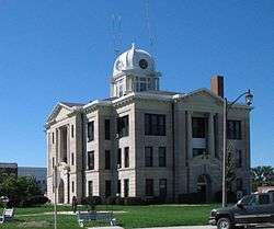 Daviess County Courthouse in Gallatin | |
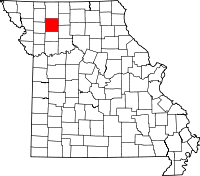 Location in the U.S. state of Missouri | |
 Missouri's location in the U.S. | |
| Founded | December 29, 1836 |
| Named for | Major Joseph Hamilton Daveiss |
| Seat | Gallatin |
| Largest city | Gallatin |
| Area | |
| • Total | 569 sq mi (1,474 km2) |
| • Land | 563 sq mi (1,458 km2) |
| • Water | 5.8 sq mi (15 km2), 1.0% |
| Population (est.) | |
| • (2015) | 8,253 |
| • Density | 15/sq mi (6/km2) |
| Congressional district | 6th |
| Time zone | Central: UTC−6/−5 |
Daviess County is a county located in the U.S. state of Missouri. As of the 2010 census, the population was 8,433.[1] Its county seat is Gallatin.[2] The county was organized December 29, 1836, from Ray County and named for Major Joseph Hamilton Daveiss, a soldier from Kentucky who was killed in 1811 at the Battle of Tippecanoe.[3]
The county includes the town of Jamesport, which has the largest Amish community in Missouri.
History
According to Latter Day Saint movement founder Joseph Smith, Adam-ondi-Ahman, situated in the central part of the county, was where Adam and Eve relocated after being banished from the Garden of Eden. According to LDS tradition, the site is to be a gathering spot prior to the Second Coming of Jesus Christ.
Joseph Smith's revelation came in 1838, two years after the county was organized, and spurred in an influx of Mormon settlers. Non-Mormon residents feared they were going to lose control of the county and attempted to prevent Mormons from voting in the Gallatin election day battle. This was to be the first skirmish in the Mormon War. Later,Mormons burned and sacked Gallatin, Grindstone Fork, Millport and other smaller settlements. The plundered goods were deposited in the Bishop's storehouse at Diahman.[4] Millport, which at the time was the largest city in the county and the center for trade, never recovered, and became a ghost town.[5] Missouri evicted the Mormons after arresting Joseph Smith and other leaders of the church.
Daviess County played a major role in the history of the outlaw James-Younger Gang. The first confirmed bank robbery involving Jesse James occurred on December 7, 1869 at the Daviess County Savings Association in Gallatin. John W. Sheets, the bank cashier, was killed in the process by Jesse James, who believed Sheets was Samuel P. Cox, who had killed James's bushwhacker colleague Bloody Bill Anderson during the American Civil War. On July 15, 1881, the gang was believed to have been responsible for the robbery of the Rock Island Line at Winston in which a conductor and passenger were killed.
After Jesse James was murdered in St. Joseph, Frank James surrendered in 1882 to face Daviess County charges in connection with the train robbery/murder as well as murder charges in the 1869 robbery. Frank James was tried from August 20-September 6, 1883. Interest was so intense that the trial was moved to the Gallatin Opera House to accommodate the crowds. James was found not guilty of involvement in both crimes. Charges were made that the jury was filled with Southern sympathizers who refused to convict one of their own.
The Daviess County Savings Association and the Gallatin Opera House have since been torn down although the Winston Rock Island Line train station still stands and is used by the historical society.
Daviess County has one of only three Rotary Jails still in existence. Also known as the "Squirrel Cage Jail," it is now a museum and is on the National Register of Historic Places.
Geography
According to the U.S. Census Bureau, the county has a total area of 569 square miles (1,470 km2), of which 563 square miles (1,460 km2) is land and 5.8 square miles (15 km2) (1.0%) is water.[6]
Adjacent counties
- Harrison County (north)
- Grundy County (northeast)
- Livingston County (southeast)
- Caldwell County (south)
- DeKalb County (west)
- Gentry County (northwest)
Major highways
Demographics
| Historical population | |||
|---|---|---|---|
| Census | Pop. | %± | |
| 1840 | 2,736 | — | |
| 1850 | 5,298 | 93.6% | |
| 1860 | 9,606 | 81.3% | |
| 1870 | 14,410 | 50.0% | |
| 1880 | 19,145 | 32.9% | |
| 1890 | 20,456 | 6.8% | |
| 1900 | 21,325 | 4.2% | |
| 1910 | 17,605 | −17.4% | |
| 1920 | 16,641 | −5.5% | |
| 1930 | 14,424 | −13.3% | |
| 1940 | 13,398 | −7.1% | |
| 1950 | 11,180 | −16.6% | |
| 1960 | 9,502 | −15.0% | |
| 1970 | 8,420 | −11.4% | |
| 1980 | 8,905 | 5.8% | |
| 1990 | 7,865 | −11.7% | |
| 2000 | 8,016 | 1.9% | |
| 2010 | 8,433 | 5.2% | |
| Est. 2016 | 8,209 | [7] | −2.7% |
| U.S. Decennial Census[8] 1790-1960[9] 1900-1990[10] 1990-2000[11] 2010-2015[1] | |||
As of the 2010 census,[12] there were 8,433 people, 3,214 households, and 2,489 families residing in the county. The population density was 15 people per square mile (6/km²). There were 4,199 housing units at an average density of 7 per square mile (3/km²). The racial makeup of the county was 98.02% White, 0.27% Black or African American, 0.38% Native American, 0.06% Asian, 0.02% Pacific Islander, 0.08% from other races, and 1.16% from two or more races. Approximately 1.03% of the population were Hispanic or Latino of any race.
There were 3,214 households out of which 31.92% had children under the age of 18 living with them, 58.81% were married couples living together, 8.06% had a female householder with no husband present, and 28.34% were non-families. 24.64% of all households were made up of individuals and 10.89% had someone living alone who was 65 years of age or older. The average household size was 2.58 and the average family size was 3.06.
In the county, the population was spread out with 26.70% under the age of 18, 7.02% from 18 to 24, 21.81% from 25 to 44, 27.38% from 45 to 64, and 17.09% who were 65 years of age or older. The median age was 40 years. For every 100 females there were 98.80 males. For every 100 females age 18 and over, there were 98.30 males.
The median income for a household in the county was $39,925, and the median income for a family was $48,839. Males had a median income of $33,882 versus $28,891 for females. The per capita income for the county was $19,900. About 9.80% of families and 13.80% of the population were below the poverty line, including 18.50% of those under age 18 and 11.60% of those age 65 or over.
Religion
According to the Association of Religion Data Archives County Membership Report (2010), Daviess County is sometimes regarded as being on the northern edge of the Bible Belt, with evangelical Protestantism being the most predominant religion. The most predominant denominations among residents in Daviess County who adhere to a religion are Southern Baptists (30.78%), Disciples of Christ (9.12%), and Amish groups (7.07%).
Education
Of adults 25 years of age and older in Daviess County, 84.0% possess a high school diploma or higher, while 14.4% hold a bachelor's degree or higher as their highest educational attainment.
Public schools
- Gallatin R-V School District - Gallatin
- Covel D. Searcy Elementary School (PK-04)
- Gallatin Middle School (05-08)
- Gallatin High School (09-12)
- North Daviess County R-III School District - Jameson
- Pattonsburg R-II School District - Pattonsburg
- Pattonsburg Elementary School (PK-06)
- Pattonsburg High School (07-12)
- Tri-County R-VII School District - Jamesport
- Tri-County Elementary School (K-06)
- Tri-County High School (07-12)
- Winston R-VI School District - Winston
- Winston Elementary School (PK-06)
- Winston High School (07-12)
Private schools
- Country View School - Jamesport - (01-08) - Amish
- Hickory Hill School - Jamesport - (01-08) - Amish
- Jamesport Mennonite School - Jamesport - (01-08) - Mennonite
- Meadow View School - Jamesport - (01-07) Amish
- Oak Grove School - Jamesport - (01-08) - Amish
- Spring Hill School - Jamesport - (01-08) - Amish
- Walnut Creek School - Jamesport - (01-08) - Amish
Public libraries
- Daviess County Library[13]
Politics
Local
Politics are divided at the local level in Daviess County. Democrats hold a majority of the elected positions in the county.
| Daviess County, Missouri | ||||
|---|---|---|---|---|
| Elected countywide officials | ||||
| Assessor | Sally Black | Democratic | ||
| Circuit Clerk | Pam Howard | Democratic | ||
| County Clerk | Ronetta Burton | Republican | ||
| Collector | Pam McNeal | Democratic | ||
| Commissioner (Presiding) |
Randy Sims | Republican | ||
| Commissioner (District 1) |
David Cox | Republican | ||
| Commissioner (District 2) |
Wayne Uthe | Republican | ||
| Coroner | David W. McWilliams | Democratic | ||
| Prosecuting Attorney | Andrea (Annie) Gibson | Democratic | ||
| Public Administrator | Kayla Michael | Republican | ||
| Recorder | Jane McKinsey | Democratic | ||
| Sheriff | Ben Becerra | Democratic | ||
| Treasurer | Pam McNeal | Democratic | ||
State
| Year | Republican | Democratic | Third Parties |
|---|---|---|---|
| 2016 | 61.65% 2,300 | 34.87% 1,301 | 3.48% 130 |
| 2012 | 48.28% 1,697 | 48.11% 1,691 | 3.61% 127 |
| 2008 | 44.81% 1,683 | 52.42% 1,969 | 2.77% 104 |
| 2004 | 55.52% 2,091 | 42.96% 1,618 | 1.51% 57 |
| 2000 | 50.91% 1,768 | 46.18% 1,604 | 2.90% 101 |
All of Daviess County is a part of Missouri's 2nd District in the Missouri House of Representatives and is currently represented by J. Eggleston (R-Maysville). Eggleston is seeking a third term in 2018.
| Party | Candidate | Votes | % | ± | |
|---|---|---|---|---|---|
| Republican | J. Eggleston | 3,294 | 100.00% | +28.13 | |
| Party | Candidate | Votes | % | ± | |
|---|---|---|---|---|---|
| Republican | J. Eggleston | 1,275 | 71.87% | -8.93 | |
| Democratic | Mike Waltemath | 499 | 28.13% | +28.13 | |
| Party | Candidate | Votes | % | ± | |
|---|---|---|---|---|---|
| Republican | Casey Guernsey | 2,710 | 80.80% | ||
| Independent | Jim Nash | 644 | 19.20% | ||
All of Daviess County is a part of Missouri’s 12th District in the Missouri Senate and is currently represented by Dan Hegeman (R-Cosby). Hegeman is seeking a second term in 2018.
| Party | Candidate | Votes | % | ± | |
|---|---|---|---|---|---|
| Republican | Dan Hegeman | 1,460 | 100.00% | ||
Federal
All of Daviess County is included in Missouri’s 6th Congressional District and is currently represented by Sam Graves (R-Tarkio) in the U.S. House of Representatives. Graves was elected to a ninth term in 2016 over Democratic challenger David M. Blackwell. He is seeking a tenth term in 2018.
| Party | Candidate | Votes | % | ± | |
|---|---|---|---|---|---|
| Republican | Sam Graves | 2,821 | 76.51% | +3.96 | |
| Democratic | David M. Blackwell | 739 | 20.04% | -2.40 | |
| Libertarian | Russ Lee Monchil | 89 | 2.41% | -2.60 | |
| Green | Mike Diel | 38 | 1.03% | +1.03 | |
| Party | Candidate | Votes | % | ± | |
|---|---|---|---|---|---|
| Republican | Sam Graves | 1,319 | 72.55% | +1.22 | |
| Democratic | Bill Hedge | 408 | 22.44% | -3.70 | |
| Libertarian | Russ Lee Monchil | 91 | 5.01% | +2.48 | |
| Party | Candidate | Votes | % | ± | |
|---|---|---|---|---|---|
| Republican | Sam Graves | 2,486 | 71.33% | ||
| Democratic | Kyle Yarber | 911 | 26.14% | ||
| Libertarian | Russ Lee Monchil | 88 | 2.53% | ||
All of Daviess County, along with the rest of the state of Missouri, is represented in the U.S. Senate by Claire McCaskill (D-St. Louis) and Roy Blunt (R-Strafford). McCaskill was elected to a second term in 2012 over Republican Congressman Todd Akin. She is seeking a third term in 2018.
| Party | Candidate | Votes | % | ± | |
|---|---|---|---|---|---|
| Democratic | Claire McCaskill | 1,654 | 47.08% | ||
| Republican | Todd Akin | 1,532 | 43.61% | ||
| Libertarian | Jonathan Dine | 327 | 9.31% | ||
Blunt was elected to a second term in 2016 over then-Missouri Secretary of State Jason Kander.
| Party | Candidate | Votes | % | ± | |
|---|---|---|---|---|---|
| Republican | Roy Blunt | 2,213 | 59.31% | +15.70 | |
| Democratic | Jason Kander | 1,266 | 33.93% | -13.15 | |
| Libertarian | Jonathan Dine | 149 | 3.99% | -5.32 | |
| Constitution | Fred Ryman | 55 | 1.47% | +1.47 | |
| Green | Johnathan McFarland | 48 | 1.29% | +1.29 | |
Political culture
| Year | Republican | Democratic | Third parties |
|---|---|---|---|
| 2016 | 74.0% 2,767 | 19.5% 730 | 6.5% 241 |
| 2012 | 65.0% 2,290 | 32.0% 1,125 | 3.0% 106 |
| 2008 | 59.8% 2,263 | 37.0% 1,400 | 3.3% 123 |
| 2004 | 62.0% 2,351 | 37.0% 1,402 | 1.1% 41 |
| 2000 | 57.6% 2,011 | 39.1% 1,367 | 3.3% 116 |
| 1996 | 39.4% 1,321 | 45.8% 1,534 | 14.9% 498 |
| 1992 | 29.7% 1,107 | 39.6% 1,477 | 30.8% 1,148 |
| 1988 | 50.2% 1,765 | 49.6% 1,743 | 0.3% 10 |
| 1984 | 61.3% 2,414 | 38.7% 1,526 | |
| 1980 | 53.3% 2,125 | 44.4% 1,770 | 2.2% 89 |
| 1976 | 45.8% 1,919 | 53.7% 2,250 | 0.5% 22 |
| 1972 | 66.5% 2,840 | 33.5% 1,430 | |
| 1968 | 53.2% 2,288 | 39.0% 1,676 | 7.8% 334 |
| 1964 | 40.6% 1,874 | 59.4% 2,739 | |
| 1960 | 59.0% 3,191 | 41.0% 2,220 | |
| 1956 | 56.0% 3,326 | 44.0% 2,611 | |
| 1952 | 61.2% 3,845 | 38.6% 2,424 | 0.2% 13 |
| 1948 | 49.6% 2,823 | 50.4% 2,868 | 0.0% 2 |
| 1944 | 58.3% 3,597 | 41.6% 2,567 | 0.1% 5 |
| 1940 | 56.3% 4,289 | 43.6% 3,325 | 0.1% 11 |
| 1936 | 49.7% 3,924 | 50.0% 3,953 | 0.3% 25 |
| 1932 | 39.8% 2,351 | 59.7% 3,523 | 0.5% 32 |
| 1928 | 60.3% 4,254 | 39.5% 2,789 | 0.2% 14 |
| 1924 | 51.4% 3,869 | 46.8% 3,520 | 1.8% 135 |
| 1920 | 54.9% 4,458 | 43.9% 3,560 | 1.2% 100 |
| 1916 | 49.1% 2,342 | 49.8% 2,375 | 1.2% 57 |
| 1912 | 23.7% 1,099 | 49.3% 2,284 | 27.0% 1,251 |
| 1908 | 50.1% 2,388 | 48.2% 2,294 | 1.7% 81 |
| 1904 | 50.3% 2,568 | 45.9% 2,344 | 3.8% 192 |
| 1900 | 45.3% 2,373 | 51.0% 2,670 | 3.8% 197 |
| 1896 | 42.3% 2,330 | 56.8% 3,125 | 0.9% 50 |
| 1892 | 42.6% 2,019 | 47.6% 2,257 | 9.9% 467 |
| 1888 | 44.2% 2,049 | 50.1% 2,320 | 5.7% 266 |
At the presidential level, Daviess County has become solidly Republican in recent years. Daviess County strongly favored Donald Trump over Hillary Clinton in 2016, and Mitt Romney carried the county easily in 2012. Bill Clinton was the last Democratic presidential nominee to carry Daviess County in 1996 with a plurality of the vote, and a Democrat hasn't won majority support from the county's voters in a presidential election since Jimmy Carter in 1976.
Like most rural areas throughout northwest Missouri, voters in Daviess County generally adhere to socially and culturally conservative principles which tend to influence their Republican leanings, at least on the state and national levels. In 2004, Missourians voted on a constitutional amendment to define marriage as the union between a man and a woman—it overwhelmingly passed in Daviess County with 79.58% of the vote. The initiative passed with 71% support from voters statewide. In 2006, Missourians voted on a constitutional amendment to fund and legalize embryonic stem cell research in the state—it failed in Daviess County with 50.96% voting against the measure. The initiative narrowly passed the state with 51% of support from voters as Missouri became one of the first states in the nation to approve embryonic stem cell research. Despite Daviess County's longstanding tradition of supporting socially conservative platforms, voters in the county have a penchant for advancing populist causes like increasing the minimum wage. In 2006, Missourians voted on a proposition (Proposition B) to increase the minimum wage in the state to $6.50 an hour—it passed Daviess County with 68.25% of the vote. The proposition strongly passed every single county in Missouri with 78.99% voting in favor. (During the same election, voters in five other states also strongly approved increases in the minimum wage.) In 2018, Missourians voted on a proposition (Proposition A) concerning right to work, the outcome of which ultimately reversed the right to work legislation passed in the state the previous year. 62.93% of Daviess County voters cast their ballots to overturn the law.
Missouri presidential preference primaries
2016
The 2016 presidential primaries for both the Republican and Democratic parties were held in Missouri on March 15. Businessman Donald Trump (R-New York) narrowly won the state overall, but carried a majority of the vote in Daviess County.
| Party | Candidate | Votes | % | ± | |
|---|---|---|---|---|---|
| Republican | Donald Trump | 634 | 50.32 | ||
| Republican | Ted Cruz | 410 | 32.54 | ||
| Republican | John Kasich | 105 | 8.33 | ||
| Republican | Marco Rubio | 74 | 5.87 | ||
| Republican | Others/Uncommitted | 37 | 2.94 | ||
On the Democratic side, former Secretary of State Hillary Clinton (D-New York) both won statewide and carried Daviess County by a small margin.
| Party | Candidate | Votes | % | ± | |
|---|---|---|---|---|---|
| Democratic | Hillary Clinton | 239 | 51.07 | ||
| Democratic | Bernie Sanders | 221 | 47.22 | ||
| Democratic | Others/Uncommitted | 8 | 1.71 | ||
2012
The 2012 Missouri Republican Presidential Primary's results were nonbinding on the state's national convention delegates. Voters in Daviess County supported former U.S. Senator Rick Santorum (R-Pennsylvania), who finished first in the state at large, but eventually lost the nomination to former Governor Mitt Romney (R-Massachusetts). Delegates to the congressional district and state conventions were chosen at a county caucus, which selected a delegation favoring Santorum.
2008
In 2008, the Missouri Republican Presidential Primary was closely contested, with Senator John McCain (R-Arizona) prevailing and eventually winning the nomination.
| Party | Candidate | Votes | % | ± | |
|---|---|---|---|---|---|
| Republican | John McCain | 236 | 29.99 | ||
| Republican | Mitt Romney | 220 | 27.95 | ||
| Republican | Mike Huckabee | 216 | 27.45 | ||
| Republican | Ron Paul | 95 | 12.07 | ||
| Republican | Others/Uncommitted | 20 | 2.54 | ||
Then-Senator Hillary Clinton (D-New York) received more votes than any candidate from either party in Daviess County during the 2008 presidential primary. Despite initial reports that Clinton had won Missouri, Barack Obama (D-Illinois), also a Senator at the time, narrowly defeated her statewide and later became that year's Democratic nominee, going on to win the presidency.
| Party | Candidate | Votes | % | ± | |
|---|---|---|---|---|---|
| Democratic | Hillary Clinton | 534 | 62.75 | ||
| Democratic | Barack Obama | 283 | 33.25 | ||
| Democratic | Others/Uncommitted | 34 | 4.00 | ||
Communities
Cities
- Coffey
- Gallatin (county seat)
- Gilman City
- Jamesport
- Pattonsburg
Villages
Census-designated place
Notable people
- Phog Allen - University of Kansas coach, called the "Father of Basketball Coaching."
- Conrad Burns - U.S. Senator (R-Montana), (1989-2007)
- Webster Davis - Mayor of Kansas City, (1894-1895)
- Alexander Monroe Dockery - Governor of Missouri, (1901-1905)
- Brice Garnett - Professional golfer
- Larry Holley - Head men's basketball coach at William Jewell College
- William Thornton Kemper, Sr. - Patriarch of the Missouri Kemper financial family
- Jerry Litton - U.S. Representative, (1973-1976)
- Johnny Ringo - outlaw who briefly lived in the area
- Martha Scott - Academy Award nominated actress
- Wild Bill Elliott -Hollywood western movie actor, best known for role as "Red Ryder"
See also
References
- 1 2 "State & County QuickFacts". United States Census Bureau. Archived from the original on July 9, 2011. Retrieved September 8, 2013.
- ↑ "Find a County". National Association of Counties. Archived from the original on 2011-05-31. Retrieved 2011-06-07.
- ↑ Eaton, David Wolfe (1916). How Missouri Counties, Towns and Streams Were Named. The State Historical Society of Missouri. p. 283.
- ↑ LeSueur, Stephen C. (1990). The 1838 Mormon War in Missouri. University of Missouri Press. pp. 117–124.
- ↑ Andrew Jensen. The Historical Record, Volumes 5-8. p. 732.
- ↑ "2010 Census Gazetteer Files". United States Census Bureau. August 22, 2012. Archived from the original on October 21, 2013. Retrieved November 15, 2014.
- ↑ "Population and Housing Unit Estimates". Retrieved June 9, 2017.
- ↑ "U.S. Decennial Census". United States Census Bureau. Archived from the original on May 12, 2015. Retrieved November 15, 2014.
- ↑ "Historical Census Browser". University of Virginia Library. Retrieved November 15, 2014.
- ↑ "Population of Counties by Decennial Census: 1900 to 1990". United States Census Bureau. Retrieved November 15, 2014.
- ↑ "Census 2000 PHC-T-4. Ranking Tables for Counties: 1990 and 2000" (PDF). United States Census Bureau. Retrieved November 15, 2014.
- ↑ "American FactFinder". United States Census Bureau. Archived from the original on 2013-09-11. Retrieved 2011-05-14.
- ↑ Breeding, Marshall. "Daviess County Library". Libraries.org. Retrieved May 8, 2017.
- ↑ Leip, David. "Dave Leip's Atlas of U.S. Presidential Elections". uselectionatlas.org. Retrieved 2018-03-25.
External links
| Wikimedia Commons has media related to Daviess County, Missouri. |
- Daviess County Sheriff's Office
- Digitized 1930 Plat Book of Daviess County from University of Missouri Division of Special Collections, Archives, and Rare Books
Places adjacent to Daviess County, Missouri | ||||||||||
|---|---|---|---|---|---|---|---|---|---|---|
| ||||||||||
Municipalities and communities of Daviess County, Missouri, United States | ||
|---|---|---|
| Cities | | |
| Villages | ||
| Townships | ||
| CDP | ||
| Unincorporated communities | ||
| Footnotes | ‡This populated place also has portions in an adjacent county or counties | |
