Crestwood, Missouri
| Crestwood, Missouri | |
|---|---|
| City | |
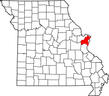
 Location of Crestwood, Missouri | |
| Coordinates: 38°33′27″N 90°22′34″W / 38.55750°N 90.37611°WCoordinates: 38°33′27″N 90°22′34″W / 38.55750°N 90.37611°W | |
| Country | United States |
| State | Missouri |
| County | St. Louis |
| Area[1] | |
| • Total | 3.60 sq mi (9.32 km2) |
| • Land | 3.60 sq mi (9.32 km2) |
| • Water | 0 sq mi (0 km2) |
| Elevation | 620 ft (189 m) |
| Population (2010)[2] | |
| • Total | 11,912 |
| • Estimate (2016)[3] | 11,905 |
| • Density | 3,300/sq mi (1,300/km2) |
| Time zone | UTC-6 (Central (CST)) |
| • Summer (DST) | UTC-5 (CDT) |
| ZIP code |
63126 (St. Louis (Sappington)) |
| FIPS code | 29-17218[4] |
| GNIS feature ID | 0755941[5] |
| Website | http://www.cityofcrestwood.org |
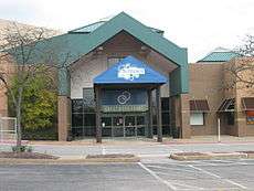
Crestwood is a city in south St. Louis County, Missouri, United States, part of the Metropolitan Statistical Area known as Greater St. Louis. The population was 11,912 at the 2010 census.[6]
Geography

Crestwood is located at 38°33′27″N 90°22′34″W / 38.55750°N 90.37611°W (38.557552, -90.376152).[7]
According to the United States Census Bureau, the city has a total area of 3.60 square miles (9.32 km2), all of it land.[1]
Crestwood is home to several public parks, including Crestwood Park, featuring baseball and soccer fields, a playground, and tennis courts, and Whitecliff Park, featuring the Crestwood Community Center and the Crestwood Aquatic Center, a public water park. Adjacent to Whitecliff Park in the small city of Grantwood Village is the animal reserve owned by Anheuser-Busch called Grant's Farm, which is free and open to the public during the summer. Grant's Farm, now home to free-roaming buffalo, zebras, and deer among other animals, is located on property formerly owned by president Ulysses S. Grant in the period between the Mexican War and the Civil War.
Crestwood is the burial place of Sgt. John Sappington. He was a Revolutionary War soldier who was a personal bodyguard to Gen. George Washington at Valley Forge. He was also one of the pioneers at Fort Boonesborough in Madison County, Kentucky. The Sappingtons were large land owners in the area, and Mark and Thomas Sappington's homes still stand in the vicinity. The Sappington Cemetery is maintained by the City of Crestwood, and several Sappington descendants still pass through to maintain the family graves. Crestwood is also the final resting place of Revered Moses Dickson buried in Father Dickson Cemetery 38° 34′ 1.29″ N, 90° 23′ 8.2″ W and is one of the historic stops along Grant's Trail a biking and walking trail in St. Louis County, Missouri[8]
Demographics
| Historical population | |||
|---|---|---|---|
| Census | Pop. | %± | |
| 1950 | 1,645 | — | |
| 1960 | 11,106 | 575.1% | |
| 1970 | 15,123 | 36.2% | |
| 1980 | 12,815 | −15.3% | |
| 1990 | 11,234 | −12.3% | |
| 2000 | 11,863 | 5.6% | |
| 2010 | 11,912 | 0.4% | |
| Est. 2016 | 11,905 | [3] | −0.1% |
| U.S. Decennial Census[9] | |||
2010 census
As of the census[2] of 2010, there were 11,912 people, 5,153 households, and 3,348 families residing in the city. The population density was 3,308.9 inhabitants per square mile (1,277.6/km2). There were 5,452 housing units at an average density of 1,514.4 per square mile (584.7/km2). The racial makeup of the city was 93.8% White, 1.6% African American, 0.2% Native American, 2.4% Asian, 0.1% Pacific Islander, 0.4% from other races, and 1.7% from two or more races. Hispanic or Latino of any race were 1.9% of the population.
There were 5,153 households of which 25.4% had children under the age of 18 living with them, 52.6% were married couples living together, 9.3% had a female householder with no husband present, 3.1% had a male householder with no wife present, and 35.0% were non-families. 30.6% of all households were made up of individuals and 16.5% had someone living alone who was 65 years of age or older. The average household size was 2.29 and the average family size was 2.87.
The median age in the city was 46 years. 20.5% of residents were under the age of 18; 6.1% were between the ages of 18 and 24; 22% were from 25 to 44; 29.2% were from 45 to 64; and 22.3% were 65 years of age or older. The gender makeup of the city was 47.1% male and 52.9% female.
2000 census
As of the census[4] of 2000, there were 11,863 people, 5,111 households, and 3,521 families residing in the city. The population density was 3,296.2 people per square mile (1,272.3/km²). There were 5,214 housing units at an average density of 1,448.7 per square mile (559.2/km²). The racial makeup of the city was 96.41% White, 0.72% African American, 0.19% Native American, 1.45% Asian, 0.01% Pacific Islander, 0.26% from other races, and 0.96% from two or more races. Hispanic or Latino of any race were 1.00% of the population.
There were 5,111 households out of which 24.0% had children under the age of 18 living with them, 57.8% were married couples living together, 8.7% had a female householder with no husband present, and 31.1% were non-families. 27.5% of all households were made up of individuals and 14.9% had someone living alone who was 65 years of age or older. The average household size was 2.32 and the average family size was 2.83.
In the city, the population was spread out with 20.0% under the age of 18, 5.9% from 18 to 24, 24.3% from 25 to 44, 25.0% from 45 to 64, and 24.8% who were 65 years of age or older. The median age was 45 years. For every 100 females, there were 88.8 males. For every 100 females age 18 and over, there were 85.3 males.
The median income for a household in the city was $54,185, and the median income for a family was $64,240. Males had a median income of $46,473 versus $31,934 for females. The per capita income for the city was $26,793. About 1.5% of families and 2.4% of the population were below the poverty line, including 3.8% of those under age 18 and 1.6% of those age 65 or over.
Governance
The city is governed by a mayor and a board of aldermen. The board comprises eight aldermen, two from each of the cities four wards. The mayor and aldermen are elected for three year terms. The current mayor is Tony Kennedy, Ward 4 Alderman and Acting Mayor. Mayor Gregg Roby resigned on June 5th 2018 for health concerns. Mayor Roby was in his second term of office which runs until April 2020.[10] A special election to elect a new mayor will be held in November 2018.
The current aldermen are:[11]
- Ward 1; Richard Breeding (elected April 2016) and Mimi Duncan (elected April 2018)
- Ward 2; Mary Stadter (elected April 2016) and Justin Charbonneau (elected April 2018)
- Ward 3; Grant Mabie (elected April 2018) and Jerry Miguel (elected April 2016)
- Ward 4; Ismaine Ayouaz (elected April 2018) and Tony Kennedy (elected April 2016)
Education
Lindbergh Schools serves almost all of Crestwood, while Affton School District serves a small portion.[12] Their respective high schools are Lindbergh High School, and Affton High School.
Public schools of the Lindbergh District within the Crestwood City limits:
- Crestwood Elementary School
- Long Elementary School
- Truman Middle School (partially in Crestwood, partially in Sunset Hills[13][14][15])
A private school, Holy Cross Academy is in Crestwood.[12]
Nearby schools:[12]
Senior high schools:
- Lutheran High School South (Affton)
- St. John Vianney High School (Kirkwood)
- Ursuline Academy (Oakland)
Grade schools:
- Cor Jesu Academy (Affton)
- Christ Community Lutheran School (Webster Groves)
- Queen of Holy Rosary School (Webster Groves)
- St. Justin The Martyr School (Sunset Hills)
Police department
The town has a police department with a total of 27 employees.[16]
References
- 1 2 "US Gazetteer files 2010". United States Census Bureau. Archived from the original on 2012-01-24. Retrieved 2012-07-08.
- 1 2 "American FactFinder". United States Census Bureau. Retrieved 2012-07-08.
- 1 2 "Population and Housing Unit Estimates". Retrieved June 9, 2017.
- 1 2 "American FactFinder". United States Census Bureau. Archived from the original on 2013-09-11. Retrieved 2008-01-31.
- ↑ "US Board on Geographic Names". United States Geological Survey. 2007-10-25. Retrieved 2008-01-31.
- ↑ "Race, Hispanic or Latino, Age, and Housing Occupancy: 2010 Census Redistricting Data (Public Law 94-171) Summary File (QT-PL), Crestwood city, Missouri". U.S. Census Bureau, American FactFinder 2. Archived from the original on September 11, 2013. Retrieved October 19, 2011.
- ↑ "US Gazetteer files: 2010, 2000, and 1990". United States Census Bureau. 2011-02-12. Retrieved 2011-04-23.
- ↑ "Grant's Trail: Father Dickson Cemetery". Retrieved 1 August 2016.
- ↑ "Census of Population and Housing". Census.gov. Archived from the original on May 12, 2015. Retrieved June 4, 2015.
- ↑ "Roby unopposed in his bid for second term as Crestwood mayor". Call Newspapers. March 5, 2017. Retrieved April 30, 2018.
- ↑ "Meet the Aldermen". City of Crestwood. April 25, 2018. Retrieved April 30, 2018.
- 1 2 3 "Area Schools." Crestwood, Missouri. Retrieved on August 22, 2017.
- ↑ Home. Truman Middle School. Retrieved on August 23, 2017. "12225 Eddie & Park Rd. St. Louis, MO 63127"
- ↑ Zoning map. Sunset Hills, Missouri. Retrieved on August 23, 2017.
- ↑ "Crestwood After Ward Changes." Crestwood, Missouri. Retrieved on August 23, 2017.
- ↑ Byers, Christine (13 April 2016). "Crestwood contemplating police contract with St. Louis County". St Louis Post-Dispatch. Retrieved 14 April 2016.
External links
- City of Crestwood official website
- City of Crestwood official website at the Wayback Machine (archive index)
| Topics |  | |
|---|---|---|
| Central city | ||
| Largest cities (over 50,000 in 2010) | ||
| Medium-sized cities (over 20,000 in 2010) | ||
| Largest towns and villages (over 10,000 in 2010) |
| |
| Missouri Counties | ||
| Illinois Counties | ||
| Subregions | ||