Howard County, Missouri
| Howard County, Missouri | |
|---|---|
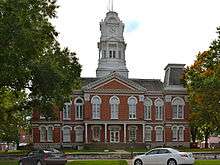 Howard County Courthouse in Fayette | |
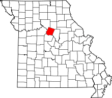 Location in the U.S. state of Missouri | |
 Missouri's location in the U.S. | |
| Founded | January 23, 1816 |
| Named for | Benjamin Howard |
| Seat | Fayette |
| Largest city | Fayette |
| Area | |
| • Total | 472 sq mi (1,222 km2) |
| • Land | 464 sq mi (1,202 km2) |
| • Water | 7.7 sq mi (20 km2), 1.6% |
| Population (est.) | |
| • (2015) | 10,139 |
| • Density | 22/sq mi (8/km2) |
| Congressional district | 4th |
| Time zone | Central: UTC−6/−5 |
Howard County is a county in the U.S. state of Missouri, with its southern border formed by the Missouri River. As of the 2010 census, the population was 10,144.[1] Its county seat is Fayette.[2] The county was organized January 23, 1816 and named for Benjamin Howard, the first Governor of the Missouri Territory.[3] Settled originally by migrants from the Upper South, it is part of the region historically known as Little Dixie.
History
Located on the north bank of the Missouri River, Howard County was settled primarily from the Upper Southern states of Kentucky, Tennessee and Virginia. The migrants brought slaves and slaveholding traditions with them, and cultivated hemp and tobacco, crops of Middle Tennessee. Howard was one of several counties settled mainly by Southerners along the Missouri River in the center of the state. Because of this, this area became known as Little Dixie, and Howard County was at its heart.[4] Following the 1848 revolutions in the German nations, many German immigrants also came to this region, developing farms.
Due to the reliance on slave labor, by 1860 African-American slaves composed at least 25 percent of the county's population.[5] Given their backgrounds and cultural affiliations, many Howard County residents supported the Confederacy during the Civil War. Ethnic German immigrants and descendants tended to support the Union.
After the end of Reconstruction, whites enforced Jim Crow laws and racial segregation in the county to maintain white supremacy. In the most violent period, at the turn of the 20th century, five African Americans were lynched in Howard County from 1891 to 1914: Olli Truxton, Frank Embree, Thomas Hayden, Arthur McNeal, and Dallas Shields.[6] Howard County tied with Pike County for the highest rate of lynchings in the state.[7]
The county continued to be developed for agriculture and is still largely rural. However, Howard County has lost population since its peak in 1880. The mechanization of farming reduced the demand for labor, and many workers left for jobs in the cities and less oppressive societies. By 2000 African Americans in the county had declined to less than seven percent of the total. In the early 21st century, nearly one-third of the residents identify as being of German ancestry, reflecting the wave of mid-19th century immigration.
Geography
According to the U.S. Census Bureau, the county has a total area of 472 square miles (1,220 km2), of which 464 square miles (1,200 km2) is land and 7.7 square miles (20 km2) (1.6%) is water.[8]
Adjacent counties
- Chariton County (northwest)
- Randolph County (northeast)
- Boone County (southeast)
- Cooper County (south)
- Saline County (west)
Major highways
National protected area
Demographics
| Historical population | |||
|---|---|---|---|
| Census | Pop. | %± | |
| 1820 | 13,426 | — | |
| 1830 | 10,854 | −19.2% | |
| 1840 | 13,108 | 20.8% | |
| 1850 | 13,969 | 6.6% | |
| 1860 | 15,946 | 14.2% | |
| 1870 | 17,233 | 8.1% | |
| 1880 | 18,428 | 6.9% | |
| 1890 | 17,371 | −5.7% | |
| 1900 | 18,337 | 5.6% | |
| 1910 | 15,653 | −14.6% | |
| 1920 | 13,997 | −10.6% | |
| 1930 | 13,490 | −3.6% | |
| 1940 | 13,026 | −3.4% | |
| 1950 | 11,857 | −9.0% | |
| 1960 | 10,859 | −8.4% | |
| 1970 | 10,561 | −2.7% | |
| 1980 | 10,008 | −5.2% | |
| 1990 | 9,631 | −3.8% | |
| 2000 | 10,212 | 6.0% | |
| 2010 | 10,144 | −0.7% | |
| Est. 2017 | 10,139 | [9] | 0.0% |
| U.S. Decennial Census[10] 1790-1960[11] 1900-1990[12] 1990-2000[13] 2010-2015[1] | |||
As of the census[14] of 2000, there were 10,212 people, 3,836 households, and 2,631 families residing in the county. The population density was 22 people per square mile (8/km²). There were 4,346 housing units at an average density of 9 per square mile (4/km²). The racial makeup of the county was 91.13% White, 6.84% Black or African American, 0.33% Native American, 0.12% Asian, 0.08% Pacific Islander, 0.40% from other races, and 1.10% from two or more races. Approximately 0.86% of the population were Hispanic or Latino of any race. 32.4% were of German, 16.1% American, 8.9% English and 8.3% Irish ancestry.
There were 3,836 households out of which 31.50% had children under the age of 18 living with them, 55.30% were married couples living together, 9.50% had a female householder with no husband present, and 31.40% were non-families. 27.30% of all households were made up of individuals and 13.30% had someone living alone who was 65 years of age or older. The average household size was 2.46 and the average family size was 2.98.
In the county, the population was spread out with 24.00% under the age of 18, 13.30% from 18 to 24, 25.20% from 25 to 44, 21.30% from 45 to 64, and 16.10% who were 65 years of age or older. The median age was 37 years. For every 100 females, there were 94.00 males. For every 100 females age 18 and over, there were 94.40 males.
The median income for a household in the county was $31,614, and the median income for a family was $40,167. Males had a median income of $26,369 versus $19,950 for females. The per capita income for the county was $15,198. About 7.50% of families and 11.60% of the population were below the poverty line, including 14.70% of those under age 18 and 14.40% of those age 65 or over.
Education
Public schools
- Fayette R-III School District – Fayette
- Laurence J. Daly Elementary School (PK-05)
- William N. Clark Middle School (06-08)
- Fayette High School (09-12)
- Glasgow School District – Glasgow
- Howard County Elementary School (PK-06)
- Glasgow High School (07-12)
- New Franklin R-I School District – New Franklin
- New Franklin Elementary School (PK-05)
- New Franklin Middle/High School (06-12)
Private schools
- St. Mary’s Catholic School – Glasgow (K-08) – Roman Catholic
- Grace & Glory Christian Academy – New Franklin (K-12) – Baptist - [Closed]
Post-secondary
- Central Methodist University – Fayette – A private, four-year Methodist university.
Public libraries
Politics
Local
The Democratic Party predominantly controls politics at the local level in Howard County. Democrats hold all but two of the elected positions in the county.
| Howard County, Missouri | ||||
|---|---|---|---|---|
| Elected countywide officials | ||||
| Assessor | John (Woody) McCutcheon | Democratic | ||
| Circuit Clerk | Charles J. Flaspohler | Democratic | ||
| County Clerk | Kathyrne Harper | Republican | ||
| Collector | Jinger Felten | Republican | ||
| Commissioner (Presiding) |
Sam Stroupe | Democratic | ||
| Commissioner (District 1) |
Richard Conrow | Democratic | ||
| Commissioner (District 2) |
Howard McMillan | Democratic | ||
| Coroner | Frank Flaspohler | Democratic | ||
| Prosecuting Attorney | Deborah Riekhof | Republican | ||
| Public Administrator | Lisa Asbury | Democratic | ||
| Recorder | Charles J. Flaspohler | Democratic | ||
| Sheriff | Mike Neal | Republican | ||
| Surveyor | Gene Bowen | Democratic | ||
| Treasurer | Susan Keyton | Democratic | ||
State
| Year | Republican | Democratic | Third Parties |
|---|---|---|---|
| 2016 | 56.47% 2,727 | 40.26% 1,944 | 3.27% 158 |
| 2012 | 47.89% 2,302 | 48.89% 2,350 | 3.22% 155 |
| 2008 | 48.69% 2,358 | 49.08% 2,377 | 2.33% 108 |
| 2004 | 52.46% 2,578 | 46.34% 2,277 | 1.20% 59 |
| 2000 | 44.96% 2,029 | 52.12% 2,352 | 2.92% 132 |
| 1996 | 33.90% 1,436 | 63.53% 2,691 | 2.57% 109 |
Howard County is split between two districts of the Missouri House of Representatives, both of which are represented by Republicans.
- District 47 — Chuck Basye consists of the eastern part of the county.
| Party | Candidate | Votes | % | ± | |
|---|---|---|---|---|---|
| Republican | Chuck Basye | 625 | 72.17% | +8.83 | |
| Democratic | Susan McClintic | 241 | 27.83% | -8.83 | |
| Party | Candidate | Votes | % | ± | |
|---|---|---|---|---|---|
| Republican | Chuck Basye | 330 | 63.34% | +5.61 | |
| Democratic | John Wright | 191 | 36.66% | -5.61 | |
| Party | Candidate | Votes | % | ± | |
|---|---|---|---|---|---|
| Republican | Mitch Richards | 474 | 57.73% | ||
| Democratic | John Wright | 347 | 42.27% | ||
- District 48 — Dave Muntzel consists of the central and western parts of the county.
| Party | Candidate | Votes | % | ± | |
|---|---|---|---|---|---|
| Republican | Dave Muntzel | 2,893 | 78.15% | -21.85 | |
| Independent | Debra Dilks | 809 | 21.85% | +21.85 | |
| Party | Candidate | Votes | % | ± | |
|---|---|---|---|---|---|
| Republican | Dave Muntzel | 1,962 | 100.00% | +50.61 | |
| Party | Candidate | Votes | % | ± | |
|---|---|---|---|---|---|
| Republican | Dave Muntzel | 1,910 | 49.39% | ||
| Democratic | Ron Monnig | 1,957 | 50.61% | ||
All of Howard County is a part of Missouri’s 21st District in the Missouri Senate and is currently represented by Denny Hoskins (R-Warrensburg).
| Party | Candidate | Votes | % | ± | |
|---|---|---|---|---|---|
| Republican | Denny Hoskins | 2,970 | 65.36% | +3.81 | |
| Democratic | ElGene Ver Dught | 1,254 | 27.60% | -4.68 | |
| Libertarian | Bill Wayne | 320 | 7.04% | +0.87 | |
| Party | Candidate | Votes | % | ± | |
|---|---|---|---|---|---|
| Republican | David Pearce | 2,835 | 61.55% | ||
| Democratic | ElGene Ver Dught | 1,487 | 32.28% | ||
| Libertarian | Steven Hedrick | 284 | 6.17% | ||
Federal
| Party | Candidate | Votes | % | ± | |
|---|---|---|---|---|---|
| Republican | Roy Blunt | 2,671 | 55.27% | +11.59 | |
| Democratic | Jason Kander | 1,928 | 39.89% | -7.89 | |
| Libertarian | Jonathan Dine | 134 | 2.77% | -5.77 | |
| Green | Johnathan McFarland | 48 | 0.99% | +0.99 | |
| Constitution | Fred Ryman | 52 | 1.08% | +1.08 | |
| Party | Candidate | Votes | % | ± | |
|---|---|---|---|---|---|
| Republican | Todd Akin | 2,101 | 43.68% | ||
| Democratic | Claire McCaskill | 2,298 | 47.78% | ||
| Libertarian | Jonathan Dine | 411 | 8.54% | ||
All of Howard County is included in Missouri’s 4th Congressional District and is currently represented by Vicky Hartzler (R-Harrisonville) in the U.S. House of Representatives.
| Party | Candidate | Votes | % | ± | |
|---|---|---|---|---|---|
| Republican | Vicky Hartzler | 3,131 | 66.82% | +2.48 | |
| Democratic | Gordon Christensen | 1,300 | 27.74% | -1.25 | |
| Libertarian | Mark Bliss | 255 | 5.44% | -1.23 | |
| Party | Candidate | Votes | % | ± | |
|---|---|---|---|---|---|
| Republican | Vicky Hartzler | 1,833 | 64.34% | +8.04 | |
| Democratic | Nate Irvin | 826 | 28.99% | -9.25 | |
| Libertarian | Herschel Young | 190 | 6.67% | +2.45 | |
| Party | Candidate | Votes | % | ± | |
|---|---|---|---|---|---|
| Republican | Vicky Hartzler | 2,640 | 56.30% | ||
| Democratic | Teresa Hensley | 1,793 | 38.24% | ||
| Libertarian | Thomas Holbrook | 198 | 4.22% | ||
| Constitution | Greg Cowan | 58 | 1.24% | ||
| Year | Republican | Democratic | Third parties |
|---|---|---|---|
| 2016 | 67.3% 3,277 | 26.4% 1,283 | 6.3% 308 |
| 2012 | 62.0% 3,017 | 35.4% 1,723 | 2.6% 127 |
| 2008 | 55.8% 2,708 | 41.9% 2,036 | 2.3% 111 |
| 2004 | 59.2% 2,915 | 40.1% 1,972 | 0.7% 34 |
| 2000 | 53.5% 2,414 | 43.1% 1,944 | 3.4% 154 |
| 1996 | 36.8% 1,545 | 47.9% 2,014 | 15.3% 644 |
| 1992 | 28.2% 1,253 | 46.9% 2,085 | 24.9% 1,105 |
| 1988 | 43.2% 1,865 | 56.6% 2,446 | 0.3% 11 |
| 1984 | 54.0% 2,360 | 46.0% 2,014 | |
| 1980 | 47.9% 2,179 | 49.3% 2,243 | 2.9% 132 |
| 1976 | 37.6% 1,690 | 61.6% 2,769 | 0.8% 35 |
| 1972 | 56.2% 2,613 | 43.9% 2,041 | |
| 1968 | 39.1% 1,825 | 50.0% 2,333 | 10.9% 507 |
| 1964 | 27.6% 1,339 | 72.4% 3,507 | |
| 1960 | 38.6% 2,075 | 61.4% 3,302 | |
| 1956 | 38.1% 2,177 | 61.9% 3,542 | |
| 1952 | 39.1% 2,340 | 60.8% 3,635 | 0.1% 7 |
| 1948 | 27.0% 1,538 | 72.8% 4,143 | 0.2% 12 |
| 1944 | 33.0% 1,951 | 66.9% 3,958 | 0.2% 9 |
| 1940 | 32.8% 2,333 | 67.0% 4,770 | 0.3% 20 |
| 1936 | 24.6% 1,745 | 75.1% 5,326 | 0.3% 21 |
| 1932 | 19.9% 1,337 | 79.5% 5,354 | 0.7% 46 |
| 1928 | 33.5% 2,254 | 66.3% 4,452 | 0.2% 14 |
| 1924 | 27.3% 1,873 | 69.4% 4,759 | 3.3% 228 |
| 1920 | 30.9% 2,125 | 68.7% 4,735 | 0.4% 28 |
| 1916 | 27.9% 1,121 | 71.2% 2,866 | 0.9% 36 |
| 1912 | 23.6% 896 | 70.5% 2,672 | 5.9% 223 |
| 1908 | 28.2% 1,141 | 71.2% 2,884 | 0.7% 28 |
| 1904 | 30.5% 1,199 | 68.1% 2,674 | 1.4% 56 |
| 1900 | 28.8% 1,295 | 69.6% 3,134 | 1.7% 76 |
| 1896 | 28.8% 1,353 | 70.6% 3,317 | 0.6% 28 |
| 1892 | 28.1% 1,052 | 68.5% 2,570 | 3.4% 129 |
| 1888 | 32.5% 1,278 | 65.5% 2,577 | 2.0% 80 |
Missouri presidential preference primary (2008)
- Former U.S. Senator Hillary Clinton (D-New York) received more votes, a total of 685, than any candidate from either party in Howard County during the 2008 presidential primary.
| Howard County, Missouri | |
|---|---|
| 2008 Republican primary in Missouri | |
| John McCain | 283 (28.44%) |
| Mike Huckabee | 328 (32.96%) |
| Mitt Romney | 319 (32.06%) |
| Ron Paul | 52 (5.23%) |
| Howard County, Missouri | |
|---|---|
| 2008 Democratic primary in Missouri | |
| Hillary Clinton | 685 (48.38%) |
| Barack Obama | 660 (46.61%) |
| John Edwards (withdrawn) | 50 (3.53%) |
| Uncommitted | 14 (0.99%) |
Cities and towns
- Armstrong
- Boonesboro
- Fayette (county seat)
- Estill
- Franklin
- Glasgow
- New Franklin
- Roanoke
Notable people
- Frank P. Briggs - former United States Senator and Assistant U.S. Secretary of the Interior.
- Sara Evans - American country music singer.
- Spottswood Rice - Union Soldier in the Civil War and African Methodist Episcopal Church minister.
- Talbot Smith, United States District Judge
See also
References
- 1 2 "State & County QuickFacts". United States Census Bureau. Archived from the original on 11 July 2011. Retrieved 9 September 2013.
- ↑ "Find a County". National Association of Counties. Archived from the original on 31 May 2011. Retrieved 7 June 2011.
- ↑ Eaton, David Wolfe (1916). How Missouri Counties, Towns and Streams Were Named. The State Historical Society of Missouri. p. 174.
- ↑ The Story of Little Dixie, Missouri, Missouri Division, Sons of Confederate Veterans, accessed 3 June 2008
- ↑ T. J. Stiles, Jesse James: The Last Rebel of the Civil War, New York: Vintage Books, 2003, pp.10-11
- ↑ NAACP (1919). Thirty Years of Lynching in the United States, 1889—1918. NAACP. pp. 80–81.
- ↑ Lynching in America/ Supplement: Lynchings by County, 3rd edition, Montgomery, Alabama: Equal Justice Initiative, 2015, p. 7
- ↑ "2010 Census Gazetteer Files". United States Census Bureau. August 22, 2012. Archived from the original on October 21, 2013. Retrieved November 16, 2014.
- ↑ "Population and Housing Unit Estimates". Retrieved June 9, 2017.
- ↑ "U.S. Decennial Census". United States Census Bureau. Archived from the original on 12 May 2015. Retrieved 16 November 2014.
- ↑ "Historical Census Browser". University of Virginia Library. Retrieved November 16, 2014.
- ↑ "Population of Counties by Decennial Census: 1900 to 1990". United States Census Bureau. Retrieved November 16, 2014.
- ↑ "Census 2000 PHC-T-4. Ranking Tables for Counties: 1990 and 2000" (PDF). United States Census Bureau. Retrieved November 16, 2014.
- ↑ "American FactFinder". United States Census Bureau. Retrieved 2008-01-31.
- ↑ Breeding, Marshall. "Howard County Library". Libraries.org. Retrieved May 8, 2017.
- ↑ Breeding, Marshall. "Lewis Library of Glasgow". Libraries.org. Retrieved May 8, 2017.
- ↑ Leip, David. "Dave Leip's Atlas of U.S. Presidential Elections". uselectionatlas.org. Retrieved 2018-03-25.
Further reading
- History of Howard and Chariton Counties, Missouri (1883) full text
External links
- Digitized 1930 Plat Book of Howard County from University of Missouri Division of Special Collections, Archives, and Rare Books
Places adjacent to Howard County, Missouri | ||||||||||
|---|---|---|---|---|---|---|---|---|---|---|
| ||||||||||
Municipalities and communities of Howard County, Missouri, United States | ||
|---|---|---|
| Cities | | |
| Townships | ||
| Unincorporated communities | ||
| Ghost town | ||
| Footnotes | ‡This populated place also has portions in an adjacent county or counties | |
