History
Clay County was settled primarily from migrants from the Upper Southern states of Kentucky, Tennessee, and Virginia. They brought slaves and slaveholding traditions with them, and quickly started cultivating crops similar to those in Middle Tennessee and Kentucky: hemp and tobacco. Clay was one of several counties settled mostly by Southerners to the north and south of the Missouri River. Given their culture and traditions, this area became known as Little Dixie. In 1860, slaves made up 25% or more of the county's population.[5] Residents generally supported the Confederacy during the Civil War, as the Confederate flag flew over the county courthouse for many years following the end of the Civil War.
Many members of the Latter Day Saint movement found refuge in Clay County in November 1833. In 1836, mobs drove the members of the church from the county.[6] Leaders of this church, most notably Joseph Smith, were imprisoned for some months in Clay County in the jail at Liberty. In May 2012, the LDS Church opened a Kansas City Missouri Temple six miles southwest of the Liberty Jail site at 7001 Searcy Creek Parkway in Kansas City, Missouri.[7]
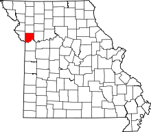
Geography
According to the U.S. Census Bureau, the county has a total area of 409 square miles (1,060 km2), of which 397 square miles (1,030 km2) is land and 11 square miles (28 km2) (2.8%) is covered by water.[8] It is the fourth-smallest county in Missouri by area.
Demographics
| Historical population |
| Census | Pop. | | %± |
| 1830 | 5,338 | | — |
| 1840 | 8,283 | | 55.2% |
| 1850 | 10,382 | | 25.3% |
| 1860 | 13,023 | | 25.4% |
| 1870 | 15,564 | | 19.5% |
| 1880 | 15,571 | | 0.0% |
| 1890 | 19,856 | | 27.5% |
| 1900 | 18,903 | | −4.8% |
| 1910 | 20,302 | | 7.4% |
| 1920 | 20,455 | | 0.8% |
| 1930 | 26,811 | | 31.1% |
| 1940 | 30,417 | | 13.4% |
| 1950 | 45,221 | | 48.7% |
| 1960 | 87,474 | | 93.4% |
| 1970 | 123,322 | | 41.0% |
| 1980 | 136,488 | | 10.7% |
| 1990 | 153,411 | | 12.4% |
| 2000 | 184,006 | | 19.9% |
| 2010 | 221,939 | | 20.6% |
| Est. 2017 | 242,874 | [9] | 9.4% |
U.S. Decennial Census[10]
1790-1960[11] 1900-1990[12]
1990-2000[13] 2010-2015[1] |
As of the census[14] of 2010, 221,939 people, 72,558 households, and 50,137 families resided in the county. The population density was 558 people per square mile (216/km²). The 93,918 housing units averaged 236 per square mile (91/km2). The racial makeup of the county was 87.46% White, 5.18% Black or African American, 0.53% Native American, 2.05% Asian, 0.26% Pacific Islander, 1.77% from other races, and 2.75% from two or more races. About 5.90% of the population were Hispanic or Latino of any race. As of the census[15] of 2000, 23.3% were of German, 14.5% American, 11.0% English, 10.8% Irish, and 5.6% Italian ancestry.
Of the 72,558 households, 33.80% had children under the age of 18 living with them, 55.40% were married couples living together, 10.20% had a female householder with no husband present, and 30.90% were not families. About 25.20% of all households were made up of individuals, and 7.40% had someone living alone who was 65 years of age or older. The average household size was 2.50 and the average family size was 3.00.
In the county, the population was distributed as 25.80% under the age of 18, 8.70% from 18 to 24, 32.30% from 25 to 44, 22.30% from 45 to 64, and 10.80% who were 65 years of age or older. The median age was 35 years. For every 100 females, there were 94.60 males. For every 100 females age 18 and over, there were 91.80 males.
In 2015 the median income for a household in Clay County was $62,099. The income per capita in Clay county was $29,793.
[16]
In 2010 the median income for a household in the county was $48,347, and for a family was $56,772. Males had a median income of $40,148 versus $27,681 for females. The per capita income for the county was $23,144. About 3.80% of families and 5.50% of the population were below the poverty line, including 6.40% of those under age 18 and 5.50% of those age 65 or over.
Registered voters number 151,042.[17]
Education
Public schools
- Excelsior Springs School District No. 40 – Excelsior Springs
- Lewis Elementary School (PK–5)
- Westview Elementary School (K–5)
- Excelsior Springs Middle School (6–8)
- Excelsior Springs High School (9–12)
- Excelsior Springs Technical High School (12) – Alternative/Technical School
- Kearney R-I School District – Kearney
- Dogwood Elementary School (PreK–5)
- Hawthorne Elementary School (K–5)
- Holt Elementary School (K–5)
- Kearney Elementary School (K–5)
- Southview Elementary School (K–5)
- Kearney Middle School (6–7)
- Kearney Junior High School (8–9)
- Kearney High School (10–12)
- Liberty School District No. 53 – Liberty
- Liberty Early Childhood Education Center (PreK)
- Alexander Doniphan Elementary School (K–5)
- Franklin Elementary School (K–5)
- Kellybrook Elementary School (K–5) – Kansas City
- Lewis & Clark Elementary School (K–5)
- Liberty Oaks Elementary School (K–5) – Kansas City
- Lillian Schumacher Elementary School (K–5)
- Manor Hill Elementary School (K–5)
- Ridgeview Elementary School (K–5)
- Shoal Creek Elementary School (K–5)
- Warren Hills Elementary School (K–5)
- Liberty Middle School (6–8)
- South Valley Middle School (6–8)
- Heritage Middle School (6–8)
- Discovery Middle School (6–8)
- Liberty High School (9–12)
- Liberty North High School (9–12)
- Missouri City School District No. 56 – Missouri City
- Missouri City Elementary School (K–8)
- North Kansas City School District No. 74 – North Kansas City
- Bell Prairie Elementary School (K–5)
- Briarcliff Elementary School (K–5)
- Chapel Hill Elementary School (K–5)
- Chouteu Elementary School (Pre-K–5)
- Clardy Elementary School (2–5)
- Crestview Elementary School (K–5)
- Davidson Elementary School (Pre-K–5)
- Fox Hill Elementary School (K–5)
- Gashland Elementary School (K–1)
- Gracemor Elementary School (Pre-K–5)
- Lakewood Elementary School (Pre-K–5)
- Linden West Elementary School (K–5) – Gladstone
- Maplewood Elementary School (K–5)
- Meadowbrook Elementary School (K–5)
- Nashua Elementary School (K–5)
- Northview Elementary School (K–5)
- Oakwood Manor Elementary School (K–5)
- Ravenwood Elementary School (K–5)
- Rising Hill Elementary School (K-5)
- Topping Elementary School (K–5)
- West Englewood Elementary School (Pre-K–5)
- Winnwood Elementary School (Pre-K–5)
- Antioch Middle School (6–8)
- Eastgate 6th Grade Center (6)
- Gateway 6th Grade Center (6)
- Maple Park Middle School (6–8)
- New Mark Middle School (6–8)
- Northgate Middle School (6–8)
- North Kansas City High School (9–12)
- Oak Park High School (Kansas City) (9–12)
- Staley High School (9–12)
- Winnetonka High School (9–12)
- Smithville R-II School District – Smithville
- Smithville Elementary School (Pre-K–2)
- Smithville Upper Elementary School (3–5)
- Smithville Middle School (6–8)
- Smithville High School (9–12)
Postsecondary
- Maple Woods :: Metropolitan Community College—Kansas City—A public, two-year Liberal Arts college
- William Jewell College – Liberty – A private, four-year Liberal Arts college.
Libraries, archives, museums
Politics
Local
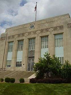
The three-person Clay County Commission oversees the issues of Clay County. The current makeup of the commissioners is two Republicans and one Democrat.
State
Past Gubernatorial Elections Results
| Year |
Republican |
Democratic |
Third Parties |
| 2016 |
48.97% 53,883 |
47.65% 52,429 |
3.37% 3,712 |
| 2012 |
41.53% 43,398 |
55.47% 57,962 |
3.00% 3,138 |
| 2008 |
38.64% 41,518 |
58.95% 63,341 |
2.40% 2,583 |
| 2004 |
46.70% 44,763 |
51.72% 49,573 |
1.58% 1,520 |
| 2000 |
46.57% 36,983 |
51.31% 40,747 |
2.12% 1,689 |
| 1996 |
34.29% 23,524 |
63.54% 43,593 |
2.18% 1,493 |
Clay County is divided into eight legislative districts in the Missouri House of Representatives, five of which are held by Republicans and three by Democrats.
Missouri House of Representatives — District 8 — Clay County (2016)
| Party |
Candidate |
Votes |
% |
± |
|
Republican |
James W. (Jim) Neely |
1,603 |
100.00% |
+25.52 |
Missouri House of Representatives — District 8 — Clay County (2014)
| Party |
Candidate |
Votes |
% |
± |
|
Republican |
James W. (Jim) Neely |
686 |
74.48% |
+9.46 |
|
Democratic |
Ted Rights |
235 |
25.52% |
-9.46 |
Missouri House of Representatives — District 8 — Clay County (2012)
| Party |
Candidate |
Votes |
% |
± |
|
Republican |
James W. (Jim) Neely |
1,106 |
65.02% |
|
|
Democratic |
James T. (Jim) Crenshaw |
595 |
34.98% |
|
Missouri House of Representatives — District 12 — Clay County (2016)
| Party |
Candidate |
Votes |
% |
± |
|
Republican |
Kenneth Wilson |
8,930 |
60.90% |
-4.80 |
|
Democratic |
Sandy Van Wagner |
5,307 |
36.19% |
+1.89 |
|
Libertarian |
Glenn Gustitus |
427 |
2.91% |
+2.91 |
Missouri House of Representatives — District 12 — Clay County (2014)
| Party |
Candidate |
Votes |
% |
± |
|
Republican |
Kenneth Wilson |
5,077 |
65.70% |
-34.30 |
|
Democratic |
Sandy Van Wagner |
2,651 |
34.30% |
+34.30 |
Missouri House of Representatives — District 12 — Clay County (2012)
| Party |
Candidate |
Votes |
% |
± |
|
Republican |
Kenneth Wilson |
11,540 |
100.00% |
|
Missouri House of Representatives — District 14 — Clay County (2016)
| Party |
Candidate |
Votes |
% |
± |
|
Republican |
Kevin Corlew |
211 |
45.87% |
-5.24 |
|
Democratic |
Martin T. Rucker II |
249 |
54.13% |
+5.24 |
Missouri House of Representatives — District 14 — Clay County (2014)
| Party |
Candidate |
Votes |
% |
± |
|
Republican |
Kevin Corlew |
92 |
51.11% |
-0.41 |
|
Democratic |
Stephanie Isaacson |
88 |
48.89% |
+0.41 |
Missouri House of Representatives — District 14 — Clay County (2012)
| Party |
Candidate |
Votes |
% |
± |
|
Republican |
Ron Scheiber |
204 |
51.52% |
|
|
Democratic |
Eric Pendell |
192 |
48.48% |
|
- District 15 — Jon Carpenter (D—Kansas City) — consists of Gladstone, Oaks, Oakview, Oakwood, Oakwood Park, and a part of Kansas City.
Missouri House of Representatives — District 15 — Clay County (2016)
| Party |
Candidate |
Votes |
% |
± |
|
Democratic |
Jon Carpenter |
12,835 |
100.00% |
|
Missouri House of Representatives — District 15 — Clay County (2014)
| Party |
Candidate |
Votes |
% |
± |
|
Democratic |
Jon Carpenter |
5,541 |
100.00% |
+43.83 |
Missouri House of Representatives — District 15 — Clay County (2012)
| Party |
Candidate |
Votes |
% |
± |
|
Democratic |
Jon Carpenter |
9,294 |
56.17% |
|
|
Republican |
Kevin Corlew |
7,251 |
43.83% |
|
Missouri House of Representatives — District 16 — Clay County (2016)
| Party |
Candidate |
Votes |
% |
± |
|
Republican |
Noel J. Shull |
16,969 |
100.00% |
|
Missouri House of Representatives — District 16 — Clay County (2014)
| Party |
Candidate |
Votes |
% |
± |
|
Republican |
Noel J. Shull |
7,010 |
100.00% |
+38.73 |
Missouri House of Representatives — District 16 — Clay County (2012)
| Party |
Candidate |
Votes |
% |
± |
|
Republican |
Noel J. Shull |
11,290 |
61.27% |
|
|
Democratic |
Jim Sweere |
7,138 |
38.73% |
|
- District 17 — Mark Ellebracht (D— Liberty) — consists of the communities of Birmingham, Claycomo, Glenaire, a part of Kansas City, and a part of Liberty.
Missouri House of Representatives — District 17 — Clay County (2010)
| Party |
Candidate |
Votes |
% |
± |
|
Democratic |
Mark Ellebracht |
8,979 |
50.52% |
+0.92 |
|
Republican |
Mary Hill |
8,146 |
45.83% |
-4.57 |
|
Libertarian |
Erik S. Buck |
649 |
3.65% |
+3.65 |
Missouri House of Representatives — District 17 — Clay County (2014)
| Party |
Candidate |
Votes |
% |
± |
|
Democratic |
Mark Ellebracht |
4,504 |
49.60% |
+0.22 |
|
Republican |
S. Nick King |
4,576 |
50.40% |
-0.22 |
Missouri House of Representatives — District 17 — Clay County (2012)
| Party |
Candidate |
Votes |
% |
± |
|
Democratic |
Mark Ellebracht |
8,500 |
49.38% |
|
|
Republican |
Myron Neth |
8,713 |
50.62% |
|
- District 18 — Lauren Arthur (D— Kansas City) — consists of the communities of Avondale, part of Kansas City, and North Kansas City.
Missouri House of Representatives — District 18 — Clay County (2016)
| Party |
Candidate |
Votes |
% |
± |
|
Democratic |
Lauren Arthur |
12,734 |
100.00% |
+43.80 |
Missouri House of Representatives — District 18 — Clay County (2014)
| Party |
Candidate |
Votes |
% |
± |
|
Democratic |
Lauren Arthur |
4,284 |
56.20% |
-43.80 |
|
Republican |
Robert Rowland |
3,339 |
43.80% |
+43.80 |
Missouri House of Representatives — District 18 — Clay County (2012)
| Party |
Candidate |
Votes |
% |
± |
|
Democratic |
Jay Swearingen |
12,694 |
100.00% |
|
- District 38 — T.J. Berry (R— Kearney) — consists of Excelsior Springs, part of Kansas City, part of Kearney, part of Liberty, Missouri City, Mosby, and Prathersville.
Missouri House of Representatives — District 38 — Clay County (2016)
| Party |
Candidate |
Votes |
% |
± |
|
Republican |
T.J. Berry |
13,391 |
77.03% |
-22.97 |
|
Libertarian |
Brian Lautenschlager |
3,993 |
22.97% |
+22.97 |
Missouri House of Representatives — District 38 — Clay County (2014)
| Party |
Candidate |
Votes |
% |
± |
|
Republican |
T.J. Berry |
7,044 |
100.00% |
+40.65 |
Missouri House of Representatives — District 38 — Clay County (2012)
| Party |
Candidate |
Votes |
% |
± |
|
Republican |
T.J. Berry |
10,215 |
59.35% |
|
|
Democratic |
Kevin Morgan |
6,997 |
40.65% |
|
Clay County is divided into two districts in the Missouri Senate, both of which are held by Republicans.
- District 12 — Dan Hegeman (R-Cosby) -- consists of the communities of Excelsior Springs, Holt, Kearney, Lawson, Missouri City, Mosby, Prathersville, and Smithville.
Missouri Senate — Senate 12 — Clay County (2014)
| Party |
Candidate |
Votes |
% |
± |
|
Republican |
Dan Hegeman |
9,718 |
100.00% |
|
- District 17 – Ryan Silvey (R-Kansas City) - consists of the communities of Avondale, Birmingham, Claycomo, Gladstone, Glenaire, Liberty, North Kansas City, Oaks, Oakview, Oakwood, Oakwood Park, Pleasant Valley, Randolph, Sugar Creek, and a part of Kansas City.
Missouri Senate — District 17 — Clay County (2016)
| Party |
Candidate |
Votes |
% |
± |
|
Republican |
Ryan Silvey |
51,262 |
61.26% |
+8.47 |
|
Democratic |
J. Ranen Bechthold |
32,422 |
38.74% |
-8.47 |
Missouri Senate — District 17 — Clay County (2012)
| Party |
Candidate |
Votes |
% |
± |
|
Republican |
Ryan Silvey |
42,491 |
52.79% |
|
|
Democratic |
Sandra Reeves |
37,997 |
47.21% |
|
Federal
U.S. Senate — Missouri — Clay County (2016)
| Party |
Candidate |
Votes |
% |
± |
|
Republican |
Roy Blunt |
49,173 |
44.66% |
+8.24 |
|
Democratic |
Jason Kander |
55,322 |
50.25% |
-5.05 |
|
Libertarian |
Jonathan Dine |
3,507 |
3.19% |
-5.09 |
|
Green |
Johnatan McFarland |
1,197 |
1.09% |
+1.09 |
|
Constitution |
Fred Ryman |
896 |
0.81% |
+0.81 |
U.S. Senate — Missouri — Clay County (2012)
| Party |
Candidate |
Votes |
% |
± |
|
Republican |
Todd Akin |
37,967 |
36.42% |
|
|
Democratic |
Claire McCaskill |
57,654 |
55.30% |
|
|
Libertarian |
Jonathan Dine |
8,631 |
8.28% |
|
Clay County is split between the 5th and 6th congressional districts of Missouri. The southern 30% of the county is represented by Emanuel Cleaver (D-Kansas City).
U.S. House of Representatives — Missouri's 5th Congressional District — Clay County (2016)
| Party |
Candidate |
Votes |
% |
± |
|
Democratic |
Emanuel Cleaver II |
17,151 |
52.94% |
+8.73 |
|
Republican |
Jacob Turk |
13,804 |
42.60% |
-7.67 |
|
Libertarian |
Roy Welborn |
1,445 |
4.46% |
-1.06 |
U.S. House of Representatives — Missouri's 5th Congressional District — Clay County (2014)
| Party |
Candidate |
Votes |
% |
± |
|
Democratic |
Emanuel Cleaver II |
6,711 |
44.21% |
-10.50 |
|
Republican |
Jacob Turk |
7,631 |
50.27% |
+8.99 |
|
Libertarian |
Roy Welborn |
838 |
5.52% |
+1.51 |
U.S. House of Representatives — Missouri's 5th Congressional District — Clay County (2012)
| Party |
Candidate |
Votes |
% |
± |
|
Democratic |
Emanuel Cleaver II |
17,449 |
54.71% |
|
|
Republican |
Jacob Turk |
13,163 |
41.28% |
|
|
Libertarian |
Randy Langkraehr |
1,278 |
4.01% |
|
The northern 70% of the county is represented by Sam Graves (R-Tarkio).
U.S. House of Representatives — Missouri’s 6th Congressional District — Clay County (2016)
| Party |
Candidate |
Votes |
% |
± |
|
Republican |
Sam Graves |
47,760 |
63.14% |
-1.00 |
|
Democratic |
David M. Blackwell |
25,056 |
33.12% |
+1.70 |
|
Libertarian |
Russ Lee Monchil |
1,943 |
2.57% |
-1.87 |
|
Green |
Mike Diel |
886 |
1.17% |
+1.17 |
U.S. House of Representatives — Missouri's 6th Congressional District — Clay County (2014)
| Party |
Candidate |
Votes |
% |
± |
|
Republican |
Sam Graves |
23,092 |
64.14% |
+1.12 |
|
Democratic |
Bill Hedge |
11,311 |
31.42% |
-3.05 |
|
Libertarian |
Russ Lee Monchil |
1,599 |
4.44% |
+1.93 |
U.S. House of Representatives — Missouri's 6th Congressional District — Clay County (2012)
| Party |
Candidate |
Votes |
% |
± |
|
Republican |
Sam Graves |
44,573 |
63.02% |
|
|
Democratic |
Kyle Yarber |
24,385 |
34.47% |
|
|
Libertarian |
Russ Lee Monchil |
1,777 |
2.51% |
|
Presidential elections results
Presidential elections results[19]
| Year |
Republican |
Democratic |
Third parties |
| 2016 |
51.7% 57,476 |
40.8% 45,304 |
7.6% 8,390 |
| 2012 |
53.0% 56,191 |
44.6% 47,310 |
2.4% 2,542 |
| 2008 |
49.6% 54,516 |
48.9% 53,761 |
1.6% 1,748 |
| 2004 |
53.1% 51,193 |
46.3% 44,670 |
0.6% 597 |
| 2000 |
48.8% 39,083 |
48.8% 39,084 |
2.5% 2,006 |
| 1996 |
41.9% 28,935 |
47.2% 32,603 |
11.0% 7,609 |
| 1992 |
31.4% 23,798 |
40.3% 30,565 |
28.3% 21,415 |
| 1988 |
50.3% 30,293 |
49.2% 29,620 |
0.6% 357 |
| 1984 |
61.8% 36,529 |
38.2% 22,586 |
|
| 1980 |
50.7% 28,521 |
43.1% 24,250 |
6.3% 3,543 |
| 1976 |
47.7% 24,962 |
50.9% 26,609 |
1.4% 744 |
| 1972 |
69.4% 33,017 |
30.6% 14,538 |
|
| 1968 |
44.5% 19,643 |
39.7% 17,547 |
15.8% 6,972 |
| 1964 |
36.8% 13,997 |
63.2% 23,993 |
|
| 1960 |
52.3% 18,955 |
47.7% 17,318 |
|
| 1956 |
49.7% 13,436 |
50.3% 13,605 |
|
| 1952 |
51.0% 13,043 |
48.8% 12,502 |
0.2% 53 |
| 1948 |
35.0% 6,408 |
64.8% 11,855 |
0.2% 41 |
| 1944 |
43.5% 6,724 |
56.2% 8,682 |
0.3% 40 |
| 1940 |
38.8% 6,159 |
61.0% 9,672 |
0.2% 30 |
| 1936 |
31.9% 4,491 |
67.7% 9,535 |
0.4% 58 |
| 1932 |
24.7% 3,117 |
74.5% 9,398 |
0.8% 97 |
| 1928 |
49.9% 5,584 |
49.8% 5,574 |
0.2% 27 |
| 1924 |
31.7% 2,998 |
64.2% 6,076 |
4.1% 385 |
| 1920 |
30.8% 2,804 |
68.9% 6,283 |
0.3% 31 |
| 1916 |
24.8% 1,307 |
74.1% 3,902 |
1.0% 55 |
| 1912 |
12.5% 592 |
72.0% 3,417 |
15.5% 737 |
| 1908 |
24.6% 1,166 |
74.2% 3,513 |
1.2% 56 |
| 1904 |
26.7% 1,077 |
70.2% 2,832 |
3.1% 124 |
| 1900 |
20.0% 921 |
78.0% 3,585 |
2.0% 90 |
| 1896 |
18.3% 924 |
80.4% 4,071 |
1.3% 67 |
| 1892 |
16.7% 738 |
69.9% 3,085 |
13.4% 589 |
| 1888 |
22.6% 1,103 |
74.4% 3,628 |
3.0% 146 |
References
- 1 2 "State & County QuickFacts". United States Census Bureau. Retrieved September 7, 2013.
- ↑ "Find a County". National Association of Counties. Archived from the original on 2011-05-31. Retrieved 2011-06-07.
- ↑ Eaton, David Wolfe (1916). How Missouri Counties, Towns and Streams Were Named. The State Historical Society of Missouri. p. 277.
- ↑ Gannett, Henry (1905). The Origin of Certain Place Names in the United States. Govt. Print. Off. p. 83.
- ↑ T. J. Stiles, Jesse James: The Last Rebel of the Civil War, New York: Vintage Books, 2003, pp.10-11
- ↑ Jenson, Andrew. Encyclopedic History of the Church of Jesus-Christ of Latter-day Saints (Salt Lake City: Deseret News Press, 1941) p. 144-145
- ↑ "Kansas City Missouri LDS (Mormon) Temple". Ldschurchtemples.com. Archived from the original on 2013-06-22. Retrieved 2013-07-10.
- ↑ "2010 Census Gazetteer Files". United States Census Bureau. August 22, 2012. Archived from the original on October 21, 2013. Retrieved November 14, 2014.
- ↑ "Population and Housing Unit Estimates". Retrieved June 9, 2017.
- ↑ "U.S. Decennial Census". United States Census Bureau. Archived from the original on May 12, 2015. Retrieved November 14, 2014.
- ↑ "Historical Census Browser". University of Virginia Library. Retrieved November 14, 2014.
- ↑ "Population of Counties by Decennial Census: 1900 to 1990". United States Census Bureau. Retrieved November 14, 2014.
- ↑ "Census 2000 PHC-T-4. Ranking Tables for Counties: 1990 and 2000" (PDF). United States Census Bureau. Retrieved November 14, 2014.
- ↑ "American FactFinder". United States Census Bureau. Archived from the original on 2013-09-11. Retrieved 2011-05-14.
- ↑ "American FactFinder". United States Census Bureau. Archived from the original on 2013-09-11. Retrieved 2008-01-31.
- ↑
- ↑ IT, Missouri Secretary of State -. "Registered Voters in Missouri". www.sos.mo.gov. Retrieved 21 March 2018.
- ↑ Breeding, Marshall. "North Kansas City Public Library". Libraries.org. Retrieved May 8, 2017.
- ↑ Leip, David. "Dave Leip's Atlas of U.S. Presidential Elections". uselectionatlas.org. Retrieved 21 March 2018.
Further reading
- Woodson, W.H. History of Clay County, Missouri (1920) online