Schuyler County, Missouri
| Schuyler County, Missouri | |
|---|---|
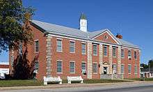 Schuyler County court house in Lancaster | |
 Location in the U.S. state of Missouri | |
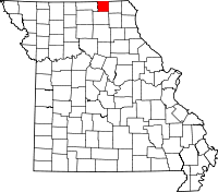
 Missouri's location in the U.S. | |
| Founded | February 14, 1845 |
| Named for | Philip Schuyler |
| Seat | Lancaster |
| Largest city | Lancaster |
| Area | |
| • Total | 308 sq mi (798 km2) |
| • Land | 307 sq mi (795 km2) |
| • Water | 0.9 sq mi (2 km2), 0.3% |
| Population (est.) | |
| • (2015) | 4,436 |
| • Density | 14/sq mi (5/km2) |
| Congressional district | 6th |
| Time zone | Central: UTC−6/−5 |

Schuyler County is a county located in the northeastern portion of the U.S. state of Missouri. As of the 2010 census, the population was 4,431,[1] making it the fourth-least populous county in Missouri. Its county seat is Lancaster.[2] The county was organized February 14, 1845, and named for General Philip Schuyler, delegate to the Continental Congress and U.S. Senator from New York.[3]
Schuyler County is part of the Kirksville, MO Micropolitan Statistical Area.
The USS Schuyler (AK-209), a World War II-era cargo ship, was named in part for Schuyler County, Missouri.
Geography
According to the U.S. Census Bureau, the county has a total area of 308 square miles (800 km2), of which 307 square miles (800 km2) is land and 0.9 square miles (2.3 km2) (0.3%) is water.[4] It is the second-smallest county in Missouri by area. Schuyler County borders Iowa to the north.
Adjacent counties
- Appanoose County, Iowa (northwest)
- Davis County, Iowa (northeast)
- Scotland County (east)
- Adair County (south)
- Putnam County (west)
Major highways
Demographics
| Historical population | |||
|---|---|---|---|
| Census | Pop. | %± | |
| 1850 | 3,287 | — | |
| 1860 | 6,697 | 103.7% | |
| 1870 | 8,880 | 32.6% | |
| 1880 | 10,470 | 17.9% | |
| 1890 | 11,249 | 7.4% | |
| 1900 | 10,840 | −3.6% | |
| 1910 | 9,062 | −16.4% | |
| 1920 | 8,383 | −7.5% | |
| 1930 | 6,951 | −17.1% | |
| 1940 | 6,627 | −4.7% | |
| 1950 | 5,760 | −13.1% | |
| 1960 | 5,052 | −12.3% | |
| 1970 | 4,665 | −7.7% | |
| 1980 | 4,979 | 6.7% | |
| 1990 | 4,236 | −14.9% | |
| 2000 | 4,170 | −1.6% | |
| 2010 | 4,431 | 6.3% | |
| Est. 2017 | 4,508 | [5] | 1.7% |
| U.S. Decennial Census[6] 1790-1960[7] 1900-1990[8] 1990-2000[9] 2010-2015[1] | |||
As of the census[10] of 2010, there were 4,431 people, 1,725 households, and 1,193 families residing in the county. The population density was 14 people per square mile (5/km²). There were 2,027 housing units at an average density of 7 per square mile (3/km²). The racial makeup of the county was 98.44% White, 0.05% Black or African American, 0.31% Native American, 0.17% Asian, 0.02% Pacific Islander, 0.17% from other races, and 0.84% from two or more races. Approximately 0.65% of the population were Hispanic or Latino of any race.
There were 1,725 households out of which 29.60% had children under the age of 18 living with them, 59.10% were married couples living together, 7.20% had a female householder with no husband present, and 30.80% were non-families. 28.20% of all households were made up of individuals and 15.20% had someone living alone who was 65 years of age or older. The average household size was 2.39 and the average family size was 2.90.
In the county, the population was spread out with 24.60% under the age of 18, 6.70% from 18 to 24, 24.80% from 25 to 44, 24.10% from 45 to 64, and 19.80% who were 65 years of age or older. The median age was 41 years. For every 100 females, there were 93.10 males. For every 100 females age 18 and over, there were 90.80 males.
The median income for a household in the county was $27,385, and the median income for a family was $34,564. Males had a median income of $25,625 versus $18,728 for females. The per capita income for the county was $15,850. About 13.20% of families and 17.00% of the population were below the poverty line, including 22.10% of those under age 18 and 17.60% of those age 65 or over.
Education
Public schools
- Schuyler County R-1 School District – Queen City
- Schuyler County Elementary School (K-06)
- Schuyler County Middle School (07-08)
- Schuyler County High School (09-12)
Public libraries
- Schuyler County Library[11]
Politics
Local
The Democratic Party predominantly controls politics at the local level in Schuyler County. Democrats hold all but four of the elected positions in the county.
| Schuyler County, Missouri | ||||
|---|---|---|---|---|
| Elected countywide officials | ||||
| Assessor | Gary Stump | Democratic | ||
| Circuit Clerk | Judy Keim | Democratic | ||
| County Clerk | Bree Shaw | Democratic | ||
| Collector | Kathy Roberts | Democratic | ||
| Commissioner (Presiding) |
Rodney Cooper | Republican | ||
| Commissioner (District 1) |
Jim Werner | Democratic | ||
| Commissioner (District 2) |
Donald Crabtree | Republican | ||
| Coroner | Douglas B. Norman | Democratic | ||
| Prosecuting Attorney | H. Scott Summers | Democratic | ||
| Public Administrator | Ronald L. Morgan | Democratic | ||
| Recorder | Linda Blessing | Republican | ||
| Sheriff | Carl Gottman | Democratic | ||
| Surveyor | Adam Mitchell | Republican | ||
| Treasurer | Karmen Buckallew | Democratic | ||
State
| Year | Republican | Democratic | Third Parties |
|---|---|---|---|
| 2016 | 66.30% 1,259 | 31.28% 594 | 2.42% 46 |
| 2012 | 50.53% 961 | 45.58% 867 | 3.89% 74 |
| 2008 | 51.64% 1,008 | 45.49% 888 | 2.87% 56 |
| 2004 | 63.80% 1,278 | 34.80% 697 | 1.40% 28 |
| 2000 | 50.68% 1,006 | 47.66% 946 | 1.66% 34 |
| 1996 | 33.10% 622 | 64.77% 1,217 | 2.13% 40 |
All of Schuyler County is included in Missouri’s 4th District in the Missouri House of Representatives and is represented by Craig Redmon (R-Canton).
| Party | Candidate | Votes | % | ± | |
|---|---|---|---|---|---|
| Republican | Craig Redmon | 1,575 | 100.00% | ||
| Party | Candidate | Votes | % | ± | |
|---|---|---|---|---|---|
| Republican | Craig Redmon | 1,201 | 100.00% | ||
| Party | Candidate | Votes | % | ± | |
|---|---|---|---|---|---|
| Republican | Craig Redmon | 1,520 | 100.00% | ||
All of Schuyler County is a part of Missouri’s 18th District in the Missouri Senate and is currently represented by Brian Munzlinger (R-Williamstown).
| Party | Candidate | Votes | % | ± | |
|---|---|---|---|---|---|
| Republican | Brian Munzlinger | 1,227 | 100.00% | ||
Federal
| Party | Candidate | Votes | % | ± | |
|---|---|---|---|---|---|
| Republican | Roy Blunt | 1,259 | 66.16% | +24.49 | |
| Democratic | Jason Kander | 547 | 28.74% | -23.02 | |
| Libertarian | Jonathan Dine | 57 | 3.00% | -3.57 | |
| Green | Johnathan McFarland | 20 | 1.05% | +1.05 | |
| Constitution | Fred Ryman | 20 | 1.05% | +1.05 | |
| Party | Candidate | Votes | % | ± | |
|---|---|---|---|---|---|
| Republican | Todd Akin | 793 | 41.67% | ||
| Democratic | Claire McCaskill | 985 | 51.76% | ||
| Libertarian | Jonathan Dine | 125 | 6.57% | ||
All of Schuyler County is included in Missouri’s 6th Congressional District and is currently represented by Sam Graves (R-Tarkio) in the U.S. House of Representatives.
| Party | Candidate | Votes | % | ± | |
|---|---|---|---|---|---|
| Republican | Sam Graves | 1.490 | 79.59% | +2.49 | |
| Democratic | David M. Blackwell | 331 | 17.68% | -1.46 | |
| Libertarian | Russ Lee Monchil | 33 | 1.76% | -2.00 | |
| Green | Mike Diel | 18 | 0.96% | +0.96 | |
| Party | Candidate | Votes | % | ± | |
|---|---|---|---|---|---|
| Republican | Sam Graves | 1,108 | 77.10% | +8.35 | |
| Democratic | Bill Hedge | 275 | 19.14% | -9.55 | |
| Libertarian | Russ Lee Monchil | 54 | 3.76% | +1.20 | |
| Party | Candidate | Votes | % | ± | |
|---|---|---|---|---|---|
| Republican | Sam Graves | 1,287 | 68.75% | ||
| Democratic | Kyle Yarber | 537 | 28.69% | ||
| Libertarian | Russ Lee Monchil | 48 | 2.56% | ||
| Year | Republican | Democratic | Third parties |
|---|---|---|---|
| 2016 | 77.7% 1,505 | 18.3% 354 | 4.0% 77 |
| 2012 | 60.6% 1,174 | 36.0% 697 | 3.5% 68 |
| 2008 | 57.4% 1,139 | 39.1% 775 | 3.5% 69 |
| 2004 | 55.3% 1,124 | 44.0% 894 | 0.6% 13 |
| 2000 | 57.8% 1,159 | 40.3% 808 | 2.0% 39 |
| 1996 | 40.2% 777 | 44.3% 857 | 15.5% 299 |
| 1992 | 34.2% 742 | 43.1% 936 | 22.7% 492 |
| 1988 | 51.1% 1,063 | 48.7% 1,013 | 0.2% 4 |
| 1984 | 52.3% 1,250 | 47.7% 1,141 | |
| 1980 | 54.2% 1,386 | 43.5% 1,114 | 2.3% 59 |
| 1976 | 45.5% 1,193 | 54.1% 1,417 | 0.4% 10 |
| 1972 | 60.1% 1,495 | 39.9% 991 | |
| 1968 | 53.2% 1,291 | 39.9% 969 | 6.9% 168 |
| 1964 | 42.5% 1,072 | 57.5% 1,449 | |
| 1960 | 55.0% 1,666 | 45.0% 1,361 | |
| 1956 | 47.7% 1,500 | 52.4% 1,648 | |
| 1952 | 49.2% 1,636 | 50.6% 1,680 | 0.2% 7 |
| 1948 | 42.0% 1,377 | 57.7% 1,892 | 0.2% 8 |
| 1944 | 46.8% 1,526 | 53.0% 1,729 | 0.3% 9 |
| 1940 | 46.2% 1,732 | 53.3% 1,998 | 0.5% 18 |
| 1936 | 39.9% 1,447 | 59.9% 2,173 | 0.3% 9 |
| 1932 | 32.9% 1,109 | 66.4% 2,239 | 0.7% 24 |
| 1928 | 50.2% 1,822 | 49.5% 1,797 | 0.3% 9 |
| 1924 | 42.4% 1,522 | 55.2% 1,982 | 2.5% 88 |
| 1920 | 49.7% 1,806 | 49.3% 1,793 | 1.0% 38 |
| 1916 | 41.9% 995 | 56.4% 1,341 | 1.7% 41 |
| 1912 | 34.2% 766 | 54.4% 1,218 | 11.5% 257 |
| 1908 | 43.8% 1,007 | 53.1% 1,222 | 3.1% 72 |
| 1904 | 45.6% 1,054 | 49.3% 1,139 | 5.1% 117 |
| 1900 | 42.4% 1,061 | 53.3% 1,335 | 4.3% 107 |
| 1896 | 41.1% 1,131 | 57.9% 1,592 | 1.0% 28 |
| 1892 | 40.4% 996 | 51.3% 1,263 | 8.3% 204 |
| 1888 | 43.5% 1,042 | 55.4% 1,328 | 1.1% 27 |
Communities
Cities
- Downing
- Greentop (small part in Adair County)
- Lancaster (county seat)
- Queen City
Village
Unincorporated community
Notable people
- Farrell Dobbs, American Trotskyist, trade unionist, and presidential candidate for the Socialist Workers Party.
- William Preston Hall (aka "The Colonel," "Diamond Billy," "Horse King of the World") (February 29, 1864 – June 29, 1932) Exotic animal dealer, horse and mule breeder, circus impresario.
- Howard R. Hughes, Sr., co-founder of the Hughes Tool Company and father of Howard Robard Hughes, Jr., the multimillionaire.
- Rupert Hughes, novelist and screenwriter, brother of Howard Hughes Sr. and uncle of Howard Hughes Jr.
- Darrin Vincent, bluegrass producer and Grammy-nominated performer (Kentucky Thunder, Dailey & Vincent)
- Rhonda Vincent, Award-winning Bluegrass performer.
See also
References
- 1 2 "State & County QuickFacts". United States Census Bureau. Retrieved September 14, 2013.
- ↑ "Find a County". National Association of Counties. Retrieved June 7, 2011.
- ↑ Eaton, David Wolfe (1918). How Missouri Counties, Towns and Streams Were Named. The State Historical Society of Missouri. p. 361.
- ↑ "2010 Census Gazetteer Files". United States Census Bureau. August 22, 2012. Archived from the original on October 21, 2013. Retrieved November 20, 2014.
- ↑ "Population and Housing Unit Estimates". Retrieved June 9, 2017.
- ↑ "U.S. Decennial Census". United States Census Bureau. Retrieved November 20, 2014.
- ↑ "Historical Census Browser". University of Virginia Library. Retrieved November 20, 2014.
- ↑ "Population of Counties by Decennial Census: 1900 to 1990". United States Census Bureau. Retrieved November 20, 2014.
- ↑ "Census 2000 PHC-T-4. Ranking Tables for Counties: 1990 and 2000" (PDF). United States Census Bureau. Retrieved November 20, 2014.
- ↑ "American FactFinder". United States Census Bureau. Retrieved January 31, 2008.
- ↑ Breeding, Marshall. "Schuyler County Library". Libraries.org. Retrieved May 8, 2017.
- ↑ Leip, David. "Dave Leip's Atlas of U.S. Presidential Elections". uselectionatlas.org. Retrieved 2018-03-26.
External links
- Digitized 1930 Plat Book of Schuyler County from University of Missouri Division of Special Collections, Archives, and Rare Books
Places adjacent to Schuyler County, Missouri | ||||||||||
|---|---|---|---|---|---|---|---|---|---|---|
| ||||||||||
Municipalities and communities of Schuyler County, Missouri, United States | ||
|---|---|---|
| Cities | | |
| Village | ||
| Townships | ||
| Unincorporated communities | ||
| Footnotes | ‡This populated place also has portions in an adjacent county or counties | |
