Sainte-Marie, Cantal
| Sainte-Marie | |
|---|---|
| Commune | |
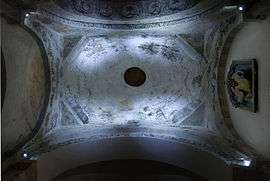 The interior of the dome of the church of Sainte-Agathe | |
 Sainte-Marie Location within Auvergne-Rhône-Alpes region  Sainte-Marie | |
| Coordinates: 44°52′42″N 2°53′10″E / 44.8783°N 2.8861°ECoordinates: 44°52′42″N 2°53′10″E / 44.8783°N 2.8861°E | |
| Country | France |
| Region | Auvergne-Rhône-Alpes |
| Department | Cantal |
| Arrondissement | Saint-Flour |
| Canton | Saint-Flour-2 |
| Intercommunality | Pays de Pierrefort |
| Government | |
| • Mayor (2008–2014) | Pierre-Jean Seguis |
| Area1 | 17.87 km2 (6.90 sq mi) |
| Population (2008)2 | 112 |
| • Density | 6.3/km2 (16/sq mi) |
| Time zone | UTC+1 (CET) |
| • Summer (DST) | UTC+2 (CEST) |
| INSEE/Postal code | 15198 /15230 |
| Elevation |
620–1,055 m (2,034–3,461 ft) (avg. 840 m or 2,760 ft) |
|
1 French Land Register data, which excludes lakes, ponds, glaciers > 1 km2 (0.386 sq mi or 247 acres) and river estuaries. 2 Population without double counting: residents of multiple communes (e.g., students and military personnel) only counted once. | |
Sainte-Marie is a commune in the Cantal department in south-central France.
Population
| Historical population | ||
|---|---|---|
| Year | Pop. | ±% |
| 1962 | 156 | — |
| 1968 | 185 | +18.6% |
| 1975 | 152 | −17.8% |
| 1982 | 133 | −12.5% |
| 1990 | 125 | −6.0% |
| 1999 | 107 | −14.4% |
| 2008 | 112 | +4.7% |
See also
References
| Wikimedia Commons has media related to Sainte-Marie (Cantal). |
This article is issued from
Wikipedia.
The text is licensed under Creative Commons - Attribution - Sharealike.
Additional terms may apply for the media files.