Roffiac
| Roffiac | |
|---|---|
| Commune | |
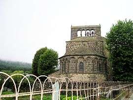 The Chuch of Saint-Gal, in Roffiac | |
 Roffiac Location within Auvergne-Rhône-Alpes region  Roffiac | |
| Coordinates: 45°03′12″N 3°02′19″E / 45.0533°N 3.0386°ECoordinates: 45°03′12″N 3°02′19″E / 45.0533°N 3.0386°E | |
| Country | France |
| Region | Auvergne-Rhône-Alpes |
| Department | Cantal |
| Arrondissement | Saint-Flour |
| Canton | Saint-Flour-1 |
| Intercommunality | Pays de Saint-Flour |
| Government | |
| • Mayor (2008–2014) | Aline Hugonnet |
| Area1 | 21.26 km2 (8.21 sq mi) |
| Population (2008)2 | 573 |
| • Density | 27/km2 (70/sq mi) |
| Time zone | UTC+1 (CET) |
| • Summer (DST) | UTC+2 (CEST) |
| INSEE/Postal code | 15164 /15100 |
| Elevation | 815–1,006 m (2,674–3,301 ft) |
|
1 French Land Register data, which excludes lakes, ponds, glaciers > 1 km2 (0.386 sq mi or 247 acres) and river estuaries. 2 Population without double counting: residents of multiple communes (e.g., students and military personnel) only counted once. | |
Roffiac is a commune in the Cantal department in south-central France.
Population
| Historical population | ||
|---|---|---|
| Year | Pop. | ±% |
| 1962 | 397 | — |
| 1968 | 421 | +6.0% |
| 1975 | 406 | −3.6% |
| 1982 | 459 | +13.1% |
| 1990 | 558 | +21.6% |
| 1999 | 563 | +0.9% |
| 2008 | 573 | +1.8% |
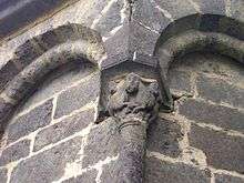
Detail from the church
See also
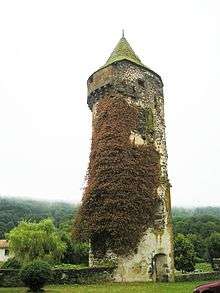
Tower
References
| Wikimedia Commons has media related to Roffiac. |
This article is issued from
Wikipedia.
The text is licensed under Creative Commons - Attribution - Sharealike.
Additional terms may apply for the media files.