Pleaux
| Pleaux | ||
|---|---|---|
| Commune | ||
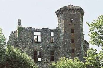 Ruins of the chateau of Branzac | ||
| ||
 Pleaux Location within Auvergne-Rhône-Alpes region  Pleaux | ||
| Coordinates: 45°08′08″N 2°13′38″E / 45.1356°N 2.2272°ECoordinates: 45°08′08″N 2°13′38″E / 45.1356°N 2.2272°E | ||
| Country | France | |
| Region | Auvergne-Rhône-Alpes | |
| Department | Cantal | |
| Arrondissement | Mauriac | |
| Canton | Mauriac | |
| Intercommunality | Pays de Salers | |
| Government | ||
| • Mayor (2008–2014) | Marc Sepchat | |
| Area1 | 92.39 km2 (35.67 sq mi) | |
| Population (2008)2 | 1,620 | |
| • Density | 18/km2 (45/sq mi) | |
| Time zone | UTC+1 (CET) | |
| • Summer (DST) | UTC+2 (CEST) | |
| INSEE/Postal code | 15153 /15700 | |
| Elevation |
264–765 m (866–2,510 ft) (avg. 640 m or 2,100 ft) | |
|
1 French Land Register data, which excludes lakes, ponds, glaciers > 1 km2 (0.386 sq mi or 247 acres) and river estuaries. 2 Population without double counting: residents of multiple communes (e.g., students and military personnel) only counted once. | ||
.svg.png)
Pleaux is a commune in the Cantal department in south-central France.
Geography
The Maronne river forms the commune's southern border, with the Enchanet reservoir.
Population
| Historical population | ||
|---|---|---|
| Year | Pop. | ±% |
| 1962 | 2,558 | — |
| 1968 | 2,721 | +6.4% |
| 1975 | 2,531 | −7.0% |
| 1982 | 2,328 | −8.0% |
| 1990 | 2,146 | −7.8% |
| 1999 | 1,823 | −15.1% |
| 2008 | 1,620 | −11.1% |
Sights
- Château de Branzac, 15th century ruined castle
- The Enchanet dam on the Maronne is on the border with the commune of Arnac
See also
References
| Wikimedia Commons has media related to Pleaux. |
This article is issued from
Wikipedia.
The text is licensed under Creative Commons - Attribution - Sharealike.
Additional terms may apply for the media files.