Molompize
| Molompize | ||
|---|---|---|
| Commune | ||
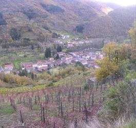 Molopize and the Alagnon valley | ||
| ||
 Molompize Location within Auvergne-Rhône-Alpes region  Molompize | ||
| Coordinates: 45°13′51″N 3°07′38″E / 45.2308°N 3.1272°ECoordinates: 45°13′51″N 3°07′38″E / 45.2308°N 3.1272°E | ||
| Country | France | |
| Region | Auvergne-Rhône-Alpes | |
| Department | Cantal | |
| Arrondissement | Saint-Flour | |
| Canton | Saint-Flour-1 | |
| Intercommunality | Pays de Massiac | |
| Government | ||
| • Mayor (2008–2014) | Jean Philippon | |
| Area1 | 17.12 km2 (6.61 sq mi) | |
| Population (2008)2 | 290 | |
| • Density | 17/km2 (44/sq mi) | |
| Time zone | UTC+1 (CET) | |
| • Summer (DST) | UTC+2 (CEST) | |
| INSEE/Postal code | 15127 /15500 | |
| Elevation |
549–997 m (1,801–3,271 ft) (avg. 588 m or 1,929 ft) | |
|
1 French Land Register data, which excludes lakes, ponds, glaciers > 1 km2 (0.386 sq mi or 247 acres) and river estuaries. 2 Population without double counting: residents of multiple communes (e.g., students and military personnel) only counted once. | ||
.svg.png)
Molompize is a commune in the Cantal department in south-central France.
Population
| Historical population | ||
|---|---|---|
| Year | Pop. | ±% |
| 1962 | 448 | — |
| 1968 | 484 | +8.0% |
| 1975 | 387 | −20.0% |
| 1982 | 407 | +5.2% |
| 1990 | 341 | −16.2% |
| 1999 | 285 | −16.4% |
| 2008 | 290 | +1.8% |
See also
References
| Wikimedia Commons has media related to Molompize. |
This article is issued from
Wikipedia.
The text is licensed under Creative Commons - Attribution - Sharealike.
Additional terms may apply for the media files.