Saint-Saury
| Saint-Saury | ||
|---|---|---|
| Commune | ||
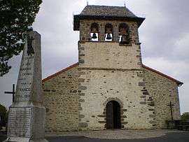 The church in Saint-Saury | ||
| ||
 Saint-Saury Location within Auvergne-Rhône-Alpes region  Saint-Saury | ||
| Coordinates: 44°52′09″N 2°08′25″E / 44.8692°N 2.1403°ECoordinates: 44°52′09″N 2°08′25″E / 44.8692°N 2.1403°E | ||
| Country | France | |
| Region | Auvergne-Rhône-Alpes | |
| Department | Cantal | |
| Arrondissement | Aurillac | |
| Canton | Saint-Paul-des-Landes | |
| Government | ||
| • Mayor (2008–2014) | Roger Condamine | |
| Area1 | 30.11 km2 (11.63 sq mi) | |
| Population (2008)2 | 203 | |
| • Density | 6.7/km2 (17/sq mi) | |
| Time zone | UTC+1 (CET) | |
| • Summer (DST) | UTC+2 (CEST) | |
| INSEE/Postal code | 15214 /15290 | |
| Elevation |
574–761 m (1,883–2,497 ft) (avg. 712 m or 2,336 ft) | |
|
1 French Land Register data, which excludes lakes, ponds, glaciers > 1 km2 (0.386 sq mi or 247 acres) and river estuaries. 2 Population without double counting: residents of multiple communes (e.g., students and military personnel) only counted once. | ||

Saint-Saury is a commune in the Cantal department in south-central France.
Population
| Historical population | ||
|---|---|---|
| Year | Pop. | ±% |
| 1962 | 274 | — |
| 1968 | 314 | +14.6% |
| 1975 | 286 | −8.9% |
| 1982 | 250 | −12.6% |
| 1990 | 221 | −11.6% |
| 1999 | 187 | −15.4% |
| 2008 | 203 | +8.6% |
See also
References
| Wikimedia Commons has media related to Saint-Saury. |
This article is issued from
Wikipedia.
The text is licensed under Creative Commons - Attribution - Sharealike.
Additional terms may apply for the media files.