Omps, Cantal
| Omps | ||
|---|---|---|
| Commune | ||
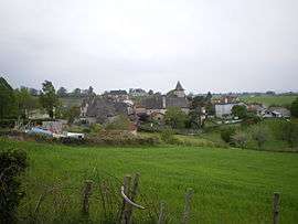 A general view of Omps | ||
| ||
 Omps Location within Auvergne-Rhône-Alpes region  Omps | ||
| Coordinates: 44°52′44″N 2°16′37″E / 44.8789°N 2.2769°ECoordinates: 44°52′44″N 2°16′37″E / 44.8789°N 2.2769°E | ||
| Country | France | |
| Region | Auvergne-Rhône-Alpes | |
| Department | Cantal | |
| Arrondissement | Aurillac | |
| Canton | Saint-Paul-des-Landes | |
| Intercommunality | Entre Cère et Rance | |
| Government | ||
| • Mayor (2008–2014) | Henri Hostains | |
| Area1 | 12.62 km2 (4.87 sq mi) | |
| Population (2008)2 | 302 | |
| • Density | 24/km2 (62/sq mi) | |
| Time zone | UTC+1 (CET) | |
| • Summer (DST) | UTC+2 (CEST) | |
| INSEE/Postal code | 15144 /15290 | |
| Elevation |
517–723 m (1,696–2,372 ft) (avg. 621 m or 2,037 ft) | |
|
1 French Land Register data, which excludes lakes, ponds, glaciers > 1 km2 (0.386 sq mi or 247 acres) and river estuaries. 2 Population without double counting: residents of multiple communes (e.g., students and military personnel) only counted once. | ||

Omps is a commune in the Cantal department in south-central France.
It comprises a collection of pleasant cottages, many with lauze roofs, surrounding the village church, but there is also an imposing Manor House. It has recently undergone improvements to the public spaces. The village's only bar closed in 2006, and with the exception of a garden centre there are no other commercial premises.
Population
| Historical population | ||
|---|---|---|
| Year | Pop. | ±% |
| 1962 | 264 | — |
| 1968 | 275 | +4.2% |
| 1975 | 248 | −9.8% |
| 1982 | 246 | −0.8% |
| 1990 | 223 | −9.3% |
| 1999 | 275 | +23.3% |
| 2008 | 302 | +9.8% |
See also
References
| Wikimedia Commons has media related to Omps, Cantal. |
This article is issued from
Wikipedia.
The text is licensed under Creative Commons - Attribution - Sharealike.
Additional terms may apply for the media files.