Arrondissement of Mauriac
| Mauriac | |
|---|---|
| Arrondissement | |
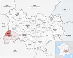 Location of the arrondissement in Auvergne-Rhône-Alpes | |
| Country | France |
| Region | Auvergne-Rhône-Alpes |
| Department | Cantal |
| Communes | 55 |
| Subprefecture | Mauriac |
| Area¹ | |
| • Total | 1,278 km2 (493 sq mi) |
| Population (2013) | |
| • Total | 26,369 |
| • Density | 21/km2 (53/sq mi) |
| ¹ French Land Register data, which exclude lakes, ponds, and glaciers larger than 1 km² as well as the estuaries of rivers. | |
The arrondissement of Mauriac is an arrondissement of France in the Cantal department of the Auvergne-Rhône-Alpes region. It has 55 communes.
Composition
Cantons
The cantons of the arrondissement of Mauriac are:
- Mauriac
- Naucelles (partly)
- Riom-ès-Montagnes (partly)
- Ydes
Communes
The communes of the arrondissement of Mauriac, and their INSEE codes, are:
| 1. Ally (15003) | 2. Anglards-de-Salers (15006) | 3. Antignac (15008) | 4. Apchon (15009) |
| 5. Arches (15010) | 6. Auzers (15015) | 7. Barriac-les-Bosquets (15018) | 8. Bassignac (15019) |
| 9. Beaulieu (15020) | 10. Brageac (15024) | 11. Chalvignac (15036) | 12. Champagnac (15037) |
| 13. Champs-sur-Tarentaine-Marchal (15038) | 14. Chaussenac (15046) | 15. Collandres (15052) | 16. Drugeac (15063) |
| 17. Escorailles (15064) | 18. Fontanges (15070) | 19. Jaleyrac (15079) | 20. La Monselie (15128) |
| 21. Lanobre (15092) | 22. Le Falgoux (15066) | 23. Le Fau (15067) | 24. Le Monteil (15131) |
| 25. Le Vaulmier (15249) | 26. Le Vigean (15261) | 27. Madic (15111) | 28. Mauriac (15120) |
| 29. Menet (15124) | 30. Moussages (15137) | 31. Méallet (15123) | 32. Pleaux (15153) |
| 33. Riom-ès-Montagnes (15162) | 34. Saignes (15169) | 35. Saint-Bonnet-de-Salers (15174) | 36. Saint-Chamant (15176) |
| 37. Saint-Hippolyte (15190) | 38. Saint-Martin-Cantalès (15200) | 39. Saint-Martin-Valmeroux (15202) | 40. Saint-Paul-de-Salers (15205) |
| 41. Saint-Pierre (15206) | 42. Saint-Projet-de-Salers (15208) | 43. Saint-Vincent-de-Salers (15218) | 44. Saint-Étienne-de-Chomeil (15185) |
| 45. Sainte-Eulalie (15186) | 46. Salers (15219) | 47. Salins (15220) | 48. Sauvat (15223) |
| 49. Sourniac (15230) | 50. Trizac (15243) | 51. Trémouille (15240) | 52. Valette (15246) |
| 53. Vebret (15250) | 54. Veyrières (15254) | 55. Ydes (15265) |
External links
This article is issued from
Wikipedia.
The text is licensed under Creative Commons - Attribution - Sharealike.
Additional terms may apply for the media files.