Maronne
| Maronne | |
|---|---|
 | |
| Country | France |
| Physical characteristics | |
| Main source |
Saint-Paul-de-Salers 1,050 m (3,440 ft) 45°08′32″N 02°35′44″E / 45.14222°N 2.59556°E |
| River mouth |
Dordogne 165 m (541 ft) 45°04′21″N 01°55′39″E / 45.07250°N 1.92750°ECoordinates: 45°04′21″N 01°55′39″E / 45.07250°N 1.92750°E |
| Length | 92.6 km (57.5 mi) |
| Discharge |
|
| Basin features | |
| Progression | Dordogne→ Atlantic Ocean |
| Basin size | 821 km2 (317 sq mi) |
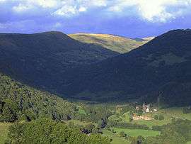
The Maronne (French: la Maronne) is a 92.6-kilometre (57.5 mi) long river in the Cantal and Corrèze départements, in south central France. Its source is several small streams joining near Récusset,a hamlet in Saint-Paul-de-Salers. It flows generally west. It is a left tributary of the Dordogne into which it flows between Argentat and Monceaux-sur-Dordogne.
Départements and communes along its course
This list is ordered from source to mouth:
- Cantal: Saint-Paul-de-Salers, Fontanges, Saint-Martin-Valmeroux, Sainte-Eulalie, Besse, Pleaux, Saint-Martin-Cantalès, Arnac,
- Corrèze: Saint-Julien-aux-Bois
- Cantal: Cros-de-Montvert,
- Corrèze: Saint-Cirgues-la-Loutre,
- Cantal: Rouffiac,
- Corrèze: Saint-Geniez-ô-Merle, Goulles, Saint-Bonnet-les-Tours-de-Merle, Sexcles, Hautefage, Mercœur, La Chapelle-Saint-Géraud, Argentat and Monceaux-sur-Dordogne
Notes
- This article is based on the equivalent article from the French Wikipedia, consulted on March 13, 2009.
References
This article is issued from
Wikipedia.
The text is licensed under Creative Commons - Attribution - Sharealike.
Additional terms may apply for the media files.