Mohania
| Mohania | |
|---|---|
| city | |
 | |
 Mohania Location in Bihar, India | |
| Coordinates: 25°10′04″N 83°37′08″E / 25.16778°N 83.61889°ECoordinates: 25°10′04″N 83°37′08″E / 25.16778°N 83.61889°E | |
| Country |
|
| State | Bihar |
| District | Kaimur (Bhabua) |
| Elevation | 76 m (249 ft) |
| Population (2001) | |
| • Total | 30,507 |
| Languages | |
| • Official | Bhojpuri, Hindi |
| Time zone | UTC+5:30 (IST) |
| PIN | 821109 |
| Telephone code | 91-6187 |
| Vehicle registration | BR-45 |
| Website |
kaimur |
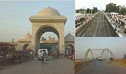
Mohania is a city in Kaimur district in the Indian state of Bihar. It serves as headquarters for the Mohania sub-division in Kaimur district. It is 17 km by road north of the city of Bhabua, at the intersection of National Highway 19 (old number: NH 2) and State Highway 14. National Highway 319 originates from Mohania.
Mohania is the hub of transport routes in Kaimur district. The famous temple Mundeshawari Devi is situated in Kaimur district. The city is on the bank of Durgavati River in south.
Geography and climate
Geography
Mohania has an average elevation of 76 metres (249 feet). Mohania is divided into wards. Here is the ancient famous Satti Devi mandir near railway station, White Hanuman mandir. Hanuman mandir is the biggest temple at station road. Here is a beautiful stadium near M.P. College. In the south, there is a river called Durgauti. Mohania is the hub of transport routes in Kaimur district. The famous temple Mundeshawari Devi is situated in Kaimur district. The route for this temple goes through Mohania. Public Transport or hired vehicles are available for the temple Mundeshwari Devi from Railway Station (Bhabua Road) or Bus stand on NH-2.
Climate
Mohania experiences a humid subtropical climate with large variations between summer and winter temperatures. The temperature ranges between 22 and 46 °C (72 and 115 °F) in the summers. Winters in Mohania see very large diurnal variations, with warm days and downright cold nights. The dry summer starts in April and lasts until June, followed by the monsoon season from July to October. Vk Cold waves from the Himalayan region cause temperatures to dip across the city in the winter from December to February and temperatures below 5 °C (41 °F) are not uncommon. Fog is common in the winters, while hot dry winds, called loo, blow in the summers. The average annual rainfall is 1,110 mm (44 in).[1][2]
| Climate data for Mohania | |||||||||||||
|---|---|---|---|---|---|---|---|---|---|---|---|---|---|
| Month | Jan | Feb | Mar | Apr | May | Jun | Jul | Aug | Sep | Oct | Nov | Dec | Year |
| Average high °C (°F) | 23 (74) |
26.6 (79.8) |
32.6 (90.7) |
37.9 (100.2) |
40.8 (105.5) |
38.4 (101.2) |
33.1 (91.6) |
31.6 (88.9) |
32 (90) |
32.1 (89.7) |
27.9 (82.3) |
24 (75.2) |
31.7 (89.1) |
| Average low °C (°F) | 18.7 (65.6) |
8.6 (47.5) |
11 (51.8) |
21 (70) |
25.5 (77.9) |
26.8 (80.3) |
25.2 (77.3) |
24.6 (76.2) |
23.6 (74.5) |
19.7 (67.5) |
14.3 (57.7) |
9 (48.2) |
19 (66.2) |
| Average precipitation mm (inches) | 20.2 (0.795) |
20.7 (0.815) |
14.2 (0.559) |
6.6 (0.26) |
11.1 (0.437) |
116.3 (4.579) |
298.2 (11.74) |
329 (12.95) |
181.5 (7.146) |
45.2 (1.78) |
11.5 (0.453) |
3.6 (0.142) |
1,057.9 (41.65) |
Transport
Mohania is well connected by air, rail and road with the major Indian cities like New Delhi, Mumbai, Kolkata, Chennai, Pune, Ahmedabad, Indore, Bhopal, Bhubaneswar, Gwalior, Jabalpur, Ujjain, Jaipur, Patna, Jamshedpur, Hyderabad etc. The town is 776 km from Delhi, 1240 km from Secunderabad. One of the major factors in Mohania's sustained existence as an inhabited city is its role as an established transportation hub between different cities. It is a subdivisional town in Kaimur district. The district headquarters, Bhabua, is 14 km southward from the railway station.
Road
- National Highway 19 (NH 2 old) (GT Road) crosses through the heart of the city.
- National Highway 319 (NH 30 old) originates from this city and connect with the capital Patna via Arrah.
The town is 180 km from Patna and 60 km from Varanasi by road
There are also a few State Highways in the city SH-14.
Mohania is connected to Buxar via Ramgarh from the south and with Bhabua (district capital, Audhaura, Bhagwanpur) from the south.
Railway
The name of the railway station of Mohania is Bhabua Road railway station, situated on Howrah–Gaya–Mughalsarai–New Delhi Grand Cord line. The station code is "BBU".
Airport
Lal Bahadur Shastri International Airport, Varanasi, commonly known as Babatpur Airport, is the nearest airport, 71 km from Mohania. Indian carriers, including Air India, Jet Airways, Kingfisher Airlines, Spicejet, and international carriers like Air India, Thai Airways International, Korean Air and Naaz Airlines, operate from here.
Education
Colleges
- Maharana Pratap College, including BEd
- Primary Teacher Training College
- Mahila College, Darwa
School
- Jawahar Navodaya Vidyalaya, Chaurasia, Ramgarh Road
- Sharda Brajraj High School (Govt), Station Road
- Project Santi Balika High School (Govt), Station Road
- Sanskrit School (Govt), Kachahari Road
- DAV School, Ratwar
- Primary Teacher Training College (Govt), Darwa
- RBS School, Durga Paraw
- Point Education, Barej
- Khushi Kids Play School, Shivpur, Colony, G.T Road
- Navdeep Academy, Darwa
- Urdu School, Sabji Mandi
- Sanjivani Public School & Hostel
- Jyoti Niketan School, GT Road
- Mother Sakuntala School, GT Road
- Adarsh School, Darwa
- SPPS School, Station Road
- TPS School
- Manas Saraswati Vidya Mandir, Near Bus Stand
- Indian Public School, Shivpur Colony
- AKI Vidyalaya
- Secondary School Bhokhari
- Government Primary School Anantpur
Near By
- Vishwanath Inter College (Govt), Mujan
- Sewa Niketan High School (Govt), Barhuli
- Shri Krishna High School (Govt), Mujan
- Bhagwat High School (Govt), Bamhour
- JC High School (Govt), Khajara Bahadura
- Maharshi Goutam Sanskrit High School, Pusuali
- Adarsh High School (Govt), Barupar
- Jayram Churaman Adarsh High School, Choursia
Institute
- Khushi Computer Institute of Higher Education, G.T Road, Mohania, Kaimur, Bihar.
- Compskill Infotech Computer Institute (Wardno-7, Streetno-6 Near Hotel Kamta singhasan Mohania)
- Aryan Computer Institute (W.NO. 10, BADI BAZAR, MOHANIA)
- TEDAP (Trust for Edupreneurship Development and promotion)
- Ranjanguru Institute of Information Technology
- IR Classes of Information, GT road
Worship places
- Mahawir Swet Mandir (Hanuman), Chandani Chowk
- Mahawir Swet Mandir (Hanuman), Station Road
- Shree Jageshwar Nath Mandir, Bhabhua Road
- Baba Ganinath Mandir, Bhabhua Road
- Sati Mandir, Station Road
- Kali Mandir, Near DAV School
- Sahid Baba, near NH 30, GT road
- Mosque-1, Sabji Madi
- Mosque-2, Sabji Madi Railway crossing
- Noori Shahi Masjid (Mosque-3), Barkat nagar
- Kali Mandir, Hanuman Mandir, Lord Buddha Mandir(ancient) in Barhupar
Bank
Misc
References
- ↑ "Today's forecasts and Hourly forecasts for Mohania, BR, Bihar, IN, India". The Weather Channel. Retrieved 2015-06-24.
- ↑
- Census of India 2001: Data from the 2001 Census, including cities, villages and towns (Provisional). Census Commission of India. Archived from the original on 2004-06-16. Retrieved 2008-11-01.