International Boundary Marker
|
International Boundary Marker | |
.jpg) International Boundary Marker in 2017 | |
 International Boundary Marker  International Boundary Marker  International Boundary Marker | |
| Location | On Louisiana-Texas state line, at intersection of FM 31 and LA 765 |
|---|---|
| Nearest city | Deadwood, Texas, Logansport, Louisiana |
| Coordinates | 32°2′3″N 94°2′35″W / 32.03417°N 94.04306°WCoordinates: 32°2′3″N 94°2′35″W / 32.03417°N 94.04306°W |
| Area | 3 acres (1.2 ha) |
| Built | 1840 |
| NRHP reference # | 77001463[1] |
| TSAL # | 8200002369 |
| Significant dates | |
| Added to NRHP | April 13, 1977 |
| Designated TSAL | May 15, 2003 |
The International Boundary Marker, also known as the Republic of Texas Granite Marker, is a boundary marker located on the Louisiana-Texas border near the junction of Texas FM 31 and Louisiana Highway 765, southeast of Deadwood, Texas. The marker was created in 1840 and placed in 1841 to mark the international border between the United States and the Republic of Texas. The survey which established this border lasted from May 1840 to June 1841; the survey team faced hazardous, swampy conditions in their work and were forced to take several extended breaks due to weather and a lack of funding. The boundary marker is the only marker remaining from the Texas border survey and is one of only two known international boundary markers located entirely within the United States (the other being a much older and humbler stone near Mobile, Alabama).[2][3]
The property of the 3 acres (1.2 ha) area is shared between DeSoto Parish, Louisiana (1 acre) and Panola County, Texas (2 acres), with the marker itself being a direct property of U.S. Government[3]
The marker was added to the National Register of Historic Places on April 13, 1977.[1]
See also
References
- 1 2 National Park Service (2013-11-02). "National Register Information System". National Register of Historic Places. National Park Service.
- ↑ "International Boundary Marker" (PDF). Louisiana Office of Cultural Development, Division of Historic Preservation. Retrieved March 27, 2014.
- 1 2 "National Register of Historic Places Inventory/Nomination Form: International Boundary Marker" (PDF). Texas Historic Site Atlas. Retrieved May 3, 2018.
External links


Municipalities and communities of DeSoto Parish, Louisiana, United States | ||
|---|---|---|
| City | 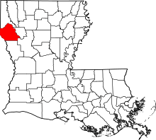 | |
| Towns | ||
| Villages | ||
| CDPs | ||
| Other unincorporated communities | ||
Municipalities and communities of Panola County, Texas, United States | ||
|---|---|---|
| Cities | 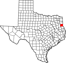 | |
| Town | ||
| Unincorporated communities | ||
| Ghost town | ||
| Footnotes | ‡This populated place also has portions in an adjacent county or counties | |