Frierson, Louisiana
| Frierson, Louisiana | |
|---|---|
| Census-designated place | |
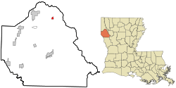 Location in De Soto Parish and the state of Louisiana. | |
| Coordinates: 32°15′7″N 93°41′24″W / 32.25194°N 93.69000°WCoordinates: 32°15′7″N 93°41′24″W / 32.25194°N 93.69000°W | |
| Country | United States |
| State | Louisiana |
| Parish | DeSoto |
| Area | |
| • Total | 0.56 sq mi (1.45 km2) |
| • Land | 0.55 sq mi (1.43 km2) |
| • Water | 0.008 sq mi (0.02 km2) |
| Elevation | 194 ft (59 m) |
| Population (2010) | |
| • Total | 143 |
| • Density | 259/sq mi (100.0/km2) |
| Time zone | UTC-6 (Central (CST)) |
| • Summer (DST) | UTC-5 (CDT) |
| ZIP code | 71027 |
| FIPS code | 22-27540 |
| GNIS feature ID | 554489[1] |
Frierson is an unincorporated community and census-designated place (CDP) in DeSoto Parish, Louisiana, United States. It is located approximately 3 miles (5 km) north of Interstate 49 (exit 186) along Louisiana State Highway 175.
As of the 2010 census, the population was 143.[2] The community is part of the Shreveport–Bossier City Metropolitan Statistical Area.
George Dement, former mayor of Bossier City, Louisiana, retired to his family farm in Frierson, where he died on January 12, 2014.[3]
References
- ↑ "Frierson, Louisiana". Geographic Names Information System. United States Geological Survey.
- ↑ "Geographic Identifiers: 2010 Demographic Profile Data (G001): Frierson CDP, Louisiana". U.S. Census Bureau, American Factfinder. Retrieved October 28, 2015.
- ↑ "John Andrew Prime, "George Dement, longtime Bossier City mayor, dies," January 12, 2014". Shreveport Times. Retrieved January 13, 2014.
Municipalities and communities of DeSoto Parish, Louisiana, United States | ||
|---|---|---|
| City | 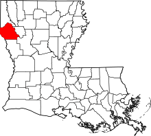 | |
| Towns | ||
| Villages | ||
| CDPs | ||
| Other unincorporated communities | ||
This article is issued from
Wikipedia.
The text is licensed under Creative Commons - Attribution - Sharealike.
Additional terms may apply for the media files.