National Register of Historic Places listings in Galveston County, Texas
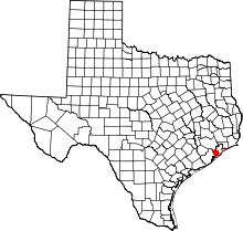
This is a list of the National Register of Historic Places listings in Galveston County, Texas.
This is intended to be a complete list of properties and districts listed on the National Register of Historic Places in Galveston County, Texas. There are nine districts, 68 individual properties, and four former properties listed on the National Register in the county. Two districts and one individually listed property are National Historic Landmarks. One district and six individually listed properties are State Antiquities Landmarks. Seventy-two properties are Recorded Texas Historic Landmarks including one property that contains two while four districts contain many more.
Many of the below locations survived the Galveston hurricane of 1900 while all former listings were victims of later hurricanes.
- This National Park Service list is complete through NPS recent listings posted October 11, 2018.[1]
Current listings
The publicly disclosed locations of National Register properties and districts may be seen in a mapping service provided.[2]
| [3] | Name on the Register[4] | Image | Date listed[5] | Location | City or town | Description |
|---|---|---|---|---|---|---|
| 1 | Ashton Villa | 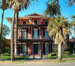 |
October 28, 1969 (#69000204) |
2328 Broadway 29°17′59″N 94°47′33″W / 29.299722°N 94.7925°W |
Galveston | Recorded Texas Historic Landmark |
| 2 | Henry Beissner House | 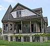 |
April 3, 1978 (#78002929) |
2818 Ball Ave. 29°18′01″N 94°47′56″W / 29.300278°N 94.798889°W |
Galveston | |
| 3 | Bishop's Palace | .jpg) |
August 25, 1970 (#70000746) |
1402 Ave. J (Broadway) 29°18′17″N 94°46′55″W / 29.304722°N 94.781944°W |
Galveston | Recorded Texas Historic Landmark, part of East End Historic District |
| 4 | Broadway Cemetery Historic District | .jpg) |
June 13, 2014 (#14000340) |
6 blks. between Broadway Ave., Ave. L, 43rd & 40th Sts. 29°17′37″N 94°48′47″W / 29.293518°N 94.812925°W |
Galveston | |
| 5 | Building at 1921-1921 1/2 Avenue D | 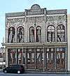 |
August 14, 1984 (#84001671) |
1921-1921 1/2 Ave. D 29°18′21″N 94°47′23″W / 29.305833°N 94.789722°W |
Galveston | Historic Resources of the Galveston Central Business District MRA |
| 6 | Building at 1925-1927 Market Street | .jpg) |
August 14, 1984 (#84001668) |
1925-1927 Market St. 29°18′25″N 94°47′29″W / 29.306944°N 94.791389°W |
Galveston | Historic Resources of the Galveston Central Business District MRA |
| 7 | Cedar Lawn Historic District | December 20, 2002 (#02001570) |
Bounded by 45th. St., 48th St., Ave. L, and Ave. N, 29°17′23″N 94°49′04″W / 29.289722°N 94.817778°W |
Galveston | ||
| 8 | City Hall | 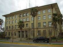 |
August 14, 1984 (#84001676) |
823 25th St. 29°18′01″N 94°47′43″W / 29.300278°N 94.795278°W |
Galveston | Historic Resources of the Galveston Central Business District MRA |
| 9 | City National Bank | 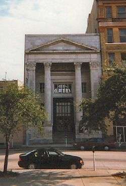 |
August 14, 1984 (#84001680) |
2219 Ave. D 29°18′18″N 94°47′36″W / 29.305°N 94.793333°W |
Galveston | Historic Resources of the Galveston Central Business District MRA |
| 10 | Frank B. Davison House | June 29, 1976 (#76002033) |
109 3rd Ave. 29°23′13″N 94°53′42″W / 29.386944°N 94.895°W |
Texas City | State Antiquities Landmark, Recorded Texas Historic Landmark | |
| 11 | Denver Court Historic District | January 14, 2002 (#01001471) |
Roughly bounded by Aves. S1/2 and U1/2, 43rd and 52nd Sts. 29°16′39″N 94°48′54″W / 29.2775°N 94.815°W |
Galveston | ||
| 12 | East End Historic District | .jpg) |
May 30, 1975 (#75001979) |
Irregular pattern including both sides of Broadway and Market Sts. 29°18′16″N 94°46′58″W / 29.304444°N 94.782778°W |
Galveston | Includes Recorded Texas Historic Landmarks |
| 13 | Eiband's | .jpg) |
August 14, 1984 (#84001683) |
2001 Central Plaza 29°18′16″N 94°47′32″W / 29.304444°N 94.792222°W |
Galveston | Historic Resources of the Galveston Central Business District MRA |
| 14 | ELISSA | .jpg) |
March 21, 1978 (#78002930) |
Pier 21, 21st Street and Harborside Drive 29°18′34″N 94°47′37″W / 29.30946667°N 94.7936°W |
Galveston | |
| 15 | Falstaff Brewery | August 29, 2018 (#100002841) |
3302 Church St. (Ave. F) 29°18′03″N 94°48′22″W / 29.300729°N 94.806066°W |
Galveston | ||
| 16 | First Evangelical Lutheran Church | 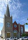 |
August 14, 1984 (#84001688) |
2401 Ave. G 29°18′07″N 94°47′39″W / 29.301944°N 94.794167°W |
Galveston | Recorded Texas Historic Landmark; Historic Resources of the Galveston Central Business District MRA |
| 17 | First Presbyterian Church | .jpg) |
January 29, 1979 (#79002942) |
1903 Church St. 29°18′15″N 94°47′19″W / 29.304167°N 94.788611°W |
Galveston | Recorded Texas Historic Landmark |
| 18 | Fort Travis | 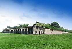 |
March 30, 2005 (#05000247) |
TX 87 at Loop 108 29°21′53″N 94°45′29″W / 29.364722°N 94.758056°W |
Port Bolivar | State Antiquities Landmark |
| 19 | Galveston Causeway | 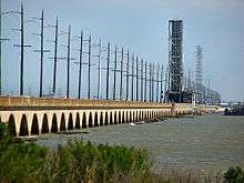 |
December 12, 1976 (#76002028) |
Spans Galveston Bay from Virginia Point to Galveston Island 29°17′51″N 94°53′12″W / 29.2975°N 94.886667°W |
Galveston | State Antiquities Landmark |
| 20 | Galveston Orphans Home | 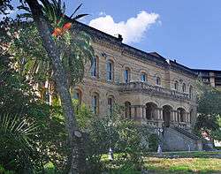 |
March 21, 1979 (#79002943) |
1315 21st St. 29°17′50″N 94°47′19″W / 29.297222°N 94.788611°W |
Galveston | Recorded Texas Historic Landmark |
| 21 | Galveston Seawall | 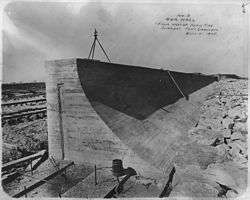 |
August 18, 1977 (#77001443) |
Seawall Blvd. 29°18′09″N 94°46′27″W / 29.3025°N 94.774167°W |
Galveston | State Antiquities Landmark |
| 22 | Galveston US Post Office, Custom House and Courthouse | 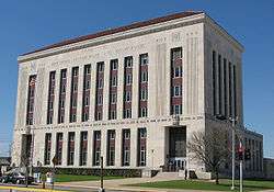 |
April 25, 2001 (#01000438) |
601 25th St. (Rosenberg St.)[6] 29°18′08″N 94°47′45″W / 29.302222°N 94.795833°W |
Galveston | |
| 23 | Galvez Hotel | 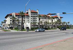 |
April 4, 1979 (#79002944) |
2024 Seawall Blvd. 29°17′32″N 94°47′08″W / 29.292222°N 94.785556°W |
Galveston | Recorded Texas Historic Landmark |
| 24 | Garten Verein Pavilion | 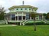 |
July 20, 1977 (#77001444) |
27th St. and Avenue O (Kempner Park) 29°17′34″N 94°47′41″W / 29.292778°N 94.794722°W |
Galveston | State Antiquities Landmark, Recorded Texas Historic Landmark |
| 25 | Grace Episcopal Church | 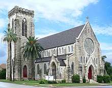 |
April 3, 1975 (#75001980) |
1115 36th St. 29°17′39″N 94°48′23″W / 29.294167°N 94.806389°W |
Galveston | Recorded Texas Historic Landmark |
| 26 | Grand Opera House | 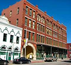 |
January 2, 1974 (#74002071) |
2012-2020 Ave. E 29°17′47″N 94°47′26″W / 29.296389°N 94.790556°W |
Galveston | Recorded Texas Historic Landmark |
| 27 | John Hagemann House |  |
June 1, 1982 (#82004505) |
3301 Ave. L 29°17′40″N 94°48′47″W / 29.294444°N 94.813056°W |
Galveston | Recorded Texas Historic Landmark |
| 28 | House at 2017-2023 Avenue I | 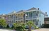 |
August 14, 1984 (#84001698) |
2017-2023 Ave. I 29°18′05″N 94°47′07″W / 29.301389°N 94.785278°W |
Galveston | Historic Resources of the Galveston Central Business District MRA |
| 29 | House at 2528 Postoffice St. | 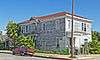 |
August 14, 1984 (#84001700) |
2528 Postoffice St. 29°18′13″N 94°47′49″W / 29.303611°N 94.796944°W |
Galveston | Historic Resources of the Galveston Central Business District MRA |
| 30 | Sealy Hutchings House | July 29, 1994 (#94000796) |
2805 Ave. O 29°17′31″N 94°47′44″W / 29.291944°N 94.795556°W |
Galveston | ||
| 31 | I.O.O.F. Lodge |  |
August 14, 1984 (#84001703) |
505 20th St. 29°18′18″N 94°47′24″W / 29.305°N 94.79°W |
Galveston | Historic Resources of the Galveston Central Business District MRA |
| 32 | Illies Building-Justine Apartments | 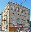 |
August 22, 1995 (#95001028) |
503 21st St. 29°17′49″N 94°46′56″W / 29.296944°N 94.782222°W |
Galveston | Historic Resources of the Galveston Central Business District MRA |
| 33 | Daniel Webster Kempner House | 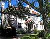 |
March 30, 1979 (#79002945) |
2504 Ave. O 29°17′35″N 94°47′34″W / 29.293056°N 94.792778°W |
Galveston | Part of Silk Stocking Residential Historic District |
| 34 | Jean Lafitte Hotel | 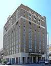 |
August 14, 1984 (#84001705) |
2105 Ave. F 29°18′14″N 94°47′27″W / 29.303889°N 94.790833°W |
Galveston | Historic Resources of the Galveston Central Business District MRA |
| 35 | Lasker Home for Homeless Children | 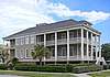 |
April 14, 1983 (#83003140) |
1019 16th St. 29°18′02″N 94°47′01″W / 29.300556°N 94.783611°W |
Galveston | Recorded Texas Historic Landmark; part of Lost Bayou Historic District |
| 36 | E.S. Levy Building | November 13, 2003 (#03001163) |
2221-2225 Market St. 29°18′17″N 94°47′36″W / 29.304722°N 94.793333°W |
Galveston | Historic Resources of the Galveston Central Business District MRA | |
| 37 | Lost Bayou Historic District | 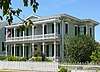 |
June 19, 2017 (#100001224) |
Roughly bounded by Broadway, Ave. N, 14th & 21st Sts. 29°17′58″N 94°47′06″W / 29.299416°N 94.784990°W |
Galveston | Includes Recorded Texas Historic Landmarks |
| 38 | Marschner Building | 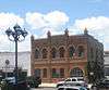 |
August 14, 1984 (#84001706) |
1914-1916 Mechanic St. 29°18′26″N 94°47′23″W / 29.307222°N 94.789722°W |
Galveston | Recorded Texas Historic Landmark; Historic Resources of the Galveston Central Business District MRA |
| 39 | McKinney-McDonald House | 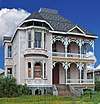 |
May 4, 1976 (#76002030) |
926 Winnie St. 29°18′24″N 94°46′39″W / 29.306667°N 94.7775°W |
Galveston | |
| 40 | Melrose Apartment Building | 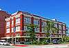 |
October 14, 1998 (#98001246) |
2002 Post Office St. 29°18′19″N 94°47′26″W / 29.305278°N 94.790556°W |
Galveston | Historic Resources of the Galveston Central Business District MRA |
| 41 | Michel B. Menard House | 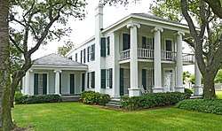 |
December 12, 1976 (#76002031) |
1605 33rd St. 29°17′27″N 94°48′06″W / 29.290833°N 94.801667°W |
Galveston | |
| 42 | Merimax Building |  |
January 24, 1985 (#85000121) |
521 22nd St. 29°18′15″N 94°47′32″W / 29.304124°N 94.792335°W |
Galveston | Historic Resources of the Galveston Central Business District MRA |
| 43 | Model Laundry |  |
August 14, 1984 (#84001707) |
513-523 25th St. 29°18′10″N 94°47′45″W / 29.302778°N 94.795833°W |
Galveston | Historic Resources of the Galveston Central Business District MRA |
| 44 | Col. Hugh B. and Helen Moore House | October 28, 1994 (#94001241) |
8 Ninth Ave., N. 29°23′38″N 94°54′10″W / 29.393889°N 94.902778°W |
Texas City | Recorded Texas Historic Landmark | |
| 45 | Mosquito Fleet Berth, Pier 19 | April 21, 1975 (#75001981) |
N end of 20th St., Pier 19 29°18′39″N 94°47′25″W / 29.310833°N 94.790278°W |
Galveston | State Antiquities Landmark | |
| 46 | Old Galveston Customhouse | 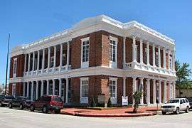 |
August 25, 1970 (#70000747) |
Southeast corner 20th and Post Office (Ave. E) Sts. 29°18′18″N 94°47′23″W / 29.305°N 94.789722°W |
Galveston | |
| 47 | Pix Building | 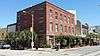 |
August 14, 1984 (#84001713) |
2128 Postoffice St. 29°18′18″N 94°47′32″W / 29.305°N 94.792222°W |
Galveston | Historic Resources of the Galveston Central Business District MRA |
| 48 | Point Bolivar Lighthouse | 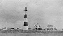 |
August 18, 1977 (#77001445) |
TX 87 29°22′00″N 94°46′00″W / 29.366667°N 94.766667°W |
Port Bolivar | |
| 49 | Powhatan House | 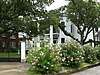 |
October 6, 1975 (#75001982) |
3427 Ave. O 29°17′24″N 94°48′11″W / 29.29°N 94.803056°W |
Galveston | Recorded Texas Historic Landmark |
| 50 | Quigg-Baulard House |  |
September 17, 2015 (#15000618) |
2628 Broadway 29°17′57″N 94°47′48″W / 29.299228°N 94.796545°W |
Galveston | Recorded Texas Historic Landmark |
| 51 | Reedy Chapel-AME Church | 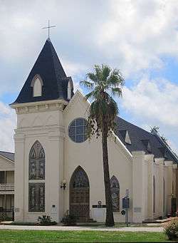 |
September 14, 1984 (#84001717) |
2013 Broadway 29°18′00″N 94°47′19″W / 29.3°N 94.788611°W |
Galveston | Recorded Texas Historic Landmark |
| 52 | Robinson Building | 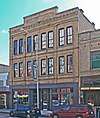 |
August 14, 1984 (#84001720) |
2009-2011 Postoffice St. 29°18′17″N 94°47′26″W / 29.304722°N 94.790556°W |
Galveston | Historic Resources of the Galveston Central Business District MRA |
| 53 | Rosenberg Library | August 14, 1984 (#84001722) |
2310 Sealy St. 29°18′03″N 94°47′34″W / 29.300833°N 94.792778°W |
Galveston | Historic Resources of the Galveston Central Business District MRA | |
| 54 | Scottish Rite Cathedral | 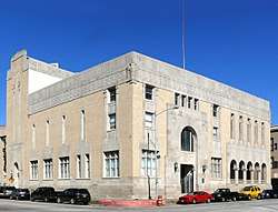 |
August 14, 1984 (#84001724) |
2128 Church St. 29°18′14″N 94°47′30″W / 29.303889°N 94.791667°W |
Galveston | Historic Resources of the Galveston Central Business District MRA |
| 55 | George Sealy House | 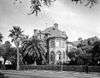 |
October 28, 1969 (#69000205) |
2424 Broadway 29°17′59″N 94°47′37″W / 29.299722°N 94.793611°W |
Galveston | Recorded Texas Historic Landmark |
| 56 | The Settlement Historic District | May 17, 2010 (#10000268) |
Centered on the intersection of N Bell Dr and the 100 block of S Bell Dr with cross-streets Carver Ave and Eunice St 29°22′58″N 94°58′38″W / 29.382778°N 94.977222°W |
Texas City | ||
| 57 | M. W. Shaw Building | 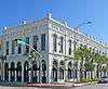 |
August 14, 1984 (#84001728) |
2427 Ave. D 29°18′16″N 94°47′45″W / 29.304444°N 94.795833°W |
Galveston | Historic Resources of the Galveston Central Business District MRA |
| 58 | Silk Stocking Residential Historic District | May 10, 1996 (#96000539) |
Roughly bounded by Ave. K, 23rd St., Ave. P, and 26th St. 29°17′42″N 94°47′30″W / 29.295°N 94.791667°W |
Galveston | Includes Recorded Texas Historic Landmarks | |
| 59 | Ashbel Smith Building |  |
October 28, 1969 (#69000203) |
914-916 Ave. B 29°18′48″N 94°46′44″W / 29.313333°N 94.778889°W |
Galveston | State Antiquities Landmark, Recorded Texas Historic Landmark |
| 60 | SS SELMA (steamship) | January 5, 1994 (#93001449) |
Within the channel between Galveston and Port Bolivar 29°20′39″N 94°47′11″W / 29.344276°N 94.786407°W |
Galveston | ||
| 61 | St. Joseph's Church | 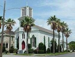 |
December 12, 1976 (#76002032) |
2202 Ave. K 29°17′57″N 94°47′26″W / 29.299167°N 94.790556°W |
Galveston | Recorded Texas Historic Landmark |
| 62 | St. Mary's Cathedral | 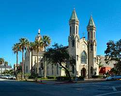 |
June 4, 1973 (#73001964) |
2011 Church Ave. 29°18′14″N 94°47′24″W / 29.303889°N 94.79°W |
Galveston | Recorded Texas Historic Landmark |
| 63 | Star Drug Store | 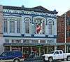 |
August 14, 1984 (#84001731) |
510 23rd St. 29°18′14″N 94°47′35″W / 29.303889°N 94.793056°W |
Galveston | Historic Resources of the Galveston Central Business District MRA |
| 64 | Steffens-Drewa House Complex | 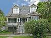 |
December 1, 1988 (#88002671) |
2701, 2705, and 2709 Ave. O 29°17′32″N 94°47′40″W / 29.292222°N 94.794444°W |
Galveston | |
| 65 | The Strand Historic District | .jpg) |
January 26, 1970 (#70000748) |
Roughly bounded by Ave. A, 20th St., alley between Aves. C and D, and railroad depot 29°18′23″N 94°47′37″W / 29.306389°N 94.793611°W |
Galveston | Includes Recorded Texas Historic Landmarks |
| 66 | Stringfellow Orchards | February 27, 2013 (#13000043) |
7902 TX 6 29°21′00″N 95°01′01″W / 29.35011°N 95.01708°W |
Hitchcock | ||
| 67 | Sweeney-Royston House | 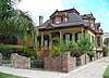 |
September 1, 1978 (#78002931) |
2402 Ave. L 29°17′52″N 94°47′32″W / 29.297778°N 94.792222°W |
Galveston | Recorded Texas Historic Landmark; part of Silk Stocking Residential Historic District |
| 68 | Texas Building | 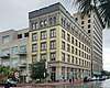 |
August 14, 1984 (#84001734) |
2200 Central Plaza 29°18′18″N 94°47′33″W / 29.305032°N 94.792604°W |
Galveston | Historic Resources of the Galveston Central Business District MRA |
| 69 | Texas Heroes Monument | 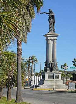 |
August 14, 1984 (#84001737) |
25th and Broadway 29°17′57″N 94°47′39″W / 29.299167°N 94.794167°W |
Galveston | Historic Resources of the Galveston Central Business District MRA |
| 70 | Trinity Protestant Episcopal Church | 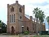 |
September 4, 1979 (#79002946) |
22nd St. and Ave. G 29°18′08″N 94°47′31″W / 29.302222°N 94.791944°W |
Galveston | Includes Recorded Texas Historic Landmarks |
| 71 | Trueheart-Adriance Building | 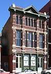 |
July 14, 1971 (#71000933) |
212 22nd St. 29°18′24″N 94°47′33″W / 29.306667°N 94.7925°W |
Galveston | Recorded Texas Historic Landmark; part of The Strand Historic District |
| 72 | U.S. National Bank | 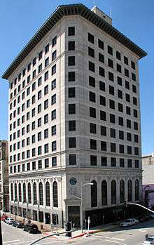 |
August 14, 1984 (#84001739) |
2201 Ave. D 29°18′19″N 94°47′34″W / 29.305278°N 94.792778°W |
Galveston | Historic Resources of the Galveston Central Business District MRA |
| 73 | USS CAVALLA (submarine) | 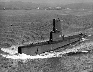 |
May 27, 2008 (#08000477) |
East End of Seawolf Park 29°20′09″N 94°46′46″W / 29.335833°N 94.779444°W |
Galveston | |
| 74 | USS HATTERAS (41GV68) | 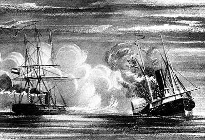 |
January 28, 1977 (#77001567) |
Address restricted[7] |
Galveston | Sunk 20 miles (32 km) off the Galveston coast during the Civil War. |
| 75 | USS STEWART | _underway_c1944.jpg) |
July 12, 2007 (#07000689) |
East End of Seawolf Park 29°20′09″N 94°46′46″W / 29.335833°N 94.779444°W |
Galveston | |
| 76 | Samuel May Williams House | 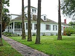 |
July 14, 1971 (#71000934) |
3601 Ave. P 29°17′16″N 94°48′15″W / 29.287778°N 94.804167°W |
Galveston | Recorded Texas Historic Landmark |
| 77 | Willis-Moody Mansion | 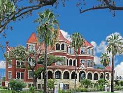 |
May 13, 1994 (#94000410) |
2618 Broadway 29°17′57″N 94°47′46″W / 29.299167°N 94.796111°W |
Galveston | Recorded Texas Historic Landmark |
Former listings
Four sites have been removed from the Register in Galveston County, three of which are due to being destroyed by Hurricane Ike in 2008.
| [3] | Name on the Register | Image | Date listed | Date removed | Location | City or town | Summary |
|---|---|---|---|---|---|---|---|
| 1 | Balinese Room |  |
April 2, 1997 (#97000258) | January 8, 2009 | 2107 Seawall Blvd. 29°17′23″N 94°47′07″W / 29.2897°N 94.7853°W |
Galveston | Destroyed by Hurricane Ike |
| 2 | The Breakers | October 10, 1998 (#98001225) | January 8, 2009 | TX 87 W. of Gilchrist 29°29′47″N 94°31′44″W / 29.4964°N 94.5289°W |
Caplen | Destroyed by Hurricane Ike September 13, 2008[8] | |
| 3 | Moser House | August 14, 1984 (#84001711) | January 8, 2009 | 509 19th St. 29°18′18″N 94°47′21″W / 29.305°N 94.7892°W |
Caplen | Destroyed by Hurricane Ike | |
| 4 | Ursuline Academy |  |
1972 (#72001546) | 1973 | 2601 Ave. N 29°17′39″N 94°47′40″W / 29.294251°N 94.794489°W |
Galveston | Critically damaged by Hurricane Carla; demolished in 1974 |
See also
References
- ↑ "National Register of Historic Places: Weekly List Actions". National Park Service, United States Department of the Interior. Retrieved on October 11, 2018.
- ↑ The latitude and longitude information provided in this table was derived originally from the National Register Information System, which has been found to be fairly accurate for about 99% of listings. For about 1% of NRIS original coordinates, experience has shown that one or both coordinates are typos or otherwise extremely far off; some corrections may have been made. A more subtle problem causes many locations to be off by up to 150 yards, depending on location in the country: most NRIS coordinates were derived from tracing out latitude and longitudes from USGS topographical quadrant maps created under the North American Datum of 1927, which differs from the current, highly accurate WGS84 GPS system used by most on-line maps. Chicago is about right, but NRIS longitudes in Washington are higher by about 4.5 seconds, and are lower by about 2.0 seconds in Maine. Latitudes differ by about 1.0 second in Florida. Some locations in this table may have been corrected to current GPS standards.
- 1 2 Numbers represent an ordering by significant words. Various colorings, defined here, differentiate National Historic Landmarks and historic districts from other NRHP buildings, structures, sites or objects.
- ↑ National Park Service (2013-11-02). "National Register Information System". National Register of Historic Places. National Park Service.
- ↑ The eight-digit number below each date is the number assigned to each location in the National Register Information System database, which can be viewed by clicking the number.
- ↑ Address based on USPS website and United States District & Bankruptcy Court website. Accessed April 10, 2016.
- ↑ Federal and state laws and practices restrict general public access to information regarding the specific location of this resource. In some cases, this is to protect archeological sites from vandalism, while in other cases it is restricted at the request of the owner. See: Knoerl, John; Miller, Diane; Shrimpton, Rebecca H. (1990), Guidelines for Restricting Information about Historic and Prehistoric Resources, National Register Bulletin (29), National Park Service, U.S. Department of the Interior, OCLC 20706997 .
- ↑ Beaumont Enterprise
External links
![]()
Places adjacent to National Register of Historic Places listings in Galveston County, Texas | ||||||||||
|---|---|---|---|---|---|---|---|---|---|---|
| ||||||||||


Municipalities and communities of Galveston County, Texas, United States | ||
|---|---|---|
| Cities | | |
| Village | ||
| CDPs | ||
| Unincorporated communities | ||
| Footnotes | ‡This populated place also has portions in an adjacent county or counties | |