| [3] |
Name on the Register |
Image |
Date listed[4] |
Location |
City or town |
Description |
|---|
| 1 |
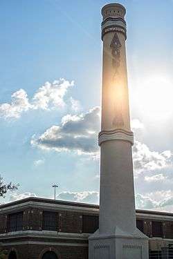
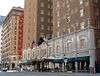
1879 Houston Waterworks |
|
May 6, 1976
(#76002037) |
27 Artesian St.
29°45′50″N 95°22′10″W / 29.763889°N 95.369444°W / 29.763889; -95.369444 (1879 Houston Waterworks) |
Houston |
|
| 2 |
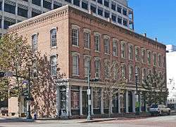
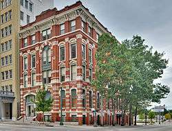
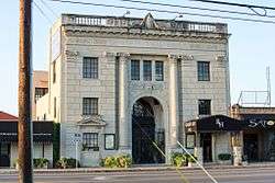
1884 Houston Cotton Exchange Building |
|
May 6, 1971
(#71000938) |
202 Travis St.
29°45′49″N 95°21′40″W / 29.763611°N 95.361111°W / 29.763611; -95.361111 (1884 Houston Cotton Exchange Building) |
Houston |
|
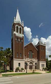
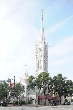
| 3 |
All Saints Roman Catholic Church |
|
June 22, 1983
(#83004425) |
201 E. 10th St.
29°47′21″N 95°23′46″W / 29.78912°N 95.39612°W / 29.78912; -95.39612 (All Saints Roman Catholic Church) |
Houston |
|
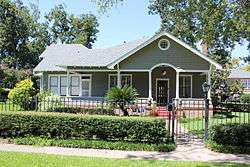
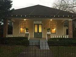
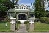
| 4 |
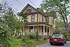
Allbach House |
|
June 22, 1983
(#83004426) |
2023 Arlington St.
29°48′18″N 95°23′41″W / 29.80489°N 95.39480°W / 29.80489; -95.39480 (Allbach House) |
Houston |
|
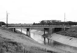
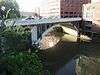
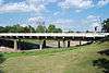
| 5 |
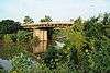
Almeda Road Bridge over Brays Bayou |
|
November 29, 2007
(#07001234) |
Almeda Rd. at Brays Bayou
29°42′47″N 95°22′55″W / 29.713194°N 95.382083°W / 29.713194; -95.382083 (Almeda Road Bridge over Brays Bayou) |
Houston |
|
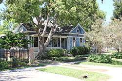
| 6 |
John W. Anderson House |
|
January 15, 1988
(#87002241) |
711 Columbia
29°47′02″N 95°23′36″W / 29.78390°N 95.39322°W / 29.78390; -95.39322 (John W. Anderson House) |
Houston |
|
| 7 |
Annunciation Church |
|
November 3, 1975
(#75001988) |
1618 Texas Ave.
29°45′23″N 95°21′25″W / 29.756389°N 95.356944°W / 29.756389; -95.356944 (Annunciation Church) |
Houston |
|
| 8 |
Antioch Missionary Baptist Church |
|
December 22, 1976
(#76002038) |
500 Clay St.
29°45′23″N 95°22′19″W / 29.75628°N 95.37199°W / 29.75628; -95.37199 (Antioch Missionary Baptist Church) |
Houston |
|
| 9 |
Apollo Mission Control Center |
|
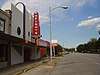
October 3, 1985
(#85002815) |
Lyndon B. Johnson Space Flight Center
29°33′29″N 95°05′18″W / 29.558056°N 95.088333°W / 29.558056; -95.088333 (Apollo Mission Control Center) |
Houston |
|
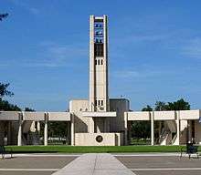
| 10 |
Armand Bayou Archeological District |
|
December 12, 1978
(#78002952) |
Address Restricted
|
Seabrook |
|
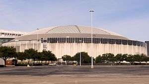
| 11 |
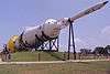
The Astrodome |
|
January 15, 2014
(#13001099) |
8400 Kirby Drive
29°41′06″N 95°24′28″W / 29.685°N 95.407778°W / 29.685; -95.407778 (The Astrodome) |
Houston |
|
| 12 |
James L. Autry House |
|
June 14, 1979
(#79002953) |
5 Courtlandt Pl.
29°44′36″N 95°22′57″W / 29.743231°N 95.382624°W / 29.743231; -95.382624 (James L. Autry House) |
Houston |
|
| 13 |
Aviary at the Houston Zoo |
|
August 9, 2005
(#05000858) |
1513 N. McGregor
29°42′59″N 95°23′27″W / 29.71640°N 95.39090°W / 29.71640; -95.39090 (Aviary at the Houston Zoo) |
Houston |
|
| 14 |
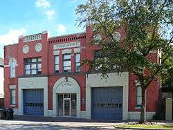
Banta House |
|
June 22, 1983
(#83004427) |
119 E. 20th St.
29°48′12″N 95°23′50″W / 29.803333°N 95.397222°W / 29.803333; -95.397222 (Banta House) |
Houston |
|
| 15 |
Otto H. Baring House |
|
January 15, 1988
(#87002242) |
1030 Rutland
29°47′23″N 95°24′02″W / 29.789722°N 95.400556°W / 29.789722; -95.400556 (Otto H. Baring House) |
Houston |
|
| 16 |
Barker House |
|
May 14, 1984
(#84001754) |
121 E. 16th St.
29°47′58″N 95°23′49″W / 29.799444°N 95.396944°W / 29.799444; -95.396944 (Barker House) |
Houston |
|
| 17 |
Barker-Cypress Archeological Site (41HR436) |
|
April 24, 1984
(#84001753) |
Address Restricted
|
Houston |
|
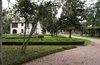
| 18 |
Bayou Bend |
|
December 6, 1979
(#79002954) |
1 Westcott St.
29°45′27″N 95°25′14″W / 29.7575°N 95.420556°W / 29.7575; -95.420556 (Bayou Bend) |
Houston |
|
| 19 |
Beaconsfield |
|
March 29, 1983
(#83004428) |
1700 Main St.
29°45′20″N 95°22′21″W / 29.755556°N 95.3725°W / 29.755556; -95.3725 (Beaconsfield) |
Houston |
|
| 20 |
Benjamin Apartments |
|
September 26, 2002
(#02001063) |
1218 Webster St.
29°44′47″N 95°22′11″W / 29.746389°N 95.369722°W / 29.746389; -95.369722 (Benjamin Apartments) |
Houston |
|
| 21 |
Bethel Baptist Church |
|
January 16, 1998
(#97001626) |
801 Andrews
29°45′04″N 95°22′33″W / 29.751111°N 95.375833°W / 29.751111; -95.375833 (Bethel Baptist Church) |
Houston |
|
| 22 |
Borgstrom House |
|
May 14, 1984
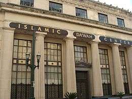
(#84001755) |
1401 Cortlandt St.
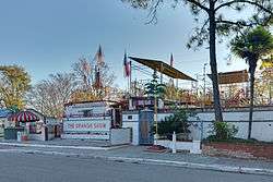
29°47′46″N 95°23′44″W / 29.796111°N 95.395556°W / 29.796111; -95.395556 (Borgstrom House) |
Houston |
|
| 23 |
Boulevard Oaks Historic District |
|
February 22, 2002
(#02000117) |
Roughly bounded by North Blvd., South Blvd., Hazard and Mandell Sts.
29°43′37″N 95°24′13″W / 29.726944°N 95.403611°W / 29.726944; -95.403611 (Boulevard Oaks Historic District) |
Houston |
|
| 24 |
Broadacres Historic District |
|
April 16, 1980
(#80004128) |
1300-1506 North Blvd. and 1305-1515 South Blvd.
29°43′37″N 95°23′48″W / 29.726944°N 95.396667°W / 29.726944; -95.396667 (Broadacres Historic District) |
Houston |
|
| 25 |
Burge House |
|
June 22, 1983
(#83004430) |
1801 Heights Blvd.
29°48′06″N 95°23′54″W / 29.801667°N 95.398333°W / 29.801667; -95.398333 (Burge House) |
Houston |
|
| 26 |
George L. Burlingame House |
|
January 15, 1988
(#87002243) |
1238 Harvard
29°47′37″N 95°23′45″W / 29.793611°N 95.395833°W / 29.793611; -95.395833 (George L. Burlingame House) |
Houston |
|
| 27 |
Burnett House |
|
August 20, 2004
(#83004671) |
219 W. Eleventh St.
29°47′27″N 95°23′59″W / 29.790969°N 95.399851°W / 29.790969; -95.399851 (Burnett House) |
Houston |
|
| 28 |
James Bute Company Warehouse |
|
July 7, 1994
(#94000677) |
711 William St.
29°46′02″N 95°21′14″W / 29.767214°N 95.353910°W / 29.767214; -95.353910 (James Bute Company Warehouse) |
Houston |
|
| 29 |
David A. Carden House |
|
July 17, 1990
(#90001048) |
718 W. 17th Ave.
29°48′02″N 95°24′39″W / 29.800476°N 95.410844°W / 29.800476; -95.410844 (David A. Carden House) |
Houston |
|
| 30 |
J. J. Carroll House |
|
June 14, 1979
(#79002955) |
16 Courtlandt Pl.
29°44′38″N 95°23′04″W / 29.743872°N 95.384427°W / 29.743872; -95.384427 (J. J. Carroll House) |
Houston |
|
| 31 |
W. T. Carter Jr. House |
|
June 14, 1979
(#79002956) |
18 Courtlandt Pl.
29°44′38″N 95°23′05″W / 29.743860°N 95.384803°W / 29.743860; -95.384803 (W. T. Carter Jr. House) |
Houston |
|
| 32 |
Cedar Bayou Archeological District |
|
March 2, 1979
(#79002952) |
Address Restricted
|
Baytown |
|
| 33 |
Cheek-Neal Coffee Company Building |
|
June 7, 2016
(#16000350) |
2017 Preston
29°45′22″N 95°21′07″W / 29.756170°N 95.351872°W / 29.756170; -95.351872 (Cheek-Neal Coffee Company Building) |
Houston |
[5] |
| 34 |
Christ Church |
|
June 15, 1979
(#79002957) |
1117 Texas Ave.
29°45′34″N 95°21′39″W / 29.759444°N 95.360833°W / 29.759444; -95.360833 (Christ Church) |
Houston |
|
| 35 |
City National Bank Building |
|
April 3, 2000
(#00000291) |
1001 McKinney Ave.
29°45′25″N 95°21′51″W / 29.7569°N 95.3643°W / 29.7569; -95.3643 (City National Bank Building) |
Houston |
|
| 36 |
Moses A. Clanton House |
|
July 17, 1990
(#90001040) |
1025 Arlington
29°47′23″N 95°23′39″W / 29.789722°N 95.394167°W / 29.789722; -95.394167 (Moses A. Clanton House) |
Houston |
|
| 37 |
J. H. Clare House |
|
January 15, 1988
(#87002244) |
939 Arlington
29°47′18″N 95°23′40″W / 29.788462°N 95.394395°W / 29.788462; -95.394395 (J. H. Clare House) |
Houston |
|
| 38 |
Clarke & Courts Building |
|
April 14, 1994
(#94000354) |
1210 W. Clay Ave.
29°45′20″N 95°23′38″W / 29.755556°N 95.393889°W / 29.755556; -95.393889 (Clarke & Courts Building) |
Houston |
|
| 39 |
William L. Clayton Summer House |
|
February 2, 1984
(#84001756) |
3376 Inwood Dr.
29°46′44″N 95°25′46″W / 29.778889°N 95.429444°W / 29.778889; -95.429444 (William L. Clayton Summer House) |
Houston |
|
| 40 |
A. S. Cleveland House |
|
June 14, 1979
(#79002958) |
8 Courtlandt Pl.
29°44′38″N 95°23′00″W / 29.743906°N 95.383217°W / 29.743906; -95.383217 (A. S. Cleveland House) |
Houston |
|
| 41 |
Arthur B. Cohn House |
|
November 7, 1985
(#85002771) |
900 block of Avenida De Las Americas
29°45′20″N 95°21′22″W / 29.75553°N 95.35603°W / 29.75553; -95.35603 (Arthur B. Cohn House) |
Houston |
Relocated from original location one block south |
| 42 |
Charles E. Coombs House |
|
July 17, 1990
(#90001041) |
1037 Columbia
29°47′25″N 95°23′36″W / 29.790164°N 95.393334°W / 29.790164; -95.393334 (Charles E. Coombs House) |
Houston |
|
| 43 |
Dr. B. F. Coop House |
|
May 14, 1984
(#84001757) |
1536 Heights Blvd.
29°47′56″N 95°23′51″W / 29.798889°N 95.3975°W / 29.798889; -95.3975 (Dr. B. F. Coop House) |
Houston |
|
| 44 |
Austin Copeland House I |
|
January 15, 1988
(#87002248) |
921 Arlington
29°47′15″N 95°23′39″W / 29.7875°N 95.394167°W / 29.7875; -95.394167 (Austin Copeland House I) |
Houston |
|
| 45 |
Austin Copeland House II |
|
January 15, 1988
(#87002245) |
925 Arlington
29°47′16″N 95°23′39″W / 29.787778°N 95.394167°W / 29.787778; -95.394167 (Austin Copeland House II) |
Houston |
|
| 46 |
Countryman House |
|
June 22, 1983
(#83004431) |
402 E. 9th St.
29°47′13″N 95°23′38″W / 29.786832°N 95.393914°W / 29.786832; -95.393914 (Countryman House) |
Houston |
|
| 47 |
Courtlandt Place Historic District |
|
December 3, 1980
(#80004129) |
2-25 Courtlandt Pl.
29°44′37″N 95°23′03″W / 29.743527°N 95.384239°W / 29.743527; -95.384239 (Courtlandt Place Historic District) |
Houston |
|
| 48 |
Cummings House |
|
June 22, 1983
(#83004432) |
1418 Heights Blvd.
29°47′47″N 95°23′51″W / 29.796389°N 95.3975°W / 29.796389; -95.3975 (Cummings House) |
Houston |
|
| 49 |
Ben C. and Jenetter Cyrus House |
|
June 4, 1997
(#97000549) |
325 E. 25th St.
29°49′05″N 95°23′33″W / 29.818056°N 95.3925°W / 29.818056; -95.3925 (Ben C. and Jenetter Cyrus House) |
Houston |
|
| 50 |
James A. Dawson House |
|
March 17, 1994
(#94000248) |
400 Emerson Ave.
29°44′29″N 95°23′01″W / 29.741380°N 95.383694°W / 29.741380; -95.383694 (James A. Dawson House) |
Houston |
|
| 51 |
DePelchin Faith Home |
|
August 9, 1984
(#84001759) |
2700 Albany St.
29°44′57″N 95°22′58″W / 29.749204°N 95.382883°W / 29.749204; -95.382883 (DePelchin Faith Home) |
Houston |
|
| 52 |
Dexter House |
|
May 14, 1984
(#84001761) |
224 W. 17th St.
29°48′02″N 95°23′59″W / 29.800556°N 95.399722°W / 29.800556; -95.399722 (Dexter House) |
Houston |
Demolished. |
| 53 |
Thomas J. Donoghue House |
|
June 14, 1979
(#79002959) |
17 Courtlandt Pl.
29°44′35″N 95°23′05″W / 29.743184°N 95.384838°W / 29.743184; -95.384838 (Thomas J. Donoghue House) |
Houston |
|
| 54 |
John M. Dorrance House |
|
June 14, 1979
(#79002960) |
9 Courtlandt Pl.
29°44′36″N 95°22′59″W / 29.743226°N 95.383130°W / 29.743226; -95.383130 (John M. Dorrance House) |
Houston |
|
| 55 |
Lula J. Doughty House |
|
July 17, 1990
(#90001046) |
1233 Yale St.
29°47′35″N 95°23′57″W / 29.793056°N 95.399167°W / 29.793056; -95.399167 (Lula J. Doughty House) |
Houston |
|
| 56 |
Downtown Houston Post Office, Processing and Distribution Center |
|
February 2, 2018
(#100002087) |
401 Franklin St.
29°45′54″N 95°21′53″W / 29.765054°N 95.364826°W / 29.765054; -95.364826 (Downtown Houston Post Office, Processing and Distribution Center) |
Houston |
|
| 57 |
Charles W., Sr. and Mary Duncan House |
|
July 24, 2017
(#100001374) |
3664 Inverness Dr.
29°45′09″N 95°26′14″W / 29.752552°N 95.437225°W / 29.752552; -95.437225 (Charles W., Sr. and Mary Duncan House) |
Houston |
|
| 58 |
Jay L. Durham House |
|
January 15, 1988
(#87002246) |
921 Heights Blvd.
29°47′17″N 95°23′11″W / 29.788056°N 95.386389°W / 29.788056; -95.386389 (Jay L. Durham House) |
Houston |
|
| 59 |
Eaton House |
|
June 22, 1983
(#83004433) |
510 Harvard St.
29°46′47″N 95°23′45″W / 29.779722°N 95.395833°W / 29.779722; -95.395833 (Eaton House) |
Houston |
|
| 60 |
Elkins House |
|
June 22, 1983
(#83004434) |
602 E. 9th St.
29°47′13″N 95°23′30″W / 29.786871°N 95.391737°W / 29.786871; -95.391737 (Elkins House) |
Houston |
|
| 61 |
Dr. Billie V. Ellis House |
|
June 22, 1983
(#83004435) |
1515 Heights Blvd.
29°47′54″N 95°23′54″W / 29.798333°N 95.398333°W / 29.798333; -95.398333 (Dr. Billie V. Ellis House) |
Houston |
|
| 62 |
Ned A. and Linda S. Eppes House |
|
December 30, 1997
(#97001599) |
5322 Institute Ln.
29°43′29″N 95°23′50″W / 29.724722°N 95.397222°W / 29.724722; -95.397222 (Ned A. and Linda S. Eppes House) |
Houston |
|
| 63 |
Ezzell House |
|
May 14, 1984
(#84001762) |
1236 Rutland St.
29°47′37″N 95°24′03″W / 29.793611°N 95.400833°W / 29.793611; -95.400833 (Ezzell House) |
Houston |
|
| 64 |
Farnsworth & Chambers Building |
|
October 29, 2009
(#09000866) |
2999 S. Wayside
29°42′22″N 95°19′06″W / 29.70605°N 95.318361°W / 29.70605; -95.318361 (Farnsworth & Chambers Building) |
Houston |
|
| 65 |
Roy and Margaret Farrar House |
|
October 4, 2006
(#06000923) |
511 Lovett Blvd.
29°44′35″N 95°23′16″W / 29.743110°N 95.387835°W / 29.743110; -95.387835 (Roy and Margaret Farrar House) |
Houston |
|
| 66 |
Fire Engine House No. 9 |
|
October 17, 1985
(#85003238) |
1810-1812 Keene St.
29°46′31″N 95°21′05″W / 29.775278°N 95.351389°W / 29.775278; -95.351389 (Fire Engine House No. 9) |
Houston |
Demolished[6] |
| 67 |
First Evangelical Church |
|
November 21, 2006
(#06001066) |
1311 Holman St.
29°44′25″N 95°22′32″W / 29.740278°N 95.375556°W / 29.740278; -95.375556 (First Evangelical Church) |
Houston |
|
| 68 |
Maria Boswell Flake Home for Old Women |
|
May 11, 2018
(#100002435) |
1130 Berry St.
29°44′19″N 95°22′40″W / 29.738608°N 95.377867°W / 29.738608; -95.377867 (Maria Boswell Flake Home for Old Women) |
Houston |
|
| 69 |
William F. Fluegel House |
|
January 15, 1988
(#87002247) |
1327 Ashland
29°47′45″N 95°24′13″W / 29.795704°N 95.403709°W / 29.795704; -95.403709 (William F. Fluegel House) |
Houston |
Significantly altered and expanded since initial listing. |
| 70 |
W.L. Foley Building |
|
October 11, 1978
(#78002942) |
214-218 Travis St.
29°45′47″N 95°21′41″W / 29.763056°N 95.361389°W / 29.763056; -95.361389 (W.L. Foley Building) |
Houston |
|
| 71 |
Forum of Civics |
|
October 13, 1988
(#88001053) |
2503 Westheimer Rd.
29°44′30″N 95°25′04″W / 29.741667°N 95.417778°W / 29.741667; -95.417778 (Forum of Civics) |
Houston |
|
| 72 |
Freedmen's Town Historic District |
|
January 17, 1985
(#85000186) |
Roughly Bounded by Genesse, West Dallas, Arthur and W. Gray Sts.
29°45′19″N 95°22′49″W / 29.755278°N 95.380278°W / 29.755278; -95.380278 (Freedmen's Town Historic District) |
Houston |
|
| 73 |
Gerloff House |
|
July 17, 1990
(#90001047) |
221 E. 12th Ave.
29°47′34″N 95°23′45″W / 29.792766°N 95.395827°W / 29.792766; -95.395827 (Gerloff House) |
Houston |
|
| 74 |
Gillette House |
|
May 14, 1984
(#84001764) |
301-303 E. 15th St.
29°47′52″N 95°23′43″W / 29.797778°N 95.395278°W / 29.797778; -95.395278 (Gillette House) |
Houston |
|
| 75 |
Gulf Building |
|
August 30, 1983
(#83004436) |
710-724 Main St.
29°46′04″N 95°21′50″W / 29.767778°N 95.363889°W / 29.767778; -95.363889 (Gulf Building) |
Houston |
|
| 76 |
Harris County Boy's School Site |
|
May 2, 1979
(#79002961) |
Address Restricted
|
Houston |
|
| 77 |
Harris County Courthouse of 1910 |
|
May 13, 1981
(#81000629) |
301 Fannin St.
29°45′40″N 95°21′34″W / 29.761111°N 95.359444°W / 29.761111; -95.359444 (Harris County Courthouse of 1910) |
Houston |
|
| 78 |
Hartley House |
|
June 22, 1983
(#83004437) |
315 W. 17th St.
29°48′04″N 95°24′08″W / 29.801129°N 95.402184°W / 29.801129; -95.402184 (Hartley House) |
Houston |
|
| 79 |
Hawkins House |
|
May 14, 1984
(#84001765) |
1015 Heights Blvd.
29°47′22″N 95°23′53″W / 29.789444°N 95.398056°W / 29.789444; -95.398056 (Hawkins House) |
Houston |
|
| 80 |
Heights Boulevard Esplanade |
|
May 14, 1984
(#84001766) |
Heights Boulevard from White Oak Bayou to 20th St.
29°46′10″N 95°23′50″W / 29.769444°N 95.397222°W / 29.769444; -95.397222 (Heights Boulevard Esplanade) |
Houston |
|
| 81 |
Heights Christian Church |
|
June 22, 1983
(#83004438) |
1703 Heights Blvd.
29°48′03″N 95°23′54″W / 29.800833°N 95.398333°W / 29.800833; -95.398333 (Heights Christian Church) |
Houston |
|
| 82 |
Heights State Bank Building |
|
June 22, 1983
(#83004439) |
3620 Washington St.
29°46′11″N 95°23′49″W / 29.76971°N 95.39682°W / 29.76971; -95.39682 (Heights State Bank Building) |
Houston |
|
| 83 |
Heights Theater |
|
July 24, 2017
(#100001375) |
339 W. 19th St.
29°48′11″N 95°24′10″W / 29.803145°N 95.402872°W / 29.803145; -95.402872 (Heights Theater) |
Houston |
|
| 84 |
Fred J. Heyne House |
|
March 25, 1994
(#94000266) |
220 Westmoreland Ave.
29°44′25″N 95°23′04″W / 29.740278°N 95.384444°W / 29.740278; -95.384444 (Fred J. Heyne House) |
Houston |
|
| 85 |
Hill Street Bridge over Buffalo Bayou |
|
October 31, 2007
(#07001131) |
S. Jensen Dr. at Buffalo Bayou
29°45′40″N 95°20′36″W / 29.761111°N 95.343333°W / 29.761111; -95.343333 (Hill Street Bridge over Buffalo Bayou) |
Houston |
|
| 86 |
Hogg Building |
|
July 14, 1978
(#78002943) |
401 Louisiana St.
29°45′45″N 95°21′50″W / 29.7625°N 95.363889°W / 29.7625; -95.363889 (Hogg Building) |
Houston |
|
| 87 |
House at 112 W. 4th Street |
|
May 14, 1984
(#84001771) |
112 W. 4th St.
29°46′40″N 95°23′52″W / 29.777778°N 95.397778°W / 29.777778; -95.397778 (House at 112 W. 4th Street) |
Houston |
|
| 88 |
House at 122 East Fifth Street |
|
May 14, 1984
(#84001776) |
122 E. 5th St.
29°46′46″N 95°23′47″W / 29.779444°N 95.396389°W / 29.779444; -95.396389 (House at 122 East Fifth Street) |
Houston |
|
| 89 |
House at 201 W. 15th Street |
|
June 22, 1983
(#83004460) |
201 W. 15th St.
29°47′51″N 95°23′57″W / 29.7975°N 95.399167°W / 29.7975; -95.399167 (House at 201 W. 15th Street) |
Houston |
|
| 90 |
House at 217 E. 5th Street |
|
May 14, 1984
(#84001786) |
217 E. 5th St.
29°46′46″N 95°23′44″W / 29.779444°N 95.395556°W / 29.779444; -95.395556 (House at 217 E. 5th Street) |
Houston |
|
| 91 |
House at 402 E. 11th Street |
|
June 22, 1983
(#83004447) |
402 E. 11th Street
29°47′26″N 95°23′38″W / 29.790541°N 95.394002°W / 29.790541; -95.394002 (House at 402 E. 11th Street) |
Houston |
|
| 92 |
House at 444 West 24th Street |
|
May 14, 1984
(#84001788) |
444 W. 24th St.
29°48′28″N 95°24′12″W / 29.807778°N 95.403333°W / 29.807778; -95.403333 (House at 444 West 24th Street) |
Houston |
|
| 93 |
House at 505 W. 18th Street |
|
May 14, 1984
(#84001791) |
505 W. 18th St.
29°48′07″N 95°24′22″W / 29.802020°N 95.406232°W / 29.802020; -95.406232 (House at 505 W. 18th Street) |
Houston |
|
| 94 |
House at 532 Harvard Street |
|
June 22, 1983
(#83004448) |
532 Harvard St.
29°46′51″N 95°23′45″W / 29.780784°N 95.395962°W / 29.780784; -95.395962 (House at 532 Harvard Street) |
Houston |
|
| 95 |
House at 828 Heights Boulevard |
|
June 22, 1983
(#83004451) |
828 Heights Blvd.
29°47′07″N 95°23′50″W / 29.785278°N 95.397222°W / 29.785278; -95.397222 (House at 828 Heights Boulevard) |
Houston |
|
| 96 |
House at 844 Columbia Street |
|
June 22, 1983
(#83004445) |
844 Columbia St.
29°47′13″N 95°23′34″W / 29.786912°N 95.392825°W / 29.786912; -95.392825 (House at 844 Columbia Street) |
Houston |
|
| 97 |
House at 844 Cortlandt |
|
June 22, 1983
(#83004444) |
844 Cortlandt
29°47′12″N 95°23′42″W / 29.786759°N 95.395003°W / 29.786759; -95.395003 (House at 844 Cortlandt) |
Houston |
|
| 98 |
House at 917 Heights Boulevard |
|
May 14, 1984
(#84001793) |
917 Heights Blvd.
29°47′14″N 95°23′53″W / 29.787222°N 95.398056°W / 29.787222; -95.398056 (House at 917 Heights Boulevard) |
Houston |
|
| 99 |
House at 943½ Cortlandt Street |
|
January 7, 1993
(#84003972) |
943½ Cortlandt St.
29°47′19″N 95°23′44″W / 29.788569°N 95.395509°W / 29.788569; -95.395509 (House at 943½ Cortlandt Street) |
Houston |
|
| 100 |
House at 1111 Heights Boulevard |
|
May 14, 1984
(#84001768) |
1111 Heights Blvd.
29°47′28″N 95°23′53″W / 29.791226°N 95.398142°W / 29.791226; -95.398142 (House at 1111 Heights Boulevard) |
Houston |
|
| 101 |
House at 1210 Harvard Street |
|
May 14, 1984
(#84001774) |
1210 Harvard St.
29°47′34″N 95°23′46″W / 29.792778°N 95.396111°W / 29.792778; -95.396111 (House at 1210 Harvard Street) |
Houston |
|
| 102 |
House at 1217 Harvard |
|
January 15, 1988
(#87002249) |
1217 Harvard
29°47′35″N 95°23′48″W / 29.793056°N 95.396667°W / 29.793056; -95.396667 (House at 1217 Harvard) |
Houston |
|
| 103 |
House at 1220 Harvard |
|
January 15, 1988
(#87002250) |
1220 Harvard
29°47′35″N 95°23′45″W / 29.793056°N 95.395833°W / 29.793056; -95.395833 (House at 1220 Harvard) |
Houston |
|
| 104 |
House at 1222 Harvard Street |
|
July 17, 1990
(#90001043) |
1222 Harvard St.
29°47′35″N 95°23′45″W / 29.793056°N 95.395833°W / 29.793056; -95.395833 (House at 1222 Harvard Street) |
Houston |
|
| 105 |
House at 1227 Rutland Street |
|
May 14, 1984
(#84001777) |
1227 Rutland St.
29°47′35″N 95°24′04″W / 29.793056°N 95.401111°W / 29.793056; -95.401111 (House at 1227 Rutland Street) |
Houston |
|
| 106 |
House at 1230 Oxford Street |
|
May 14, 1984
(#84001780) |
1230 Oxford St.
29°47′37″N 95°23′32″W / 29.793611°N 95.392222°W / 29.793611; -95.392222 (House at 1230 Oxford Street) |
Houston |
|
| 107 |
House at 1237 Rutland Street |
|
June 22, 1983
(#83004456) |
1237 Rutland St.
29°47′37″N 95°24′04″W / 29.793611°N 95.401111°W / 29.793611; -95.401111 (House at 1237 Rutland Street) |
Houston |
|
| 108 |
House at 1304 Cortlandt Street |
|
May 14, 1984
(#84001784) |
1304 Cortlandt St.
29°47′41″N 95°23′42″W / 29.794632°N 95.395110°W / 29.794632; -95.395110 (House at 1304 Cortlandt Street) |
Houston |
|
| 109 |
House at 1343 Allston Street |
|
June 22, 1983
(#83004443) |
1343 Allston St.
29°47′46″N 95°24′02″W / 29.796003°N 95.400427°W / 29.796003; -95.400427 (House at 1343 Allston Street) |
Houston |
Significantly altered and expanded since initial listing. |
| 110 |
House at 1421 Harvard St. |
|
June 22, 1983
(#83004449) |
1421 Harvard St.
29°47′48″N 95°23′48″W / 29.796667°N 95.396667°W / 29.796667; -95.396667 (House at 1421 Harvard St.) |
Houston |
|
| 111 |
House at 1421 Heights Boulevard |
|
June 22, 1983
(#83004452) |
1421 Heights Blvd.
29°47′49″N 95°23′54″W / 29.797060°N 95.398261°W / 29.797060; -95.398261 (House at 1421 Heights Boulevard) |
Houston |
|
| 112 |
House at 1421-1423 Waverly Street |
|
June 22, 1983
(#83004459) |
1421-1423 Waverly St.
29°47′47″N 95°24′16″W / 29.796389°N 95.404444°W / 29.796389; -95.404444 (House at 1421-1423 Waverly Street) |
Houston |
|
| 113 |
House at 1435 Heights Boulevard |
|
January 15, 1988
(#87002251) |
1435 Heights Blvd.
29°47′50″N 95°23′53″W / 29.797222°N 95.398056°W / 29.797222; -95.398056 (House at 1435 Heights Boulevard) |
Houston |
|
| 114 |
House at 1437 Heights Boulevard |
|
June 22, 1983
(#83004453) |
1437 Heights Blvd.
29°47′50″N 95°23′54″W / 29.797222°N 95.398333°W / 29.797222; -95.398333 (House at 1437 Heights Boulevard) |
Houston |
|
| 115 |
House at 1437 Waverly Street |
|
June 22, 1983
(#83004458) |
1437 Waverly St.
29°47′49″N 95°24′16″W / 29.796944°N 95.404444°W / 29.796944; -95.404444 (House at 1437 Waverly Street) |
Houston |
|
| 116 |
House at 1443 Allston Street |
|
June 22, 1983
(#83004442) |
1443 Allston St.
29°47′52″N 95°24′02″W / 29.797751°N 95.400441°W / 29.797751; -95.400441 (House at 1443 Allston Street) |
Houston |
|
| 117 |
House at 1509 Allston Street |
|
June 22, 1983
(#83004441) |
1509 Allston St.
29°47′55″N 95°24′02″W / 29.798486°N 95.400520°W / 29.798486; -95.400520 (House at 1509 Allston Street) |
Houston |
|
| 118 |
House at 1515 Allston Street |
|
June 22, 1983
(#83004440) |
1515 Allston St.
29°47′55″N 95°24′02″W / 29.798631°N 95.400468°W / 29.798631; -95.400468 (House at 1515 Allston Street) |
Houston |
|
| 119 |
House at 1517 Cortland Street |
|
June 22, 1983
(#83004446) |
1517 Cortland St.
29°47′56″N 95°23′45″W / 29.798826°N 95.395767°W / 29.798826; -95.395767 (House at 1517 Cortland Street) |
Houston |
|
| 120 |
House at 1537 Tulane Street |
|
June 22, 1983
(#83004457) |
1537 Tulane Street
29°47′56″N 95°24′08″W / 29.798889°N 95.402222°W / 29.798889; -95.402222 (House at 1537 Tulane Street) |
Houston |
|
| 121 |
House at 1640 Harvard Street |
|
June 22, 1983
(#83004450) |
1640 Harvard St.
29°48′05″N 95°23′47″W / 29.801511°N 95.396361°W / 29.801511; -95.396361 (House at 1640 Harvard Street) |
Houston |
Hose modified and expanded significantly since initial listing. |
| 122 |
House at 2035 Rutland Street |
|
June 22, 1983
(#83004455) |
2035 Rutland St.
29°48′17″N 95°24′06″W / 29.804722°N 95.401722°W / 29.804722; -95.401722 (House at 2035 Rutland Street) |
Houston |
|
| 123 |
House at 2402 Rutland Street |
|
June 22, 1983
(#83004454) |
2402 Rutland St.
29°48′29″N 95°24′05″W / 29.808161°N 95.401298°W / 29.808161; -95.401298 (House at 2402 Rutland Street) |
Houston |
|
| 124 |
Houston Bar Center Building |
|
June 26, 2017
(#100001254) |
723 Main St.
29°45′36″N 95°22′09″W / 29.76°N 95.369167°W / 29.76; -95.369167 (Houston Bar Center Building) |
Houston |
|
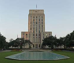
| 125 |
Houston City Hall |
|
September 18, 1990
(#90001471) |
901 Bagby St.
29°45′36″N 95°22′09″W / 29.76°N 95.369167°W / 29.76; -95.369167 (Houston City Hall) |
Houston |
|
| 126 |
Houston Fire Station No. 3 |
|
February 28, 2017
(#100000696) |
1919 Houston Ave.
29°46′30″N 95°22′22″W / 29.775088°N 95.372656°W / 29.775088; -95.372656 (Houston Fire Station No. 3) |
Houston |
|
| 127 |
Houston Fire Station No. 7 |
|
April 17, 1986
(#86000798) |
2403 Milam St.
29°44′51″N 95°22′29″W / 29.747417°N 95.374806°W / 29.747417; -95.374806 (Houston Fire Station No. 7) |
Houston |
|
| 128 |
Houston Heights Fire Station |
|
June 22, 1983
(#83004461) |
Yale and 12th Sts.
29°47′33″N 95°23′56″W / 29.7925°N 95.398889°W / 29.7925; -95.398889 (Houston Heights Fire Station) |
Houston |
|
| 129 |
Houston Heights Waterworks Reservoir |
|
June 22, 1983
(#83004462) |
W. 20 and Nicolson Sts.
29°48′15″N 95°24′23″W / 29.804167°N 95.406389°W / 29.804167; -95.406389 (Houston Heights Waterworks Reservoir) |
Houston |
|
| 130 |
Houston Heights Woman's Club |
|
June 22, 1983
(#83004463) |
1846 Harvard St
29°48′13″N 95°23′47″W / 29.803677°N 95.396438°W / 29.803677; -95.396438 (Houston Heights Woman's Club) |
Houston |
|
| 131 |
Houston National Cemetery |
|
February 28, 2017
(#100000697) |
10410 Veterans Memorial Dr.
29°55′51″N 95°27′02″W / 29.930902°N 95.450636°W / 29.930902; -95.450636 (Houston National Cemetery) |
Houston |
|
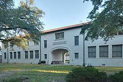
| 132 |
Houston Negro Hospital |
|
December 27, 1982
(#82004856) |
3204 Ennis St.
29°43′52″N 95°21′37″W / 29.731111°N 95.360278°W / 29.731111; -95.360278 (Houston Negro Hospital) |
Houston |
|
| 133 |
Houston Negro Hospital School of Nursing Building |
|
December 27, 1982
(#82004857) |
Holman Ave. and Ennis St.
29°43′34″N 95°21′26″W / 29.726111°N 95.357222°W / 29.726111; -95.357222 (Houston Negro Hospital School of Nursing Building) |
Houston |
|
| 134 |
Houston Post |
|
April 2, 2018
(#100002269) |
2410 Polk St.
29°44′49″N 95°21′16″W / 29.747064°N 95.354404°W / 29.747064; -95.354404 (Houston Post) |
Houston |
|
| 135 |
Houston Post-Dispatch Building |
|
February 14, 2002
(#02000072) |
609 Fannin
29°45′32″N 95°21′41″W / 29.758889°N 95.361389°W / 29.758889; -95.361389 (Houston Post-Dispatch Building) |
Houston |
|
| 136 |
Houston Public Library |
|
May 14, 1984
(#84001795) |
1302 Heights Blvd.
29°47′39″N 95°23′51″W / 29.794167°N 95.3975°W / 29.794167; -95.3975 (Houston Public Library) |
Houston |
|
| 137 |
Humble Oil Building |
|
January 27, 1999
(#99000068) |
1212 Main St.
29°45′18″N 95°22′00″W / 29.755°N 95.366667°W / 29.755; -95.366667 (Humble Oil Building) |
Houston |
|
| 138 |
Julia Ideson Building |
|
November 23, 1977
(#77001447) |
500 McKinney St.
29°45′32″N 95°22′09″W / 29.758889°N 95.369167°W / 29.758889; -95.369167 (Julia Ideson Building) |
Houston |
|
| 139 |
Idylwood Historic District |
|
July 6, 2011
(#11000425) |
Roughly bounded by Lawndale Ave., N. MacGregor Way, Sylvan Rd. & Wayside Dr.
29°43′15″N 95°18′36″W / 29.720833°N 95.31°W / 29.720833; -95.31 (Idylwood Historic District) |
Houston |
|
| 140 |
Immanuel Lutheran Church |
|
June 22, 1983
(#83004464) |
1448 Cortlandt St.
29°47′52″N 95°23′42″W / 29.797778°N 95.395°W / 29.797778; -95.395 (Immanuel Lutheran Church) |
Houston |
|
| 141 |
Independence Heights Residential Historic District |
|
June 4, 1997
(#97000542) |
Roughly bounded by N. Yale and E. 34th Sts., and I-610
29°48′54″N 95°23′45″W / 29.815°N 95.395833°W / 29.815; -95.395833 (Independence Heights Residential Historic District) |
Houston |
|
| 142 |
Independence Park |
|
June 4, 1997
(#97000544) |
Roughly bounded by 1000 Blk. of E. 40th St.
29°49′21″N 95°23′11″W / 29.8225°N 95.386389°W / 29.8225; -95.386389 (Independence Park) |
Houston |
|
| 143 |
Isabella Court |
|
June 24, 1994
(#94000628) |
3909-3917 S. Main St.
29°44′11″N 95°22′50″W / 29.736389°N 95.380556°W / 29.736389; -95.380556 (Isabella Court) |
Houston |
|
| 144 |
Isbell House |
|
June 22, 1983
(#83004465) |
639 Heights Blvd.
29°46′56″N 95°23′52″W / 29.782222°N 95.397778°W / 29.782222; -95.397778 (Isbell House) |
Houston |
|
| 145 |
Jefferson Davis Hospital |
|
August 10, 2005
(#05000859) |
1101 Elder
29°46′10″N 95°22′07″W / 29.769444°N 95.368611°W / 29.769444; -95.368611 (Jefferson Davis Hospital) |
Houston |
|
| 146 |
James L. Jensen House |
|
July 17, 1990
(#90001039) |
721 Arlington
29°47′03″N 95°23′39″W / 29.784085°N 95.394260°W / 29.784085; -95.394260 (James L. Jensen House) |
Houston |
|
| 147 |
Charles Johnson House |
|
June 4, 1997
(#97000550) |
301 E. 35th St.
29°49′05″N 95°23′45″W / 29.818056°N 95.395833°W / 29.818056; -95.395833 (Charles Johnson House) |
Houston |
|
| 148 |
Morris and Mary Johnson House |
|
June 4, 1997
(#97000541) |
3818 Spencer St.
29°46′30″N 95°23′58″W / 29.775°N 95.399444°W / 29.775; -95.399444 (Morris and Mary Johnson House) |
Houston |
Demolished[7] |
| 149 |
Jones House |
|
June 22, 1983
(#83004466) |
1115-1117 Allston St.
29°47′29″N 95°24′02″W / 29.791433°N 95.400447°W / 29.791433; -95.400447 (Jones House) |
Houston |
|
| 150 |
Jones-Hunt House |
|
June 14, 1979
(#79002962) |
24 Courtlandt Pl.
29°44′38″N 95°23′09″W / 29.743842°N 95.385751°W / 29.743842; -95.385751 (Jones-Hunt House) |
Houston |
|
| 151 |
Keller House |
|
May 14, 1984
(#84001797) |
1448 Heights Blvd.
29°47′51″N 95°23′51″W / 29.7975°N 95.3975°W / 29.7975; -95.3975 (Keller House) |
Houston |
|
| 152 |
Kellum-Noble House |
|
April 3, 1975
(#75001989) |
212 Dallas St.
29°45′31″N 95°22′19″W / 29.758611°N 95.371944°W / 29.758611; -95.371944 (Kellum-Noble House) |
Houston |
|
| 153 |
Kennedy Bakery |
|
July 27, 1979
(#79002963) |
813 Congress St.
29°45′46″N 95°21′41″W / 29.762778°N 95.361389°W / 29.762778; -95.361389 (Kennedy Bakery) |
Houston |
|
| 154 |
Marshall W. Kennedy House |
|
January 15, 1988
(#87002252) |
1122 Harvard
29°47′28″N 95°23′45″W / 29.791111°N 95.395833°W / 29.791111; -95.395833 (Marshall W. Kennedy House) |
Houston |
|
| 155 |
Kleinhaus House |
|
June 22, 1983
(#83004467) |
803 Yale St.
29°47′07″N 95°23′57″W / 29.785355°N 95.399132°W / 29.785355; -95.399132 (Kleinhaus House) |
Houston |
|
| 156 |
Knittel House |
|
June 22, 1983
(#83004468) |
1601 Ashland St.
29°47′59″N 95°24′10″W / 29.799722°N 95.402778°W / 29.799722; -95.402778 (Knittel House) |
Houston |
|
| 157 |
Kress Building |
|
October 4, 2002
(#02001102) |
705 Main St.
29°45′31″N 95°21′46″W / 29.758611°N 95.362778°W / 29.758611; -95.362778 (Kress Building) |
Houston |
|
| 158 |
Kronenberger House |
|
June 22, 1983
(#83004469) |
612 W. 26th St.
29°48′34″N 95°24′18″W / 29.809444°N 95.405°W / 29.809444; -95.405 (Kronenberger House) |
Houston |
|
| 159 |
Lewis Apartment Building |
|
May 24, 1996
(#96000587) |
2815-2817 Smith St.
29°44′43″N 95°22′44″W / 29.745278°N 95.378889°W / 29.745278; -95.378889 (Lewis Apartment Building) |
Houston |
|
| 160 |
Ella Lewis Store and Rental Houses |
|
June 4, 1997
(#97000543) |
3404-3406-3408 Cortlandt St.
29°49′02″N 95°23′44″W / 29.817222°N 95.395556°W / 29.817222; -95.395556 (Ella Lewis Store and Rental Houses) |
Houston |
|
| 161 |
Emil Lindenburg House |
|
January 15, 1988
(#87002253) |
1445 Harvard
29°47′52″N 95°23′48″W / 29.797778°N 95.396667°W / 29.797778; -95.396667 (Emil Lindenburg House) |
Houston |
|
| 162 |
Oscar Lindsay House |
|
June 4, 1997
(#97000546) |
7415 N. Main St.
29°49′02″N 95°23′34″W / 29.817222°N 95.392778°W / 29.817222; -95.392778 (Oscar Lindsay House) |
Houston |
|
| 163 |
Link-Lee House |
|
September 11, 2000
(#00000751) |
3800 Montrose
29°44′16″N 95°23′29″W / 29.737778°N 95.391389°W / 29.737778; -95.391389 (Link-Lee House) |
Houston |
|
| 164 |
Logue House |
|
April 30, 1998
(#98000428) |
1101 Milford
29°43′44″N 95°23′31″W / 29.728889°N 95.391944°W / 29.728889; -95.391944 (Logue House) |
Houston |
|
| 165 |
Fayette C. Lowry House |
|
July 19, 1990
(#90001045) |
2009 Harvard
29°48′16″N 95°23′49″W / 29.804580°N 95.396945°W / 29.804580; -95.396945 (Fayette C. Lowry House) |
Houston |
|
| 166 |
Lund House |
|
June 22, 1983
(#83004470) |
301 E. 5th St.
29°46′46″N 95°23′42″W / 29.779444°N 95.395°W / 29.779444; -95.395 (Lund House) |
Houston |
|
| 167 |
Leonard W. Macatee House |
|
May 6, 2005
(#05000387) |
1220 Southmore Blvd.
29°43′37″N 95°23′07″W / 29.726886°N 95.385284°W / 29.726886; -95.385284 (Leonard W. Macatee House) |
Houston |
|
| 168 |
William Mackey House |
|
June 4, 1997
(#97000547) |
313 E. 37th St.
29°49′12″N 95°23′43″W / 29.819881°N 95.395298°W / 29.819881; -95.395298 (William Mackey House) |
Houston |
|
| 169 |
Main Street/Market Square Historic District |
|
July 18, 1983
(#83004471) |
Roughly bounded by Buffalo Bayou, Fannin, Texas, and Milam streets
29°45′47″N 95°21′40″W / 29.763056°N 95.361111°W / 29.763056; -95.361111 (Main Street/Market Square Historic District) |
Houston |
|
| 170 |
Mansfield House |
|
June 22, 1983
(#83004472) |
1802 Harvard St.
29°48′06″N 95°23′47″W / 29.801667°N 95.396389°W / 29.801667; -95.396389 (Mansfield House) |
Houston |
|
| 171 |
Mansfield Street Archeological Site |
|
May 22, 1978
(#78002945) |
Address Restricted
|
Houston |
|
| 172 |
Marguerite Meachum & John S. Mellinger House |
|
June 20, 2012
(#12000351) |
3452 Del Monte Drive
29°45′04″N 95°25′58″W / 29.75111°N 95.43291°W / 29.75111; -95.43291 (Marguerite Meachum & John S. Mellinger House) |
Houston |
|
| 173 |
Henry Hicks McCain House |
|
January 15, 1988
(#87002254) |
1026 Allston
29°47′23″N 95°23′59″W / 29.789852°N 95.399845°W / 29.789852; -95.399845 (Henry Hicks McCain House) |
Houston |
|
| 174 |
D. C. McCollum House |
|
July 17, 1990
(#90001049) |
433 W. 24th St.
29°48′29″N 95°24′16″W / 29.808056°N 95.404444°W / 29.808056; -95.404444 (D. C. McCollum House) |
Houston |
|
| 175 |
McDonald House |
|
June 22, 1983
(#83004473) |
1801 Ashland St.
29°48′06″N 95°24′10″W / 29.801667°N 95.402778°W / 29.801667; -95.402778 (McDonald House) |
Houston |
Demolished[8] |
| 176 |
McKee Street Bridge |
|
September 3, 2002
(#02000729) |
McKee St. and Buffalo Bayou
29°45′57″N 95°21′07″W / 29.765833°N 95.351944°W / 29.765833; -95.351944 (McKee Street Bridge) |
Houston |
|
| 177 |
Medical Towers |
|
December 27, 2016
(#16000918) |
1709 Dryden Rd.
29°42′35″N 95°24′05″W / 29.709787°N 95.401493°W / 29.709787; -95.401493 (Medical Towers) |
Houston |
|
| 178 |
James V. Meek House |
|
March 17, 1994
(#94000247) |
3704 Garrott Ave.
29°44′22″N 95°23′08″W / 29.739444°N 95.385556°W / 29.739444; -95.385556 (James V. Meek House) |
Houston |
|
| 179 |
Meitzen House |
|
May 14, 1984
(#84001813) |
725 Harvard St.
29°47′04″N 95°23′48″W / 29.784331°N 95.396536°W / 29.784331; -95.396536 (Meitzen House) |
Houston |
|
| 180 |
Melrose Building |
|
September 17, 2014
(#14000627) |
1121 Walker
29°45′25″N 95°21′46″W / 29.7569°N 95.3627°W / 29.7569; -95.3627 (Melrose Building) |
Houston |
|
| 181 |
Merchants and Manufacturers Building |
|
September 17, 1980
(#80004130) |
University of Houston–Downtown
1 Main St.
29°45′57″N 95°21′32″W / 29.765833°N 95.358889°W / 29.765833; -95.358889 (Merchants and Manufacturers Building) |
Houston |
|
| 182 |
Miller House |
|
May 14, 1984
(#84001814) |
1245 Yale St.
29°47′37″N 95°23′57″W / 29.793611°N 95.399167°W / 29.793611; -95.399167 (Miller House) |
Houston |
|
| 183 |
Ezekial and Mary Jane Miller House |
|
October 6, 1983
(#83003788) |
304 Hawthorne St.
29°44′36″N 95°23′02″W / 29.743333°N 95.383889°W / 29.743333; -95.383889 (Ezekial and Mary Jane Miller House) |
Houston |
|
| 184 |
John Milroy House |
|
November 12, 1980
(#80004131) |
1102 Heights Blvd.
29°47′28″N 95°23′50″W / 29.790997°N 95.397269°W / 29.790997; -95.397269 (John Milroy House) |
Houston |
Second duplicate listing approved in 1983 (#83004474). |
| 185 |
Milroy-Muller House |
|
May 14, 1984
(#84001816) |
1602 Harvard St.
29°47′59″N 95°23′46″W / 29.799722°N 95.396111°W / 29.799722; -95.396111 (Milroy-Muller House) |
Houston |
|
| 186 |
Simon and Mamie Minchen House |
|
December 7, 2000
(#00001496) |
1753 North Blvd.
29°43′45″N 95°24′15″W / 29.729167°N 95.404167°W / 29.729167; -95.404167 (Simon and Mamie Minchen House) |
Houston |
|
| 187 |
Angelo and Lillian Minella House |
|
September 13, 2006
(#06000818) |
6328 Brookside Dr.
29°43′52″N 95°18′59″W / 29.731111°N 95.316389°W / 29.731111; -95.316389 (Angelo and Lillian Minella House) |
Houston |
|
| 188 |
Morgan's Point Historic District |
|
September 30, 1994
(#94001160) |
89-835 Bayridge Rd. and 300-322 Vinsonia
29°40′13″N 94°59′39″W / 29.670278°N 94.994167°W / 29.670278; -94.994167 (Morgan's Point Historic District) |
Morgan's Point |
|
| 189 |
Glenn W. Morris House |
|
July 17, 1990
(#90001044) |
1611 Harvard St.
29°48′01″N 95°23′49″W / 29.800414°N 95.396824°W / 29.800414; -95.396824 (Glenn W. Morris House) |
Houston |
|
| 190 |
Morton Brothers Grocery |
|
January 15, 1988
(#87002255) |
401 W. Ninth
29°47′13″N 95°24′04″W / 29.786944°N 95.401111°W / 29.786944; -95.401111 (Morton Brothers Grocery) |
Houston |
|
| 191 |
Mulcahy House |
|
May 14, 1984
(#84001819) |
1046 Harvard St.
29°47′26″N 95°23′46″W / 29.790514°N 95.396188°W / 29.790514; -95.396188 (Mulcahy House) |
Houston |
|
| 192 |
Sterling Myer House |
|
June 14, 1979
(#79002964) |
4 Courtlandt Pl.
29°44′37″N 95°22′55″W / 29.743611°N 95.381944°W / 29.743611; -95.381944 (Sterling Myer House) |
Houston |
|
| 193 |
Myers-Spalti Manufacturing Plant |
|
September 12, 2003
(#03000936) |
2115 Runnels St.
29°45′45″N 95°20′49″W / 29.7625°N 95.346944°W / 29.7625; -95.346944 (Myers-Spalti Manufacturing Plant) |
Houston |
|
| 194 |
Forrest A. Nairn House |
|
November 12, 1991
(#87002256) |
1148 Heights Blvd.
29°47′33″N 95°23′51″W / 29.792404°N 95.397388°W / 29.792404; -95.397388 (Forrest A. Nairn House) |
Houston |
|
| 195 |
William R. Nash House |
|
August 23, 1990
(#90001293) |
215 Westmoreland Ave.
29°44′27″N 95°23′04″W / 29.740833°N 95.384444°W / 29.740833; -95.384444 (William R. Nash House) |
Houston |
|
| 196 |
National Biscuit Company Building |
|
February 20, 1998
(#98000141) |
15 N. Chenevert
29°45′36″N 95°21′08″W / 29.76°N 95.352222°W / 29.76; -95.352222 (National Biscuit Company Building) |
Houston |
|
| 197 |
Near North Side Historic District |
|
November 29, 2010
(#10000960) |
Roughly bounded by Little White Oak Bayou on the N; Hogan on the S; I-45 on the W and the block between N Main and Keene
29°46′42″N 95°21′55″W / 29.778333°N 95.365278°W / 29.778333; -95.365278 (Near North Side Historic District) |
Houston |
|
| 198 |
C. L. Neuhaus House |
|
June 14, 1979
(#79002965) |
6 Courtlandt Pl.
29°44′38″N 95°22′58″W / 29.743904°N 95.382815°W / 29.743904; -95.382815 (C. L. Neuhaus House) |
Houston |
|
| 199 |
Hugo V. Neuhaus Jr. House |
|
March 30, 2005
(#05000246) |
2910 Lazy Ln.
29°45′23″N 95°25′01″W / 29.756369°N 95.416873°W / 29.756369; -95.416873 (Hugo V. Neuhaus Jr. House) |
Houston |
|
| 200 |
Joseph Ogle House |
|
June 22, 1983
(#83004475) |
530 Harvard St.
29°46′50″N 95°23′46″W / 29.780639°N 95.395985°W / 29.780639; -95.395985 (Joseph Ogle House) |
Houston |
|
| 201 |
Old Houston National Bank |
|
July 17, 1975
(#75001990) |
202 Main St.
29°45′47″N 95°21′38″W / 29.762926°N 95.360541°W / 29.762926; -95.360541 (Old Houston National Bank) |
Houston |
Now the Islamic Da’wah Center[9] |
| 202 |
Old Sixth Ward Historic District |
|
January 23, 1978
(#78002946) |
Bounded by Washington, Union, Houston, Capitol and Glenwood Cemetery
29°45′57″N 95°22′38″W / 29.765833°N 95.377222°W / 29.765833; -95.377222 (Old Sixth Ward Historic District) |
Houston |
|
| 203 |
The Orange Show |
|
November 21, 2006
(#06001063) |
2401 Munger St.
29°43′10″N 95°19′28″W / 29.719444°N 95.324444°W / 29.719444; -95.324444 (The Orange Show) |
Houston |
|
| 204 |
Oriental Textile Mill |
|
June 22, 1983
(#83004476) |
2201 Lawrence St.
29°48′22″N 95°24′30″W / 29.806083°N 95.408472°W / 29.806083; -95.408472 (Oriental Textile Mill) |
Houston |
|
| 205 |
Otto House |
|
May 14, 1984
(#84001820) |
835 Rutland St.
29°47′09″N 95°24′03″W / 29.785833°N 95.400833°W / 29.785833; -95.400833 (Otto House) |
Houston |
|
| 206 |
Palace Hotel |
|
September 13, 2006
(#06000825) |
216 La Branch
29°45′44″N 95°21′24″W / 29.762222°N 95.356667°W / 29.762222; -95.356667 (Palace Hotel) |
Houston |
|
| 207 |
Edward Albert Palmer Memorial Chapel and Autry House |
|
October 31, 1984
(#84000388) |
6221 and 6265 Main St.
29°42′57″N 95°23′47″W / 29.715833°N 95.396389°W / 29.715833; -95.396389 (Edward Albert Palmer Memorial Chapel and Autry House) |
Houston |
|
| 208 |
John W. Parker House |
|
June 14, 1979
(#79002966) |
2 Courtlandt Pl.
29°44′38″N 95°22′55″W / 29.743958°N 95.381990°W / 29.743958; -95.381990 (John W. Parker House) |
Houston |
|
| 209 |
Paul Building |
|
April 6, 1979
(#79002967) |
1018 Preston Ave.
29°45′39″N 95°21′39″W / 29.760937°N 95.360765°W / 29.760937; -95.360765 (Paul Building) |
Houston |
|
| 210 |
D. D. Peden House |
|
July 16, 1991
(#91000889) |
2 Longfellow Ln.
29°43′21″N 95°23′35″W / 29.722593°N 95.393002°W / 29.722593; -95.393002 (D. D. Peden House) |
Houston |
|
| 211 |
Perry-Swilley House |
|
June 22, 1983
(#83004477) |
1101 Heights Blvd.
29°47′28″N 95°23′53″W / 29.791075°N 95.398054°W / 29.791075; -95.398054 (Perry-Swilley House) |
Houston |
|
| 212 |
Pomeroy Homestead |
|
May 1, 2003
(#03000329) |
202 and 204 S. Main St.
29°42′38″N 95°12′35″W / 29.710580°N 95.209785°W / 29.710580; -95.209785 (Pomeroy Homestead) |
Pasadena |
|
| 213 |
Thomas B. Reed House |
|
July 17, 1990
(#90001038) |
933 Allston St.
29°47′17″N 95°24′01″W / 29.788056°N 95.400278°W / 29.788056; -95.400278 (Thomas B. Reed House) |
Houston |
|
| 214 |
Rice Hotel |
|
June 23, 1978
(#78002947) |
Main St. and Texas Ave.
29°45′37″N 95°21′46″W / 29.760278°N 95.362778°W / 29.760278; -95.362778 (Rice Hotel) |
Houston |
|
| 215 |
Charles Roessler House |
|
January 15, 1988
(#87002257) |
736 Cortland
29°47′05″N 95°23′42″W / 29.784641°N 95.394922°W / 29.784641; -95.394922 (Charles Roessler House) |
Houston |
|
| 216 |
Ghent W. Rogers House |
|
July 17, 1990
(#90001042) |
1150 Cortlandt
29°47′33″N 95°23′42″W / 29.792419°N 95.395129°W / 29.792419; -95.395129 (Ghent W. Rogers House) |
Houston |
|
| 217 |
Rothko Chapel |
|
August 16, 2000
(#00000883) |
1409 Sul Ross Ave.
29°44′15″N 95°23′46″W / 29.7375°N 95.396111°W / 29.7375; -95.396111 (Rothko Chapel) |
Houston |
|
| 218 |
Sabine Street Bridge over Buffalo Bayou |
|
September 28, 2007
(#07001023) |
Sabine St. at Buffalo Bayou
29°45′45″N 95°22′31″W / 29.7625°N 95.375278°W / 29.7625; -95.375278 (Sabine Street Bridge over Buffalo Bayou) |
Houston |
|
| 219 |
Sam Houston Hotel |
|
April 17, 2002
(#02000276) |
1117 Prairie St.
29°45′42″N 95°21′37″W / 29.761667°N 95.360278°W / 29.761667; -95.360278 (Sam Houston Hotel) |
Houston |
Now known as Alden Houston. |
| 220 |
San Felipe Courts Historic District |
|
February 16, 1988
(#88000042) |
1 Allen Pkwy. Village
29°45′34″N 95°22′42″W / 29.759444°N 95.378333°W / 29.759444; -95.378333 (San Felipe Courts Historic District) |
Houston |
|
| 221 |
San Jacinto Battlefield |
|
October 15, 1966
(#66000815) |
22 mi (35 km). E of Houston on TX 134
29°44′56″N 95°04′49″W / 29.748889°N 95.080278°W / 29.748889; -95.080278 (San Jacinto Battlefield) |
Houston |
|
| 222 |
San Jacinto Senior High School |
|
December 5, 2012
(#12001000) |
Houston Community College Central
1300 Holman St.
29°44′15″N 95°22′36″W / 29.7374°N 95.37654°W / 29.7374; -95.37654 (San Jacinto Senior High School) |
Houston |
Consists of three contributing buildings[10] |
| 223 |
San Jacinto Street Bridge over Buffalo Bayou |
|
October 16, 2007
(#07001098) |
San Jacinto St. at Buffalo Bayou
29°45′53″N 95°21′27″W / 29.764722°N 95.3575°W / 29.764722; -95.3575 (San Jacinto Street Bridge over Buffalo Bayou) |
Houston |
|
| 224 |
Saturn V Launch Vehicle |
|
February 4, 2003
(#02001731) |
Johnson Space Center
29°33′26″N 95°05′20″W / 29.557222°N 95.088889°W / 29.557222; -95.088889 (Saturn V Launch Vehicle) |
Houston |
|
| 225 |
Scanlan Building |
|
May 23, 1980
(#80004132) |
405 Main St.
29°45′40″N 95°21′40″W / 29.761111°N 95.361111°W / 29.761111; -95.361111 (Scanlan Building) |
Houston |
|
| 226 |
Schlesser-Burrows House |
|
May 14, 1984
(#84001823) |
1123 Harvard St.
29°47′30″N 95°23′48″W / 29.791547°N 95.396682°W / 29.791547; -95.396682 (Schlesser-Burrows House) |
Houston |
|
| 227 |
Schlumberger Well Surveying Corporation Building |
|
June 24, 2018
(#10002601) |
2720 Leeland Street
29°44′35″N 95°21′12″W / 29.743175°N 95.353444°W / 29.743175; -95.353444 (Schlumberger Well Surveying Corporation Building) |
Houston |
|
| 228 |
Sessums-James House |
|
November 19, 1998
(#98001344) |
3802 Spencer
29°46′30″N 95°23′57″W / 29.775°N 95.399167°W / 29.775; -95.399167 (Sessums-James House) |
Houston |
Demolished[11] |
| 229 |
Cleveland Harding Sewall House |
|
April 14, 1975
(#75001991) |
3452 Inwood St.
29°45′07″N 95°25′48″W / 29.751944°N 95.43°W / 29.751944; -95.43 (Cleveland Harding Sewall House) |
Houston |
|
| 230 |
Sheridan Apartments |
|
August 2, 1984
(#84001825) |
802-804 McGowen St.
29°44′45″N 95°22′32″W / 29.745833°N 95.375556°W / 29.745833; -95.375556 (Sheridan Apartments) |
Houston |
|
| 231 |
John H. Shoaf House |
|
January 15, 1988
(#87002258) |
2030 Arlington
29°48′19″N 95°23′39″W / 29.805169°N 95.394210°W / 29.805169; -95.394210 (John H. Shoaf House) |
Houston |
|
| 232 |
South Texas National Bank |
|
December 8, 1978
(#78002948) |
215 Main St.
29°45′44″N 95°21′36″W / 29.762222°N 95.36°W / 29.762222; -95.36 (South Texas National Bank) |
Houston |
Demolished in 1983[12] |
| 233 |
Southwestern Bell Capitol Main Office |
|
August 25, 2016
(#16000574) |
1121 Capitol St. & 1114 Texas Ave.
29°45′31″N 95°21′41″W / 29.758654°N 95.361361°W / 29.758654; -95.361361 (Southwestern Bell Capitol Main Office) |
Houston |
|
| 234 |
Space Environment Simulation Laboratory |
|
October 3, 1985
(#85002810) |
Lyndon B. Johnson Space Center
29°33′38″N 95°05′17″W / 29.560556°N 95.088056°W / 29.560556; -95.088056 (Space Environment Simulation Laboratory) |
Houston |
|
| 235 |
Star Engraving Company Building |
|
January 6, 1995
(#94001521) |
3201 Allen Pkwy.
29°45′36″N 95°23′19″W / 29.76°N 95.388611°W / 29.76; -95.388611 (Star Engraving Company Building) |
Houston |
|
| 236 |
State Highway 35 Bridge at the West Fork of the San Jacinto River |
|
October 10, 1996
(#96001110) |
US 59, 1.4 mi (2.3 km). N of jct. with FM 1960
30°01′39″N 95°15′28″W / 30.0275°N 95.257778°W / 30.0275; -95.257778 (State Highway 35 Bridge at the West Fork of the San Jacinto River) |
Humble |
|
| 237 |
State National Bank Building |
|
August 11, 1982
(#82004843) |
412 Main St.
29°45′40″N 95°21′42″W / 29.761111°N 95.361667°W / 29.761111; -95.361667 (State National Bank Building) |
Houston |
|
| 238 |
Sterling S. Ross House |
|
October 29, 1982
(#82004858) |
515 Bayridge Rd.
29°40′07″N 94°59′42″W / 29.668611°N 94.995°W / 29.668611; -94.995 (Sterling S. Ross House) |
Morgan's Point |
|
| 239 |
Sterling-Berry House |
|
July 14, 1983
(#83004479) |
4515 Yoakum Blvd.
29°43′56″N 95°23′32″W / 29.732248°N 95.392118°W / 29.732248; -95.392118 (Sterling-Berry House) |
Houston |
|
| 240 |
Joseph R. and Mary M. Stevenson House |
|
March 21, 1996
(#96000275) |
804 Harold St.
29°44′28″N 95°23′20″W / 29.741111°N 95.388889°W / 29.741111; -95.388889 (Joseph R. and Mary M. Stevenson House) |
Houston |
|
| 241 |
Dr. James M. and Dove Stewart House |
|
February 16, 1996
(#96000067) |
5702 Fourth St.
29°47′21″N 95°49′21″W / 29.789167°N 95.8225°W / 29.789167; -95.8225 (Dr. James M. and Dove Stewart House) |
Katy |
|
| 242 |
Stowers Building |
|
June 3, 2015
(#15000335) |
820 Fannin
29°45′27″N 95°21′49″W / 29.757462°N 95.363546°W / 29.757462; -95.363546 (Stowers Building) |
Houston |
|
| 243 |
Sweeney, Coombs & Fredericks Building |
|
June 20, 1974
(#74002074) |
301 Main St.
29°45′43″N 95°21′38″W / 29.761944°N 95.360556°W / 29.761944; -95.360556 (Sweeney, Coombs & Fredericks Building) |
Houston |
|
| 244 |
Sylvan Beach Pavilion |
|
September 9, 2010
(#10000738) |
554 N Bayshore Dr.
29°39′04″N 95°00′38″W / 29.651111°N 95.010556°W / 29.651111; -95.010556 (Sylvan Beach Pavilion) |
La Porte |
|
| 245 |
Judson L. Taylor House |
|
June 14, 1979
(#79002968) |
20 Courtlandt Pl.
29°44′38″N 95°23′06″W / 29.743876°N 95.385120°W / 29.743876; -95.385120 (Judson L. Taylor House) |
Houston |
|
| 246 |
Telephone Road Bridge over Brays Bayou |
|
November 29, 2007
(#07001235) |
Telephone Rd. at Brays Bayou
29°42′37″N 95°18′48″W / 29.710278°N 95.313333°W / 29.710278; -95.313333 (Telephone Road Bridge over Brays Bayou) |
Houston |
|
| 247 |
Temple Beth Israel |
|
March 1, 1984
(#84001826) |
3517 Austin St.
29°44′12″N 95°22′30″W / 29.736667°N 95.375°W / 29.736667; -95.375 (Temple Beth Israel) |
Houston |
|
| 248 |
Texas Company Building |
|
April 2, 2003
(#03000185) |
1111 Rusk
29°45′28″N 95°21′46″W / 29.757778°N 95.362778°W / 29.757778; -95.362778 (Texas Company Building) |
Houston |
|
| 249 |
Texas State Hotel |
|
January 10, 2008
(#07001384) |
720 Fannin
29°45′28″N 95°21′46″W / 29.757778°N 95.362778°W / 29.757778; -95.362778 (Texas State Hotel) |
Houston |
|
| 250 |
Dr. Penn B. Thornton House |
|
June 22, 1983
(#83004480) |
1541 Tulane St.
29°47′57″N 95°24′08″W / 29.799167°N 95.402222°W / 29.799167; -95.402222 (Dr. Penn B. Thornton House) |
Houston |
|
| 251 |
Lucie Wray and Anderson Todd House |
|
August 31, 2018
(#100002842) |
9 Shadowlawn Cir.
29°43′28″N 95°23′42″W / 29.7245°N 95.3950°W / 29.7245; -95.3950 (Lucie Wray and Anderson Todd House) |
Houston |
|
| 252 |
Trinity Church |
|
May 26, 1983
(#83004481) |
3404 S. Main St.
29°44′22″N 95°22′39″W / 29.739444°N 95.3775°W / 29.739444; -95.3775 (Trinity Church) |
Houston |
|
| 253 |
U.S. Customhouse |
|
August 28, 1974
(#74002075) |
701 San Jacinto St.
29°45′26″N 95°21′40″W / 29.757222°N 95.361111°W / 29.757222; -95.361111 (U.S. Customhouse) |
Houston |
|
| 254 |
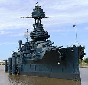
U.S.S. TEXAS |
|
December 8, 1976
(#76002039) |
22 mi (35 km). E of Houston on TX 134 at San Jacinto Battleground
29°45′21″N 95°05′22″W / 29.755833°N 95.089444°W / 29.755833; -95.089444 (U.S.S. TEXAS) |
Houston |
|
| 255 |
Union Station |
|
November 10, 1977
(#77001448) |
501 Crawford St.
29°45′25″N 95°21′23″W / 29.756944°N 95.356389°W / 29.756944; -95.356389 (Union Station) |
Houston |
|
| 256 |
Union Transfer and Storage Building |
|
January 16, 2001
(#00001665) |
1113 Vine St.
29°46′12″N 95°21′25″W / 29.77°N 95.356944°W / 29.77; -95.356944 (Union Transfer and Storage Building) |
Houston |
|
| 257 |
Upchurch House |
|
June 22, 1983
(#83004482) |
301 E. 14th St.
29°47′45″N 95°23′43″W / 29.795833°N 95.395278°W / 29.795833; -95.395278 (Upchurch House) |
Houston |
|
| 258 |
W-K-M Company, Inc. Historic District |
|
June 25, 2018
(#100002602) |
Roughly bounded by Commerce, Sampson, Preston & Velasco Streets
29°45′03″N 95°20′27″W / 29.750724°N 95.340707°W / 29.750724; -95.340707 (W-K-M Company, Inc. Historic District) |
Houston |
|
| 259 |
Walker House |
|
April 10, 2012
(#12000195) |
3534 Miramar Dr.
29°37′09″N 95°00′14″W / 29.619264°N 95.00389°W / 29.619264; -95.00389 (Walker House) |
Shoreacres |
|
| 260 |
Ward House |
|
June 22, 1983
(#83004483) |
323 W. 17th St.
29°48′01″N 95°24′04″W / 29.800278°N 95.401111°W / 29.800278; -95.401111 (Ward House) |
Houston |
|
| 261 |
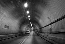
Washburn Tunnel |
|
April 16, 2008
(#08000316) |
3198 Washburn Tunnel
29°43′35″N 95°12′43″W / 29.726389°N 95.211944°W / 29.726389; -95.211944 (Washburn Tunnel) |
Pasadena |
|
| 262 |
Webber House |
|
May 14, 1984
(#84001829) |
N Shaver St at the Houston Ship Channel
29°47′26″N 95°23′53″W / 29.790556°N 95.398056°W / 29.790556; -95.398056 (Webber House) |
Houston |
|
| 263 |
Samuel H. Webber House |
|
June 22, 1983
(#83004484) |
407 Heights Blvd.
29°46′42″N 95°23′52″W / 29.778249°N 95.397839°W / 29.778249; -95.397839 (Samuel H. Webber House) |
Houston |
|
| 264 |
West Eleventh Place Historic District |
|
April 14, 1997
(#97000317) |
1-8 W. 11th Pl.
29°43′31″N 95°23′31″W / 29.725278°N 95.391944°W / 29.725278; -95.391944 (West Eleventh Place Historic District) |
Houston |
|
| 265 |
James M. and Jessie West Mansion |
|
August 19, 1994
(#94001015) |
3303 NASA Rd. 1
29°33′37″N 95°04′28″W / 29.560278°N 95.074444°W / 29.560278; -95.074444 (James M. and Jessie West Mansion) |
Pasadena |
|
| 266 |
Westmoreland Historic District |
|
August 16, 1994
(#94000859) |
Bounded by Hawthorne, Burlington and Marshall Aves., and Garott St.
29°44′26″N 95°23′00″W / 29.740556°N 95.383333°W / 29.740556; -95.383333 (Westmoreland Historic District) |
Houston |
|
| 267 |
Wilkins House |
|
May 14, 1984
(#84001831) |
1541 Ashland St.
29°47′57″N 95°24′12″W / 29.799167°N 95.403333°W / 29.799167; -95.403333 (Wilkins House) |
Houston |
|
| 268 |
Williams-Brueder House |
|
June 22, 1983
(#83004485) |
245 W. 18th St.
29°48′08″N 95°24′04″W / 29.802129°N 95.401147°W / 29.802129; -95.401147 (Williams-Brueder House) |
Houston |
|
| 269 |
Willow Street Pump Station |
|
May 27, 2004
(#04000547) |
University of Houston–Downtown
811 N. San Jacinto St.
29°46′03″N 95°21′26″W / 29.7675°N 95.357222°W / 29.7675; -95.357222 (Willow Street Pump Station) |
Houston |
|
| 270 |
Wilson House |
|
May 14, 1984
(#84001841) |
1206 Cortlandt St.
29°47′34″N 95°23′42″W / 29.792785°N 95.395118°W / 29.792785; -95.395118 (Wilson House) |
Houston |
|
| 271 |
Wimberly House |
|
May 14, 1984
(#84001843) |
703 Harvard St.
29°46′28″N 95°23′46″W / 29.774444°N 95.396111°W / 29.774444; -95.396111 (Wimberly House) |
Houston |
|
| 272 |
Wisnoski House |
|
May 14, 1984
(#84001844) |
1651 Columbia St.
29°47′59″N 95°23′36″W / 29.799722°N 95.393333°W / 29.799722; -95.393333 (Wisnoski House) |
Houston |
|
| 273 |
Woodard House |
|
May 14, 1984
(#84001847) |
740 Rutlant St.
29°47′04″N 95°24′02″W / 29.784444°N 95.400556°W / 29.784444; -95.400556 (Woodard House) |
Houston |
|
| 274 |
Woodlawn Garden of Memories Cemetery |
|
October 22, 2004
(#04001174) |
1101 Antoine
29°47′18″N 95°28′41″W / 29.788333°N 95.478056°W / 29.788333; -95.478056 (Woodlawn Garden of Memories Cemetery) |
Houston |
|
| 275 |
Woodward House |
|
June 22, 1983
(#83004486) |
1605 Heights Blvd.
29°48′01″N 95°23′54″W / 29.800401°N 95.398304°W / 29.800401; -95.398304 (Woodward House) |
Houston |
|
| 276 |
Andrew Jackson and Margaret Cullinan Wray House |
|
August 19, 1993
(#93000844) |
3 Remington Ln.
29°43′25″N 95°23′35″W / 29.723603°N 95.393163°W / 29.723603; -95.393163 (Andrew Jackson and Margaret Cullinan Wray House) |
Houston |
|
| 277 |
Peter and Sophie Wunderlich Farm |
|
February 27, 1997
(#97000202) |
18202 Theiss Mail Rd.
30°01′49″N 95°32′54″W / 30.030278°N 95.548333°W / 30.030278; -95.548333 (Peter and Sophie Wunderlich Farm) |
Klein |
|
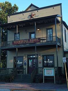
| 278 |
Wunsche Bros. Saloon and Hotel |
|
February 16, 1984
(#84001849) |
103 Midway St.
30°04′44″N 95°25′03″W / 30.078889°N 95.4175°W / 30.078889; -95.4175 (Wunsche Bros. Saloon and Hotel) |
Spring |
|
| 279 |
Yale Street Bridge over White Oak Bayou |
|
December 30, 2011
(#11000981) |
Yale St. at White Oak Bayou
29°46′32″N 95°23′55″W / 29.77553°N 95.3987°W / 29.77553; -95.3987 (Yale Street Bridge over White Oak Bayou) |
Houston |
|
.jpg)
116.jpg)
.jpg)
.jpg)
.jpg)
.jpg)
.jpg)
.jpg)
.jpg)
.jpg)
.jpg)
.jpg)
.jpg)
.jpg)
.jpg)
.jpg)
.jpg)
.jpg)
_HDR.jpg)
.jpg)
.jpg)
.jpg)
.jpg)
.jpg)
.jpg)
.jpg)
.jpg)
.jpg)
.jpg)
.jpg)
.jpg)
.jpg)
.jpg)
.jpg)
.jpg)
.jpg)
.jpg)
.jpg)
.jpg)
.jpg)
.jpg)
.jpg)
.jpg)
.jpg)
.jpg)
.jpg)
.jpg)
.jpg)
.jpg)
.jpg)
.jpg)
.jpg)
.jpg)
.jpg)
.jpg)
.jpg)
.jpg)
.jpg)
.jpg)
.jpg)
.jpg)
.jpg)
.jpg)
_Houston.jpg)
.jpg)
.jpg)

.jpg)
.jpg)
.jpg)
.jpg)
.jpg)
.jpg)
.jpg)
.jpg)
.jpg)
_(HDR).jpg)
.jpg)
.JPG)
.jpg)
.jpg)
.jpg)
.jpg)
.jpg)
.jpg)
.jpg)
.jpg)
.jpg)
.jpg)
.jpg)
.JPG)
.jpg)
_Houston.jpg)
.jpg)

.jpg)