| [3] |
Name on the Register[4] |
Image |
Date listed[5] |
Location |
City or town |
Description |
|---|
| 1 |
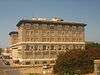
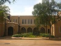
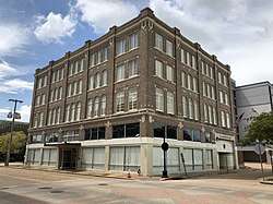
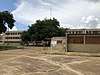
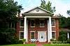
Alexander State Forest Headquarters Building |
|
May 21, 1987
(#87000771) |
Alexander State Forest
31°08′28″N 92°28′29″W / 31.141111°N 92.474722°W / 31.141111; -92.474722 (Alexander State Forest Headquarters Building) |
Woodworth |
|
| 2 |
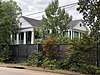
Alexandria Garden District |
|
April 9, 2001
(#01000336) |
Roughly bounded by Marye St., Bolton Ave., White St., and Bayou Hynson
31°17′59″N 92°27′32″W / 31.299722°N 92.458889°W / 31.299722; -92.458889 (Alexandria Garden District) |
Alexandria |
|
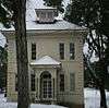
| 3 |
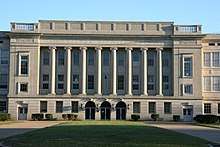
Alexandria Hall-Louisiana College |
|
May 15, 1986
(#86001059) |
Louisiana College
31°19′31″N 92°25′36″W / 31.325278°N 92.426667°W / 31.325278; -92.426667 (Alexandria Hall-Louisiana College) |
Pineville |
|
| 4 |
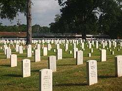
Alexandria National Cemetery |
|
July 9, 1997
(#97000767) |
209 Shamrock Ave.
31°19′19″N 92°26′34″W / 31.321944°N 92.442778°W / 31.321944; -92.442778 (Alexandria National Cemetery) |
Pineville |
part of the Civil War Era National Cemeteries Multiple Property Submission (MPS) |
| 5 |
Alexandria Post-War Suburbs Historic District |
|
June 6, 2013
(#13000366) |
Bounded by Bayou Hynson, Darby, Texas & Elliott Sts.
31°17′43″N 92°28′19″W / 31.295303°N 92.472005°W / 31.295303; -92.472005 (Alexandria Post-War Suburbs Historic District) |
Alexandria |
|
| 6 |
Alexandria Veterans Administration Hospital Historic District |
|
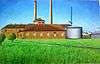
September 29, 1986
(#86003116) |
U.S. Routes 71/167; also 2495 Shreveport Hwy.
31°21′17″N 92°26′08″W / 31.354722°N 92.435556°W / 31.354722; -92.435556 (Alexandria Veterans Administration Hospital Historic District) |
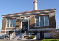
Alexandria |
Listed as the "Veterans Administration Medical Center"; name changed and 2495 Shreveport added by a boundary increase of November 28, 2012 |
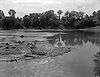
| 7 |
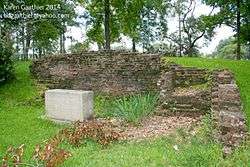
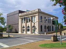
Bailey's Dam Site |
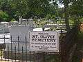
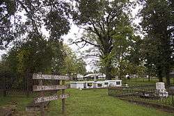
|
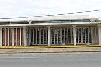
June 29, 1976
(#76000973) |
Red River south of U.S. Route 71
31°19′32″N 92°27′07″W / 31.325556°N 92.451944°W / 31.325556; -92.451944 (Bailey's Dam Site) |
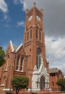
Alexandria |
|
| 8 |
Bayouside |
|
March 26, 1980
(#80001757) |
North of McNutt off Louisiana Highway 121
31°18′48″N 92°38′38″W / 31.313333°N 92.643889°W / 31.313333; -92.643889 (Bayouside) |
McNutt |
|
| 9 |
Bennett Plantation House |
|
May 14, 1979
(#79001083) |
6291 Old Baton Rouge Highway
31°13′16″N 92°25′11″W / 31.221111°N 92.419722°W / 31.221111; -92.419722 (Bennett Plantation House) |
Alexandria |
|
| 10 |
Bentley Hotel |
|
November 15, 1979
(#79001084) |
801 3rd St.
31°18′43″N 92°26′42″W / 31.311944°N 92.445°W / 31.311944; -92.445 (Bentley Hotel) |
Alexandria |
|
| 11 |
Blanchard House |
|
July 22, 1982
(#82002793) |
West of Boyce on Bayou Jean de Jean
31°22′57″N 92°42′04″W / 31.3825°N 92.701111°W / 31.3825; -92.701111 (Blanchard House) |
Boyce |
|
| 12 |
Bland House |
|
October 17, 1985
(#85003148) |
330 Saint James St.
31°18′32″N 92°26′33″W / 31.308889°N 92.4425°W / 31.308889; -92.4425 (Bland House) |
Alexandria |
|
| 13 |
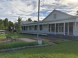
Bohemian Community Hall |
|
June 19, 2018
(#100002586) |
94 Industrial Rd.
31°21′06″N 92°20′02″W / 31.3518°N 92.3340°W / 31.3518; -92.3340 (Bohemian Community Hall) |
Libuse |
|
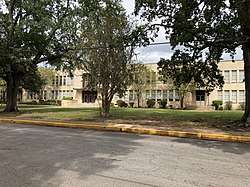
| 14 |
Bolton High School |
|
January 9, 1984
(#84001349) |
2101 Vance Ave.
31°17′36″N 92°27′20″W / 31.293333°N 92.455556°W / 31.293333; -92.455556 (Bolton High School) |
Alexandria |
|
| 15 |
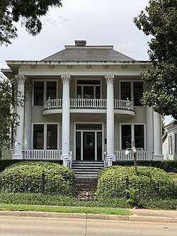
James Wade Bolton House |
|
November 15, 1979
(#79001085) |
1330 Main St.
31°18′35″N 92°26′31″W / 31.309722°N 92.441944°W / 31.309722; -92.441944 (James Wade Bolton House) |
Alexandria |
|
| 16 |
Arna Wendell Bontemps House |
|
September 13, 1993
(#93000886) |
1327 3rd St.
31°18′34″N 92°26′34″W / 31.309444°N 92.442778°W / 31.309444; -92.442778 (Arna Wendell Bontemps House) |
Alexandria |
|
| 17 |
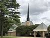
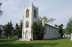
Boyce Methodist Church |
|
September 12, 2013
(#13000733) |
309 Londonderry Ave.
31°23′25″N 92°40′06″W / 31.390242°N 92.66839°W / 31.390242; -92.66839 (Boyce Methodist Church) |
Boyce |
|
| 18 |
Britt Place |
|
November 21, 1980
(#80001756) |
East of Glenmora on Lake Cocodrie Rd.
30°58′05″N 92°33′47″W / 30.968056°N 92.563056°W / 30.968056; -92.563056 (Britt Place) |
Glenmora |
|
| 19 |
J.E. Byram House |
|
February 1, 2016
(#15001015) |
915 City Park Blvd.
31°17′39″N 92°27′51″W / 31.294092°N 92.464130°W / 31.294092; -92.464130 (J.E. Byram House) |
Alexandria |
|
| 20 |
Carnahan House |
|
April 7, 1995
(#95000373) |
212 Ulster Ave.
31°23′29″N 92°40′08″W / 31.391389°N 92.668889°W / 31.391389; -92.668889 (Carnahan House) |
Boyce |
|
| 21 |
Central Louisiana State Hospital Dairy Barn |
|
May 15, 1986
(#86001078) |
U.S. Route 165
31°20′01″N 92°26′27″W / 31.333611°N 92.440833°W / 31.333611; -92.440833 (Central Louisiana State Hospital Dairy Barn) |
Pineville |
|
| 22 |
Chickama |
|
May 31, 2016
(#16000302) |
687 Chickamaw Rd.
31°06′43″N 92°25′35″W / 31.111838°N 92.426442°W / 31.111838; -92.426442 (Chickama) |
Lecompte |
|
| 23 |
China Grove |
|
December 5, 1984
(#84000553) |
Louisiana Highway 496
31°18′48″N 92°38′06″W / 31.313333°N 92.635°W / 31.313333; -92.635 (China Grove) |
Gardner |
part of the Neo-Classical Architecture of Bayou Rapides Thematic Resource (TR) |
| 24 |
Commercial Building |
|
November 29, 1978
(#78001436) |
3rd and Johnston Sts.
31°18′38″N 92°26′37″W / 31.310556°N 92.443611°W / 31.310556; -92.443611 (Commercial Building) |
Alexandria |
|
| 25 |
Cook House |
|
November 15, 1979
(#79001086) |
222 Florence Ave.
31°18′24″N 92°27′39″W / 31.306667°N 92.460833°W / 31.306667; -92.460833 (Cook House) |
Alexandria |
|
| 26 |
Cottingham House |
|
September 8, 1987
(#87001477) |
1403 College Dr.
31°19′41″N 92°25′32″W / 31.328056°N 92.425556°W / 31.328056; -92.425556 (Cottingham House) |
Pineville |
|
| 27 |
Crowell Sawmill Historic District |
|
February 11, 1993
(#93000036) |
11789 U.S. Route 165, S.
31°00′18″N 92°33′33″W / 31.005°N 92.559167°W / 31.005; -92.559167 (Crowell Sawmill Historic District) |
Longleaf |
|
| 28 |
Myrtle Groves Huie Dellmon House |
|
January 31, 2017
(#100000603) |
430 St. James St.
31°18′31″N 92°26′35″W / 31.308739°N 92.443047°W / 31.308739; -92.443047 (Myrtle Groves Huie Dellmon House) |
Alexandria |
|
| 29 |
Downtown Alexandria Commercial Historic District |
|
August 8, 2018
(#100002588) |
Bounded by 2nd, Jackson, Beauregard, 4th, 5th, 6th, Murray, Washington & Lee Sts.
31°18′37″N 92°26′41″W / 31.3104°N 92.4448°W / 31.3104; -92.4448 (Downtown Alexandria Commercial Historic District) |
Alexandria |
|
| 30 |
Eden |
|
December 5, 1984
(#84000554) |
Off Louisiana Highway 121
31°19′53″N 92°40′42″W / 31.331389°N 92.678333°W / 31.331389; -92.678333 (Eden) |
Gardner |
part of the Neo-Classical Architecture of Bayou Rapides TR |
| 31 |
Emmanuel Baptist Church |
|
November 21, 2001
(#01001255) |
430 Jackson St.
31°18′42″N 92°26′50″W / 31.311667°N 92.447222°W / 31.311667; -92.447222 (Emmanuel Baptist Church) |
Alexandria |
|
| 32 |
First Methodist Church |
|
June 6, 1980
(#80001751) |
630 Jackson St.
31°18′37″N 92°26′54″W / 31.310278°N 92.448333°W / 31.310278; -92.448333 (First Methodist Church) |
Alexandria |
|
| 33 |
First United Methodist Church |
|
November 19, 2015
(#14001172) |
2727 Jackson Ave.
31°17′38″N 92°27′58″W / 31.294°N 92.4661°W / 31.294; -92.4661 (First United Methodist Church) |
Alexandria |
|
| 34 |
Fort Buhlow |
|
June 1, 1981
(#81000299) |
Off U.S. Route 165
31°19′07″N 92°26′56″W / 31.318611°N 92.448889°W / 31.318611; -92.448889 (Fort Buhlow) |
Pineville |
|
| 35 |
Fort Randolph |
|
June 1, 1981
(#81000300) |
Off U.S. Route 165
31°18′53″N 92°26′54″W / 31.314722°N 92.448333°W / 31.314722; -92.448333 (Fort Randolph) |
Pineville |
|
| 36 |
Gemiluth Chassodim Synagogue |
|
January 29, 2014
(#13001128) |
2021 Turner St.
31°17′52″N 92°27′18″W / 31.29786°N 92.454899°W / 31.29786; -92.454899 (Gemiluth Chassodim Synagogue) |
Alexandria |
|
| 37 |
Geneva |
|
December 5, 1984
(#84000539) |
Louisiana Highway 496
31°18′50″N 92°30′48″W / 31.313889°N 92.513333°W / 31.313889; -92.513333 (Geneva) |
Alexandria |
part of the Neo-Classical Architecture of Bayou Rapides TR |
| 38 |
Guaranty Bank, Park Avenue Branch |
|
January 23, 2013
(#12001206) |
403 Bolton Ave.
31°18′26″N 92°27′24″W / 31.307283°N 92.456585°W / 31.307283; -92.456585 (Guaranty Bank, Park Avenue Branch) |
Alexandria |
|
| 39 |
Hemenway Furniture Co. Building |
|
October 4, 1983
(#83003632) |
3rd and Jackson Sts.
31°18′44″N 92°26′46″W / 31.312222°N 92.446111°W / 31.312222; -92.446111 (Hemenway Furniture Co. Building) |
Alexandria |
|
| 40 |
Mayer Hirsch House |
|
July 26, 1979
(#79001087) |
1216 Jackson St.
31°18′30″N 92°44′06″W / 31.308333°N 92.735°W / 31.308333; -92.735 (Mayer Hirsch House) |
Alexandria |
|
| 41 |
Hope |
|
December 13, 1984
(#84003856) |
Off Louisiana Highway 121 and Mill Race Rd.
31°18′43″N 92°39′05″W / 31.311944°N 92.651389°W / 31.311944; -92.651389 (Hope) |
Gardner |
part of the Neo-Classical Architecture of Bayou Rapides TR |
| 42 |
Inglewood Plantation Historic District |
|
January 14, 1988
(#87002449) |
Off U.S. Route 71
31°13′43″N 92°25′12″W / 31.228611°N 92.42°W / 31.228611; -92.42 (Inglewood Plantation Historic District) |
Alexandria |
|
| 43 |
Island Home |
|
December 5, 1984
(#84000557) |
Across Bayou Rapides off Louisiana Highway 121
31°19′49″N 92°40′35″W / 31.330278°N 92.676389°W / 31.330278; -92.676389 (Island Home) |
Gardner |
part of the Neo-Classical Architecture of Bayou Rapides TR |
| 44 |
Wade H. Jones, Sr., House |
|
August 27, 1987
(#87001428) |
Meeker Rd.
31°03′17″N 92°23′06″W / 31.054722°N 92.385°W / 31.054722; -92.385 (Wade H. Jones, Sr., House) |
Meeker |
|
| 45 |
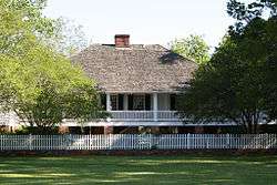
Kent Plantation House |
|
August 5, 1971
(#71000362) |
West of Alexandria on Bayou Rapides at Virginia Ave.
31°18′11″N 92°28′58″W / 31.303056°N 92.482778°W / 31.303056; -92.482778 (Kent Plantation House) |
Alexandria |
|
| 46 |
Lamourie Lock |
|
October 14, 1994
(#94001218) |
Junction of Lamourie Rd. and U.S. Route 71
31°07′46″N 92°24′24″W / 31.129444°N 92.406667°W / 31.129444; -92.406667 (Lamourie Lock) |
Lecompte |
|
| 47 |
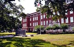
Lecompte High School |
|
September 22, 1992
(#92001251) |
1610 Charter St.
31°05′23″N 92°24′12″W / 31.089722°N 92.403333°W / 31.089722; -92.403333 (Lecompte High School) |
Lecompte |
|
| 48 |
Huey P. Long Memorial Hospital |
|
June 24, 2015
(#15000362) |
352 Hospital Blvd.
31°19′16″N 92°26′25″W / 31.321°N 92.4402°W / 31.321; -92.4402 (Huey P. Long Memorial Hospital) |
Pineville |
|
| 49 |
Longview |
|
December 5, 1984
(#84000559) |
Across Bayou Rapides from Louisiana Highway 121 near its intersection with Louisiana Highway 1200
31°19′44″N 92°40′40″W / 31.328889°N 92.677778°W / 31.328889; -92.677778 (Longview) |
Gardner |
part of the Neo-Classical Architecture of Bayou Rapides TR |
| 50 |
Loyd Hall Plantation |
|
April 29, 1977
(#77000678) |
Northwest of Cheneyville on Loyd Bridge Rd.
31°02′04″N 92°21′18″W / 31.034444°N 92.355°W / 31.034444; -92.355 (Loyd Hall Plantation) |
Cheneyville |
|
| 51 |
Masonic Building |
|
January 16, 1986
(#86000079) |
4th and Johnston Sts.
31°18′36″N 92°26′42″W / 31.31°N 92.445°W / 31.31; -92.445 (Masonic Building) |
Alexandria |
|
| 52 |
Masonic Home for Children |
|
November 20, 1987
(#87002038) |
2145 Horseshoe Dr.
31°15′34″N 92°28′41″W / 31.259444°N 92.478056°W / 31.259444; -92.478056 (Masonic Home for Children) |
Alexandria |
|
| 53 |
Dr. Robert E. McGill House |
|
June 2, 2000
(#00000566) |
2704 Hill St.
31°17′35″N 92°27′49″W / 31.293056°N 92.463611°W / 31.293056; -92.463611 (Dr. Robert E. McGill House) |
Alexandria |
|
| 54 |
McNutt Rural Historic District |
|
September 15, 1988
(#88001595) |
Belgard Bend Rd. and Louisiana Highway 121
31°18′44″N 92°38′40″W / 31.312222°N 92.644444°W / 31.312222; -92.644444 (McNutt Rural Historic District) |
McNutt |
|
| 55 |
McNutt School |
|
September 26, 1997
(#97001182) |
720 Millrace Rd.
31°18′23″N 92°39′30″W / 31.306389°N 92.658333°W / 31.306389; -92.658333 (McNutt School) |
Boyce |
|
| 56 |
Meeker Sugar Refinery |
|
November 16, 1987
(#87002023) |
U.S. Route 71
31°03′30″N 92°22′43″W / 31.058333°N 92.378611°W / 31.058333; -92.378611 (Meeker Sugar Refinery) |
Meeker |
|
| 57 |
Melady House |
|
February 23, 1996
(#96000160) |
5800 England Dr.
31°19′53″N 92°30′40″W / 31.331389°N 92.511111°W / 31.331389; -92.511111 (Melady House) |
Alexandria |
|
| 58 |
Mt. Olivet Episcopal Church and Cemetery |
|
June 22, 2000
(#00000718) |
335 Main St.
31°19′05″N 92°26′22″W / 31.318056°N 92.439444°W / 31.318056; -92.439444 (Mt. Olivet Episcopal Church and Cemetery) |
Pineville |
|
| 59 |
Myrtlewood |
|
August 28, 2012
(#12000556) |
2301 Military Hwy.
31°20′39″N 92°25′19″W / 31.344071°N 92.421908°W / 31.344071; -92.421908 (Myrtlewood) |
Pineville |
|
| 60 |
Old Alexandria Public Library |
|
January 19, 1989
(#88003225) |
503 Washington St.
31°18′31″N 92°26′43″W / 31.308611°N 92.445278°W / 31.308611; -92.445278 (Old Alexandria Public Library) |
Alexandria |
|
| 61 |
Old LSU Site |
|
August 14, 1973
(#73000876) |
North of Pineville at 2500 Shreveport Highway
31°21′31″N 92°26′14″W / 31.358611°N 92.437222°W / 31.358611; -92.437222 (Old LSU Site) |
Pineville |
|
| 62 |
Pegram Plantation House |
|
October 24, 2003
(#03001064) |
881 Chickamaw Rd.
31°05′55″N 92°25′46″W / 31.098611°N 92.429444°W / 31.098611; -92.429444 (Pegram Plantation House) |
Lecompte |
|
| 63 |
Rapides Bank and Trust Company Building |
|
May 15, 1980
(#80001752) |
933 Main St.
31°18′43″N 92°26′39″W / 31.311944°N 92.444167°W / 31.311944; -92.444167 (Rapides Bank and Trust Company Building) |
Alexandria |
|
| 64 |
Rapides Cemetery |
|
June 15, 1979
(#79001088) |
Hardtner and Main Sts.
31°19′00″N 92°26′30″W / 31.316667°N 92.441667°W / 31.316667; -92.441667 (Rapides Cemetery) |
Pineville |
|
| 65 |
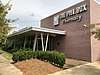
Rapides Parish Library |
|
January 26, 2016
(#15001005) |
411 Washington St.
31°18′34″N 92°26′40″W / 31.309454°N 92.444365°W / 31.309454; -92.444365 (Rapides Parish Library) |
Alexandria |
|
| 66 |
Rosalie Plantation Sugar Mill |
|
January 2, 1976
(#76000974) |
South of Alexandria off U.S. Route 71
31°12′07″N 92°24′41″W / 31.201944°N 92.411389°W / 31.201944; -92.411389 (Rosalie Plantation Sugar Mill) |
Alexandria |
|
| 67 |
Rose Cottage |
|
September 15, 1983
(#83000535) |
Azalea St.
31°19′51″N 92°26′16″W / 31.330833°N 92.437778°W / 31.330833; -92.437778 (Rose Cottage) |
Pineville |
|
| 68 |
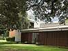
Rugg Elementary School |
|
August 10, 2001
(#01000807) |
1319 Bush Ave.
31°17′42″N 92°27′46″W / 31.295°N 92.462778°W / 31.295; -92.462778 (Rugg Elementary School) |
Alexandria |
|
| 69 |
St. Francis Xavier Cathedral |
|
December 3, 1980
(#80001753) |
626 4th St.
31°18′44″N 92°26′52″W / 31.312222°N 92.447778°W / 31.312222; -92.447778 (St. Francis Xavier Cathedral) |
Alexandria |
|
| 70 |
St. John Baptist Church |
|
June 25, 1982
(#82002794) |
Off Louisiana Highway 456
31°07′51″N 92°24′37″W / 31.130833°N 92.410278°W / 31.130833; -92.410278 (St. John Baptist Church) |
Lecompte |
|
| 71 |
St. Philip's Episcopal Church |
|
February 8, 2012
(#12000004) |
414 Clare St.
31°23′17″N 92°40′00″W / 31.388169°N 92.666631°W / 31.388169; -92.666631 (St. Philip's Episcopal Church) |
Boyce |
|
| 72 |
C.A. Schnack Jewelry Company Store |
|
June 30, 2000
(#00000684) |
924 3rd St.
31°18′40″N 92°26′42″W / 31.311111°N 92.445°W / 31.311111; -92.445 (C.A. Schnack Jewelry Company Store) |
Alexandria |
|
| 73 |
Tioga Commissary |
|
October 16, 1986
(#86002880) |
Tioga Rd.
31°22′59″N 92°25′43″W / 31.383056°N 92.428611°W / 31.383056; -92.428611 (Tioga Commissary) |
Tioga |
|
| 74 |
Trinity Episcopal Church |
|
October 16, 1980
(#80001754) |
Bayou Rapides
31°01′20″N 92°17′23″W / 31.022222°N 92.289722°W / 31.022222; -92.289722 (Trinity Episcopal Church) |
Cheneyville |
|
| 75 |
US Post Office and Courthouse-Alexandria |
|
May 18, 2000
(#00000501) |
515 Murray St.
31°18′38″N 92°45′40″W / 31.310556°N 92.761111°W / 31.310556; -92.761111 (US Post Office and Courthouse-Alexandria) |
Alexandria |
|
| 76 |
Morgan Walker House |
|
January 22, 1987
(#86003682) |
2400 Horseshoe Dr.
31°15′27″N 92°28′20″W / 31.2575°N 92.472222°W / 31.2575; -92.472222 (Morgan Walker House) |
Alexandria |
|
| 77 |
Walnut Grove |
|
November 21, 1980
(#80001755) |
East of Cheneyville
31°00′37″N 92°15′30″W / 31.010278°N 92.258333°W / 31.010278; -92.258333 (Walnut Grove) |
Cheneyville |
|
| 78 |
Welcek Farmstead |
|
July 18, 1985
(#85001586) |
Louisiana Highway 107
31°16′37″N 92°18′53″W / 31.276944°N 92.314722°W / 31.276944; -92.314722 (Welcek Farmstead) |
Kolin |
|
.JPG)


.JPG)

.JPG)
_Alexandria_(Rapides_Parish%2C_Louisiana).jpg)